Data
Level of Effort:
The Connecticut Town Profiles is a project of CTData Collaborative in partnership with AdvanceCT (formerly the Connecticut Economic Resource Center). The Connecticut Town Profiles are two-page reports of demographic and economic information for Connecticut’s municipalities, regions, and the state as a whole. They contain information about population, major employers, education, fiscal information, labor force, housing and quality of life.
Training
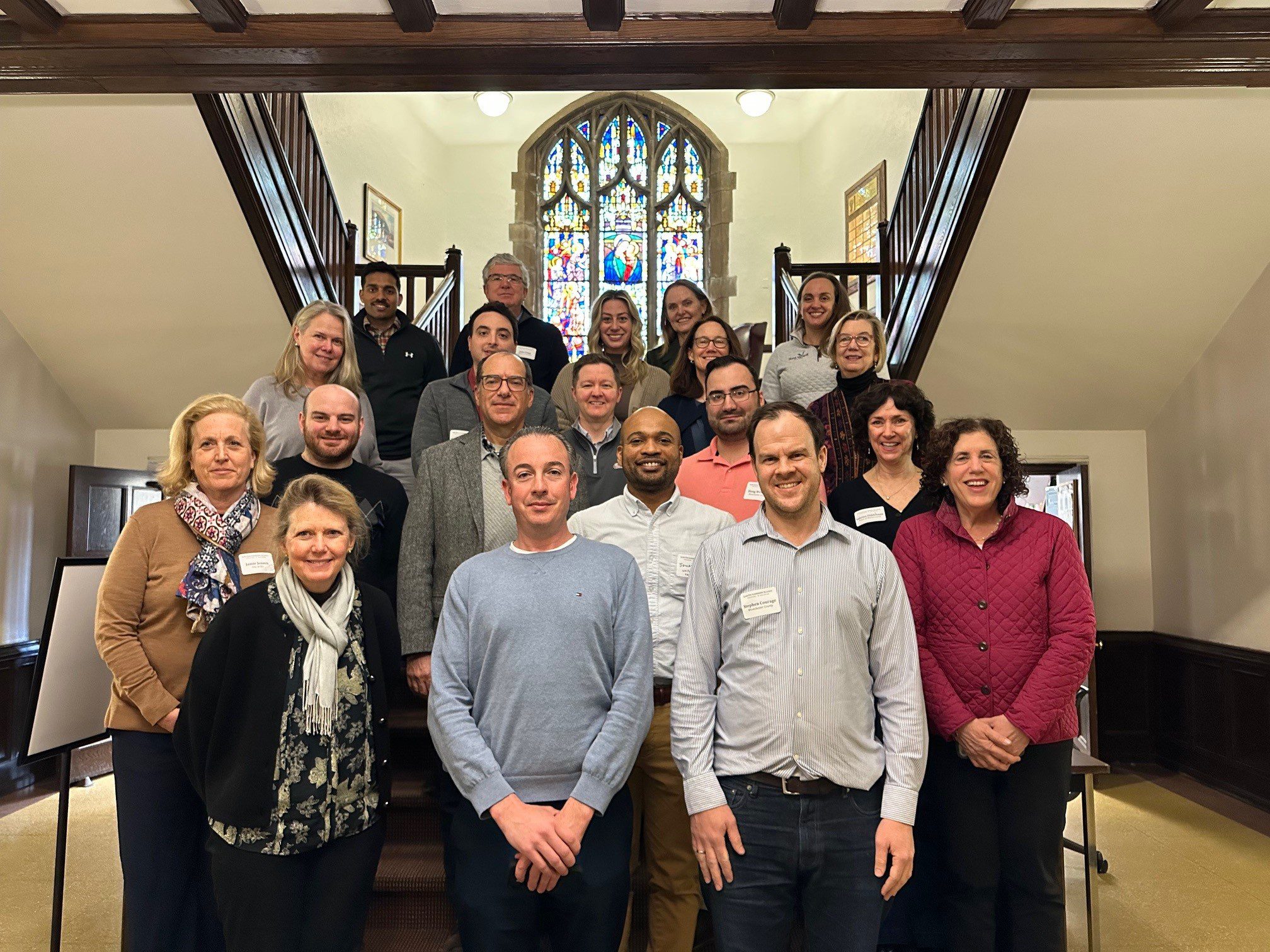
With funding from Long Island Sound Study and support from New York Sea Grant’s Sustainable and Resilient Communities Extension Professionals, Pace University’s Land Use Law Center brought its award-winning Land Use Leadership Alliance Training Program to Westchester municipalities within the Long Island Sound watershed. The training consisted of three full-day workshops held April 1, 8, and 22, 2025 in White Plains, NY to train local leaders on developing balanced strategies for effectively accomplishing policy objectives, particularly focused on land use, flood resilience, and natural resource protection to strengthen community planning and informed decision-making.
22 municipal staff and community leaders, representing 7 different Long Island Sound communities received resilience gap analyses that reviewed their municipality’s current zoning and comprehensive plan language, discussed common issues with their neighbors and built new networks of support, and graduated from the program empowered to plan for a more resilient future for their community and the Long Island Sound region.
If you are interested in learning more and participating in a future LULA training, please email lisresilience@gmail.com.
Training
In Spring 2025 the SRC Team hosted funding workshops on Long Island, NY and New Haven, CT.

The Sustainable and Resilient Communities (SRC) team hosted the 2nd Annual Connecticut Regional Funding Workshop on Monday, March 31, 2025 to provide information on funding opportunities to support sustainability and resilience-focused projects. Attendees heard from program officers representing various local, state, and regional funding organizations and were able to engage in discussions with funders and assistance programs to explore project ideas and ways to improve funding applications. A panel of successful awardees shared their experiences and strategies. Attendees also worked through the guidance in the SRC Resilience Planning Guide. The workshop is intended for municipal officials and staff, nonprofits, community organizations, and other groups interested in planning and implementing projects that advance the sustainability and resilience of Long Island Sound communities.

Training
In Spring 2025 the SRC Team hosted funding workshops on Long Island, NY and New Haven, CT.
The Sustainable and Resilient Communities (SRC) team hosted the 2nd Annual Connecticut Regional Funding Workshop on Monday, March 31, 2025 to provide information on funding opportunities to support sustainability and resilience-focused projects. Attendees heard from program officers representing various local, state, and regional funding organizations and were able to engage in discussions with funders and assistance programs to explore project ideas and ways to improve funding applications. A panel of successful awardees shared their experiences and strategies. Attendees also worked through the guidance in the SRC Resilience Planning Guide. The workshop is intended for municipal officials and staff, nonprofits, community organizations, and other groups interested in planning and implementing projects that advance the sustainability and resilience of Long Island Sound communities.
Training
In Spring 2025 the SRC team hosted funding workshops on Long Island, NY and New Haven, CT.

The Sustainable and Resilient Communities (SRC) team hosted the 2nd Annual Long Island Regional Funding Workshop on March 27, 2025 to provide information on funding opportunities to support sustainability and resilience-focused projects. Attendees heard from program officers representing 35 local, state, and Long Island Sound funding organizations and were able to engage in discussions with funders to explore project ideas and ways to improve funding applications and worked through guidance in the Resilience Planning Guide. Attendees also heard from a panel of successful awardees about their experiences and strategies.

Training
In Spring 2025 the SRC team hosted funding workshops on Long Island, NY and New Haven, CT.
The Sustainable and Resilient Communities (SRC) team hosted the 2nd Annual Long Island Regional Funding Workshop on March 27, 2025 to provide information on funding opportunities to support sustainability and resilience-focused projects. Attendees heard from program officers representing 35 local, state, and Long Island Sound funding organizations and were able to engage in discussions with funders to explore project ideas and ways to improve funding applications and worked through guidance in the Resilience Planning Guide. Attendees also heard from a panel of successful awardees about their experiences and strategies.
Story Map
Created by UConn CLEAR in partnership with the Long Island Sound Study, this Population and Demographic Story Map explores the land and people in the Long Island Sound Watershed. From Canada down to the northern coast of Long Island, the watershed is a vastly diverse area in both land and people, populated by nearly 9 million people and characterized by farms, forests, urban centers, beaches, marshes and more. This story map showcases how the Sound is an integral part of the lives of those who live, work, and visit the region every day.
Training
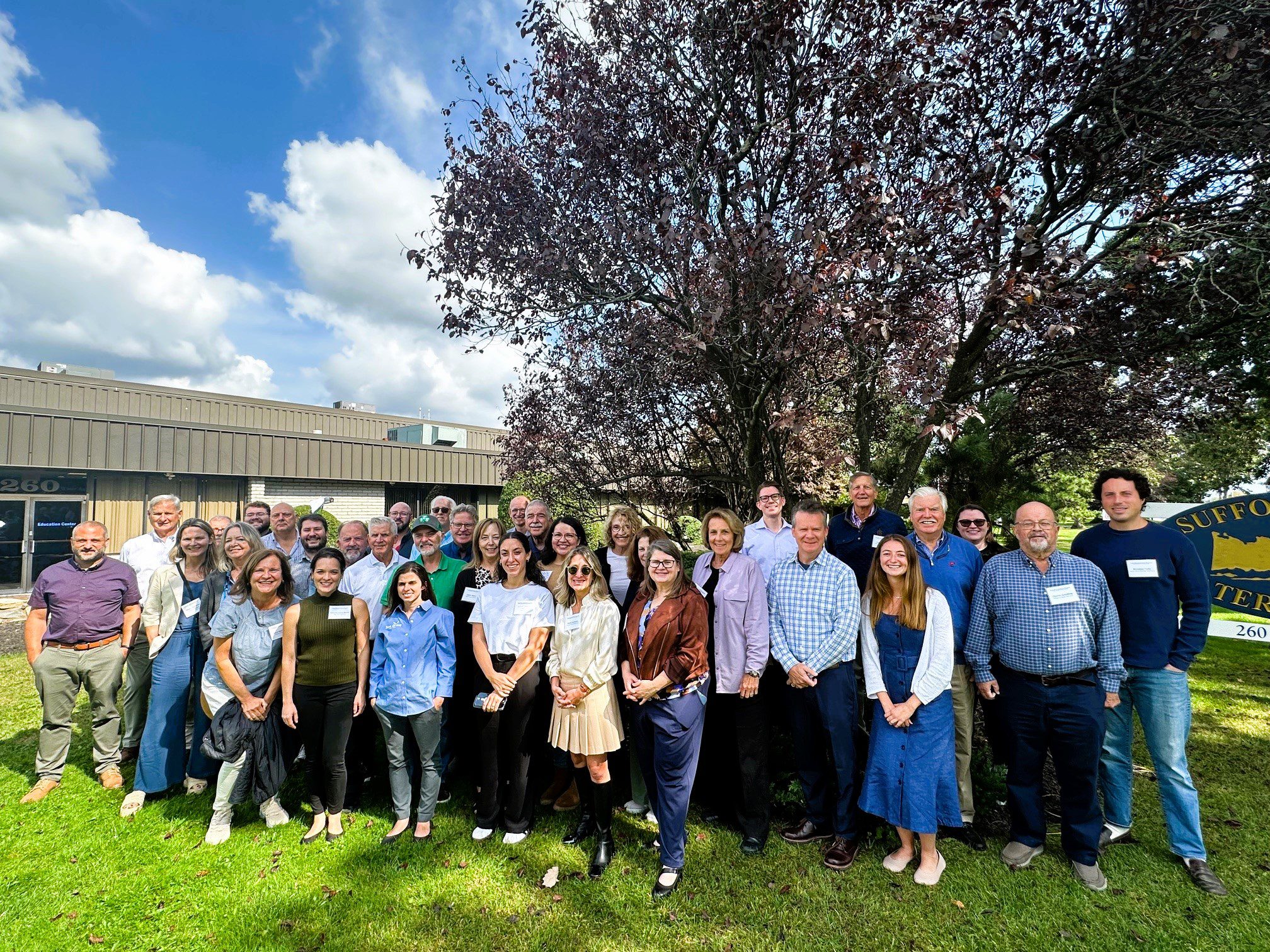
With funding from Long Island Sound Study and support from New York Sea Grant’s Sustainable and Resilient Communities Extension Professionals, Pace University’s Land Use Law Center brought its award-winning Land Use Leadership Alliance Training Program to Suffolk and Nassau municipalities within the Long Island Sound watershed. The training program consisted of three full-day workshops held in Hauppauge, NY that focused on the land use system, innovative approaches to sea level rise adaptation, hazard mitigation, and natural resource protection to strengthen community planning, regulation, and informed decision-making. 28 municipal staff and community leaders, representing 18 different Long Island Sound communities, completed the Program. Program graduates gained new networks of support, identified successful land use techniques, and developed implementation plans that will enable a more resilient future for their community and the Long Island Sound region.
The program comprised three full-day sessions on September 27, October 4, and October 18, 2024 at the Suffolk County Water Authority Education Center, 260 Motor Parkway in Hauppauge, NY.
If you are interested in learning more and participating in a future LULA training, please email lisresilience@gmail.com.
Training
With funding from Long Island Sound Study and support from New York Sea Grant’s Sustainable and Resilient Communities Extension Professionals, Pace University’s Land Use Law Center brought its award-winning Land Use Leadership Alliance Training Program to Suffolk and Nassau municipalities within the Long Island Sound watershed. The training program consisted of three full-day workshops held in Hauppauge, NY that focused on the land use system, innovative approaches to sea level rise adaptation, hazard mitigation, and natural resource protection to strengthen community planning, regulation, and informed decision-making. 28 municipal staff and community leaders, representing 18 different Long Island Sound communities, completed the Program. Program graduates gained new networks of support, identified successful land use techniques, and developed implementation plans that will enable a more resilient future for their community and the Long Island Sound region.
The program comprised three full-day sessions on September 27, October 4, and October 18, 2024 at the Suffolk County Water Authority Education Center, 260 Motor Parkway in Hauppauge, NY.
If you are interested in learning more and participating in a future LULA training, please email lisresilience@gmail.com.
Mapper
Level of Effort:
The Connecticut Housing Data Hub provides users the ability to explore several categories of state- and town-wide housing data over time. Available data on the dashboard includes permitting, housing stock, rent burden, and housing programs.
Mapper
Level of Effort:
The Connecticut Housing Data Hub provides users the ability to explore several categories of state- and town-wide housing data over time. Available data on the dashboard includes permitting, housing stock, rent burden, and housing programs.
Mapper
Level of Effort:
Connecticut EJ Screening Tool is an interactive resource that combines both community and data-driven approach that incorporates environmental burdens and demographic indicators. This map allows users to explore the environmental health and the conditions (socioeconomic and or other distinguishing community characteristics) within a specific region, town, city, and or entire state.
The data included in this map finalize into a score that allows users to understand the relationship between the community and environmental justice. Through the presentation of this information, citizens and policymakers alike can understand what communities are experiencing and form policies that reshape these matters.
Guidance Tool
Level of Effort:
This toolkit describes “how” local government leads and partners can design more fundable projects by pulling specific policy levers, seeking key partnerships, using innovative accounting practices, inverting power structures, and rethinking and redesigning internal processes. It will help local government leads and partners operate within current finance and policy systems to better prepare themselves and their communities for climate resilience funding and finance.
Mapper
Level of Effort:
Neighborhoods at Risk is an easy-to-use website with interactive maps, charts, and resources to help communities identify neighborhoods that may be more impacted by climate change. It shows where people may experience unequal impacts from flooding and extreme heat.
Mapper
Level of Effort:
Neighborhoods at Risk is an easy-to-use website with interactive maps, charts, and resources to help communities identify neighborhoods that may be more impacted by climate change. It shows where people may experience unequal impacts from flooding and extreme heat.
Guidance Tool
Level of Effort:
Inclusive community engagement is essential for successful environmental decision-making. The New York State Climate Smart Communities Program seeks to guide local governments in their community engagement efforts, particularly for inclusion of Disadvantaged Communities (DAC). Only through the leadership of those most affected by the climate crisis and environmental pollution can environmental and climate justice be achieved.
Mapper
Level of Effort:
This mapper, developed through the New York Climate Act, was developed by the State Climate Justice Working Group to identify disadvantaged communities to ensure that frontline and otherwise underserved communities benefit from the state’s historic transition to cleaner, greener sources of energy, reduced pollution and cleaner air, and economic opportunities. The interactive map identifies areas throughout the State that meet the disadvantaged community Criteria as defined by the Climate Justice Working Group.
Guidance Tool
Level of Effort:
This policy guide identifies specific ways in which the drafting, public engagement, application, mapping, and enforcement of zoning regulations can be changed to dismantle the barriers that perpetuate the separation of historically disadvantaged and vulnerable communities.
Resources & Tools

