Resilience Steps
Find support and resources tailored to your project needs. Select your Planning Phase, Location, and/or Topic of interest to access a filtered selection of our curated resources and tools.

Find support and resources tailored to your project needs. Select your Planning Phase, Location, and/or Topic of interest to access a filtered selection of our curated resources and tools.

Learn about the environmental threats and climate risks in your community

Identify strategies to help mitigate risks and develop ways to adapt to a changing climate

Find funding and guidance to help put your plans into action

Monitor, maintain, and adaptively-manage your project to sustain success
Select one or more of the filters below to find relevant tools and resources for your needs


Learn how to identify, prioritize, and implement high-impact projects
Guidance Tool
The CTDEEP document provides information about the many ways individuals, property owners, and communities can help protect Connecticut’s tidal wetlands.
Guidance Tool
The CTDEEP document provides information about the many ways individuals, property owners, and communities can help protect Connecticut’s tidal wetlands.
Website
Sustainable CT provides a wide-ranging menu of resilience best practices, opportunities for grant funding, and a voluntary certification program that recognizes thriving and resilient CT communities. Municipalities choose Sustainable CT actions, implement them, and earn points toward certification.
Resource
Level of Effort:
This fact sheet produced by the Connecticut Institute for Resilience and Climate Adaptation (CIRCA) reviews how culverts are defined in Connecticut, explains their connection to climate resilience, provides examples of how Connecticut towns are addressing needs for upgraded culverts, and highlights related resources.
Guidance Tool
Level of Effort:
Keep Forests Healthy: A Tool to Assess Resilience, Health & Productivity was developed by Cornell Cooperative Extension, the Northern Institute of Applied Climate Science, and The Nature Conservancy Central and Western New York Chapter to enable landowners to assess how their forest may be affected by changing climate conditions. This tool can help landowners identify potential risks to forests and highlight forest management options that may increase the ability of a forest to cope with the pressure of changing conditions. The document identifies 16 characteristics that may increase or decrease the risk of harm to a forest in a changing climate, which can then be discussed with a professional to plan forest management activities.
Website
Level of Effort:
A website and a downloadable app for your mobile device. The resource has information about rain gardens, designing, selecting plants, and installing a garden on your property.
Website
Level of Effort:
A website and a downloadable app for your mobile device. The resource has information about rain gardens, designing, selecting plants, and installing a garden on your property.
Guidance Tool
Level of Effort:
Inclusive community engagement is essential for successful environmental decision-making. The New York State Climate Smart Communities Program seeks to guide local governments in their community engagement efforts, particularly for inclusion of Disadvantaged Communities (DAC). Only through the leadership of those most affected by the climate crisis and environmental pollution can environmental and climate justice be achieved.
Story Map
Level of Effort:
This story map examines the coastal processes and hazards of Long Island and provides options for sustainable and resilient shoreline management. Information is useful for coastal managers, planners and coastal property owners.
Story Map
Level of Effort:
This story map examines the coastal processes and hazards of Long Island and provides options for sustainable and resilient shoreline management. Information is useful for coastal managers, planners and coastal property owners.
Website
Level of Effort:
A platform with resources by state for brownfield remediation, resilience, and sustainable redevelopment.
Website
Level of Effort:
A platform with resources by state for brownfield remediation, resilience, and sustainable redevelopment.
Mapper
Level of Effort:
The Connecticut Department of Energy and Environmental Protection (DEEP) and their contractor Whiteout Solutions have released a groundbreaking high-resolution dataset capturing over 12,000 acres of coastal saltmarsh and adjoining upland buffer in the state of Connecticut. The new dataset, available to the public via Whiteout’s web-based geospatial application geoSAP, includes:
All data layers can be viewed and downloaded through geoSAP.
Guidance Tool
Level of Effort:
FEMA’s National Resilience Guidance document is intended to help all individuals, communities, and organizations understand our nation’s vision for resilience, the key principles that must be applied to strengthen resilience, and the players and systems that contribute to resilience. It also outlines how to strengthen resilience by organizing and engaging people, incorporating resilience concepts into planning efforts, creating change through policies, prioritizing projects and programs, financing resilience efforts, and measuring and evaluating resilience. Finally, the NRG includes a Resilience Maturity Model that illustrates stages in the evolution of a community’s approach to resilience.
Guidance Tool
Level of Effort:
The Resilience Implementation and Strategic Enhancements (RISE) Local Assessment Tool helps you approach hazards and risks comprehensively; and assess and refine your laws and policies in a way that improves resilience and helps achieve desired community outcomes. The tool works by assessing two critical elements of building resilience:
the “how” – once identified, resilience-enhancing measures can be successfully integrated into existing land use laws, building codes, and planning policies; and
the “what” – gaps in policies and regulations that support resilience.
Guidance Tool
Level of Effort:
This toolkit describes “how” local government leads and partners can design more fundable projects by pulling specific policy levers, seeking key partnerships, using innovative accounting practices, inverting power structures, and rethinking and redesigning internal processes. It will help local government leads and partners operate within current finance and policy systems to better prepare themselves and their communities for climate resilience funding and finance.
Guidance Tool
Level of Effort:
The New York State Department of State (NYS DOS) developed the Statewide Shoreline Monitoring Framework to provide clear and consistent information to those planning projects to improve their shoreline resiliency.
Guidance Tool
Level of Effort:
The New York State Department of State (NYS DOS) developed the Statewide Shoreline Monitoring Framework to provide clear and consistent information to those planning projects to improve their shoreline resiliency.
Guidance Tool
Level of Effort:
This guide gives community leaders five main strategies to carry out Nature-Based Solution projects: 1) Building Strong Partnerships, 2) Engaging the Whole Community, 3) Matching Project Size With Desired Goals and Benefits, 4) Maximizing Benefits, and 5) Designing for the Future. This is not a technical guide for planning, constructing or funding NBS. It covers the value of each strategy and suggests how to move forward with NBS projects.
Website
Level of Effort:
CLEAR, a program of UConn’s College of Agriculture, Health, and Natural Resources, provides information, education, and assistance to land use decision makers, in support of balancing growth and natural resource protection.
Website
Level of Effort:
CLEAR, a program of UConn’s College of Agriculture, Health, and Natural Resources, provides information, education, and assistance to land use decision makers, in support of balancing growth and natural resource protection.
Guidance Tool
Level of Effort:
This website provides an overview of each chapter of Connecticut’s new Stormwater Quality Manual, which includes guidance on how to design, install, and maintain these types of practices.
Guidance Tool
Level of Effort:
This website provides an overview of each chapter of Connecticut’s new Stormwater Quality Manual, which includes guidance on how to design, install, and maintain these types of practices.
Guidance Tool
Level of Effort:
This guidance document is intended for stakeholders pursuing FEMA HMA grants for nature-based solutions to mitigate risks associated with flooding (riverine and coastal) and wildfire.
Guidance Tool
Level of Effort:
This guidance document is intended for stakeholders pursuing FEMA HMA grants for nature-based solutions to mitigate risks associated with flooding (riverine and coastal) and wildfire.
Guidance Tool
Level of Effort:
The NYSDEC document is to provide guidance on the issuance of permits for living shorelines techniques in the Marine and Coastal District Waters of New York (the Marine District) and encourages the use of green or natural infrastructure.
Guidance Tool
Level of Effort:
The NYSDEC document is to provide guidance on the issuance of permits for living shorelines techniques in the Marine and Coastal District Waters of New York (the Marine District) and encourages the use of green or natural infrastructure.
Training
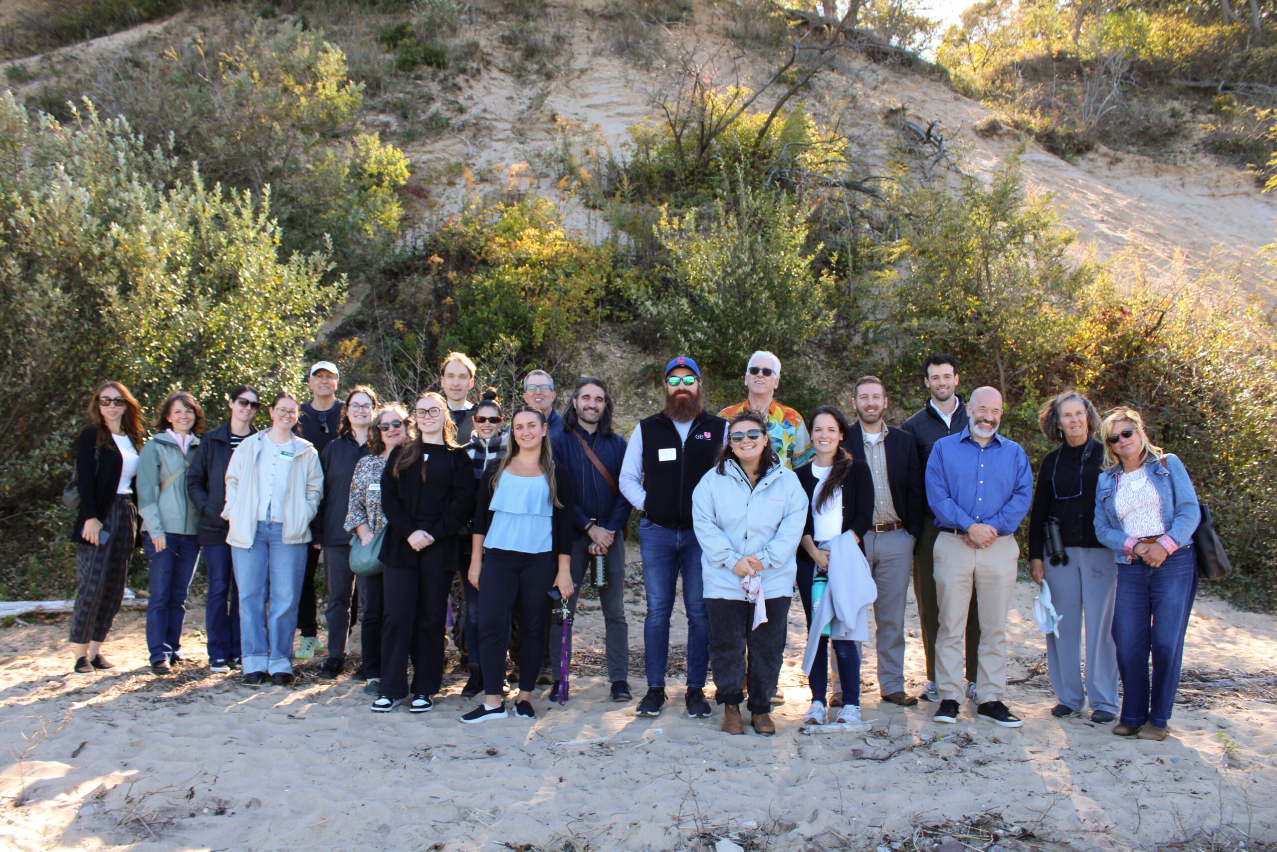
2025 Nassau Coastal Resilience Forum field trip to Sands Point Preserve. Credit: Sumayyah Uddin / NYSG
On October 9, 2025 state and local decision makers, municipal staff, and other interested parties working to address flooding, shoreline erosion and other coastal issues gathered at the Sands Point Preserve Conservancy in Sands Point, NY for the 3rd Annual Nassau County Coastal Resilience Forum. The Forum provided a chance to share information on best practices, discuss challenges, identify opportunities to increase resilience, and enhance coordination across communities. Forum attendees heard updates on State resilience initiatives from agencies like the NYS Department of Environmental Conservation and NYS Division of Homeland Security and Emergency Services, as well as presentations on new resilience tools and resources from Seatuck Environmental Association, the U.S. Geological Survey, New York Sea Grant, Cornell Cooperative Extension of Nassau County, and Nassau County Soil and Water Conservation District. In the afternoon, Forum attendees were given a guided tour of the recent expansions to the bluff stabilization project at the Preserve.
The event was hosted by Long Island Sound Partnership and New York Sea Grant, in partnership with the Sands Point Preserve Conservancy and Nassau and Suffolk County Soil and Water Conservation Districts.


Training

2025 Nassau Coastal Resilience Forum field trip to Sands Point Preserve. Credit: Sumayyah Uddin / NYSG
On October 9, 2025 state and local decision makers, municipal staff, and other interested parties working to address flooding, shoreline erosion and other coastal issues gathered at the Sands Point Preserve Conservancy in Sands Point, NY for the 3rd Annual Nassau County Coastal Resilience Forum. The Forum provided a chance to share information on best practices, discuss challenges, identify opportunities to increase resilience, and enhance coordination across communities. Forum attendees heard updates on State resilience initiatives from agencies like the NYS Department of Environmental Conservation and NYS Division of Homeland Security and Emergency Services, as well as presentations on new resilience tools and resources from Seatuck Environmental Association, the U.S. Geological Survey, New York Sea Grant, Cornell Cooperative Extension of Nassau County, and Nassau County Soil and Water Conservation District. In the afternoon, Forum attendees were given a guided tour of the recent expansions to the bluff stabilization project at the Preserve.
The event was hosted by Long Island Sound Partnership and New York Sea Grant, in partnership with the Sands Point Preserve Conservancy and Nassau and Suffolk County Soil and Water Conservation Districts.


Training
In Spring 2025 the SRC Team hosted funding workshops on Long Island, NY and New Haven, CT.

The Sustainable and Resilient Communities (SRC) team hosted the 2nd Annual Connecticut Regional Funding Workshop on Monday, March 31, 2025 to provide information on funding opportunities to support sustainability and resilience-focused projects. Attendees heard from program officers representing various local, state, and regional funding organizations and were able to engage in discussions with funders and assistance programs to explore project ideas and ways to improve funding applications. A panel of successful awardees shared their experiences and strategies. Attendees also worked through the guidance in the SRC Resilience Planning Guide. The workshop is intended for municipal officials and staff, nonprofits, community organizations, and other groups interested in planning and implementing projects that advance the sustainability and resilience of Long Island Sound communities.
Training
In Spring 2025 the SRC Team hosted funding workshops on Long Island, NY and New Haven, CT.

The Sustainable and Resilient Communities (SRC) team hosted the 2nd Annual Connecticut Regional Funding Workshop on Monday, March 31, 2025 to provide information on funding opportunities to support sustainability and resilience-focused projects. Attendees heard from program officers representing various local, state, and regional funding organizations and were able to engage in discussions with funders and assistance programs to explore project ideas and ways to improve funding applications. A panel of successful awardees shared their experiences and strategies. Attendees also worked through the guidance in the SRC Resilience Planning Guide. The workshop is intended for municipal officials and staff, nonprofits, community organizations, and other groups interested in planning and implementing projects that advance the sustainability and resilience of Long Island Sound communities.


Training
In Spring 2025 the SRC team hosted funding workshops on Long Island, NY and New Haven, CT.
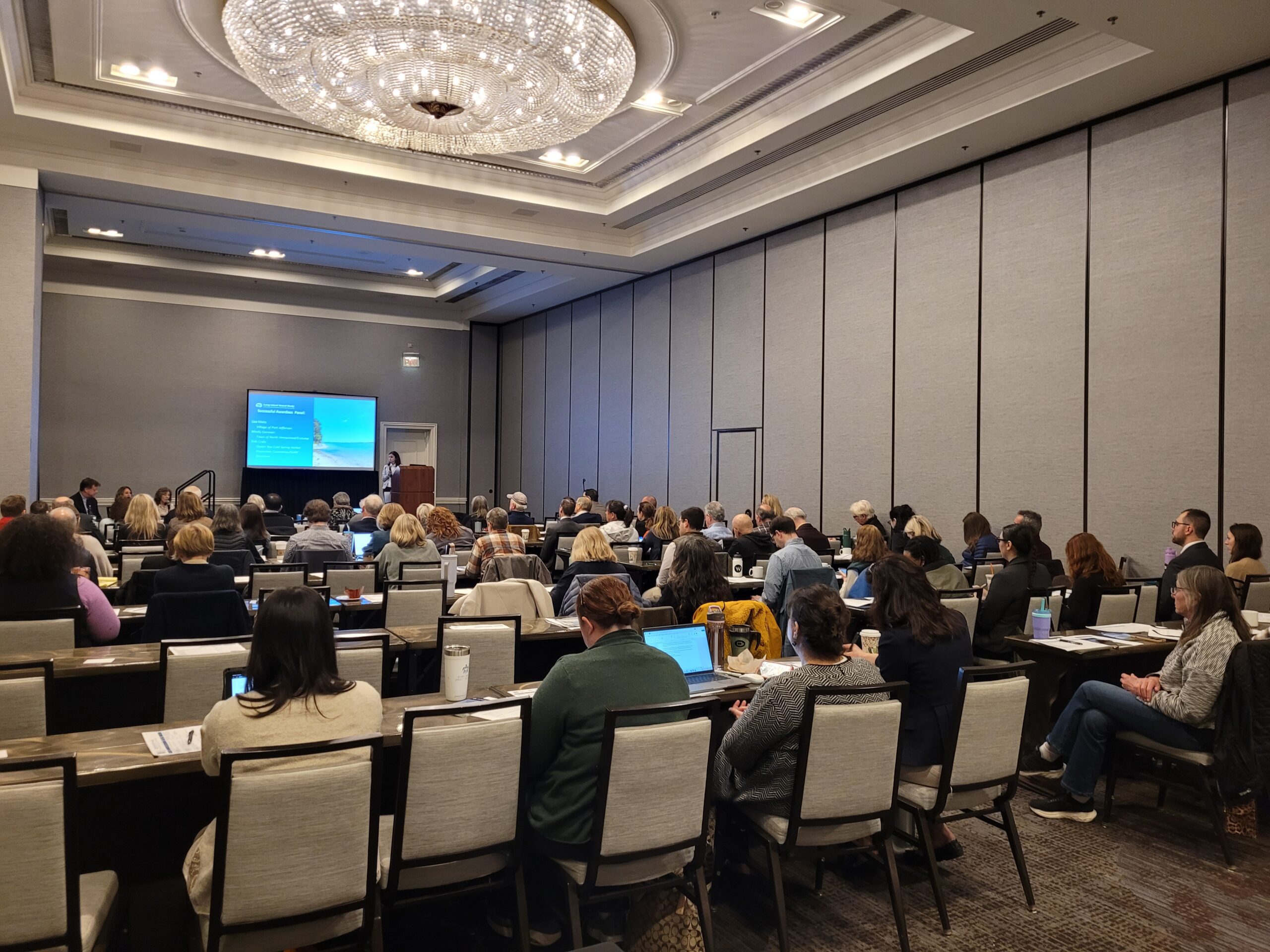
The Sustainable and Resilient Communities (SRC) team hosted the 2nd Annual Long Island Regional Funding Workshop on March 27, 2025 to provide information on funding opportunities to support sustainability and resilience-focused projects. Attendees heard from program officers representing 35 local, state, and Long Island Sound funding organizations and were able to engage in discussions with funders to explore project ideas and ways to improve funding applications and worked through guidance in the Resilience Planning Guide. Attendees also heard from a panel of successful awardees about their experiences and strategies.


Training
In Spring 2025 the SRC team hosted funding workshops on Long Island, NY and New Haven, CT.

The Sustainable and Resilient Communities (SRC) team hosted the 2nd Annual Long Island Regional Funding Workshop on March 27, 2025 to provide information on funding opportunities to support sustainability and resilience-focused projects. Attendees heard from program officers representing 35 local, state, and Long Island Sound funding organizations and were able to engage in discussions with funders to explore project ideas and ways to improve funding applications and worked through guidance in the Resilience Planning Guide. Attendees also heard from a panel of successful awardees about their experiences and strategies.


Training
The Long Island Sound Sustainable and Resilient Communities (SRC) Team held our 2024 Annual Workshop virtually as three sessions over two days. Session topics focused on our assistance programs, new regional resilience resources and tools, and a discussion on planning for inundation and different considerations communities may face.
Session 3 – Planning for Inundation was held on Wednesday, December 11th from 10 AM-12 PM. Participants heard from communities and regional entities that are using or considering different aspects of planning for inundation, including buyout programs, land use policies, and community perspectives on retreat/relocation.


Training
The Long Island Sound Sustainable and Resilient Communities (SRC) Team held our 2024 Annual Workshop virtually as three sessions over two days. Session topics focused on our assistance programs, new regional resilience resources and tools, and a discussion on planning for inundation and different considerations communities may face.
Session 2 – Resilience Tools was held on Tuesday, December 10th from 1:30-3:30 PM. Participants learned about new Resilience Tools being developed and used throughout coastal Long Island Sound.


Training
The Long Island Sound Sustainable and Resilient Communities (SRC) Team held our 2024 Annual Workshop virtually as three sessions over two days. Session topics focused on our assistance programs, new regional resilience resources and tools, and a discussion on planning for inundation and different considerations communities may face.
Session 1 – SRC Resilience Assistance Programs was held on Tuesday, December 10th from 10-11:30 AM. Participants learned about our Sustainable and Resilient Communities resilience assistance programs and heard from communities who have successfully utilized them to advance resilience project plans, build capacity, and secure competitive grant funding!


Training
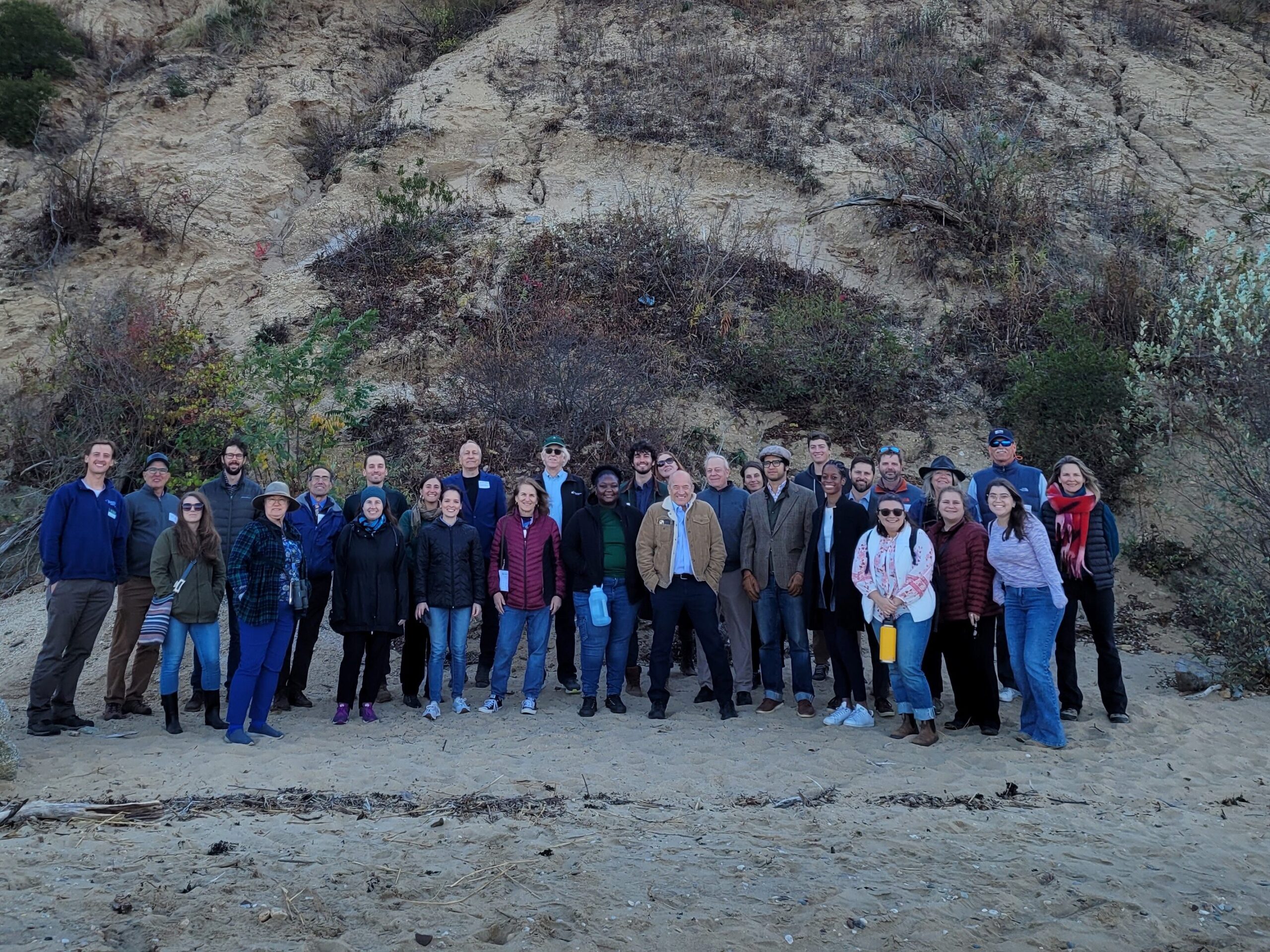
2024 Nassau Coastal Resilience Forum field trip to Sands Point Preserve. Credit: NYSG
On October 28, 2024, state and local decision makers, municipal staff, and other interested parties working to address coastal issues gathered at the Sands Point Preserve Conservancy in Sands Point, NY for the 2nd Annual Nassau County Coastal Resilience Forum to identify opportunities to increase resilience, learn about best practices, and enhance coordination across communities. There were presentations on the Long Island Sound Resilience Resource Hub & Assistance Programs, NYSDEC Office of Climate Change updates, marsh conservation planning, bluff management and restoration, and nature-based solutions to increase shoreline resilience. There was also a guided walking tour of the resilience projects at Sands Point Preserve.
The event is hosted by Long Island Sound Study and New York Sea Grant, in partnership with the Sands Point Preserve Conservancy and Nassau and Suffolk Soil and Water Conservation Districts.


Training

2024 Nassau Coastal Resilience Forum field trip to Sands Point Preserve. Credit: NYSG
On October 28, 2024, state and local decision makers, municipal staff, and other interested parties working to address coastal issues gathered at the Sands Point Preserve Conservancy in Sands Point, NY for the 2nd Annual Nassau County Coastal Resilience Forum to identify opportunities to increase resilience, learn about best practices, and enhance coordination across communities. There were presentations on the Long Island Sound Resilience Resource Hub & Assistance Programs, NYSDEC Office of Climate Change updates, marsh conservation planning, bluff management and restoration, and nature-based solutions to increase shoreline resilience. There was also a guided walking tour of the resilience projects at Sands Point Preserve.
The event is hosted by Long Island Sound Study and New York Sea Grant, in partnership with the Sands Point Preserve Conservancy and Nassau and Suffolk Soil and Water Conservation Districts.


Training
On October 29, 2024, state and local decision makers, municipal staff, and other interested parties working to address coastal issues gathered at the Dorothy P. Flint 4-H Camp in Riverhead, NY to identify opportunities to increase resilience, learn about best practices, and enhance coordination across communities. There were presentations on the Long Island Sound Resilience Resource Hub, NYSDEC Climate Office updates, marsh conservation planning, bluff management and restoration, and nature-based solutions to increase shoreline resilience. There was also a field trip to Iron Pier Beach/Maidstone Landing to view and learn about a community bluff restoration project.
This event was hosted by Long Island Sound Study and New York Sea Grant, in partnership with Nassau and Suffolk Soil and Water Conservation Districts, Nassau CCE, and Maidstone Landing.


Training
The programs covered in this webinar were developed by the Sustainable and Resilient Communities Extension Professional team to assist with the development of sustainability and resilience focused projects that will impact a community or communities within or partially within the Long Island Sound coastal boundary. On Oct. 16, 2023 a new LIS Resilience Planning Support Program in addition to a second round of the Long Island Sound Resilience Grant Writing Assistance Program were made available for municipalities and community organizations. These separate programs (Track 1 and Track 2) are supported by funding from the U.S. EPA through the Long Island Sound Study and administered through New York Sea Grant and Connecticut Sea Grant.


Training
The second annual Long Island Sound Bi-State Sustainable and Resilient Communities Workshop brought together nearly 200 people virtually on Dec. 7, 2023 to learn about a new Long Island Sound Resilience Resource Hub (launching in early 2024), hear from communities and groups around the Sound working on resilience planning, and consider pathways for updating codes and ordinances. Videos of the workshop’s six sessions are available on YouTube. They can be accessed below along with supporting documents.


Training
In this Coastal Resiliency Network webinar, Barbara Kendall from the NYS Department of State provides an overview of Local Waterfront Revitalization Programs (LWRP) and then representatives from four NYS coastal communities discuss their experiences developing and implementing their LWRPs. The Coastal Resilience Network, led by the New York State Association of Conservation Commissions (NYSACC) with assistance from NY Sea Grant, is a collaborative open forum for communities in coastal Westchester, Nassau, and Suffolk Counties to discuss and learn about opportunities to increase their resilience to sea level rise, flooding, and extreme events.


Training
In this Coastal Resiliency Network webinar Suzette Lopane with Westchester County and Marian Russo with the Village of Patchogue spoke about two exciting living shoreline projects. The Coastal Resilience Network, led by the New York State Association of Conservation Commissions (NYSACC) with assistance from NY Sea Grant, is a collaborative open forum for communities in coastal Westchester, Nassau, and Suffolk Counties to discuss and learn about opportunities to increase their resilience to sea level rise, flooding, and extreme events.


Training
The first annual Long Island Sound Bi-State Sustainable and Resilient Communities Workshop brought together more than 260 people virtually on Dec. 1, 2022 to learn about opportunities to increase the resilience of the Sound’s communities to climate change and other environmental threats. Interactive sessions included opportunities to learn more about the SRC Extension Professionals’ needs assessment findings and recommendations, the newly released Long Island Sound Resilience Grant Writing Assistance Program, and tips for success with Long Island Sound funding opportunities. Concurrent breakout sessions highlighted the work of partners related to shoreline planning and implementation, using green infrastructure for stormwater management, sustainable climate planning for relocation, and new sustainability/resilience tools available in both New York and Connecticut. Videos of the workshop’s six sessions are available on YouTube. They can be accessed below along with supporting documents.


Training
This online information session held Sept. 19, and repeated Sept. 21, provides an introduction to resilience planning in the Long Island Sound region. It includes discussions on local climate impacts and projections, resilience planning strategies, and climate certification programs for both New York and Connecticut municipalities. In addition to the main presentation, videos of the Connecticut and New York breakout sessions can be accessed below. The presentations and other resource materials are available here.


Training
Held at Port Jefferson Village Center in Suffolk County on May 10, 2023, this forum brought together state and local decision makers and other stakeholders, working to address coastal erosion along the Long Island Sound shoreline. Panelists highlighted strategies and options to address coastal erosion, discussed the Coastal Erosion Hazard Areas Program, local codes, updated New York State sea level rise projections and more. During small group discussions, attendees discussed challenges and identified opportunities to increase resilience, all in an effort to enhance coordination across communities. This forum was hosted by New York Sea Grant and Long Island Sound Study, in partnership with Suffolk County Soil and Water Conservation District and Suffolk County Legislators Sarah Anker, Stephanie Bontempi, Kara Hahn, and Al Krupski.


Training
Held at Locust Valley Library in Nassau County on May 4, 2023, this forum brought together state and local decision makers and other stakeholders, working to address coastal erosion along the Long Island Sound shoreline. Panelists highlighted strategies and options to address coastal erosion, discussed the Coastal Erosion Hazard Areas Program, local codes, updated New York State sea level rise projections and more. During small group discussions, attendees discussed challenges and identified opportunities to increase resilience, all in an effort to enhance coordination across communities. This forum was hosted by New York Sea Grant and Long Island Sound Study, in partnership with Nassau County Soil and Water Conservation District.


Training
The Long Island Sound Community Impact Fund (LISCIF) is a partnership between Restore America’s Estuaries, the U.S. Environmental Protection Agency, and the Long Island Sound Study (LISS). The purpose of LISCIF is to build capacity for organizations located in communities affected by disproportionate environmental and human health risks. The purpose of the LISCIF is to provide technical and financial assistance to communities and improve the quality and accessibility of the Long Island Sound. The Long Island Sound Community Impact Fund seeks to increase organizational capacity through training that supports day-to-day operations, project implementation, and future funding opportunities.



Case Study
Hamden, CT
The Town of Hamden’s Bioretention Project is the largest municipally owned rain garden in the state! Save the Sound, in partnership with the Town of Hamden, completed this large-scale rain garden project at Hamden Town Center Park to improve local water quality, restore habitat, and enhance community resilience. The project transformed approximately 2.5 acres of lawn into a functioning green infrastructure system that now manages runoff from an 88-acre urban watershed draining Dixwell Avenue and surrounding neighborhoods. Prior to the project, stormwater often overflowed directly into Pardee Brook and the Mill River, carrying pollutants and inundating the park.
The newly constructed rain garden was engineered with layers of soil, sand, and rock, and planted with more than 7,000 native grasses, flowers, and shrubs thanks to additional support from the Land Trust of Hamden. These plantings naturally filter pollutants such as fertilizers, road salt, and chemicals. Community volunteers helped complete the planting, strengthening local stewardship in the Town of Hamden.


Nicole Davis, Save the Sound
Jim Sirch, Hamden Land Conservation Trust
Stephen White, PE, Town of Hamden Engineer/LTA
Case Study
Hamden, CT
The Town of Hamden’s Bioretention Project is the largest municipally owned rain garden in the state! Save the Sound, in partnership with the Town of Hamden, completed this large-scale rain garden project at Hamden Town Center Park to improve local water quality, restore habitat, and enhance community resilience. The project transformed approximately 2.5 acres of lawn into a functioning green infrastructure system that now manages runoff from an 88-acre urban watershed draining Dixwell Avenue and surrounding neighborhoods. Prior to the project, stormwater often overflowed directly into Pardee Brook and the Mill River, carrying pollutants and inundating the park.
The newly constructed rain garden was engineered with layers of soil, sand, and rock, and planted with more than 7,000 native grasses, flowers, and shrubs thanks to additional support from the Land Trust of Hamden. These plantings naturally filter pollutants such as fertilizers, road salt, and chemicals. Community volunteers helped complete the planting, strengthening local stewardship in the Town of Hamden.
Case Study
Project
Rye, NY
Shoreline erosion problems had been noted at Edith G. Read Wildlife Sanctuary in Rye, NY in the early 2000s, and after the devastation caused by Hurricane Sandy in 2012 and subsequent storms, it was clear there was a need for restoration. Westchester County decided to create a 900 foot living shoreline in order to restore the shoreline, reduce erosion, and support aquatic life in Long Island Sound. The project, designed by SLR, used two types of structures – boulder sills and reef balls – to slow wave action and provide aquatic habitat. A total of 43 reef balls were installed along with 40 types of native grasses, shrubs, and trees to further stabilize the shoreline. Additional native ecotype-specific plantings will be added periodically throughout the next five years of monitoring (2025-2030).


Suzette Lopane, PLA, ASLA, sbl1@westchestergov.com
Matthew Castro, mvc1@westchestercountyny.gov
Case Study
Project
Rye, NY
Shoreline erosion problems had been noted at Edith G. Read Wildlife Sanctuary in Rye, NY in the early 2000s, and after the devastation caused by Hurricane Sandy in 2012 and subsequent storms, it was clear there was a need for restoration. Westchester County decided to create a 900 foot living shoreline in order to restore the shoreline, reduce erosion, and support aquatic life in Long Island Sound. The project, designed by SLR, used two types of structures – boulder sills and reef balls – to slow wave action and provide aquatic habitat. A total of 43 reef balls were installed along with 40 types of native grasses, shrubs, and trees to further stabilize the shoreline. Additional native ecotype-specific plantings will be added periodically throughout the next five years of monitoring (2025-2030).

Case Study
Project
Halesite, NY
With support from the Long Island Sound Resilience Grant Writing Assistance Program, in December 2024 1653 Foundation was awarded $549,955 from the NYSDEC Water Quality Improvement Project (WQIP) Program to fund the Final design and implementation of habitat improvements and green infrastructure at Halesite Park, NY.
1653 Foundation Inc. will restore degrading shoreline at Halesite Park on the eastern shore of Huntington Harbor. The project will remove a failing seawall to expand shallow water habitat, install an offshore rock sill and oyster reef, and expand salt marsh vegetation, and upland plantings.
LIS Resilience Grant Writing Assistance Program Details:
Grant Writing Consultant: DLB Planning, LLC.
Grant Writing Assistance Award: $9,900
Case Study
Plan
Old Saybrook, CT
With support from the Long Island Sound Resilience Grant Writing Assistance (GWA) Program, in December 2024 the Town of Old Saybrook was awarded $323,400 from the Long Island Sound Futures Fund to support the project: Planning to Restore Chalker and Chapman Beach Marshes and Mitigate Marsh-Associated Flooding (CT).
The project will conduct a feasibility analysis for restoring the degraded Chalker Beach Marsh and mitigate erosion of Cold Spring Brook marsh, examine potential residential neighborhood flood mitigation strategies and evaluate alternative concepts to restore the Cold Spring Brook marsh. Project will provide Chalker Beach marsh restoration plan and design alternatives, concept-level neighborhood-scale flood mitigation strategies and a concept-level Cold Spring Brook marsh erosion control/restoration practices.
LIS Resilience Grant Writing Assistance Program Details:
Grant Writing Consultant: David Kozak
Grant Writing Assistance Award: $6,375
Christina M. Costa, CZEO, CFM, Zoning Enforcement Officer/Town Planner, Town of Old Saybrook, Chris.Costa@OldSaybrookCT.gov
Case Study
Plan
Old Saybrook, CT
With support from the Long Island Sound Resilience Grant Writing Assistance (GWA) Program, in December 2024 the Town of Old Saybrook was awarded $323,400 from the Long Island Sound Futures Fund to support the project: Planning to Restore Chalker and Chapman Beach Marshes and Mitigate Marsh-Associated Flooding (CT).
The project will conduct a feasibility analysis for restoring the degraded Chalker Beach Marsh and mitigate erosion of Cold Spring Brook marsh, examine potential residential neighborhood flood mitigation strategies and evaluate alternative concepts to restore the Cold Spring Brook marsh. Project will provide Chalker Beach marsh restoration plan and design alternatives, concept-level neighborhood-scale flood mitigation strategies and a concept-level Cold Spring Brook marsh erosion control/restoration practices.
LIS Resilience Grant Writing Assistance Program Details:
Grant Writing Consultant: David Kozak
Grant Writing Assistance Award: $6,375
Case Study
Plan
Mystic, CT
With support from the Long Island Sound Resilience Grant Writing Assistance (GWA) Program, in December 2024 the Alliance for the Mystic River Watershed was awarded $419,900 from the Long Island Sound Futures Fund to support the project: Developing a Mystic River Watershed Resilience Action Plan Using Equitable Community Engagement, CT.
The project will launch a robust engagement effort and planning process throughout four municipalities and two Tribal Nations within Mystic, Connecticut, in order to initiate efforts to improve the watershed health along the 30.6-square-mile Mystic River Watershed. The project will develop a community- and stakeholder-supported EPA Nine Element watershed-based plan, which will strive to address water quality impairments, community inequities and resilience challenges in the watershed.
LIS Resilience Grant Writing Assistance Program Details:
Grant Writing Consultant: Resilient Land and Water, LLC.
Grant Writing Assistance Award: $9,950

Maggie Favretti, President & Chair Board of Directors, Alliance for the Mystic River Watershed, info@alliancemrw.org
Case Study
Plan
Mystic, CT
With support from the Long Island Sound Resilience Grant Writing Assistance (GWA) Program, in December 2024 the Alliance for the Mystic River Watershed was awarded $419,900 from the Long Island Sound Futures Fund to support the project: Developing a Mystic River Watershed Resilience Action Plan Using Equitable Community Engagement, CT.
The project will launch a robust engagement effort and planning process throughout four municipalities and two Tribal Nations within Mystic, Connecticut, in order to initiate efforts to improve the watershed health along the 30.6-square-mile Mystic River Watershed. The project will develop a community- and stakeholder-supported EPA Nine Element watershed-based plan, which will strive to address water quality impairments, community inequities and resilience challenges in the watershed.
LIS Resilience Grant Writing Assistance Program Details:
Grant Writing Consultant: Resilient Land and Water, LLC.
Grant Writing Assistance Award: $9,950
Case Study
Project
Fairfield, CT
With support from the Long Island Sound Resilience Grant Writing Assistance (GWA) Program, in 2024 the Mill River Wetland Committee (MRWC) was awarded $26,987 from the Long Island Sound Community Impact Fund to support MRWC to lead the 5th Grade classes (2) at Barnum School in Bridgeport, CT through the Groundwater Study Trip in the fall of 2024 and Water Monitoring training in the spring of 2025.
LIS Resilience Grant Writing Assistance Program Details:
Grant Writing Consultant: CT Grant Writers
Grant Writing Assistance Award: $1,912.50
Case Study
Program
Nassau & Suffolk County, NY
With support from the Long Island Sound Resilience Grant Writing Assistance (GWA) Program, in December 2023 ReWild Long Island was awarded $230,300 from the Long Island Sound Futures Fund to fund the project – ReWild Gardens for Long Island Sound: Implementation of an expanded community garden program Long Island within the LISS watershed.
The Community Gardens Program installs native plant gardens with community partners who plant & maintain them. The Summer Program to Fight Hunger and Climate Change supports high school students to plant & tend gardens with local nonprofit partners.
LIS Resilience Grant Writing Assistance Program Details:
Grant Writing Consultant: Elizabeth Skolnick
Grant Writing Assistance Award: $7,500
Case Study
Project
Cold Spring Harbor, NY
With support from the Long Island Sound Resilience Grant Writing Assistance (GWA) Program, in December 2023, North Shore Land Alliance was awarded $192,969 from the NYSDEC Water Quality Improvement Project (WQIP) Program to fund the implementation of green infrastructure at the North Shore Land Alliance Shore Road Sanctuary in Cold Spring Harbor, NY. The North Shore Land Alliance will install an upland infiltration system to reduce the volume and velocity of stormwater on a 40-acre parcel and replace invasive plants along the shoreline with a native plant community. The project will restore habitat and reduce the amount stormwater and pollutants entering Cold Spring Harbor and Long Island Sound.
LIS Resilience Grant Writing Assistance Program Details:
Grant Writing Consultant: Nelson Pope & Voorhis
Grant Writing Assistance Award: $9,900

Jane Jackson, Director of Stewardship, North Shore Land Alliance, jjackson@northshorelandalliance.org
Case Study
Project
Cold Spring Harbor, NY
With support from the Long Island Sound Resilience Grant Writing Assistance (GWA) Program, in December 2023, North Shore Land Alliance was awarded $192,969 from the NYSDEC Water Quality Improvement Project (WQIP) Program to fund the implementation of green infrastructure at the North Shore Land Alliance Shore Road Sanctuary in Cold Spring Harbor, NY. The North Shore Land Alliance will install an upland infiltration system to reduce the volume and velocity of stormwater on a 40-acre parcel and replace invasive plants along the shoreline with a native plant community. The project will restore habitat and reduce the amount stormwater and pollutants entering Cold Spring Harbor and Long Island Sound.
LIS Resilience Grant Writing Assistance Program Details:
Grant Writing Consultant: Nelson Pope & Voorhis
Grant Writing Assistance Award: $9,900
Case Study
Program
Port Washington, NY
With support from the Long Island Sound Resilience Grant Writing Assistance (GWA) Program, in December 2023 Cornell Cooperative Extension of Nassau County was awarded $250,000 from the Long Island Sound Futures Fund to fund the project – Building Volunteer-Driven Oyster Restoration on Long Island Sound: Implementation and development of a framework for a community Oyster Gardening Program.
The program aims to develop a volunteer training program to engage people to cultivate oyster gardens for reef restoration; source and procure spat-on-shell oysters for gardening; conduct a pilot project in Manhasset Bay; and deliver an education campaign to teach 500 residents at 15 events about shellfish restoration in Manhasset Bay, Town of North Hempstead, New York. Project will provide a framework to contribute to restoration of oyster reefs an Important Coastal Habitat of Long Island Sound.
LIS Resilience Grant Writing Assistance Program Details:
Grant Writing Consultant: Ken Schlather Consulting; Grant Writing Assistance Award: $3,000
Grant Writing Consultant: Richard Eisendorf; Grant Writing Assistance Award: $6,800

Michael Fiorentino, Cornell University Cooperative Extension Nassau County, mf628@cornell.edu
Case Study
Program
Port Washington, NY
With support from the Long Island Sound Resilience Grant Writing Assistance (GWA) Program, in December 2023 Cornell Cooperative Extension of Nassau County was awarded $250,000 from the Long Island Sound Futures Fund to fund the project – Building Volunteer-Driven Oyster Restoration on Long Island Sound: Implementation and development of a framework for a community Oyster Gardening Program.
The program aims to develop a volunteer training program to engage people to cultivate oyster gardens for reef restoration; source and procure spat-on-shell oysters for gardening; conduct a pilot project in Manhasset Bay; and deliver an education campaign to teach 500 residents at 15 events about shellfish restoration in Manhasset Bay, Town of North Hempstead, New York. Project will provide a framework to contribute to restoration of oyster reefs an Important Coastal Habitat of Long Island Sound.
LIS Resilience Grant Writing Assistance Program Details:
Grant Writing Consultant: Ken Schlather Consulting; Grant Writing Assistance Award: $3,000
Grant Writing Consultant: Richard Eisendorf; Grant Writing Assistance Award: $6,800
Case Study
Project
Norwalk, CT
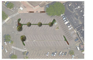
In 2019, the City of Norwalk secured a LIS Future Fund grant to install green infrastructure in the Webster Street Parking to reduce the impacts of stormwater on the Norwalk River and Harbor and mitigate local flooding of surrounding businesses through the installation of four different types of infiltration and bio-retention structures:
1) Underground infiltration systems.
2) Retention basins and curb inlet planters in eight different areas.
3) Porous pavement with storage in two areas.
4) Infiltration gutters and tree filters in two other areas.


Bryan Lutz
Assistant Director of Parking
blutz@norwalkct.gov; 203-854-7253
Case Study
Project
Norwalk, CT
In 2019, the City of Norwalk secured a LIS Future Fund grant to install green infrastructure in the Webster Street Parking to reduce the impacts of stormwater on the Norwalk River and Harbor and mitigate local flooding of surrounding businesses through the installation of four different types of infiltration and bio-retention structures:
1) Underground infiltration systems.
2) Retention basins and curb inlet planters in eight different areas.
3) Porous pavement with storage in two areas.
4) Infiltration gutters and tree filters in two other areas.
Case Study
Project
Stonington, CT
This public greenspace was suffering from mosquito overpopulation, invasion from Phragmites, and poor tidal/stormwater drainage. The Wetland’s Habitat and Mosquito Management Program (WHAMM) created a new drainage area and tunnels, while also eliminating invasive plants. Then organizations and volunteers banded together to remove and replace invasive plant species with native plants.


Juliana Barrett, CT Sea Grant Extension, 860-405-9106, juliana.barrett@uconn.edu
Journal of Extension Article: Moving With the Marsh: Encouraging Property Owner Adaptation to Marsh Migration
Case Study
Project
Stonington, CT
This public greenspace was suffering from mosquito overpopulation, invasion from Phragmites, and poor tidal/stormwater drainage. The Wetland’s Habitat and Mosquito Management Program (WHAMM) created a new drainage area and tunnels, while also eliminating invasive plants. Then organizations and volunteers banded together to remove and replace invasive plant species with native plants.
Case Study
Project
New Haven, CT
The City of New Haven has installed 286 right-of-way bioswales throughout the city as part of a multifaceted approach to reducing flooding in the downtown area. Right-of-way bioswales are engineered planted areas that are located on sidewalks. They are designed to capture and infiltrate stormwater into the ground that would otherwise directly enter a storm drain. These bioswales were installed as the result of various partnerships and funding opportunities related to flood prevention, localized drainage solutions, combined sewer overflow mitigation, research, and traffic calming projects.
City of New Haven, Dept of Engineering
Urban Resources Initiative, EMERGE Inc., Save the Sound, Yale School of the Environment, and Quinnipiac University, among others.


Dawn Henning
dhenning@newhavenct.gov
475-434-1643
Case Study
Project
New Haven, CT
The City of New Haven has installed 286 right-of-way bioswales throughout the city as part of a multifaceted approach to reducing flooding in the downtown area. Right-of-way bioswales are engineered planted areas that are located on sidewalks. They are designed to capture and infiltrate stormwater into the ground that would otherwise directly enter a storm drain. These bioswales were installed as the result of various partnerships and funding opportunities related to flood prevention, localized drainage solutions, combined sewer overflow mitigation, research, and traffic calming projects.
City of New Haven, Dept of Engineering
Urban Resources Initiative, EMERGE Inc., Save the Sound, Yale School of the Environment, and Quinnipiac University, among others.
Case Study
Project
Wilton, CT
Dana Dam (aka Strong Pond Dam) at Merwin Meadows Park in Wilton, CT was the first barrier to upstream fish migration from Long Island Sound on the Norwalk River. A series of dams along the Norwalk River (historically, and presently) prevented fish from reaching their historic spawning grounds, have posed safety risks, and disconnected the river from its natural floodplain. On September 11, 2023, demolition of this dam began! In addition to restoring habitat and allowing fish passage, the removal restored natural floodplain connectivity, realigned 200 feet of river channel away from an active railroad embankment, and removed a known safety hazard.


Alex Krofta, akrofta@savethesound.org
Case Study
Project
Wilton, CT
Dana Dam (aka Strong Pond Dam) at Merwin Meadows Park in Wilton, CT was the first barrier to upstream fish migration from Long Island Sound on the Norwalk River. A series of dams along the Norwalk River (historically, and presently) prevented fish from reaching their historic spawning grounds, have posed safety risks, and disconnected the river from its natural floodplain. On September 11, 2023, demolition of this dam began! In addition to restoring habitat and allowing fish passage, the removal restored natural floodplain connectivity, realigned 200 feet of river channel away from an active railroad embankment, and removed a known safety hazard.
Case Study
Project
Stratford, CT
This project consists of 750 feet of shoreline in Stratford, CT. The goal of the project was to protect the beach from coastal erosion and to help combat sea level rise. The steps consisted of adding a smooth cordgrass marsh, artificial shellfish reefs (reef balls), high marsh, and a coastal dune area. The site was awarded the “Best Restored Shore Area” from the American Shore and Beach Preservation Association. To adaptively manage the site, a second restoration project is being developed to extend the marsh seaward by 0.35 acres over an additional 250 feet of shore using a combination of bagged slipper shell and small, modular oyster castles near the marsh edge, along with additional cordgrass plantings in the intertidal zone.
Sacred Heart University

LaTina Steele
203-396-8485
steelel@sacredheart.edu
Case Study
Project
Stratford, CT
This project consists of 750 feet of shoreline in Stratford, CT. The goal of the project was to protect the beach from coastal erosion and to help combat sea level rise. The steps consisted of adding a smooth cordgrass marsh, artificial shellfish reefs (reef balls), high marsh, and a coastal dune area. The site was awarded the “Best Restored Shore Area” from the American Shore and Beach Preservation Association. To adaptively manage the site, a second restoration project is being developed to extend the marsh seaward by 0.35 acres over an additional 250 feet of shore using a combination of bagged slipper shell and small, modular oyster castles near the marsh edge, along with additional cordgrass plantings in the intertidal zone.
Sacred Heart University
Case Study
Project
Stratford, CT
This project restored 46 acres of the Great Meadows Marsh in Connecticut that was degraded from dredge material that was dumped on site, poor drainage, and sea level rise. The marsh was also overrun with invasive plants and mosquitoes. A controlled fire was started to kill the invasive reeds growing in the marsh. Then a construction crew removed invasive plants and the dumped dredge material. Lastly, channels were carefully dug for tidal flushing which will allow the marsh to keep pace with sea level rise. Soil hummocks were constructed for Salt Marsh Sparrow habitat. Now the area continues to be monitored, assessed for resiliency, and provides a field for innovative solutions to be tested in.
Trustees: USFWS, NOAA, State of Connecticut; Project Partners: Audubon Connecticut, Town of Stratford


Molly Sperduto at molly_sperduto@fws.gov;
Corrie Folsom-O’Keefe cfolsom.okeefe@audubon.org;
Jack Matthias jack.matthias@audubon.org
Case Study
Project
Stratford, CT
This project restored 46 acres of the Great Meadows Marsh in Connecticut that was degraded from dredge material that was dumped on site, poor drainage, and sea level rise. The marsh was also overrun with invasive plants and mosquitoes. A controlled fire was started to kill the invasive reeds growing in the marsh. Then a construction crew removed invasive plants and the dumped dredge material. Lastly, channels were carefully dug for tidal flushing which will allow the marsh to keep pace with sea level rise. Soil hummocks were constructed for Salt Marsh Sparrow habitat. Now the area continues to be monitored, assessed for resiliency, and provides a field for innovative solutions to be tested in.
Trustees: USFWS, NOAA, State of Connecticut; Project Partners: Audubon Connecticut, Town of Stratford
Case Study
Project
In partnership with Sands Point Preserve Conservancy, an innovative cliff face stabilization system, engineered by Long Island based company Coastal Technologies Corp (CTC), was deployed as a pilot on Oct. 30th, 2022 at a steep & loose coastal moraine bluff located at The Sands Point Preserve, NY. The pilot project was designed to test the efficacy of this system to secure and stabilize sediment under constant erosive pressure preventing vegetation from taking hold. This bluff was selected due to its very high rate of stormwater & aeolian erosion. American beach grass, bayberry, beach plum & rose plugs, all protected from erosive forces, have thrived. Slope erosion was prevented by the devices, and all plants were successfully held against the slope, exactly as designed.
Case Study
Project
Roslyn Harbor, NY
The Nassau County Museum of Art restored coastal grassland and use the restored grassland to educate visitors about the environment at the William Cullen Bryant Preserve, Roslyn Harbor, New York. The project will restore an important coastal habitat of Long Island Sound. The whole area was seeded mid-October 2023 and the meadow growth began in the spring of 2024, although it will take 2-3 years to resemble a meadow.

Jean Henning, Conservation Project Coordinator, William Cullen Bryant Preserve
jdshenning@gmail.com
Case Study
Project
Roslyn Harbor, NY
The Nassau County Museum of Art restored coastal grassland and use the restored grassland to educate visitors about the environment at the William Cullen Bryant Preserve, Roslyn Harbor, New York. The project will restore an important coastal habitat of Long Island Sound. The whole area was seeded mid-October 2023 and the meadow growth began in the spring of 2024, although it will take 2-3 years to resemble a meadow.
Case Study
Project
Sea Cliff, NY
The Hempstead Harbor Protection Committee and Village of Sea Cliff completed subwatershed improvements at Scudders Pond to address stormwater drainage problems impacting the water quality of the pond and Hempstead Harbor, highlighted as a priority in the 1998 Hempstead Harbor Water Quality Improvement Plan. The improvements included dredging the pond, installing a hydrodynamic separator to intercept sediment, removing invasive Phragmites australis and replacing with native plants, realigning the stream to reduce erosion, redirecting the stormwater from residences to the bioswale, creation of a biofilter wetland area, replacement of the weir between the upper and lower ponds and weir at Shore Road.

Eric Swenson, Hempstead Harbor Protection Committee, hempsteadharbor@gmail.com
Case Study
Project
Sea Cliff, NY
The Hempstead Harbor Protection Committee and Village of Sea Cliff completed subwatershed improvements at Scudders Pond to address stormwater drainage problems impacting the water quality of the pond and Hempstead Harbor, highlighted as a priority in the 1998 Hempstead Harbor Water Quality Improvement Plan. The improvements included dredging the pond, installing a hydrodynamic separator to intercept sediment, removing invasive Phragmites australis and replacing with native plants, realigning the stream to reduce erosion, redirecting the stormwater from residences to the bioswale, creation of a biofilter wetland area, replacement of the weir between the upper and lower ponds and weir at Shore Road.
Case Study
Project
The Maidstone Landing Association, situated between Town of Riverhead Iron Pier Beach and Hallock State Park, wanted to take action to mitigate erosion of their bluff. First they worked with Town of Riverhead to put up signage and fencing to stop beachgoers from climbing and driving on or near the bluff, which was causing significant destruction. Next they opted for a small-scale, nature-based approach to help stabilize the bluff. They purchased snow fencing from Home Depot and native beachgrass from Long Island Natives. They engaged Riverhead Charter High School to help with putting up the snow fencing and the plantings. The Maidstone Landing Association is using their bluff as an “outdoor classroom” to teach students and the public about the importance of conserving our coastal habitats and best practices.


Tom Mohrman mustangtpm@gmail.com; Corey Humphrey corey.humphrey@suffolkcountyny.gov
Case Study
Project
The Maidstone Landing Association, situated between Town of Riverhead Iron Pier Beach and Hallock State Park, wanted to take action to mitigate erosion of their bluff. First they worked with Town of Riverhead to put up signage and fencing to stop beachgoers from climbing and driving on or near the bluff, which was causing significant destruction. Next they opted for a small-scale, nature-based approach to help stabilize the bluff. They purchased snow fencing from Home Depot and native beachgrass from Long Island Natives. They engaged Riverhead Charter High School to help with putting up the snow fencing and the plantings. The Maidstone Landing Association is using their bluff as an “outdoor classroom” to teach students and the public about the importance of conserving our coastal habitats and best practices.
Case Study
Project
Increased development and the historic construction of a dam on Sunken Meadow Creek in the 1950’s led to reduced tidal exchange, increased water levels in the creek, poor water quality, and the proliferation of invasive species. In 2008 a number of partners (NYS OPRHP, NOAA, NYSDEC, LISS, TNC, Save the Sound, USFWS, LI Botanical Society) came together to work to restore the degraded marsh habitat around Sunken Meadow Creek, increase tidal flow, improve aquatic organism passage, limit invasives, and improve water quality. A restoration feasibility study was completed in 2010. In 2012 Superstorm Sandy blew out the dam on Sunken Meadow Creek, naturally kick-starting restoration. Following Superstorm Sandy, the project partners were able to quickly capitalize on available funding and grants, due to their prior planning efforts. A bridge was built across the Creek where the dam blew out, salt marsh habitat was restored at three locations, green infrastructure was installed in one of the parking areas to capture and treat stormwater runoff, fish passage feasibility on the creek was investigated, and education and outreach was conducted to thousands of people. These projects were completed in 2019. Now, with funding through Long Island Sound Futures Fund, Audubon NY is leading a large-scale marsh restoration project at Sunken Meadow Creek to restore important high-marsh habitat for at risk species, like the Saltmarsh Sparrow, and to increase the resilience of the marsh in the face of rising sea levels. Audubon will be working to finalize the designs and secure permits over the next two years, with on-the-ground restoration expected in 2026.


Sean Cruickshank Sean.Cruickshank@parks.ny.gov, Jon Vander Werff jvanderwerff@savethesound.org, Phoebe Clark phoebe.clark@audubon.org, Vicky O’Neill victoria.oneill@audubon.org
Case Study
Project
Increased development and the historic construction of a dam on Sunken Meadow Creek in the 1950’s led to reduced tidal exchange, increased water levels in the creek, poor water quality, and the proliferation of invasive species. In 2008 a number of partners (NYS OPRHP, NOAA, NYSDEC, LISS, TNC, Save the Sound, USFWS, LI Botanical Society) came together to work to restore the degraded marsh habitat around Sunken Meadow Creek, increase tidal flow, improve aquatic organism passage, limit invasives, and improve water quality. A restoration feasibility study was completed in 2010. In 2012 Superstorm Sandy blew out the dam on Sunken Meadow Creek, naturally kick-starting restoration. Following Superstorm Sandy, the project partners were able to quickly capitalize on available funding and grants, due to their prior planning efforts. A bridge was built across the Creek where the dam blew out, salt marsh habitat was restored at three locations, green infrastructure was installed in one of the parking areas to capture and treat stormwater runoff, fish passage feasibility on the creek was investigated, and education and outreach was conducted to thousands of people. These projects were completed in 2019. Now, with funding through Long Island Sound Futures Fund, Audubon NY is leading a large-scale marsh restoration project at Sunken Meadow Creek to restore important high-marsh habitat for at risk species, like the Saltmarsh Sparrow, and to increase the resilience of the marsh in the face of rising sea levels. Audubon will be working to finalize the designs and secure permits over the next two years, with on-the-ground restoration expected in 2026.
Case Study
Project
Mamaroneck, NY
Otter Creek Preserve is located along a three-mile stretch of coastline on Long Island Sound in Mamaroneck, NY. It contains 90% of the remaining productive salt marshes in Westchester County, and is an important site for migratory birds, marine life, and other wildlife. The 35-acre preserve is the largest privately-owned tidal wetland designated and protected as a nature sanctuary in Westchester County.
Following improvements made to the coastal forest and tidal marsh in 2015 and 2016 with support from the Westchester Community Foundation, in 2017 Westchester Land Trust (WLT) received NFWF LISFF funding to continue removing non-native trees, shrubs, and vines, replant with native species, and conduct expanded outreach and educational programming at the preserve.

Westchester Land Trust
403 Harris Road
Bedford Hills, NY 10507
www.westchesterlandtrust.org
Case Study
Project
Mamaroneck, NY
Otter Creek Preserve is located along a three-mile stretch of coastline on Long Island Sound in Mamaroneck, NY. It contains 90% of the remaining productive salt marshes in Westchester County, and is an important site for migratory birds, marine life, and other wildlife. The 35-acre preserve is the largest privately-owned tidal wetland designated and protected as a nature sanctuary in Westchester County.
Following improvements made to the coastal forest and tidal marsh in 2015 and 2016 with support from the Westchester Community Foundation, in 2017 Westchester Land Trust (WLT) received NFWF LISFF funding to continue removing non-native trees, shrubs, and vines, replant with native species, and conduct expanded outreach and educational programming at the preserve.
Resources & Tools