Mapper
Level of Effort:
This NOAA Fisheries ArcGIS StoryMap aids project applicants and Federal action agency partners in using relevant, sensitive habitats data to develop comprehensive Essential Fish Habitat (EFH) assessments. The tool also supports Federal action agencies and project proponents in determining when an updated habitat survey for sensitive resources (including tidal marsh, shellfish habitat, hard seafloor, submerged aquatic vegetation, rocky habitats, and mudflats) may be required for a complete EFH consultation.
Story Map
Level of Effort:
A StoryMap on Hypoxia
This StoryMap describes how the Long Island Sound (LIS) Partnership has reduced hypoxia and improved nutrient management efforts in Long Island Sound and its watershed.
It includes an explanation of hypoxia, impacts from the region’s history, how LIS Partnership is addressing hypoxia, plans for the future, and how to use this information to inform meaningful action.
Mapper
Level of Effort:
The Long Island Sound watershed is home to nearly 9 million people in parts of Connecticut, Massachusetts, New Hampshire, New York, Rhode Island, Vermont, and Canada. Government agencies, nonprofits, and Tribal Nations have overseen numerous projects to monitor and protect the water resources of this watershed and the sound. Although there is an abundance of data, there is no easy way to search them or a central place to manage this information. To help, the U.S. Geological Survey, the U.S. Environmental Protection Agency, and the Long Island Sound Study have created an interactive map to help users find and understand data about the water resources of the Long Island Sound and its watershed.
This mapping tool does not host data or maintain data repositories. Instead, it compiles and presents metadata from publicly accessible databases managed by State and other organizations.
Refer to this fact sheet for details about the application and its data sources: The Long Island Sound and Watershed Metadata map application
Training
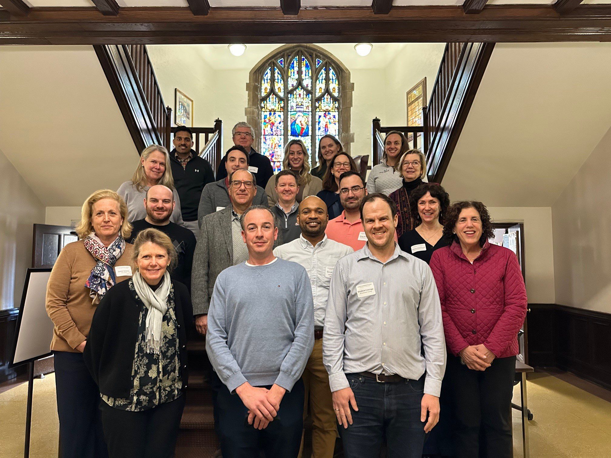
With funding from Long Island Sound Study and support from New York Sea Grant’s Sustainable and Resilient Communities Extension Professionals, Pace University’s Land Use Law Center brought its award-winning Land Use Leadership Alliance Training Program to Westchester municipalities within the Long Island Sound watershed. The training consisted of three full-day workshops held April 1, 8, and 22, 2025 in White Plains, NY to train local leaders on developing balanced strategies for effectively accomplishing policy objectives, particularly focused on land use, flood resilience, and natural resource protection to strengthen community planning and informed decision-making.
22 municipal staff and community leaders, representing 7 different Long Island Sound communities received resilience gap analyses that reviewed their municipality’s current zoning and comprehensive plan language, discussed common issues with their neighbors and built new networks of support, and graduated from the program empowered to plan for a more resilient future for their community and the Long Island Sound region.
If you are interested in learning more and participating in a future LULA training, please email lisresilience@gmail.com.
Training
With funding from Long Island Sound Study and support from New York Sea Grant’s Sustainable and Resilient Communities Extension Professionals, Pace University’s Land Use Law Center brought its award-winning Land Use Leadership Alliance Training Program to Westchester municipalities within the Long Island Sound watershed. The training consisted of three full-day workshops held April 1, 8, and 22, 2025 in White Plains, NY to train local leaders on developing balanced strategies for effectively accomplishing policy objectives, particularly focused on land use, flood resilience, and natural resource protection to strengthen community planning and informed decision-making.
22 municipal staff and community leaders, representing 7 different Long Island Sound communities received resilience gap analyses that reviewed their municipality’s current zoning and comprehensive plan language, discussed common issues with their neighbors and built new networks of support, and graduated from the program empowered to plan for a more resilient future for their community and the Long Island Sound region.
If you are interested in learning more and participating in a future LULA training, please email lisresilience@gmail.com.
Mapper
Level of Effort:
The Connecticut Department of Energy and Environmental Protection (DEEP) and their contractor Whiteout Solutions have released a groundbreaking high-resolution dataset capturing over 12,000 acres of coastal saltmarsh and adjoining upland buffer in the state of Connecticut. The new dataset, available to the public via Whiteout’s web-based geospatial application geoSAP, includes:
All data layers can be viewed and downloaded through geoSAP.
Training
In Spring 2025 the SRC Team hosted funding workshops on Long Island, NY and New Haven, CT.

The Sustainable and Resilient Communities (SRC) team hosted the 2nd Annual Connecticut Regional Funding Workshop on Monday, March 31, 2025 to provide information on funding opportunities to support sustainability and resilience-focused projects. Attendees heard from program officers representing various local, state, and regional funding organizations and were able to engage in discussions with funders and assistance programs to explore project ideas and ways to improve funding applications. A panel of successful awardees shared their experiences and strategies. Attendees also worked through the guidance in the SRC Resilience Planning Guide. The workshop is intended for municipal officials and staff, nonprofits, community organizations, and other groups interested in planning and implementing projects that advance the sustainability and resilience of Long Island Sound communities.

Training
In Spring 2025 the SRC Team hosted funding workshops on Long Island, NY and New Haven, CT.
The Sustainable and Resilient Communities (SRC) team hosted the 2nd Annual Connecticut Regional Funding Workshop on Monday, March 31, 2025 to provide information on funding opportunities to support sustainability and resilience-focused projects. Attendees heard from program officers representing various local, state, and regional funding organizations and were able to engage in discussions with funders and assistance programs to explore project ideas and ways to improve funding applications. A panel of successful awardees shared their experiences and strategies. Attendees also worked through the guidance in the SRC Resilience Planning Guide. The workshop is intended for municipal officials and staff, nonprofits, community organizations, and other groups interested in planning and implementing projects that advance the sustainability and resilience of Long Island Sound communities.
Training
In Spring 2025 the SRC team hosted funding workshops on Long Island, NY and New Haven, CT.

The Sustainable and Resilient Communities (SRC) team hosted the 2nd Annual Long Island Regional Funding Workshop on March 27, 2025 to provide information on funding opportunities to support sustainability and resilience-focused projects. Attendees heard from program officers representing 35 local, state, and Long Island Sound funding organizations and were able to engage in discussions with funders to explore project ideas and ways to improve funding applications and worked through guidance in the Resilience Planning Guide. Attendees also heard from a panel of successful awardees about their experiences and strategies.

Training
In Spring 2025 the SRC team hosted funding workshops on Long Island, NY and New Haven, CT.
The Sustainable and Resilient Communities (SRC) team hosted the 2nd Annual Long Island Regional Funding Workshop on March 27, 2025 to provide information on funding opportunities to support sustainability and resilience-focused projects. Attendees heard from program officers representing 35 local, state, and Long Island Sound funding organizations and were able to engage in discussions with funders to explore project ideas and ways to improve funding applications and worked through guidance in the Resilience Planning Guide. Attendees also heard from a panel of successful awardees about their experiences and strategies.
Mapper
Level of Effort:
Connecticut shoreline data is now available via USDA’s Web Soil Survey mapping tool. This includes detailed aspects of the shallow subaqueous, submerged soils, and adjacent nearshore areas such as tidal marshes and beaches. This information will help inventory resources, plan for hazard mitigation, guide restoration efforts, and track environmental changes. The next phase of the project will map the New York side of the shoreline. See the Coastal Zone Soil Survey Fact Sheet to learn more about the process for collecting and documenting these data.
Training
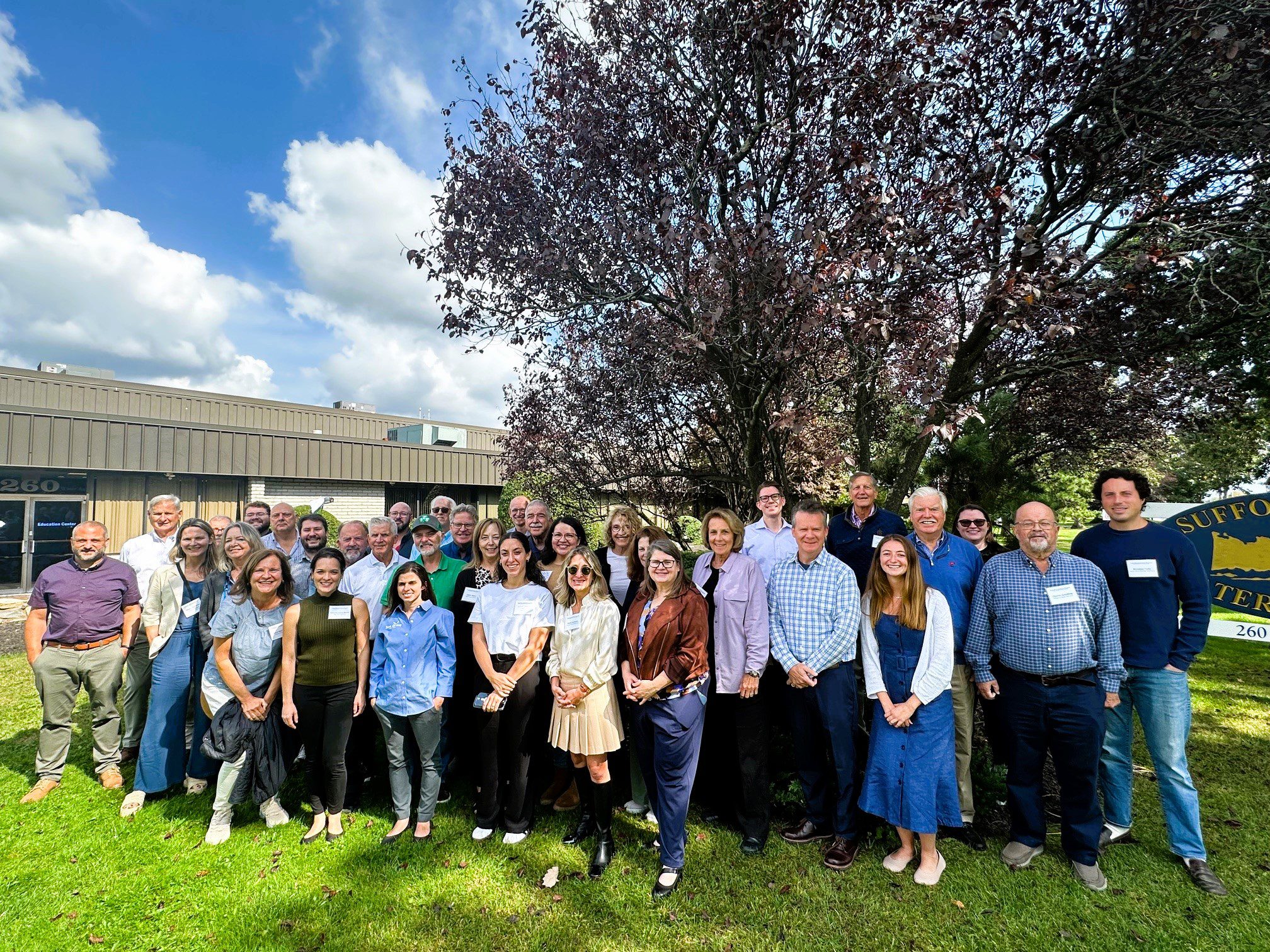
With funding from Long Island Sound Study and support from New York Sea Grant’s Sustainable and Resilient Communities Extension Professionals, Pace University’s Land Use Law Center brought its award-winning Land Use Leadership Alliance Training Program to Suffolk and Nassau municipalities within the Long Island Sound watershed. The training program consisted of three full-day workshops held in Hauppauge, NY that focused on the land use system, innovative approaches to sea level rise adaptation, hazard mitigation, and natural resource protection to strengthen community planning, regulation, and informed decision-making. 28 municipal staff and community leaders, representing 18 different Long Island Sound communities, completed the Program. Program graduates gained new networks of support, identified successful land use techniques, and developed implementation plans that will enable a more resilient future for their community and the Long Island Sound region.
The program comprised three full-day sessions on September 27, October 4, and October 18, 2024 at the Suffolk County Water Authority Education Center, 260 Motor Parkway in Hauppauge, NY.
If you are interested in learning more and participating in a future LULA training, please email lisresilience@gmail.com.
Training
The Long Island Sound Sustainable and Resilient Communities (SRC) Team held our 2024 Annual Workshop virtually as three sessions over two days. Session topics focused on our assistance programs, new regional resilience resources and tools, and a discussion on planning for inundation and different considerations communities may face.
Session 2 – Resilience Tools was held on Tuesday, December 10th from 1:30-3:30 PM. Participants learned about new Resilience Tools being developed and used throughout coastal Long Island Sound.
Mapper
Level of Effort:
This site provides federally supported data visualizations coupled with explanations and science education to help communities prepare for challenges that will affect our coastal environments. By showing how sea levels are changing regionally, the site provides a foundation to inform decision-making related to coastal planning, resource management, and emergency operations.
This website is a collaborative effort from The Interagency Task Force on Sea Level Change (DOD, EPA, FEMA, NASA, NOAA, USACE, USAID, and USGS).
Mapper
Level of Effort:
5th National Climate Assessment Atlas
To help Americans anticipate how changing climate conditions might affect their homes and businesses, the United States Global Change Research Program conducts a comprehensive review of scientific information on climate trends and impacts in our country every four years. The 5th National Climate Assessment — often referred to as NCA5 — was published in 2023.
This Interactive Atlas provides access to data compiled for NCA5. Browse the collection for your own investigations, or access the data for custom analysis and mapping.
Report
Level of Effort:
The Fifth National Climate Assessment is the US Government’s preeminent report on climate change impacts, risks, and responses. It is a congressionally mandated interagency effort that provides the scientific foundation to support informed decision-making across the United States.
Website
Level of Effort:
The New York State Climate Impacts Assessment explores current and future climate change impacts to New York State communities, ecosystems, and economy. The New York State Energy Research and Development Authority (NYSERDA) assembled more than 250 New York–based, national, and Indigenous climate science experts and representatives from diverse communities and industries across the state to contribute to this assessment. The findings are intended to help residents, businesses, and decision-makers across the state plan and prepare for climate change impacts.
Plan
Level of Effort:
This study by Seth et al. provides up-to-date information on observed trends and projections of temperature and precipitation in Connecticut.
Plan
Level of Effort:
This study by Seth et al. provides up-to-date information on observed trends and projections of temperature and precipitation in Connecticut.
Case Study
Plan
Huntington, NY
This comprehensive study and plan, funded through the National Fish and Wildlife Foundation, Long Island Sound Futures Fund, identifies initial strategies to maintain and enhance the local watershed resources of Crab Meadow. It is meant to be a land management tool to guide the implementation of best practices. The plan was developed in consultation with many partners and stakeholders. There is now significant community buy-in to take action to protect and restore this important watershed.
Following adoption of the plan, the Town of Huntington began working with US Fish and Wildlife Service and Audubon to study and restore Crab Meadow marsh and implement recommendations from the Stewardship Plan. Audubon, in partnership with Town of Huntington and USFWS, received a 2024 Long Island Sound Futures Fund Grant ($429K) to develop design plans for marsh restoration at Crab Meadow.
Garrett Chelius gchelius@huntingtonny.gov, Victoria O’Neill victoria.oneill@audubon.org, Suzanne Paton suzanne_paton@fws.gov
 Photo by Jonah Saitz, USFWS.
Case Study
Plan
Huntington, NY
This comprehensive study and plan, funded through the National Fish and Wildlife Foundation, Long Island Sound Futures Fund, identifies initial strategies to maintain and enhance the local watershed resources of Crab Meadow. It is meant to be a land management tool to guide the implementation of best practices. The plan was developed in consultation with many partners and stakeholders. There is now significant community buy-in to take action to protect and restore this important watershed.
Following adoption of the plan, the Town of Huntington began working with US Fish and Wildlife Service and Audubon to study and restore Crab Meadow marsh and implement recommendations from the Stewardship Plan. Audubon, in partnership with Town of Huntington and USFWS, received a 2024 Long Island Sound Futures Fund Grant ($429K) to develop design plans for marsh restoration at Crab Meadow.
Case Study
Project
New Haven, CT
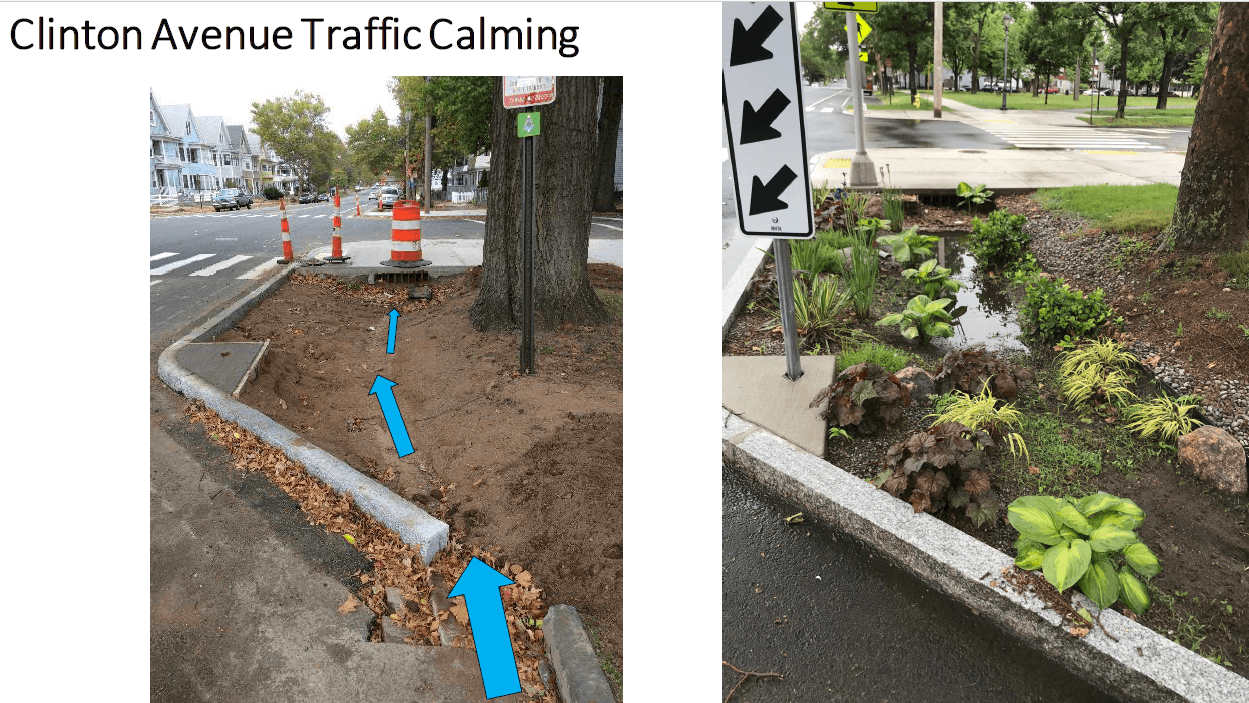
The City of New Haven has installed 286 right-of-way bioswales throughout the city as part of a multifaceted approach to reducing flooding in the downtown area. Right-of-way bioswales are engineered planted areas that are located on sidewalks. They are designed to capture and infiltrate stormwater into the ground that would otherwise directly enter a storm drain. These bioswales were installed as the result of various partnerships and funding opportunities related to flood prevention, localized drainage solutions, combined sewer overflow mitigation, research, and traffic calming projects.
City of New Haven, Dept of Engineering
Urban Resources Initiative, EMERGE Inc., Save the Sound, Yale School of the Environment, and Quinnipiac University, among others.


Dawn Henning
dhenning@newhavenct.gov
475-434-1643
Case Study
Project
New Haven, CT
The City of New Haven has installed 286 right-of-way bioswales throughout the city as part of a multifaceted approach to reducing flooding in the downtown area. Right-of-way bioswales are engineered planted areas that are located on sidewalks. They are designed to capture and infiltrate stormwater into the ground that would otherwise directly enter a storm drain. These bioswales were installed as the result of various partnerships and funding opportunities related to flood prevention, localized drainage solutions, combined sewer overflow mitigation, research, and traffic calming projects.
City of New Haven, Dept of Engineering
Urban Resources Initiative, EMERGE Inc., Save the Sound, Yale School of the Environment, and Quinnipiac University, among others.
Case Study
Project
Stratford, CT
This project consists of 750 feet of shoreline in Stratford, CT. The goal of the project was to protect the beach from coastal erosion and to help combat sea level rise. The steps consisted of adding a smooth cordgrass marsh, artificial shellfish reefs (reef balls), high marsh, and a coastal dune area. The site was awarded the “Best Restored Shore Area” from the American Shore and Beach Preservation Association. To adaptively manage the site, a second restoration project is being developed to extend the marsh seaward by 0.35 acres over an additional 250 feet of shore using a combination of bagged slipper shell and small, modular oyster castles near the marsh edge, along with additional cordgrass plantings in the intertidal zone.
Sacred Heart University
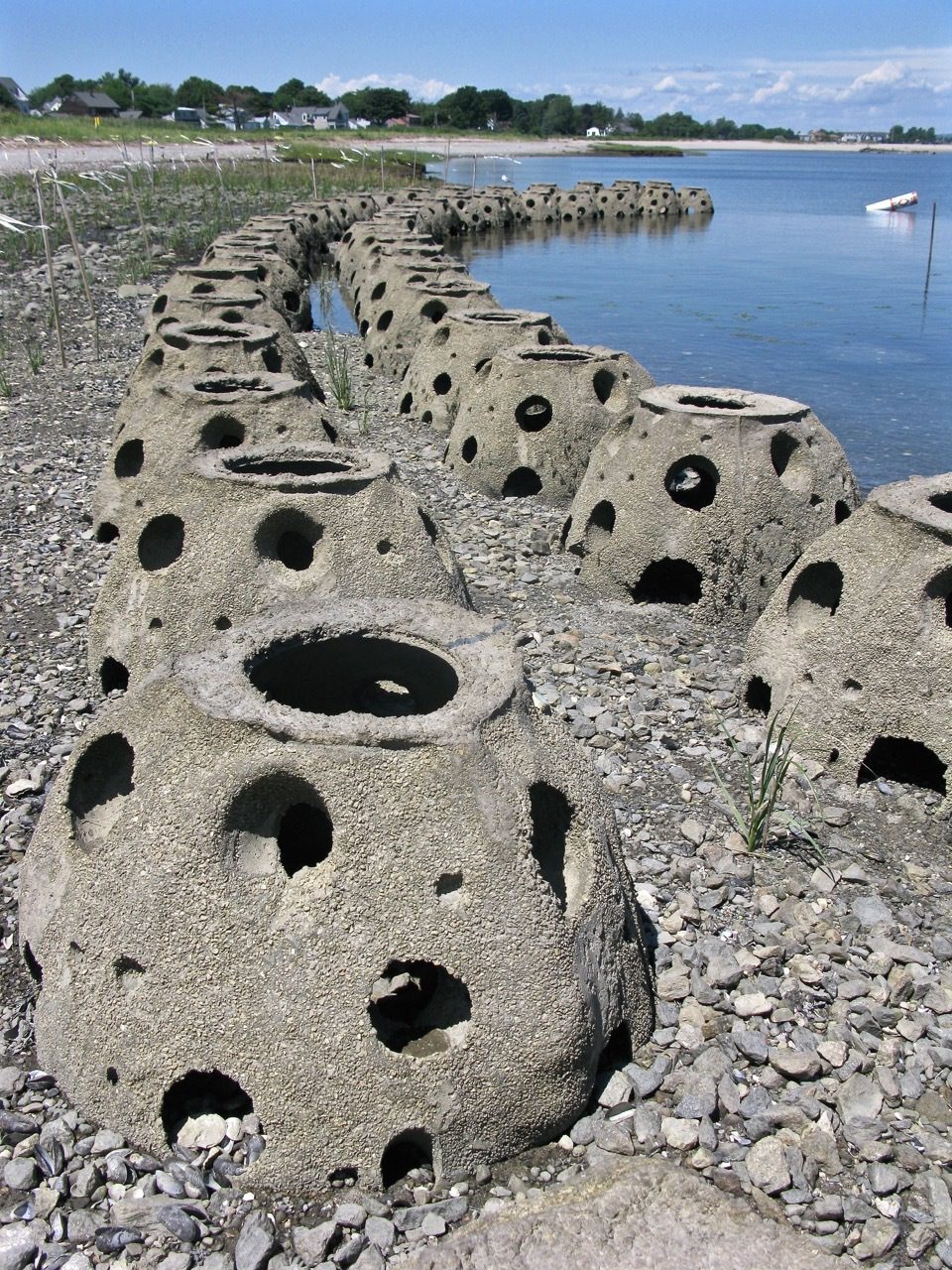
LaTina Steele
203-396-8485
steelel@sacredheart.edu
Case Study
Project
Stratford, CT
This project consists of 750 feet of shoreline in Stratford, CT. The goal of the project was to protect the beach from coastal erosion and to help combat sea level rise. The steps consisted of adding a smooth cordgrass marsh, artificial shellfish reefs (reef balls), high marsh, and a coastal dune area. The site was awarded the “Best Restored Shore Area” from the American Shore and Beach Preservation Association. To adaptively manage the site, a second restoration project is being developed to extend the marsh seaward by 0.35 acres over an additional 250 feet of shore using a combination of bagged slipper shell and small, modular oyster castles near the marsh edge, along with additional cordgrass plantings in the intertidal zone.
Sacred Heart University
Case Study
Plan
Oyster Bay, NY and Cold Spring Harbor, NY
In 2023, Long Island Sound Study, New York Sea Grant and Warren Pinnacle, in partnership with committed municipalities and marsh-conservation groups/organizations, developed a Plan to understand the benefits, threats and recommended conservation actions at seven focal areas across the harbors. The goal of the Plan is to inform local municipalities and marsh-conservation groups as to where they might focus their conservation efforts to maximize the conservation of marsh ecosystem services under sea-level rise conditions. This process brought together a diversity of stakeholders to develop a cohesive strategy for seven focal areas across Oyster Bay and Cold Spring Harbor: Frost Creek, Mill Neck Creek, West Shore Road, Bayville Bridge to Centre Island, Centre Island, Shore Road, and Lower Cold Spring Harbor. The partners will now work to implement the recommendations in the plan.
St. John’s Episcopal Church (lower Cold Spring Harbor) and Village of Lattingtown (Frost Creek) were 2024 LIS Resilience Planning Support Program awardees. Their projects will build off the Oyster Bay & Cold Spring Harbor marsh conservation plan and develop specific recommendations to enhance and restore marsh habitat in lower Cold Spring Harbor and Frost Creek.

Sarah Schaefer-Brown, scs292@cornell.edu
Case Study
Plan
Oyster Bay, NY and Cold Spring Harbor, NY
In 2023, Long Island Sound Study, New York Sea Grant and Warren Pinnacle, in partnership with committed municipalities and marsh-conservation groups/organizations, developed a Plan to understand the benefits, threats and recommended conservation actions at seven focal areas across the harbors. The goal of the Plan is to inform local municipalities and marsh-conservation groups as to where they might focus their conservation efforts to maximize the conservation of marsh ecosystem services under sea-level rise conditions. This process brought together a diversity of stakeholders to develop a cohesive strategy for seven focal areas across Oyster Bay and Cold Spring Harbor: Frost Creek, Mill Neck Creek, West Shore Road, Bayville Bridge to Centre Island, Centre Island, Shore Road, and Lower Cold Spring Harbor. The partners will now work to implement the recommendations in the plan.
St. John’s Episcopal Church (lower Cold Spring Harbor) and Village of Lattingtown (Frost Creek) were 2024 LIS Resilience Planning Support Program awardees. Their projects will build off the Oyster Bay & Cold Spring Harbor marsh conservation plan and develop specific recommendations to enhance and restore marsh habitat in lower Cold Spring Harbor and Frost Creek.
Case Study
Plan
Stony Brook, Head of Harbor and Nissequogue, NY
In 2023, Long Island Sound Study and Warren Pinnacle, in partnership with committed municipalities and conservation groups/organizations, developed a Plan to understand the benefits, threats, and recommended conservation actions for the Stony Brook Harbor and West Meadow Creek marsh ecosystem. The goal of the Plan is to help inform conservation and restoration efforts to maximize marsh ecosystem services under rising sea levels.

Elizabeth Hornstein, eeh78@cornell.edu
Case Study
Plan
Stony Brook, Head of Harbor and Nissequogue, NY
In 2023, Long Island Sound Study and Warren Pinnacle, in partnership with committed municipalities and conservation groups/organizations, developed a Plan to understand the benefits, threats, and recommended conservation actions for the Stony Brook Harbor and West Meadow Creek marsh ecosystem. The goal of the Plan is to help inform conservation and restoration efforts to maximize marsh ecosystem services under rising sea levels.
Case Study
Plan
In 2023, Long Island Sound Study and Warren Pinnacle, in partnership with Westchester County and conservation groups/organizations, have developed a Plan to understand the benefits of, threats to, and recommended conservation actions for marsh ecosystems on Glen Island Park in New Rochelle, NY. The goal of the Plan is to help inform conservation and restoration efforts to maximize marsh ecosystem services under rising sea levels.
Sara Powell, slp285@cornell.edu
Case Study
Plan
In 2023, Long Island Sound Study and Warren Pinnacle, in partnership with Westchester County and conservation groups/organizations, have developed a Plan to understand the benefits of, threats to, and recommended conservation actions for marsh ecosystems on Glen Island Park in New Rochelle, NY. The goal of the Plan is to help inform conservation and restoration efforts to maximize marsh ecosystem services under rising sea levels.
Mapper
Level of Effort:
This mapper is intended to provide federal, state, and local managers with tools to estimate the vulnerability and ecosystem service potential of wetlands. It allows you to display information on the unvegetated to vegetated ratio (UVVR), marsh elevation, tidal range, and shoreline change rates for New York’s tidal wetlands.
Mapper
Level of Effort:
Coastal Resilience is a Connecticut-based decision support tool that provides local, regional, state and national stakeholders a step-wise process to guide decisions to reduce the ecological and socio-economic risks of coastal and inland hazards.
Mapper
Level of Effort:
Coastal Resilience is a Connecticut-based decision support tool that provides local, regional, state and national stakeholders a step-wise process to guide decisions to reduce the ecological and socio-economic risks of coastal and inland hazards.
Mapper
Level of Effort:
Save the Sound’s Sound Health Explorer displays information on water quality for Long Island Sound beaches, embayments, and open waters.
Mapper
Level of Effort:
Save the Sound’s Sound Health Explorer displays information on water quality for Long Island Sound beaches, embayments, and open waters.
Mapper
Level of Effort:
Developed by The Nature Conservancy, this tool identifies priority road-stream and tidal crossings in Suffolk County for replacement or upgrades. Prioritization is based on social and ecological criteria. Additionally, it includes data on current and future projected flooding and marsh extent under various sea level rise scenarios. The tool is meant to be a screening tool for planning efforts.
Data
Level of Effort:
The Long Island Tidal Wetlands Trends Analysis measures wetlands loss and changes in marsh condition within the Long Island Sound, Peconic, and South Shore estuaries including all or parts of Westchester, Bronx, Queens, Nassau, and Suffolk Counties between 1974 and 2005/2008. The results of this project are intended for use by environmental managers, conservation advocates and elected officials across a variety of regulatory agencies, environmental organizations, and governments.
Story Map
Level of Effort:
This Story map illustrates climate change projections, considering scenarios that factor in temperature, precipitation, extreme heat, storms, and sea level.
Story Map
Level of Effort:
This Story map illustrates climate change projections, considering scenarios that factor in temperature, precipitation, extreme heat, storms, and sea level.
Mapper
Level of Effort:
RAPT provides access to important data and analysis tools to support your community before, during and after a disaster.
Mapper
Level of Effort:
RAPT provides access to important data and analysis tools to support your community before, during and after a disaster.
Data
Level of Effort:
Provides the most up-to-date sea level rise projections for all U.S. states and territories, out to the year 2150. Extrapolations of available tide gauge observations are also provided. The sea level scenarios and information contained in this tool originate from 2022 technical report produced by the Sea Level Rise and Coastal Flood Hazard Scenarios and Tools Interagency Task Force.
Mapper
Level of Effort:
The purpose of the interactive viewer is to illustrate the fate of significant marsh systems on Long Island Sound under future Sea-Level Rise conditions. Model results are combined with tax-parcel information and integrated with information about marsh ecosystem services to assist municipalities and conservation groups in defining and assessing various land-management alternatives.
Website
Level of Effort:
Submit your coastal flooding photos through this website/app. Photos are linked to real-time environmental conditions to create flooding reports that help stakeholders understand our changing environment and make informed decisions.
Website
Level of Effort:
Submit your coastal flooding photos through this website/app. Photos are linked to real-time environmental conditions to create flooding reports that help stakeholders understand our changing environment and make informed decisions.
Website
Level of Effort:
MyCoast NY collects and catalogs photos provided by volunteers that document changing water levels, shorelines, and hazardous weather impacts across New York’s varied coasts and water bodies. Photos are linked to real-time environmental conditions to create flooding and storm impact reports that help stakeholders like government agencies, business owners, and residents understand our changing environment and make informed decisions.
Mapper
Level of Effort:
Use this mapper to visualize people, infrastructure, and natural resources exposed to coastal flood hazards. You can save and share the online maps to communicate with stakeholders. Tip: watch the short video about the tool before getting started!
Mapper
Level of Effort:
Use this mapper to visualize people, infrastructure, and natural resources exposed to coastal flood hazards. You can save and share the online maps to communicate with stakeholders. Tip: watch the short video about the tool before getting started!
Mapper
Level of Effort:
This tool produces location-specific scenarios for sea level and flooding, as well as information about present-day and past conditions. Local governments and other practitioners can use the information to make informed decisions about strategic adaptation investments. The site incorporates data, maps, and visualizations and produces automated, location-specific reports.
Mapper
Level of Effort:
Use this web mapping tool to visualize community-level impacts from coastal flooding or sea level rise (up to 10 feet above average high tides). Photo simulations of how future flooding might impact local landmarks are also provided, as well as data related to water depth, connectivity, flood frequency, socio-economic vulnerability, wetland loss and migration, and mapping confidence.
Website
Level of Effort:
The 2022 State Climate Summaries provide new information on assessment topics directly related to NOAA’s mission, specifically historical climate variations and trends, future climate model projections of climate conditions during the 21st century, and past and future conditions of sea level and coastal flooding. Select your state to find state-level information for observed changes in climate, including both long-term trends and extreme weather events.
Data
Level of Effort:
New York State sea level rise projections. The New York State Department of Environmental Conservation is currently updating these projections.
Data
Level of Effort:
New York State sea level rise projections. The New York State Department of Environmental Conservation is currently updating these projections.
Mapper
Level of Effort:
This floodplain mapper shows the estimated boundary of future coastal floodplains for different sea level rise scenarios for New York State. Customize a scenario by choosing the amount of sea level rise in inches and a coastal flood recurrence interval.
Mapper
Level of Effort:
This floodplain mapper shows the estimated boundary of future coastal floodplains for different sea level rise scenarios for New York State. Customize a scenario by choosing the amount of sea level rise in inches and a coastal flood recurrence interval.
Guidance Tool
Level of Effort:
This guide is designed to assist decision makers and coastal professionals with applying and integrating the information in the 2022 Sea Level Rise Technical Report, produced by the Sea Level Rise and Coastal Flood Hazard Scenarios and Tools Interagency Task Force, into local sea level rise planning and adaptation decisions.
Training
This online information session held Sept. 19, and repeated Sept. 21, provides an introduction to resilience planning in the Long Island Sound region. It includes discussions on local climate impacts and projections, resilience planning strategies, and climate certification programs for both New York and Connecticut municipalities. In addition to the main presentation, videos of the Connecticut and New York breakout sessions can be accessed below. The presentations and other resource materials are available here.
Resources & Tools

