Resources for
Sustainable
Guidance Tool
Level of Effort:
Climate Action Tool
The 2025 expansion of the Climate Action Tool (CAT) allows you to:
1) Access information on climate impacts and vulnerability of species and habitats; and
2) Explore adaptation strategies and actions, related to connectivity, conservation planning, and forestry, among other relevant areas.
This tool was developed by the Northeast Climate Adaptation Science Center and the University of Massachusetts Amherst (UMass) Center for Agriculture, Food, and the Environment.
Mapper
Level of Effort:
Long Island Sound Crossing Prioritization Tool
The Long Island Sound Crossing Prioritization Tool can be used to prioritize road-stream crossings (culverts and bridges) for ecological, infrastructure, and community resilience benefits in Westchester, Nassau and Suffolk County, NY. The tool helps communities plan improvements that restore habitat for diadromous fishes, strengthen infrastructure, and keep communities connected.
Developed by Save the Sound in partnership with Seatuck Environmental Association and The Nature Conservancy, the Long Island Sound Crossing Prioritization Tool was built by CivicMapper and is hosted on ArcGIS Online. It is intended to be a resource for municipalities, especially parts of municipal government that make infrastructure or environmental decisions for their communities, by making it easier to apply for grant funding. The tool is a useful resource for agency partners and fellow environmental organizations working to accelerate river restoration and protect communities from a changing climate.
SRC Training
4th Annual SRC Workshop: Session 2 – Using Nature-Based Solutions for Resilience
The Long Island Sound Sustainable and Resilient Communities (SRC) Team held our 2025 Annual Workshop virtually as three sessions over two days. Session topics focused on resources and tools available to help take advantage of state resilience funds, a panel discussion on why and how to incorporate nature-based solutions into resilience planning, and an overview of our available assistance programs.
Session 2 – Using Nature-Based Solutions for Resilience: A Panel Discussion on Common Challenges & Strategies for Success was held on Thursday, December 4, 2025. In this interactive session, practitioners and experts discussed techniques for integrating nature-based solutions into resilience initiatives. The panel highlighted common challenges and shared successful strategies from projects in the Long Island Sound region. Video of the session along with supporting materials is available below.
Website
Level of Effort:
The Atlas of Inspiration
The Atlas of Inspiration is a national database that highlights real projects helping communities adapt to extreme weather, flooding, heat, and sea-level rise. It showcases innovative infrastructure, planning strategies, and funding approaches that can be adapted or scaled by other communities. The Atlas is designed to celebrate successful ideas and give decision-makers examples they can use when seeking state or federal funding.
The Atlas is fully searchable, allowing users to browse projects by type, climate hazard, or location. It builds on Rebuild by Design’s earlier work including the Atlas of Disaster and the Atlas of Accountability by showing not only the risks communities face, but the solutions that are already making a difference.
Rebuild by Design also invites communities to share their own climate resilience projects for inclusion in the Atlas. Submissions help expand the collection and highlight new approaches being used across the country.
Report
Level of Effort:
Building a Resilient Trail
This report provides on guidance on ways to adapt the Shoreline Greenway Trail to the increasing frequencies of heavy rain, wildfires, hurricanes, flood events, and storm surges. The report defines what we mean by resilience for a trail in coastal Connecticut, identifies climate impacts facing the trail now, and in the years to come, shares design suggestions that could build resiliency on existing and new sections, and explores how the trail itself can be essential to wider community resiliency.
Resource
Long Island Watershed Action Agenda
The Long Island Watershed Action Agenda is a clear-cut blueprint for water quality improvements, aquatic habitat conservation, groundwater protection, and the public engagement necessary to ensure success for the surface, coastal, and ground waters of Nassau and Suffolk counties. The Long Island Watershed Action Agenda is an evolution of the success of the Long Island Nitrogen Action Plan (LINAP) and will expand the scope of its work beyond nitrogen reduction.
SRC Training
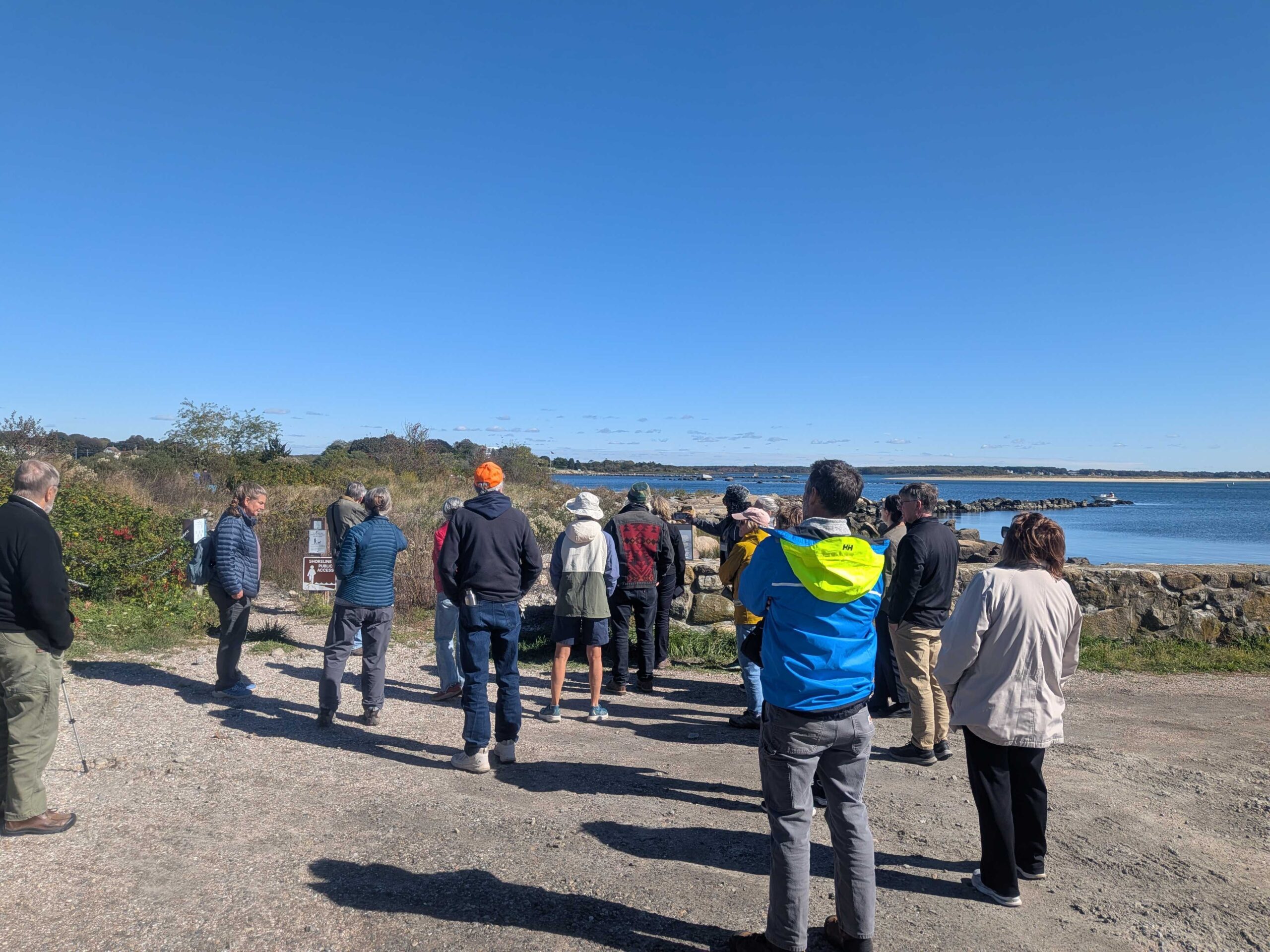
Dodge Paddock & Beal Preserve Marsh Restoration Field Trip and Workshop
On October 16, 2025, the Sustainable and Resilient Communities (SRC) team of the Long Island Sound Partnership hosted a field trip featuring the Dodge Paddock and Beal Preserve Marsh Restoration Project in Stonington Borough. The day started with a presentation outlining the history and current state of the site, followed by a walk to Dodge Paddock and Beal Preserve where there was a guided tour led by Connecticut Sea Grant, Avalonia Land Conservancy, and local volunteers. The day included a deep dive into the invasive species removal process, plantings to accommodate marsh migration, and a close up look at what has grown since then. Special thanks to our partners with Avalonia Land Conservancy, Connecticut Sea Grant, and the Stonington Community.
SRC Training
Dodge Paddock & Beal Preserve Marsh Restoration Field Trip and Workshop
On October 16, 2025, the Sustainable and Resilient Communities (SRC) team of the Long Island Sound Partnership hosted a field trip featuring the Dodge Paddock and Beal Preserve Marsh Restoration Project in Stonington Borough. The day started with a presentation outlining the history and current state of the site, followed by a walk to Dodge Paddock and Beal Preserve where there was a guided tour led by Connecticut Sea Grant, Avalonia Land Conservancy, and local volunteers. The day included a deep dive into the invasive species removal process, plantings to accommodate marsh migration, and a close up look at what has grown since then. Special thanks to our partners with Avalonia Land Conservancy, Connecticut Sea Grant, and the Stonington Community.
Story Map
Level of Effort:
A StoryMap on Hypoxia
Success in the Urban Sea: Breathing Oxygen Back into the Long Island Sound’s Waters
This StoryMap describes how the Long Island Sound (LIS) Partnership has reduced hypoxia and improved nutrient management efforts in Long Island Sound and its watershed.
It includes an explanation of hypoxia, impacts from the region’s history, how LIS Partnership is addressing hypoxia, plans for the future, and how to use this information to inform meaningful action.
Report
Level of Effort:
Opportunities for Federal Support of Community-Driven Relocation
Community-driven relocation describes a situation where a community decides it will relocate,
in whole or in part, to reduce the risk faced by communities and individuals. This Community-Driven Relocation Subcommittee report provides background on community-driven relocation, an
overview of the current federal legal and programmatic landscape, and potential next steps that
Federal agencies can take, as part of a whole-of-government approach, to support communities
contemplating relocation.
SRC Training
3rd Annual SRC Workshop: Session 3 – Planning for Inundation
The Long Island Sound Sustainable and Resilient Communities (SRC) Team held our 2024 Annual Workshop virtually as three sessions over two days. Session topics focused on our assistance programs, new regional resilience resources and tools, and a discussion on planning for inundation and different considerations communities may face.
Session 3 – Planning for Inundation was held on Wednesday, December 11th from 10 AM-12 PM. Participants heard from communities and regional entities that are using or considering different aspects of planning for inundation, including buyout programs, land use policies, and community perspectives on retreat/relocation.
Resource
Level of Effort:
Green Stormwater Infrastructure Workbook
This workbook made by Groundwork Bridgeport provides a thorough but accessible introduction to green stormwater infrastructure. The workbook explains the issues that green infrastructure can help solve, introduces several green infrastructure methods, and then provides definitions, explains why each is uses, and details how to build them.
Website
Level of Effort:
New York State Climate Impacts Assessment: Understanding and Preparing for Our Changing Climate
The New York State Climate Impacts Assessment explores current and future climate change impacts to New York State communities, ecosystems, and economy. The New York State Energy Research and Development Authority (NYSERDA) assembled more than 250 New York–based, national, and Indigenous climate science experts and representatives from diverse communities and industries across the state to contribute to this assessment. The findings are intended to help residents, businesses, and decision-makers across the state plan and prepare for climate change impacts.
Guidance Tool
CTDEEP Tidal Wetlands Guidance Document
The CTDEEP document provides information about the many ways individuals, property owners, and communities can help protect Connecticut’s tidal wetlands.
Guidance Tool
CTDEEP Tidal Wetlands Guidance Document
The CTDEEP document provides information about the many ways individuals, property owners, and communities can help protect Connecticut’s tidal wetlands.
Case Study
Plan
Stony Brook, Head of Harbor and Nissequogue, NY
Marsh Conservation Planning for Stony Brook Harbor
In 2023, Long Island Sound Partnership and Warren Pinnacle, in partnership with committed municipalities and conservation groups/organizations, developed a Plan to understand the benefits, threats, and recommended conservation actions for the Stony Brook Harbor and West Meadow Creek marsh ecosystem. The goal of the Plan is to help inform conservation and restoration efforts to maximize marsh ecosystem services under rising sea levels.

This process brought together a diversity of stakeholders to develop a cohesive strategy for Stony Brook Harbor. The partners will now work to implement the recommendations in the plan.
Elizabeth Hornstein, eeh78@cornell.edu
Case Study
Plan
Stony Brook, Head of Harbor and Nissequogue, NY
Marsh Conservation Planning for Stony Brook Harbor
In 2023, Long Island Sound Partnership and Warren Pinnacle, in partnership with committed municipalities and conservation groups/organizations, developed a Plan to understand the benefits, threats, and recommended conservation actions for the Stony Brook Harbor and West Meadow Creek marsh ecosystem. The goal of the Plan is to help inform conservation and restoration efforts to maximize marsh ecosystem services under rising sea levels.
Case Study
Plan
Oyster Bay, NY and Cold Spring Harbor, NY
Marsh Conservation Planning for Oyster Bay & Cold Spring Harbor
In 2023, Long Island Sound Study, New York Sea Grant and Warren Pinnacle, in partnership with committed municipalities and marsh-conservation groups/organizations, developed a Plan to understand the benefits, threats and recommended conservation actions at seven focal areas across the harbors. The goal of the Plan is to inform local municipalities and marsh-conservation groups as to where they might focus their conservation efforts to maximize the conservation of marsh ecosystem services under sea-level rise conditions. This process brought together a diversity of stakeholders to develop a cohesive strategy for seven focal areas across Oyster Bay and Cold Spring Harbor: Frost Creek, Mill Neck Creek, West Shore Road, Bayville Bridge to Centre Island, Centre Island, Shore Road, and Lower Cold Spring Harbor. The partners will now work to implement the recommendations in the plan.
St. John’s Episcopal Church (lower Cold Spring Harbor) and Village of Lattingtown (Frost Creek) were 2024 LIS Resilience Planning Support Program awardees. Their projects will build off the Oyster Bay & Cold Spring Harbor marsh conservation plan and develop specific recommendations to enhance and restore marsh habitat in lower Cold Spring Harbor and Frost Creek.

Sarah Schaefer-Brown, scs292@cornell.edu
Case Study
Plan
Oyster Bay, NY and Cold Spring Harbor, NY
Marsh Conservation Planning for Oyster Bay & Cold Spring Harbor
In 2023, Long Island Sound Study, New York Sea Grant and Warren Pinnacle, in partnership with committed municipalities and marsh-conservation groups/organizations, developed a Plan to understand the benefits, threats and recommended conservation actions at seven focal areas across the harbors. The goal of the Plan is to inform local municipalities and marsh-conservation groups as to where they might focus their conservation efforts to maximize the conservation of marsh ecosystem services under sea-level rise conditions. This process brought together a diversity of stakeholders to develop a cohesive strategy for seven focal areas across Oyster Bay and Cold Spring Harbor: Frost Creek, Mill Neck Creek, West Shore Road, Bayville Bridge to Centre Island, Centre Island, Shore Road, and Lower Cold Spring Harbor. The partners will now work to implement the recommendations in the plan.
St. John’s Episcopal Church (lower Cold Spring Harbor) and Village of Lattingtown (Frost Creek) were 2024 LIS Resilience Planning Support Program awardees. Their projects will build off the Oyster Bay & Cold Spring Harbor marsh conservation plan and develop specific recommendations to enhance and restore marsh habitat in lower Cold Spring Harbor and Frost Creek.
Case Study
Plan
Huntington, NY
Crab Meadow Watershed Hydrology Study and Stewardship Plan
This comprehensive study and plan, funded through the National Fish and Wildlife Foundation, Long Island Sound Futures Fund, identifies initial strategies to maintain and enhance the local watershed resources of Crab Meadow. It is meant to be a land management tool to guide the implementation of best practices. The plan was developed in consultation with many partners and stakeholders. There is now significant community buy-in to take action to protect and restore this important watershed.
Following adoption of the plan, the Town of Huntington began working with US Fish and Wildlife Service and Audubon to study and restore Crab Meadow marsh and implement recommendations from the Stewardship Plan. Audubon, in partnership with Town of Huntington and USFWS, received a 2024 Long Island Sound Futures Fund Grant ($429K) to develop design plans for marsh restoration at Crab Meadow.
Garrett Chelius gchelius@huntingtonny.gov, Victoria O’Neill victoria.oneill@audubon.org, Suzanne Paton suzanne_paton@fws.gov
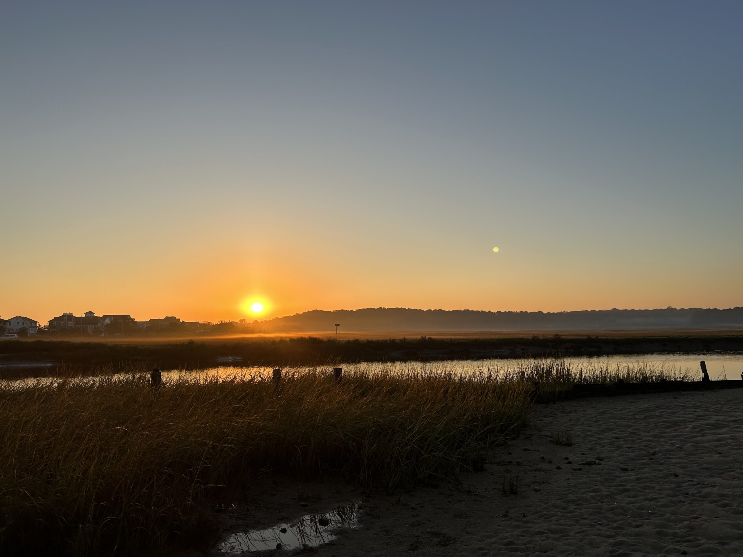 Photo by Jonah Saitz, USFWS.
Case Study
Plan
Huntington, NY
Crab Meadow Watershed Hydrology Study and Stewardship Plan
This comprehensive study and plan, funded through the National Fish and Wildlife Foundation, Long Island Sound Futures Fund, identifies initial strategies to maintain and enhance the local watershed resources of Crab Meadow. It is meant to be a land management tool to guide the implementation of best practices. The plan was developed in consultation with many partners and stakeholders. There is now significant community buy-in to take action to protect and restore this important watershed.
Following adoption of the plan, the Town of Huntington began working with US Fish and Wildlife Service and Audubon to study and restore Crab Meadow marsh and implement recommendations from the Stewardship Plan. Audubon, in partnership with Town of Huntington and USFWS, received a 2024 Long Island Sound Futures Fund Grant ($429K) to develop design plans for marsh restoration at Crab Meadow.
Case Study
Plan
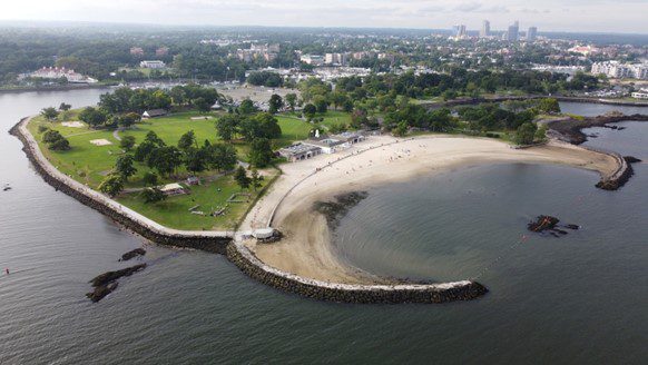
Marsh Conservation Planning for Glen Island Park
In 2023, Long Island Sound Study and Warren Pinnacle, in partnership with Westchester County and conservation groups/organizations, have developed a Plan to understand the benefits of, threats to, and recommended conservation actions for marsh ecosystems on Glen Island Park in New Rochelle, NY. The goal of the Plan is to help inform conservation and restoration efforts to maximize marsh ecosystem services under rising sea levels.
This process brought together a diversity of stakeholders to consider management strategies for Glen Island Park.
Sara Powell, slp285@cornell.edu
Case Study
Plan
Marsh Conservation Planning for Glen Island Park
In 2023, Long Island Sound Study and Warren Pinnacle, in partnership with Westchester County and conservation groups/organizations, have developed a Plan to understand the benefits of, threats to, and recommended conservation actions for marsh ecosystems on Glen Island Park in New Rochelle, NY. The goal of the Plan is to help inform conservation and restoration efforts to maximize marsh ecosystem services under rising sea levels.
Mapper
Level of Effort:
Road-Stream and Tidal Crossing Prioritization Tool – Suffolk County, Long Island
Developed by The Nature Conservancy, this tool identifies priority road-stream and tidal crossings in Suffolk County for replacement or upgrades. Prioritization is based on social and ecological criteria. Additionally, it includes data on current and future projected flooding and marsh extent under various sea level rise scenarios. The tool is meant to be a screening tool for planning efforts.
Guidance Tool
Level of Effort:
Promoting Nature-Based Hazard Mitigation Through FEMA Mitigation Grants
This guidance document is intended for stakeholders pursuing FEMA HMA grants for nature-based solutions to mitigate risks associated with flooding (riverine and coastal) and wildfire.
Guidance Tool
Level of Effort:
Promoting Nature-Based Hazard Mitigation Through FEMA Mitigation Grants
This guidance document is intended for stakeholders pursuing FEMA HMA grants for nature-based solutions to mitigate risks associated with flooding (riverine and coastal) and wildfire.
Guidance Tool
Level of Effort:
NYSDEC Tidal Wetlands Guidance Document
The NYSDEC document is to provide guidance on the issuance of permits for living shorelines techniques in the Marine and Coastal District Waters of New York (the Marine District) and encourages the use of green or natural infrastructure.
Mapper
Level of Effort:
NYS Sea Level Rise Viewer
This floodplain mapper shows the estimated boundary of future coastal floodplains for different sea level rise scenarios for New York State. Customize a scenario by choosing the amount of sea level rise in inches and a coastal flood recurrence interval.
Story Map
Level of Effort:
NY Sea Grant Long Island Dynamic Shorelines
This story map examines the coastal processes and hazards of Long Island and provides options for sustainable and resilient shoreline management. Information is useful for coastal managers, planners and coastal property owners.
Story Map
Level of Effort:
NY Sea Grant Long Island Dynamic Shorelines
This story map examines the coastal processes and hazards of Long Island and provides options for sustainable and resilient shoreline management. Information is useful for coastal managers, planners and coastal property owners.
Mapper
Level of Effort:
NOAA Sea Level Rise Viewer
Use this web mapping tool to visualize community-level impacts from coastal flooding or sea level rise (up to 10 feet above average high tides). Photo simulations of how future flooding might impact local landmarks are also provided, as well as data related to water depth, connectivity, flood frequency, socio-economic vulnerability, wetland loss and migration, and mapping confidence.
Mapper
Level of Effort:
LIS Marsh Viewer
The purpose of the interactive viewer is to illustrate the fate of significant marsh systems on Long Island Sound under future Sea-Level Rise conditions. Model results are combined with tax-parcel information and integrated with information about marsh ecosystem services to assist municipalities and conservation groups in defining and assessing various land-management alternatives.
Mapper
Level of Effort:
FEMA Resilience Analysis and Planning Tool (RAPT)
RAPT provides access to important data and analysis tools to support your community before, during and after a disaster.
Mapper
Level of Effort:
FEMA Resilience Analysis and Planning Tool (RAPT)
RAPT provides access to important data and analysis tools to support your community before, during and after a disaster.
Guidance Tool
Level of Effort:
Building Community Resilience with Nature-Based Solutions: Strategies for Success (FEMA)
This guide gives community leaders five main strategies to carry out Nature-Based Solution projects: 1) Building Strong Partnerships, 2) Engaging the Whole Community, 3) Matching Project Size with Desired Goals and Benefits, 4) Maximizing Benefits, and 5) Designing for the Future. This is not a technical guide for planning, constructing, or funding NBS. It covers the value of each strategy and suggests how to move forward with NBS projects.
Plan
Level of Effort:
Expanding FEMA’s Benefit Cost Analysis: Chittenden Living Shoreline Case Study
An effort by Save the Sound and Earth Economics to identify opportunities for the Federal Emergency Management Agency (FEMA) and other federal agencies and funders to improve the ability of benefit-cost analysis tools to account for ecosystem-based benefits.
Guidance Tool
Level of Effort:
APPLICATION GUIDE for the 2022 Sea Level Rise Technical Report
This guide is designed to assist decision makers and coastal professionals with applying and integrating the information in the 2022 Sea Level Rise Technical Report, produced by the Sea Level Rise and Coastal Flood Hazard Scenarios and Tools Interagency Task Force, into local sea level rise planning and adaptation decisions.
Mapper
Level of Effort:
CIRCA Connecticut Sea Level Rise and Storm Surge Viewer
Shows various SLR scenarios and flood event scenarios calibrated for the Long Island Sound CT coast. Also includes FEMA Limit of Moderate Wave Action boundary for referencing building codes.
Mapper
Level of Effort:
CIRCA Connecticut Sea Level Rise and Storm Surge Viewer
Shows various SLR scenarios and flood event scenarios calibrated for the Long Island Sound CT coast. Also includes FEMA Limit of Moderate Wave Action boundary for referencing building codes.