Resources for
marsh
Funding
: Oct 23 – Nov 21, 2025
$200,000-500,000
National Estuary Program Watersheds Grant Program
The National Estuary Program (NEP) Watersheds Grant Program is a nationally competitive grants addressing the most pressing threats to estuarine health within the 28 NEP boundary areas. This program is offered through Restore America’s Estuaries, with funding from the U.S. EPA.
Program priorities include: 1) Habitat loss (wetlands, seagrass, mangroves, reefs), 2) Coastal resilience and sea level rise, 3) Nutrient pollution, 4) Stormwater impacts and erosion, and 5) Invasive species and marine mammal mortalities.
Funding
: Oct 23 – Nov 21, 2025
$200,000-500,000
National Estuary Program Watersheds Grant Program
The National Estuary Program (NEP) Watersheds Grant Program is a nationally competitive grants addressing the most pressing threats to estuarine health within the 28 NEP boundary areas. This program is offered through Restore America’s Estuaries, with funding from the U.S. EPA.
Training
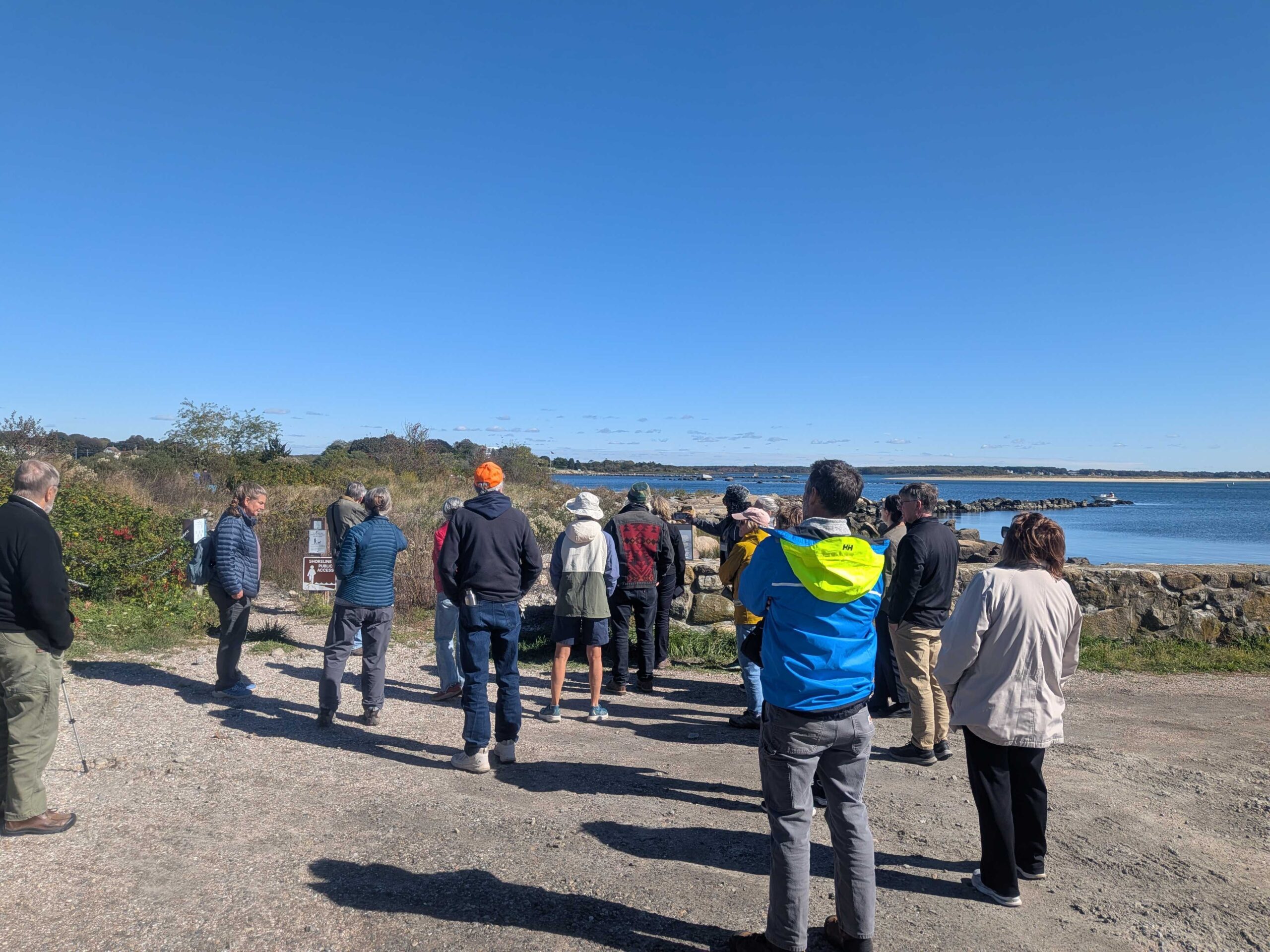
Dodge Paddock & Beal Preserve Marsh Restoration Field Trip and Workshop
On October 16, 2025, the Sustainable and Resilient Communities (SRC) team of the Long Island Sound Partnership hosted a field trip featuring the Dodge Paddock and Beal Preserve Marsh Restoration Project in Stonington Borough. The day started with a presentation outlining the history and current state of the site, followed by a walk to Dodge Paddock and Beal Preserve where there was a guided tour led by Connecticut Sea Grant, Avalonia Land Conservancy, and local volunteers. The day included a deep dive into the invasive species removal process, plantings to accommodate marsh migration, and a close up look at what has grown since then. Special thanks to our partners with Avalonia Land Conservancy, Connecticut Sea Grant, and the Stonington Community.

Training
Dodge Paddock & Beal Preserve Marsh Restoration Field Trip and Workshop
On October 16, 2025, the Sustainable and Resilient Communities (SRC) team of the Long Island Sound Partnership hosted a field trip featuring the Dodge Paddock and Beal Preserve Marsh Restoration Project in Stonington Borough. The day started with a presentation outlining the history and current state of the site, followed by a walk to Dodge Paddock and Beal Preserve where there was a guided tour led by Connecticut Sea Grant, Avalonia Land Conservancy, and local volunteers. The day included a deep dive into the invasive species removal process, plantings to accommodate marsh migration, and a close up look at what has grown since then. Special thanks to our partners with Avalonia Land Conservancy, Connecticut Sea Grant, and the Stonington Community.
Funding
: Oct 1 – Dec 16, 2025
$100K - $1.5M
CT DEEP Long Island Sound Ecosystems Grant
The Connecticut Department of Energy and Environmental Protection’s (DEEP’s) Land and Water Resources Division requests proposals for the new CT DEEP Long Island Sound Ecosystems Grant, made possible by financial support provided by the Long Island Sound Partnership from the U.S. EPA. There are two primary goals of the program: 1) to promote large-scale habitat restoration and enhance restoration planning, while also helping coastal communities and ecosystems adapt to changing environmental conditions; and 2) to further promote the application of green stormwater infrastructure techniques to reduce nonpoint source pollution, improving water resource quality.
There is approximately $7 million available, and no match is required. Eligible projects include: 1) Habitat Restoration (planning/engineering/design and construction for habitat restoration projects); and 2) Green Stormwater Infrastructure (planning/engineering/design and construction for green stormwater infrastructure projects).
Funding
: Oct 1 – Dec 16, 2025
$100K - $1.5M
CT DEEP Long Island Sound Ecosystems Grant
The Connecticut Department of Energy and Environmental Protection’s (DEEP’s) Land and Water Resources Division requests proposals for the new CT DEEP Long Island Sound Ecosystems Grant, made possible by financial support provided by the Long Island Sound Partnership from the U.S. EPA. There are two primary goals of the program: 1) to promote large-scale habitat restoration and enhance restoration planning, while also helping coastal communities and ecosystems adapt to changing environmental conditions; and 2) to further promote the application of green stormwater infrastructure techniques to reduce nonpoint source pollution, improving water resource quality.
Case Study
Project
Rye, NY
Edith G. Read Wildlife Sanctuary Living Shoreline
Shoreline erosion problems had been noted at Edith G. Read Wildlife Sanctuary in Rye, NY in the early 2000s, and after the devastation caused by Hurricane Sandy in 2012 and subsequent storms, it was clear there was a need for restoration. Westchester County decided to create a 900 foot living shoreline in order to restore the shoreline, reduce erosion, and support aquatic life in Long Island Sound. The project, designed by SLR, used two types of structures – boulder sills and reef balls – to slow wave action and provide aquatic habitat. A total of 43 reef balls were installed along with 40 types of native grasses, shrubs, and trees to further stabilize the shoreline. Additional native ecotype-specific plantings will be added periodically throughout the next five years of monitoring (2025-2030).


This is the only Long Island Sound living shoreline project in Westchester County and it serves as a model for other communities - in Westchester, Long Island Sound, and beyond.
Suzette Lopane, PLA, ASLA, sbl1@westchestergov.com
Matthew Castro, mvc1@westchestercountyny.gov
Case Study
Project
Rye, NY
Edith G. Read Wildlife Sanctuary Living Shoreline
Shoreline erosion problems had been noted at Edith G. Read Wildlife Sanctuary in Rye, NY in the early 2000s, and after the devastation caused by Hurricane Sandy in 2012 and subsequent storms, it was clear there was a need for restoration. Westchester County decided to create a 900 foot living shoreline in order to restore the shoreline, reduce erosion, and support aquatic life in Long Island Sound. The project, designed by SLR, used two types of structures – boulder sills and reef balls – to slow wave action and provide aquatic habitat. A total of 43 reef balls were installed along with 40 types of native grasses, shrubs, and trees to further stabilize the shoreline. Additional native ecotype-specific plantings will be added periodically throughout the next five years of monitoring (2025-2030).
Mapper
Level of Effort:
High Resolution Marsh Mapping
The Connecticut Department of Energy and Environmental Protection (DEEP) and their contractor Whiteout Solutions have released a groundbreaking high-resolution dataset capturing over 12,000 acres of coastal saltmarsh and adjoining upland buffer in the state of Connecticut. The new dataset, available to the public via Whiteout’s web-based geospatial application geoSAP, includes:
- Topobathymetric LiDAR data, capable of capturing elevation points even below the water’s surface.
- Multispectral and RGB imagery detailing the complex structure of marshland vegetation and terrain.
- Landcover classification of the seven most common saltmarsh plant species derived from multiple overlapping datasets to aid in habitat monitoring and planning.
All data layers can be viewed and downloaded through geoSAP.
$200,000-500,000
National Estuary Program Watersheds Grant Program
The NEP Coastal Watersheds Grant Program is a nationally competitive grants program designed to support projects that address urgent and challenging issues threatening the well-being of estuaries within the 28 NEP boundary areas.
This grant program funds projects aimed at addressing the following Congressionally-set priorities: • Loss of key habitats resulting in significant impacts on fisheries and water quality such as seagrass, mangroves, tidal and freshwater wetlands, forested wetlands, kelp beds, shellfish beds, and coral reefs; • Coastal resilience and extreme weather events including flooding and coastal erosion related to sea level rise, changing precipitation, warmer waters, or salt marsh, seagrass, or wetland degradation or loss and accelerated land loss; • Impacts of nutrients and warmer water temperatures on aquatic life and ecosystems, including low dissolved oxygen conditions in estuarine waters; • Stormwater runoff which not only can erode stream banks but can carry nutrients, sediment, and trash into rivers and streams that flow into estuaries; • Recurring harmful algae blooms; • Unusual or unexplained marine mammal mortalities; and • Proliferation or invasion of species that limit recreational uses, threaten wastewater systems, or cause other ecosystem damage.
$200,000-500,000
National Estuary Program Watersheds Grant Program
The NEP Coastal Watersheds Grant Program is a nationally competitive grants program designed to support projects that address urgent and challenging issues threatening the well-being of estuaries within the 28 NEP boundary areas.
Case Study
Project
Mamaroneck, NY
Coastal Forest Restoration at Otter Creek Preserve
Otter Creek Preserve is located along a three-mile stretch of coastline on Long Island Sound in Mamaroneck, NY. It contains 90% of the remaining productive salt marshes in Westchester County, and is an important site for migratory birds, marine life, and other wildlife. The 35-acre preserve is the largest privately-owned tidal wetland designated and protected as a nature sanctuary in Westchester County.
Following improvements made to the coastal forest and tidal marsh in 2015 and 2016 with support from the Westchester Community Foundation, in 2017 Westchester Land Trust (WLT) received NFWF LISFF funding to continue removing non-native trees, shrubs, and vines, replant with native species, and conduct expanded outreach and educational programming at the preserve.

12 acres of forest were restored by 2018 with the LISFF funds.
Westchester Land Trust
403 Harris Road
Bedford Hills, NY 10507
www.westchesterlandtrust.org
Case Study
Project
Mamaroneck, NY
Coastal Forest Restoration at Otter Creek Preserve
Otter Creek Preserve is located along a three-mile stretch of coastline on Long Island Sound in Mamaroneck, NY. It contains 90% of the remaining productive salt marshes in Westchester County, and is an important site for migratory birds, marine life, and other wildlife. The 35-acre preserve is the largest privately-owned tidal wetland designated and protected as a nature sanctuary in Westchester County.
Following improvements made to the coastal forest and tidal marsh in 2015 and 2016 with support from the Westchester Community Foundation, in 2017 Westchester Land Trust (WLT) received NFWF LISFF funding to continue removing non-native trees, shrubs, and vines, replant with native species, and conduct expanded outreach and educational programming at the preserve.