min $250,000 (no max)
The Community Investment Fund 2030 (CIF) will foster economic development in historically underserved communities across Connecticut. CIF will provide a total of up to $875 million to eligible municipalities as well as not-for-profit organizations and community development corporations that operate within them.
up to $200,000
The Trees for Communities Grant Program supports urban forestry projects that will increase tree cover or contribute to other urban forestry objectives such as improvement of forest health or utilization of urban wood in communities of need. Recent awardee projects can be found here: Urban and Community Forestry Grant Accomplishments.
Mapper
Level of Effort:
A product of Climate Central’s Sea Level Program, Coastal Risk Finder allows users to get local flood projections, understand who and what is at risk in their communities, and learn about solutions for coastal states, counties, cities, towns, congressional districts, and state legislative districts in the contiguous U.S., with more to come. Users can download data and graphics to further their local adaptation and communication efforts related to coastal flooding. Coastal Risk Finder includes detailed briefs on adaptation efforts in coastal states and territories, providing insights into policies, projects, and key organizations working to mitigate flood risks. By highlighting actionable solutions, we aim to empower communities with the knowledge and tools needed to address coastal flooding challenges.
The accompanying User Guides highlight the most useful features and provide guidance on using the tool for specific applications. A recording of the Launch Webinar featuring expert insights is also available.
Funding
: Mar 27 – May 6, 2025
$100,000 - $10M
The National Coastal Resilience Fund (NCRF) is a national program focused on reducing risks to coastal communities. The NCRF is now soliciting pre-proposals for projects that will create and/or restore natural systems in order to increase protection for communities from coastal hazards, such as storms, sea- and lake-level changes, inundation, and coastal erosion, while improving habitats for fish and wildlife species.
Funding
: Jul 15, 2025
max $200,000 to $4M, depending on grant type
The Connecticut Department of Economic and Community Development’s (DECD) Office of Brownfield Remediation and Development (OBRD) announced multiple funding availability notices under Round 21:
The total funding amount available for all Round 21 notices is $25 million.
Funding
: Apr 28 – Jun 5, 2025
min $250,000 (no max)
The Community Investment Fund 2030 (CIF) will foster economic development in historically underserved communities across Connecticut. CIF will provide a total of up to $875 million to eligible municipalities as well as not-for-profit organizations and community development corporations that operate within them.
Funding
: Dec 13 – May 12, 2025
$75,000-$2M
$20 million in funding is available under the Bipartisan Infrastructure Law for projects that will advance the coastal habitat restoration and climate resilience priorities of tribes and underserved communities. Through this funding, NOAA will help support community-driven habitat restoration and build the capacity of tribes and underserved communities to more fully participate in restoration activities.
Funding
: Jan 10 – Mar 7, 2025
max $200,000 to $4M, depending on grant type
The Connecticut Department of Economic and Community Development’s (DECD) Office of Brownfield Remediation and Development (OBRD) announced multiple funding availability notices under Round 21:
The total funding amount available for all Round 21 notices is $25 million.
Funding
: Jan 10 – Mar 7, 2025
max $200,000 to $4M, depending on grant type
The Connecticut Department of Economic and Community Development’s (DECD) Office of Brownfield Remediation and Development (OBRD) announced multiple funding availability notices under Round 21:
The total funding amount available for all Round 21 notices is $25 million.
$75,000 - $350,000
EPA has selected Environmental Justice for New England to serve as pass-through entity for the Environmental Justice Thriving Communities Grants for CT, ME, MA, NH, RI, and VT. Thriving Communities subgrants will be distributed to support capacity building in communities affected by environmental or public health issues to eligible applicants. The program aims to reduce the burden of the federal grants application process and distribute federal funds to potential applicants working to address environmental justice issues.
Training
The Long Island Sound Sustainable and Resilient Communities (SRC) Team held our 2024 Annual Workshop virtually as three sessions over two days. Session topics focused on our assistance programs, new regional resilience resources and tools, and a discussion on planning for inundation and different considerations communities may face.
Session 1 – SRC Resilience Assistance Programs was held on Tuesday, December 10th from 10-11:30 AM. Participants learned about our Sustainable and Resilient Communities resilience assistance programs and heard from communities who have successfully utilized them to advance resilience project plans, build capacity, and secure competitive grant funding!
min $250,000 (no max)
The Community Investment Fund 2030 (CIF) will foster economic development in historically underserved communities across Connecticut. CIF will provide a total of up to $875 million to eligible municipalities as well as not-for-profit organizations and community development corporations that operate within them.
Funding
: Aug 26 – Oct 23, 2024
The Rooting Resilience Program will provide funding and technical assistance to community-based projects that build resilience and enhance communities’ abilities to plan and carry out forestry projects. This opportunity is available for projects located in federally designated disadvantaged communities, including urban, suburban, and rural communities in the United States and its territories. Special priority will be given to community-led groups that are seeking federal funding for the first time.
Guidance Tool
Level of Effort:
FEMA’s National Resilience Guidance document is intended to help all individuals, communities, and organizations understand our nation’s vision for resilience, the key principles that must be applied to strengthen resilience, and the players and systems that contribute to resilience. It also outlines how to strengthen resilience by organizing and engaging people, incorporating resilience concepts into planning efforts, creating change through policies, prioritizing projects and programs, financing resilience efforts, and measuring and evaluating resilience. Finally, the NRG includes a Resilience Maturity Model that illustrates stages in the evolution of a community’s approach to resilience.
Funding
: May 9 – Aug 16, 2024
EPA’s Creating Resilient Water Utilities (CRWU) initiative is offering no-cost climate change risk assessment technical assistance to drinking water, wastewater, and stormwater utilities, as well as other water sector stakeholders. Through this technical assistance process, CRWU will assist approximately 75 water sector utilities / communities in identifying long-term climate change adaptation strategies, as well as potential funding options to implement adaptive measures.
Funding
: Jul 18 – Sep 30, 2024
$2,000 - $50,000
In collaboration with CT Department of Energy and Environmental Protection (DEEP), the Connecticut Institute for Resilience and Climate Adaptation (CIRCA) requests grant proposals for projects that increase the capacity of vulnerable communities to mitigate, plan for, and respond to climate change impacts. This funding supports the recommendations of the Governor’s Council on Climate Change (GC3).
Funding
: Jul 12 – Sep 27, 2024
max $200,000 or max $4M
The Connecticut Department of Economic and Community Development’s (DECD) Office of Brownfield Remediation and Development (OBRD) announced multiple funding availability notices under Round 20:
The total funding amount available for all Round 20 notices is $25 million.
Funding
: Nov 1 – Mar 31, 2025
$75,000 - $350,000
EPA has selected Fordham University to serve as pass-through entity for the Thriving Communities Grants for New York, New Jersey, Puerto Rico, and the US Virgin Islands. Thriving Communities subgrants will be distributed to support capacity building in communities affected by environmental or public health issues to eligible applicants. Applications will be accepted on a rolling basis until March 31, 2025.
Website
Level of Effort:
The New York State Climate Impacts Assessment explores current and future climate change impacts to New York State communities, ecosystems, and economy. The New York State Energy Research and Development Authority (NYSERDA) assembled more than 250 New York–based, national, and Indigenous climate science experts and representatives from diverse communities and industries across the state to contribute to this assessment. The findings are intended to help residents, businesses, and decision-makers across the state plan and prepare for climate change impacts.
Funding
: Jul 13, 2025
$500 - $1,000
Awards small grants in support of grassroots efforts and community-based environmental work in New England. The Grassroots Fund utilizes participatory grantmaking to move resources to New England grassroots groups working at the intersections of Environmental Justice. The program is geared toward groups who have some experience implementing a project in their community. Grants support groups to deepen their work by further developing a community vision, lowering barriers to participation, identifying new stakeholders, and working to bring more voices and lived experiences into core decision-making processes.
Funding
: Feb 22 – Apr 10, 2024
$100,000 - $10M
The NCRF is a national program with the goal of enhancing protection for coastal communities from the impacts of storms, floods, and other natural coastal hazards and to improve habitats for fish and wildlife. This year, NFWF will award approximately $140 million in grants for the planning, design, and implementation of natural and nature-based solutions.
Guidance Tool
The CTDEEP document provides information about the many ways individuals, property owners, and communities can help protect Connecticut’s tidal wetlands.
Guidance Tool
The CTDEEP document provides information about the many ways individuals, property owners, and communities can help protect Connecticut’s tidal wetlands.
Funding
: Oct 12 – Dec 15, 2023
$800M total available
The Flood Mitigation Assistance grant program is a competitive program that provides funding to states, federally recognized Tribal governments, U.S. territories, and local governments. Since the National Flood Insurance Reform Act of 1994 was signed into law, funds are used for projects that reduce or eliminate the risk of repetitive flood damage to buildings insured by the National Flood Insurance Program.
Funding
: Oct 12 – Dec 15, 2023
$1B total available
The Federal Emergency Management Agency (FEMA) Building Resilient Infrastructure and Communities (BRIC) grant program will support states, local communities, tribes and territories as they undertake hazard mitigation projects, reducing the risks they face from disasters and natural hazards. The BRIC program’s guiding principles are to support communities through capability and capacity building, encourage and enable innovation; promote partnerships, enable large projects, maintain flexibility, and provide consistency.
up to $50,000
The Nature Conservancy is pleased to announce a fifth round of funding available in New York through our Climate Resilience Grant Program. The program supports conservation and climate adaptation projects, including land protection, led by local organizations, with the goal of increasing resilience to climate change for people and nature. Program grants will help local organizations with fee and easement acquisitions of lands that connect with important floodplains and shorelines that mitigate flooding and erosion. The grants will also provide funding for organizational capacity-building, planning and strategy development. We will prioritize projects that include engagement with and benefits to local communities, particularly in underserved and frontline communities.
Guidance Tool
Level of Effort:
Guidance and training modules for Connecticut Zoning changes to address climate vulnerabilities. On the website there are examples of zoning policies municipalities could modify and/or adopt to enhance local climate resilience. Where applicable, model ordinances and examples of where the policies have been adopted are included.
Guidance Tool
Level of Effort:
The Federal Highway Administration (FHWA’s) Vulnerability Assessment and Adaptation Framework, 3rd Edition, is a guide and collection of resources for use in analyzing the impacts of climate change and extreme weather on transportation infrastructure. Its purpose is to identify key considerations, questions, and resources that can be used to design and implement a climate change vulnerability assessment. The processes, lessons learned, and resources outlined in the framework are geared toward state departments of transportation (DOTs), metropolitan planning organizations (MPOs), and other agencies involved in planning, building, or maintaining the transportation system. It includes suggestions and examples applicable to a wide range of applications, from small qualitative studies to large, detailed, data-intensive analyses. The resources included in the framework will be added to and updated over time.
Mapper
Level of Effort:
The Long Island Sound Watershed Land Cover Viewer contains all dates of land cover as well as Change To, Change From, Riparian Area Land Cover, and Impervious Surface Estimate layers. It also has many layers where HUC 12 watersheds are colored based on a single land cover.
Mapper
Level of Effort:
The Long Island Sound Watershed Land Cover Viewer contains all dates of land cover as well as Change To, Change From, Riparian Area Land Cover, and Impervious Surface Estimate layers. It also has many layers where HUC 12 watersheds are colored based on a single land cover.
Mapper
Level of Effort:
Connecticut Environmental Conditions Online (CT ECO) is the collaborative work of the Connecticut Department of Energy and Environmental Protection (DEEP) and the University of Connecticut Center for Land Use Education and Research (CLEAR) to share environmental and natural resource information with the general public. CT ECO’s mission is to encourage, support, and promote informed land use and development decisions in Connecticut by providing local, state and federal agencies, and the general public with convenient access to the most up-to-date and complete natural resource information available statewide.
CT ECO includes a variety of online maps and tools for viewing Connecticut’s environmental and natural resources as well as high resolution aerial imagery, elevation data, and land cover. The Advanced Map Viewer provides flexibility to turn on and off layers of the map.
Mapper
Level of Effort:
To better understand how Connecticut’s coastal area marshes and roads may respond to sea level rise (SLR), Sea Level Affecting Marshes Model (SLAMM) was applied to Connecticut’s shoreline by Warren Pinnacle Consulting, Inc. This viewer displays the model’s results for Connecticut’s 21 largest marshes and all coastal area roads. For marshes, SLAMM was run two hundred times using alternative model inputs for key model parameters, including various SLR scenarios, to produce probability based results of likely future marsh conditions. For roads, the model uses a single SLR scenario of about 4.2 feet by 2100 from the base year of 2002. The Sea Level Rise Effects on Roads and Marshes projects is a project between CT DEEP and UConn CLEAR.
Guidance Tool
Level of Effort:
The LINAP Embayment Water Exchange Study looked at how water exchange practices could affect the nitrogen impairments in embayments. A water exchange practice changes the amount, speed, or direction of water moving through an area. The results of the study show that water exchange techniques are not effective in large waterbodies like most of Long Island’s embayments. Often, the physical size of the water exchange practice is small compared to the large waterbodies to which they are applied, which means their impact is limited. Water exchange projects may be useful, however, for smaller Long Island waterbodies, where the volume of increased water exchange approaches the volume of the overall waterbody. The goal of the study was to provide communities with basic information on water exchange practices suitable for Long Island.
Guidance Tool
Level of Effort:
The Equitable Resilience Builder (ERB) is an application that supports communities in resilience planning with a focus on equity. It engages users in a guided process to inclusively assess local hazards, equity, and the resilience of built, natural, and social environment systems. Results can be used to collaboratively prioritize actions to build community resilience in an equitable way.
Funding
: Jul 13 – Jun 1, 2023
Variable
The Trust funding interests include: Community development (affordable housing, economic development), Community-based health care (primary care access and delivery), Education (early education, K-12 public schools), the Environment (land and water conservation, parks and gardens), and Social services (hunger, immigration, seniors, youth development).
Funding
: Mar 1 – May 12, 2023
$25,000-$150,000
Clean Water Act Section 604(b) Water Quality Planning Grants fund regional comprehensive water quality management planning activities as described in Section 604(b) of the federal Clean Water Act. 604(b) funds are to be used for water quality management planning activities, such as determining the nature, extent and causes of point and nonpoint source water pollution problems, and developing plans to resolve these problems.
DEC typically issues a Request for Applications (RFA) every 3-5 years and awards funds to multi-year projects.
$2 million - $20 million
The Long Island Investment Fund will focus on large scale, transformative projects that will have lasting impacts on Long Island and that are consistent with the strategic goals and priorities of the Long Island Regional Economic Development Council’s strategic plan and the four strategic pillars of Empire State Development. This includes projects that 1) have garnered community support, 2) will result in quality jobs, 3) leverage non-State investment, 4) are financially sound, and 5) can quickly begin. Funds will be directed towards purposes that may include, but not be limited to, support of manufacturing, agriculture, business parks, community anchor facilities, advanced technology, biotechnology and biomedical facilities, main street revitalization, and multi-family housing.
Funding
: Jul 13 – Nov 14, 2023
Non-monetary Award
The Drinking Water Source Protection Program (DWSP2) is a locally led, state-supported program that empowers municipalities to take action to improve and protect their public water sources and surrounding environment. Communities accepted into the program are provided free technical assistance to develop their own unique DWSP2 plan, leading to actionable steps the municipality can take to protect their drinking water sources now and into the future.
Funding
: Jul 13 – Sep 1, 2023
$25,000-$100,000
WCF’s 2023 Environmental Grant Program is focused on addressing environmental issues and accelerating climate mitigation and adaptation efforts in Westchester County.
Funding
: Jul 13 – Sep 1, 2023
$25,000-$100,000
WCF’s 2023 Environmental Grant Program is focused on addressing environmental issues and accelerating climate mitigation and adaptation efforts in Westchester County.
Funding
: May 19 – Jul 31, 2025
Max award of $50-75K
The Non-Agricultural Nonpoint Source Planning and MS4 Mapping Grant (NPG) is a competitive, reimbursement grant program that funds planning reports for nonpoint source water quality improvement projects and mapping of Municipal Separate Storm Sewer Systems (MS4s). The program aims to prepare nonpoint source projects for implementation funding, and to encourage and support cooperation among regulated MS4s to complete mapping of their stormwater system.
Funding
: May 19 – Jul 31, 2025
$50K-$2M for implementation grants, $10K-200K for certification grants
The Climate Smart Communities (CSC) Grant program was established in 2016 to provide grants to cities, towns, villages, and counties of the State of New York for eligible climate change mitigation, adaptation, and planning and assessment projects. Funds are available for two broad project categories – implementation and certification. The first project category supports implementation projects related to the reduction of greenhouse gas emissions (mainly outside the power sector), climate change adaptation, and engineering feasibility studies for flood mitigation and Hydrofluorocarbons. The second supports planning and assessment projects aligned with Climate Smart Communities certification actions.
Funding
: May 19 – Jul 31, 2025
$50K-$2M
The NYS Department of State (NYSDOS) is soliciting applications from eligible villages, towns, cities located along New York’s coasts or designated inland waterways, counties, or regional planning councils to advance the preparation or implementation of strategies for community and waterfront revitalization through the following grant categories: Preparing or Updating a Local Waterfront Revitalization Program (LWRP), including Updating an LWRP to be More Resilient to Climate Risks; Preparing an LWRP Component, including a Watershed Management Plan; Implementing an LWRP or a completed LWRP Component.
Funding
: May 19 – Jul 31, 2025
$100-400K
The NYS Department of State (NYSDOS) is soliciting applications from eligible municipalities, community-based not-for-profit organizations, and NYC Community Boards for Brownfield Opportunity Area Program funding. Funds are available for projects that establish or implement strategies for community redevelopment of areas affected by historical disinvestment, vacant and blighted properties, and the presence or potential presence of brownfields.
no maximum or minimum
Smart Growth promotes several land use planning principles that create livable, sustainable and equitable communities. Financial assistance grants are available on a competitive basis to municipalities to develop or update comprehensive plans, area plans (such as Transit Oriented Development plan) or zoning ordinances that incorporate smart growth principles including promoting efficient and sustainable land development and redevelopment patterns that optimize prior infrastructure investments. These planning efforts should reflect a community goals and aspirations for its own future, and address a wide range of planning issues including, but not limited to, appropriate physical development, economic development, transportation patterns, natural and built resource inventories, and population trends, while setting a course for clean and affordable energy, efficient use of land, protection of agricultural working lands and forests and overall healthy communities.
Funding
: Jul 13 – Jul 28, 2023
Up to $100K
Grants are available to help municipalities with median household income requirements to develop engineering reports so they can be prepared to seek financing to help them complete their wastewater, sewer and water quality projects.
Funding
: Jul 13 – Jul 28, 2023
Up to $100K
Grants are available to help municipalities with median household income requirements to develop engineering reports so they can be prepared to seek financing to help them complete their wastewater, sewer and water quality projects.
Funding
: May 14 – Jul 31, 2024
Up to $500K
This program provides funding for the acquisition, planning, development, and improvement of parks, historic properties, and heritage areas.
Funding
: May 14 – Jul 31, 2024
Up to $500K
This program provides funding for the acquisition, planning, development, and improvement of parks, historic properties, and heritage areas.
Funding
: Jul 13 – Jul 28, 2023
Minimum of $50,000
The State’s Regional Economic Development Council Initiative helps drive regional and local economic development across New York State in cooperation with ten Regional Economic Development Councils (“Regional Councils”). Capital grant funding is available for capital-based economic development projects intended to create or retain jobs; prevent, reduce or eliminate unemployment and underemployment; and/or increase business or economic activity in a community or Region.
Funding
: Jul 8 – Nov 1, 2024
$40,000
The Healthy Communities Grant Program is EPA New England’s main competitive grant program to work directly with communities to reduce environmental risks to protect and improve human health and the quality of life. he Healthy Communities Grant Program will achieve this through identifying and funding projects that:
– Target resources to benefit communities at risk.
– Assess, understand, and reduce environmental and human health risks.
– Increase collaboration through partnerships and community-based projects.
– Build institutional and community capacity to understand and solve environmental and human health problems.
– Achieve measurable environmental and human health benefits.
Funding
: Jul 13, 2025
Up to $5000
Sustainable CT’s Community Match Fund is an innovative program that provides fast, flexible funding and support for engaging your community on wide-ranging sustainability projects. Eligible projects receive dollar-for-dollar matching funds from Sustainable CT.
Funding
: Jul 13, 2025
Up to $5000
Sustainable CT’s Community Match Fund is an innovative program that provides fast, flexible funding and support for engaging your community on wide-ranging sustainability projects. Eligible projects receive dollar-for-dollar matching funds from Sustainable CT.
typically $150,000-350,000
Grants are awarded for projects that address Nonpoint Source impacts in surface waters including creation and implementation of approved Watershed Based Plans.
typically $150,000-350,000
Grants are awarded for projects that address Nonpoint Source impacts in surface waters including creation and implementation of approved Watershed Based Plans.
Funding
: Apr 29 – Jun 21, 2024
min $250,000 (no max)
The Community Investment Fund 2030 (CIF) will foster economic development in historically underserved communities across Connecticut. CIF will provide a total of up to $875 million to eligible municipalities as well as not-for-profit organizations and community development corporations that operate within them.
Funding
: Mar 20 – Sep 17, 2024
$1,000 - $4,000
Awards small grants in support of grassroots efforts and community-based environmental work in New England. The Grassroots Fund utilizes participatory grantmaking to move resources to New England grassroots groups working at the intersections of Environmental Justice. The program is geared toward groups who have some experience implementing a project in their community. Grants support groups to deepen their work by further developing a community vision, lowering barriers to participation, identifying new stakeholders, and working to bring more voices and lived experiences into core decision-making processes.
Funding
: Dec 31 – Mar 11, 2024
less than $1M
This year, Connecticut Department of Energy and Environmental Protection (DEEP)’s Recreational Trails Program will make $10 million available to improve Connecticut’s trail infrastructure, which has seen significant usage increases since the onset of the pandemic. This grant program aims to help support communities managing the trail usage increases that have endured as more residents and visitors become familiar with the more than 2,500 miles of multi-use trails and greenways that crisscross the state.
Funding
: Jul 13 – Feb 27, 2024
up to $2,000
The Connecticut Society for Women Environmental Professionals Grant Program provides funding for local projects in Connecticut that benefit the environment. Grants of up to $2,000 will be awarded. Any application meeting the grant guidelines that is not successful in one cycle may reapply during any following cycle. The applications will be judged based on the environmental benefits of each project, in comparison to others. “Environmental benefits” can vary widely and successful applications have ranged from property clean-ups to environmental education.
Funding
: Nov 14 – Feb 2, 2024
up to $10,000
The Green Fund seeks innovative proposals from committed organizations and individuals for activities that advance our mission which is to promote environmental quality, public health and equity in our community by providing grants and other incentives that contribute to a more environmentally sustainable future and reduce air, water and land pollution.
Funding
: Oct 16 – Dec 15, 2023
min $250,000 (no max)
The Community Investment Fund 2030 (CIF) will foster economic development in historically underserved communities across the state. CIF will provide a total of up to $875 million to eligible municipalities as well as not-for-profit organizations and community development corporations that operate within them.
Funding
: Jul 26 – Sep 22, 2023
$200,000-$4M
The Connecticut Department of Economic and Community Development’s (DECD) Office of Brownfield Remediation and Development (OBRD) announced funding availability under Round 18. The purpose of the Municipal Grant Program as per C.G.S Section 32-763, is to provide grants for brownfield remediation and redevelopment. OBRD has also simultaneously announced the availability of funding under the Targeted Brownfield Development Loan and the Assessment-only Grant Program.
Funding
: Mar 10 – May 5, 2023
$75,000 - $250,000 (~$800,000 total available- projected around 4-10 projects total)
The NEP Coastal Watersheds Grant Program is a nationally competitive grants program designed to support projects that address urgent and challenging issues threatening the well-being of coastal and estuarine areas within determined estuaries of national significance.
Funding
: Mar 1 – Apr 28, 2023
Phase 1: All states are eligible for up to $3 million in funding for a four-year planning period. Single tribes may receive up to $500,000 each, and groups of 2 or more tribes, or tribal consortia, are eligible to receive up to $1 million. Each of these 67 municipalities is eligible to receive up to $1 million. Phase 2:
The Climate Pollution Reduction Grants (CPRG) program will provide grants to states, local governments, tribes, and territories to develop and implement plans for reducing greenhouse gas emissions and other harmful air pollution. Section 60114 of the Inflation Reduction Act provides an investment of $5 billion to support efforts by states, municipalities, air pollution control agencies, tribes, and groups thereof to develop and implement strong, local greenhouse gas reduction strategies. This two-staged grant program (Phase 1: Plan & Phase 2: Implement) provides funding of $250 million for noncompetitive planning grants, and $4.6 billion for competitive implementation grants.
Funding
: Jul 13 – Apr 12, 2023
$100,000 - $1,000,000
NFWF will award up to $140 million in grants to create and restore natural systems in order to increase protection for communities from coastal hazards, such as storms, sea- and lake-level changes, inundation, and coastal erosion, while improving habitats for fish and wildlife species. NFWF prioritizes projects that are community led or incorporate direct community engagement and benefit underserved communities facing disproportionate harm from climate impacts.
Funding
: Jul 13 – Feb 14, 2023
$45,000-$70,000 for base grants; up to $125,000 for competitive grants
Tribes and Nations are eligible to receive Clean Water Act (CWA) Section (§)319 grant funding to implement EPA-approved NPS programs. As required under the CWA, Tribes must be approved for treatment in a similar manner as a state and have an EPA-approved NPS assessment report and NPS management program to receive §319 funds. Each year, a §319-eligible Tribe may apply for a base §319 grant that support their NPS management program, and they are eligible to compete nationally for additional §319 funds (competitive §319 grants) to implement on-the-ground projects to restore and protect their waters.
varies by program
The NRCS offers a suite of programs and initiatives that provide technical and financial assistance to agricultural producers and landowners. Relevant programs include:
1) NRCS Agricultural Conservation Easement Program (ACEP)
ACEP helps landowners, land trusts, and other entities protect, restore, and enhance wetlands or protect working farms and ranches through conservation easements.
2) NRCS Environmental Quality Incentives Program (EQIP)
The Environmental Quality Incentives Program (EQIP) is NRCS’ flagship conservation program that helps farmers, ranchers, and forest landowners integrate conservation into working lands.
3) NRCS Conservation Stewardship Program (CSP)
The Conservation Stewardship Program (CSP) helps you build on your existing conservation efforts while strengthening your operation.
4) NRCS Regional Conservation Partnership Program (RCPP)
The Regional Conservation Partnership Program (RCPP) helps partners co-invest in impactful and innovative solutions to on-farm, watershed, and natural resource concerns.
Funding
: Mar 27 – May 29, 2025
$50K - $1.5M
The Long Island Sound Futures Fund (LISFF) is seeking proposals to restore the health and living resources of Long Island Sound (Sound). The program is managed by National Fish and Wildlife Foundation (NFWF) in collaboration with the U.S. Environmental Protection Agency (EPA) and the Long Island Sound Study (LISS). Major funding is from EPA through the LISS with additional funding from the U.S. Fish and Wildlife Service, Natural Resources Conservation Service, and Zoetis Foundation.
This grant program supports efforts to test innovative approaches to conservation, deliver transformative projects, and support people and communities who value the sound and take a direct role in its future. Projects should advance implementation of the Long Island Sound Comprehensive Conservation and Management Plan 2020-2024 Update (CCMP). The Futures Fund invests in projects under three CCMP themes: 1) Clean Waters and Healthy Watersheds; 2) Thriving Habitats and Abundant Wildlife; 3) Sustainable and Resilient Communities.
Funding
: Oct 12 – Jan 23, 2024
$1B total available
The Federal Emergency Management Agency (FEMA) Building Resilient Infrastructure and Communities (BRIC) grant program will support states, local communities, tribes and territories as they undertake hazard mitigation projects, reducing the risks they face from disasters and natural hazards. The BRIC program’s guiding principles are to support communities through capability and capacity building, encourage and enable innovation; promote partnerships, enable large projects, maintain flexibility, and provide consistency.
Funding
: Oct 12 – Jan 23, 2024
$800M total available
The Flood Mitigation Assistance grant program is a competitive program that provides funding to states, federally recognized Tribal governments, U.S. territories, and local governments. Since the National Flood Insurance Reform Act of 1994 was signed into law, funds are used for projects that reduce or eliminate the risk of repetitive flood damage to buildings insured by the National Flood Insurance Program.
Funding
: Jun 13 – Jan 10, 2024
$200K - $4M
The NOAA National Estuarine Research Reserve System (NERRS) Habitat Protection and Restoration Bipartisan Infrastructure Law (BIL) Competition will fund designated Reserve agencies and universities to conduct land acquisition and habitat restoration projects that support the NERRS mission. NOAA will strengthen protection of key land and water areas, improve climate resilience, enhance long-term protection of Reserve areas for research and education, and support the habitat protection goals and priorities of the National Coastal Zone Management Act.
Funding
: Sep 1 – Dec 19, 2023
$75,000-$3M
$45 million in funding is available for projects that will advance the coastal habitat restoration and climate resilience priorities of tribes and underserved communities under the Bipartisan Infrastructure Law and Inflation Reduction Act. Through this funding, NOAA will help support community-driven habitat restoration and build the capacity of tribes and underserved communities to more fully participate in restoration activities.
Funding
: Sep 9 – Nov 22, 2024
$5,000-$100,000
EPA Long Island Sound Study announced the second round of this program focused on the Long Island Sound watershed area within New York and Connecticut. The purpose of the Long Island Sound Community Impact Fund (LISCIF) is to provide technical and financial assistance to communities to address environmental issues and improve the quality and accessibility of the Long Island Sound. Technical assistance will be provided through LISCIF and is available to communities/organizations even if one does not submit a funding proposal.
Funding
: Jun 29 – Nov 30, 2023
$500K - $10M
Sea Grant and the NOAA Climate Program Office, with support from the NOAA Office for Coastal Management, seek to establish programs aimed at placing people across the country into good jobs that advance climate resilience and assisting employers in developing a 21st century workforce that is climate literate, informed by climate resilience, and skilled at addressing consequent challenges. NOAA will assist communities in coastal and Great Lakes states and territories so they may form partnerships that train workers and place them into jobs that enhance climate resilience.
Funding
: Jul 31 – Nov 8, 2023
$300K - $12M
Nearly $85 million in funding is available for fish passage and tribal capacity building under the Bipartisan Infrastructure Law and Inflation Reduction Act. This funding will support U.S. federally recognized tribes, Alaska Native Corporations, and tribal organizations in implementing fish passage work and building tribal organizational capacity.
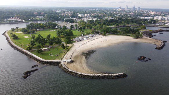
Case Study
East Haddam, CT
With support from the Nature Conservancy and Sustainable CT, East Haddam organized a Community Resilience Building process and workshop, the results of which were compiled into this summary. The team engaged with community members to determine the present hazards and vulnerabilities and identify resilient solutions.
Case Study
In 2023, Long Island Sound Study and Warren Pinnacle, in partnership with Westchester County and conservation groups/organizations, have developed a Plan to understand the benefits of, threats to, and recommended conservation actions for marsh ecosystems on Glen Island Park in New Rochelle, NY. The goal of the Plan is to help inform conservation and restoration efforts to maximize marsh ecosystem services under rising sea levels.
Sara Powell, slp285@cornell.edu
Case Study
In 2023, Long Island Sound Study and Warren Pinnacle, in partnership with Westchester County and conservation groups/organizations, have developed a Plan to understand the benefits of, threats to, and recommended conservation actions for marsh ecosystems on Glen Island Park in New Rochelle, NY. The goal of the Plan is to help inform conservation and restoration efforts to maximize marsh ecosystem services under rising sea levels.
Case Study
Increased development and the historic construction of a dam on Sunken Meadow Creek in the 1950’s led to reduced tidal exchange, increased water levels in the creek, poor water quality, and the proliferation of invasive species. In 2008 a number of partners (NYS OPRHP, NOAA, NYSDEC, LISS, TNC, Save the Sound, USFWS, LI Botanical Society) came together to work to restore the degraded marsh habitat around Sunken Meadow Creek, increase tidal flow, improve aquatic organism passage, limit invasives, and improve water quality. A restoration feasibility study was completed in 2010. In 2012 Superstorm Sandy blew out the dam on Sunken Meadow Creek, naturally kick-starting restoration. Following Superstorm Sandy, the project partners were able to quickly capitalize on available funding and grants, due to their prior planning efforts. A bridge was built across the Creek where the dam blew out, salt marsh habitat was restored at three locations, green infrastructure was installed in one of the parking areas to capture and treat stormwater runoff, fish passage feasibility on the creek was investigated, and education and outreach was conducted to thousands of people. These projects were completed in 2019. Now, with funding through Long Island Sound Futures Fund, Audubon NY is leading a large-scale marsh restoration project at Sunken Meadow Creek to restore important high-marsh habitat for at risk species, like the Saltmarsh Sparrow, and to increase the resilience of the marsh in the face of rising sea levels. Audubon will be working to finalize the designs and secure permits over the next two years, with on-the-ground restoration expected in 2026.
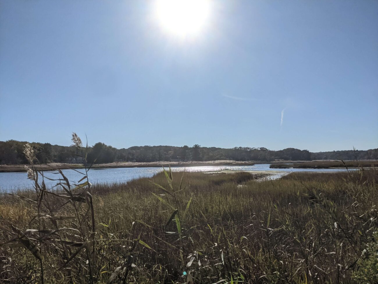


Sean Cruickshank Sean.Cruickshank@parks.ny.gov, Jon Vander Werff jvanderwerff@savethesound.org, Phoebe Clark phoebe.clark@audubon.org, Vicky O’Neill victoria.oneill@audubon.org
Case Study
Increased development and the historic construction of a dam on Sunken Meadow Creek in the 1950’s led to reduced tidal exchange, increased water levels in the creek, poor water quality, and the proliferation of invasive species. In 2008 a number of partners (NYS OPRHP, NOAA, NYSDEC, LISS, TNC, Save the Sound, USFWS, LI Botanical Society) came together to work to restore the degraded marsh habitat around Sunken Meadow Creek, increase tidal flow, improve aquatic organism passage, limit invasives, and improve water quality. A restoration feasibility study was completed in 2010. In 2012 Superstorm Sandy blew out the dam on Sunken Meadow Creek, naturally kick-starting restoration. Following Superstorm Sandy, the project partners were able to quickly capitalize on available funding and grants, due to their prior planning efforts. A bridge was built across the Creek where the dam blew out, salt marsh habitat was restored at three locations, green infrastructure was installed in one of the parking areas to capture and treat stormwater runoff, fish passage feasibility on the creek was investigated, and education and outreach was conducted to thousands of people. These projects were completed in 2019. Now, with funding through Long Island Sound Futures Fund, Audubon NY is leading a large-scale marsh restoration project at Sunken Meadow Creek to restore important high-marsh habitat for at risk species, like the Saltmarsh Sparrow, and to increase the resilience of the marsh in the face of rising sea levels. Audubon will be working to finalize the designs and secure permits over the next two years, with on-the-ground restoration expected in 2026.
Case Study
Huntington, NY
This comprehensive study and plan, funded through the National Fish and Wildlife Foundation, Long Island Sound Futures Fund, identifies initial strategies to maintain and enhance the local watershed resources of Crab Meadow. It is meant to be a land management tool to guide the implementation of best practices. The plan was developed in consultation with many partners and stakeholders. There is now significant community buy-in to take action to protect and restore this important watershed.
Following adoption of the plan, the Town of Huntington began working with US Fish and Wildlife Service and Audubon to study and restore Crab Meadow marsh and implement recommendations from the Stewardship Plan. Audubon, in partnership with Town of Huntington and USFWS, received a 2024 Long Island Sound Futures Fund Grant ($429K) to develop design plans for marsh restoration at Crab Meadow.
Garrett Chelius gchelius@huntingtonny.gov, Victoria O’Neill victoria.oneill@audubon.org, Suzanne Paton suzanne_paton@fws.gov
 Photo by Jonah Saitz, USFWS.
Case Study
Huntington, NY
This comprehensive study and plan, funded through the National Fish and Wildlife Foundation, Long Island Sound Futures Fund, identifies initial strategies to maintain and enhance the local watershed resources of Crab Meadow. It is meant to be a land management tool to guide the implementation of best practices. The plan was developed in consultation with many partners and stakeholders. There is now significant community buy-in to take action to protect and restore this important watershed.
Following adoption of the plan, the Town of Huntington began working with US Fish and Wildlife Service and Audubon to study and restore Crab Meadow marsh and implement recommendations from the Stewardship Plan. Audubon, in partnership with Town of Huntington and USFWS, received a 2024 Long Island Sound Futures Fund Grant ($429K) to develop design plans for marsh restoration at Crab Meadow.
Case Study
Stony Brook, Head of Harbor and Nissequogue, NY
In 2023, Long Island Sound Study and Warren Pinnacle, in partnership with committed municipalities and conservation groups/organizations, developed a Plan to understand the benefits, threats, and recommended conservation actions for the Stony Brook Harbor and West Meadow Creek marsh ecosystem. The goal of the Plan is to help inform conservation and restoration efforts to maximize marsh ecosystem services under rising sea levels.

Elizabeth Hornstein, eeh78@cornell.edu
Case Study
Stony Brook, Head of Harbor and Nissequogue, NY
In 2023, Long Island Sound Study and Warren Pinnacle, in partnership with committed municipalities and conservation groups/organizations, developed a Plan to understand the benefits, threats, and recommended conservation actions for the Stony Brook Harbor and West Meadow Creek marsh ecosystem. The goal of the Plan is to help inform conservation and restoration efforts to maximize marsh ecosystem services under rising sea levels.
Case Study
Oyster Bay, NY and Cold Spring Harbor, NY
In 2023, Long Island Sound Study, New York Sea Grant and Warren Pinnacle, in partnership with committed municipalities and marsh-conservation groups/organizations, developed a Plan to understand the benefits, threats and recommended conservation actions at seven focal areas across the harbors. The goal of the Plan is to inform local municipalities and marsh-conservation groups as to where they might focus their conservation efforts to maximize the conservation of marsh ecosystem services under sea-level rise conditions. This process brought together a diversity of stakeholders to develop a cohesive strategy for seven focal areas across Oyster Bay and Cold Spring Harbor: Frost Creek, Mill Neck Creek, West Shore Road, Bayville Bridge to Centre Island, Centre Island, Shore Road, and Lower Cold Spring Harbor. The partners will now work to implement the recommendations in the plan.
St. John’s Episcopal Church (lower Cold Spring Harbor) and Village of Lattingtown (Frost Creek) were 2024 LIS Resilience Planning Support Program awardees. Their projects will build off the Oyster Bay & Cold Spring Harbor marsh conservation plan and develop specific recommendations to enhance and restore marsh habitat in lower Cold Spring Harbor and Frost Creek.

Sarah Schaefer-Brown, scs292@cornell.edu
Case Study
Oyster Bay, NY and Cold Spring Harbor, NY
In 2023, Long Island Sound Study, New York Sea Grant and Warren Pinnacle, in partnership with committed municipalities and marsh-conservation groups/organizations, developed a Plan to understand the benefits, threats and recommended conservation actions at seven focal areas across the harbors. The goal of the Plan is to inform local municipalities and marsh-conservation groups as to where they might focus their conservation efforts to maximize the conservation of marsh ecosystem services under sea-level rise conditions. This process brought together a diversity of stakeholders to develop a cohesive strategy for seven focal areas across Oyster Bay and Cold Spring Harbor: Frost Creek, Mill Neck Creek, West Shore Road, Bayville Bridge to Centre Island, Centre Island, Shore Road, and Lower Cold Spring Harbor. The partners will now work to implement the recommendations in the plan.
St. John’s Episcopal Church (lower Cold Spring Harbor) and Village of Lattingtown (Frost Creek) were 2024 LIS Resilience Planning Support Program awardees. Their projects will build off the Oyster Bay & Cold Spring Harbor marsh conservation plan and develop specific recommendations to enhance and restore marsh habitat in lower Cold Spring Harbor and Frost Creek.
Case Study
Sea Cliff, NY
The Hempstead Harbor Protection Committee and Village of Sea Cliff completed subwatershed improvements at Scudders Pond to address stormwater drainage problems impacting the water quality of the pond and Hempstead Harbor, highlighted as a priority in the 1998 Hempstead Harbor Water Quality Improvement Plan. The improvements included dredging the pond, installing a hydrodynamic separator to intercept sediment, removing invasive Phragmites australis and replacing with native plants, realigning the stream to reduce erosion, redirecting the stormwater from residences to the bioswale, creation of a biofilter wetland area, replacement of the weir between the upper and lower ponds and weir at Shore Road.

Eric Swenson, Hempstead Harbor Protection Committee, hempsteadharbor@gmail.com
Case Study
Sea Cliff, NY
The Hempstead Harbor Protection Committee and Village of Sea Cliff completed subwatershed improvements at Scudders Pond to address stormwater drainage problems impacting the water quality of the pond and Hempstead Harbor, highlighted as a priority in the 1998 Hempstead Harbor Water Quality Improvement Plan. The improvements included dredging the pond, installing a hydrodynamic separator to intercept sediment, removing invasive Phragmites australis and replacing with native plants, realigning the stream to reduce erosion, redirecting the stormwater from residences to the bioswale, creation of a biofilter wetland area, replacement of the weir between the upper and lower ponds and weir at Shore Road.
Guidance Tool
Level of Effort:
The New York State Stormwater Management Design Manual provides designers with a general overview on how to size, design, select, and locate stormwater management practices at a development site to comply with State stormwater performance standards.
Guidance Tool
Level of Effort:
The New York State Stormwater Management Design Manual provides designers with a general overview on how to size, design, select, and locate stormwater management practices at a development site to comply with State stormwater performance standards.
Guidance Tool
Level of Effort:
The NYSDEC document is to provide guidance on the issuance of permits for living shorelines techniques in the Marine and Coastal District Waters of New York (the Marine District) and encourages the use of green or natural infrastructure.
Guidance Tool
Level of Effort:
The NYSDEC document is to provide guidance on the issuance of permits for living shorelines techniques in the Marine and Coastal District Waters of New York (the Marine District) and encourages the use of green or natural infrastructure.
Guidance Tool
Level of Effort:
The New York State Department of State worked with the Department of Environmental Conservation and other partners to create model local laws to help local governments be more resilient to sea-level rise, storm surge, and flooding. Cities, towns, and villages are invited to adapt model local laws to meet the resilience needs of the community with the assistance of their municipal attorneys.
Guidance Tool
Level of Effort:
This toolkit describes “how” local government leads and partners can design more fundable projects by pulling specific policy levers, seeking key partnerships, using innovative accounting practices, inverting power structures, and rethinking and redesigning internal processes. It will help local government leads and partners operate within current finance and policy systems to better prepare themselves and their communities for climate resilience funding and finance.
Guidance Tool
Level of Effort:
The Resilience Implementation and Strategic Enhancements (RISE) Local Assessment Tool helps you approach hazards and risks comprehensively; and assess and refine your laws and policies in a way that improves resilience and helps achieve desired community outcomes. The tool works by assessing two critical elements of building resilience:
the “how” – once identified, resilience-enhancing measures can be successfully integrated into existing land use laws, building codes, and planning policies; and
the “what” – gaps in policies and regulations that support resilience.
Mapper
Level of Effort:
Developed by The Nature Conservancy, this tool identifies priority road-stream and tidal crossings in Suffolk County for replacement or upgrades. Prioritization is based on social and ecological criteria. Additionally, it includes data on current and future projected flooding and marsh extent under various sea level rise scenarios. The tool is meant to be a screening tool for planning efforts.
Mapper
Level of Effort:
The River Revival Project Map is a GIS-based map that identifies every river and stream in Nassau and Suffolk Counties. It also identifies the tributaries where river herring runs are known to exist, and shows all existing, planned or proposed connectivity projects on the island. The map is intended to be a tool to engage citizens in the restoration of rivers and streams in their communities.
Mapper
Level of Effort:
Seatuck and the Greentree Foundation, in association with Cameron Engineering, initiated the Long Island Water Reuse Roadmap and Action Plan to catalyze the implementation of water reuse on Long Island and ensure that the strategy plays a larger and more meaningful role in safeguarding the region’s drinking water and surface water resources.
Mapper
Level of Effort:
Coastal Resilience is a Connecticut-based decision support tool that provides local, regional, state and national stakeholders a step-wise process to guide decisions to reduce the ecological and socio-economic risks of coastal and inland hazards.
Mapper
Level of Effort:
Coastal Resilience is a Connecticut-based decision support tool that provides local, regional, state and national stakeholders a step-wise process to guide decisions to reduce the ecological and socio-economic risks of coastal and inland hazards.
Guidance Tool
Level of Effort:
The Coastal Science Navigator is intended to help users discover USGS Coastal Change Hazards information, products, and tools relevant to their scientific or decision-making needs.
Guidance Tool
Level of Effort:
The Coastal Science Navigator is intended to help users discover USGS Coastal Change Hazards information, products, and tools relevant to their scientific or decision-making needs.
Story Map
Level of Effort:
This Story Map was developed to provide an overview of the Westchester County Multi-Jurisdictional Hazard Mitigation Plan (HMP) to facilitate county-wide access to the plan. The Westchester County HMP was developed to provide a roadmap to resilience by identifying hazards affecting the county and its communities.
Story Map
Level of Effort:
This story map by the by the UConn Center for Land Use Education and Research (CLEAR) and the Naugatuck Valley Council of Governments (NVCOG) shows a snapshot of Connecticut Municipalities’ Low Impact Development Policies (LID) that are included plans of conservation and development, zoning/subdivision regulations, and stormwater/LID design manuals.
Guidance Tool
Level of Effort:
This website provides an overview of each chapter of Connecticut’s new Stormwater Quality Manual, which includes guidance on how to design, install, and maintain these types of practices.
Guidance Tool
Level of Effort:
This website provides an overview of each chapter of Connecticut’s new Stormwater Quality Manual, which includes guidance on how to design, install, and maintain these types of practices.
Plan
The Superstorm Sandy Review Task Force conducted an in-depth review of the preparation for and response to Superstorm Sandy in Suffolk County by government agencies, first responders, nonprofits and private sector entities to determine which measures were effective and what actions must be taken in the future to increase resiliency and improve response to extreme weather events.
Guidance Tool
Level of Effort:
This document offers foundational learning opportunities for the emergency management community and beyond. By sharing communication techniques, climate information, data resources, and guidance for connecting with experts, this resource helps advance the integration of climate change considerations into actionable efforts before, during, and after disasters.
Guidance Tool
Level of Effort:
This Guide provides planning tools, regulatory information, and best management practices to jumpstart shellfish restoration-based project planning.
Guidance Tool
Level of Effort:
This Guide provides planning tools, regulatory information, and best management practices to jumpstart shellfish restoration-based project planning.
Guidance Tool
Level of Effort:
This guide gives community leaders five main strategies to carry out Nature-Based Solution projects: 1) Building Strong Partnerships, 2) Engaging the Whole Community, 3) Matching Project Size With Desired Goals and Benefits, 4) Maximizing Benefits, and 5) Designing for the Future. This is not a technical guide for planning, constructing or funding NBS. It covers the value of each strategy and suggests how to move forward with NBS projects.
Mapper
Level of Effort:
RAPT provides access to important data and analysis tools to support your community before, during and after a disaster.
Mapper
Level of Effort:
RAPT provides access to important data and analysis tools to support your community before, during and after a disaster.
Guidance Tool
Level of Effort:
This toolkit features legal and policy tools, best and emerging practices, and case studies to support learning and decision making around managed retreat and climate adaptation. It is meant to be used by state, territorial, and local policymakers in U.S. coastal jurisdictions
Mapper
Level of Effort:
The purpose of the interactive viewer is to illustrate the fate of significant marsh systems on Long Island Sound under future Sea-Level Rise conditions. Model results are combined with tax-parcel information and integrated with information about marsh ecosystem services to assist municipalities and conservation groups in defining and assessing various land-management alternatives.
Plan
Level of Effort:
The Nassau County Hazard Mitigation Plan was developed through a year-long interactive planning process in close coordination with stakeholders. The process included identifying the hazards of concern within the County, assessing those hazards, estimating risk, and developing a strategy to mitigate risk to these hazards throughout the County.
Guidance Tool
Level of Effort:
This website and the associated tools can be used by planners and engineers to help understand how rising sea levels, more intense storms, and heavy rainfalls affect stormwater systems, and to generate reports that can be used to inform planning.
Guidance Tool
Level of Effort:
This website and the associated tools can be used by planners and engineers to help understand how rising sea levels, more intense storms, and heavy rainfalls affect stormwater systems, and to generate reports that can be used to inform planning.
Mapper
Level of Effort:
This tool produces location-specific scenarios for sea level and flooding, as well as information about present-day and past conditions. Local governments and other practitioners can use the information to make informed decisions about strategic adaptation investments. The site incorporates data, maps, and visualizations and produces automated, location-specific reports.
Guidance Tool
Level of Effort:
Healthy ecosystems provide a wide range of benefits, from recreational opportunities to storm surge protection. These benefits are often referred to as ecosystem services. Understanding how changes to the ecosystem may affect these benefits should play a role in the community’s decision making process. This page provides a guide to learning more and key NOAA Digital Coast resources useful for this task.
Mapper
Level of Effort:
The Sea Level Affecting Marshes Model, or SLAMM, uses digital data and other information to simulate potential impacts of long-term sea level rise on wetlands and shorelines. Additional data related to dike locations or other protected areas, accretion rates, erosion rates, and other factors can be included within the model as optional factors. Requires ArcGIS for viewing outputs in a mapping environment and software, such as Microsoft Excel and Word, to view the text and tabular output.
Mapper
Level of Effort:
Use this web mapping tool to visualize community-level impacts from coastal flooding or sea level rise (up to 10 feet above average high tides). Photo simulations of how future flooding might impact local landmarks are also provided, as well as data related to water depth, connectivity, flood frequency, socio-economic vulnerability, wetland loss and migration, and mapping confidence.
Resources & Tools

