Funding
: Dec 13 – May 12, 2025
$75,000-$2M
$20 million in funding is available under the Bipartisan Infrastructure Law for projects that will advance the coastal habitat restoration and climate resilience priorities of tribes and underserved communities. Through this funding, NOAA will help support community-driven habitat restoration and build the capacity of tribes and underserved communities to more fully participate in restoration activities.
Funding
: Apr 2 – Oct 1, 2025
$4,000 - $40,000
This fund of the South Central Connecticut Regional Water Authority aims to protect water quality by acquiring watershed land and promoting environmental education. The fund partners with local land trusts, municipalities, state agencies and others to protect threatened watershed lands and protect water quality while adding value to a community’s quality of life by protecting open spaces. There are grants available for land acquisition and environmental education programs.
Funding
: Oct 2 – Apr 1, 2025
$4,000 - $40,000
This fund of the South Central Connecticut Regional Water Authority aims to protect water quality by acquiring watershed land and promoting environmental education. The fund partners with local land trusts, municipalities, state agencies and others to protect threatened watershed lands and protect water quality while adding value to a community’s quality of life by protecting open spaces. There are grants available for land acquisition and environmental education programs.
Mapper
Level of Effort:
The US Army Corps of Engineers New England District Disposal Area Monitoring System (DAMOS) Program developed an online mapping tool to facilitate the identification of beneficial use opportunities for dredged material in New England. The tool includes all Federal Navigation Projects that the District anticipates dredging in the next five years as well as beneficial use sites that were catalogued from federal, state, and non-government sources. The tool is an interactive map to allow project proponents and stakeholders to match projects in need of sediment with a local source of available dredged material.
Min $100K for Planning Grants, $500K for Implementation
Established through the Bipartisan Infrastructure Law, the Promoting Resilient Operations for Transformative, Efficient, and Cost-Saving Transportation (PROTECT) Discretionary Grant Program aims to help make surface transportation more resilient to natural hazards, including climate change, sea level rise, flooding, extreme weather events, and other natural disasters. Funding is available for planning activities, resilience improvements, community resilience and evacuation routes, and at-risk costal infrastructure. Projects selected under this program should be grounded in the best available scientific understanding of climate change risks, impacts, and vulnerabilities, and should utilize innovative and collaborative approaches to risk reduction, including the use of nature-based solutions.
Resource
Level of Effort:
This fact sheet for Conservation Commissions in Connecticut reviews the role of these commissions for enhancing the climate resilience of their communities. The resource was developed by CIRCA and covers the authority and duties of conservation commissions as well as detailing specific strategies and approaches.
Guidance Tool
Level of Effort:
The permitting process for shoreline modification projects is complex and it can be daunting to know where to begin. Check out New York Sea Grant’s NEW Guide to Permitting Shoreline Modification Projects in New York’s Tidal Waters for an overview of the process informed by federal, state, and local perspectives. It is intended for permit applicants using the New York State Joint Application for shoreline construction or modification, ranging from major to minor projects such as construction of floating docks, installing natural and nature-based features, bulkhead repair, development near a wetland, dredging, and invasive species removal.
Funding
: Jul 1, 2025
$500 - $1,000
Awards small grants in support of grassroots efforts and community-based environmental work in New England. The Grassroots Fund utilizes participatory grantmaking to move resources to New England grassroots groups working at the intersections of Environmental Justice. The program is geared toward groups who have some experience implementing a project in their community. Grants support groups to deepen their work by further developing a community vision, lowering barriers to participation, identifying new stakeholders, and working to bring more voices and lived experiences into core decision-making processes.
Funding
: Feb 14 – Jun 21, 2024
$50,000 - $1M
The primary goal of the National Coastal Wetlands Conservation Grant (NCWCG) Program is the long‐term conservation of coastal wetland ecosystems. The program is designed to acquire, restore, and enhance wetlands in coastal areas through competitive matching grants to eligible State agencies.
Guidance Tool
The CTDEEP document provides information about the many ways individuals, property owners, and communities can help protect Connecticut’s tidal wetlands.
Guidance Tool
The CTDEEP document provides information about the many ways individuals, property owners, and communities can help protect Connecticut’s tidal wetlands.
up to $50,000
The Nature Conservancy is pleased to announce a fifth round of funding available in New York through our Climate Resilience Grant Program. The program supports conservation and climate adaptation projects, including land protection, led by local organizations, with the goal of increasing resilience to climate change for people and nature. Program grants will help local organizations with fee and easement acquisitions of lands that connect with important floodplains and shorelines that mitigate flooding and erosion. The grants will also provide funding for organizational capacity-building, planning and strategy development. We will prioritize projects that include engagement with and benefits to local communities, particularly in underserved and frontline communities.
Guidance Tool
Level of Effort:
Guidance and training modules for Connecticut Zoning changes to address climate vulnerabilities. On the website there are examples of zoning policies municipalities could modify and/or adopt to enhance local climate resilience. Where applicable, model ordinances and examples of where the policies have been adopted are included.
Mapper
Level of Effort:
The Long Island Sound Watershed Land Cover Viewer contains all dates of land cover as well as Change To, Change From, Riparian Area Land Cover, and Impervious Surface Estimate layers. It also has many layers where HUC 12 watersheds are colored based on a single land cover.
Mapper
Level of Effort:
The Long Island Sound Watershed Land Cover Viewer contains all dates of land cover as well as Change To, Change From, Riparian Area Land Cover, and Impervious Surface Estimate layers. It also has many layers where HUC 12 watersheds are colored based on a single land cover.
Mapper
Level of Effort:
Connecticut Environmental Conditions Online (CT ECO) is the collaborative work of the Connecticut Department of Energy and Environmental Protection (DEEP) and the University of Connecticut Center for Land Use Education and Research (CLEAR) to share environmental and natural resource information with the general public. CT ECO’s mission is to encourage, support, and promote informed land use and development decisions in Connecticut by providing local, state and federal agencies, and the general public with convenient access to the most up-to-date and complete natural resource information available statewide.
CT ECO includes a variety of online maps and tools for viewing Connecticut’s environmental and natural resources as well as high resolution aerial imagery, elevation data, and land cover. The Advanced Map Viewer provides flexibility to turn on and off layers of the map.
Mapper
Level of Effort:
To better understand how Connecticut’s coastal area marshes and roads may respond to sea level rise (SLR), Sea Level Affecting Marshes Model (SLAMM) was applied to Connecticut’s shoreline by Warren Pinnacle Consulting, Inc. This viewer displays the model’s results for Connecticut’s 21 largest marshes and all coastal area roads. For marshes, SLAMM was run two hundred times using alternative model inputs for key model parameters, including various SLR scenarios, to produce probability based results of likely future marsh conditions. For roads, the model uses a single SLR scenario of about 4.2 feet by 2100 from the base year of 2002. The Sea Level Rise Effects on Roads and Marshes projects is a project between CT DEEP and UConn CLEAR.
$50K-$2M
The NYS Department of State (NYSDOS) is soliciting applications from eligible villages, towns, cities located along New York’s coasts or designated inland waterways, counties, or regional planning councils to advance the preparation or implementation of strategies for community and waterfront revitalization through the following grant categories: Preparing or Updating a Local Waterfront Revitalization Program (LWRP), including Updating an LWRP to be More Resilient to Climate Risks; Preparing an LWRP Component, including a Watershed Management Plan; Implementing an LWRP or a completed LWRP Component.
Max award of $50-75K
The Non-Agricultural Nonpoint Source Planning and MS4 Mapping Grant (NPG) is a competitive, reimbursement grant program that funds planning reports for nonpoint source water quality improvement projects and mapping of Municipal Separate Storm Sewer Systems (MS4s). The program aims to prepare nonpoint source projects for implementation funding, and to encourage and support cooperation among regulated MS4s to complete mapping of their stormwater system.
The NYS Department of Environmental Conservation (NYSDEC) WQIP funds implementation projects to improve water quality or habitat, promote flood risk reduction, restoration, and enhanced flood and climate resiliency, or protect a drinking water source.
The NYS Department of Environmental Conservation (NYSDEC) WQIP funds implementation projects to improve water quality or habitat, promote flood risk reduction, restoration, and enhanced flood and climate resiliency, or protect a drinking water source.
$50K-$2M for implementation grants, $10K-200K for certification grants
The Climate Smart Communities (CSC) Grant program was established in 2016 to provide grants to cities, towns, villages, and counties of the State of New York for eligible climate change mitigation, adaptation, and planning and assessment projects. Funds are available for two broad project categories – implementation and certification. The first project category supports implementation projects related to the reduction of greenhouse gas emissions (mainly outside the power sector), climate change adaptation, and engineering feasibility studies for flood mitigation and Hydrofluorocarbons. The second supports planning and assessment projects aligned with Climate Smart Communities certification actions.
Funding
: Jul 1 – Jul 28, 2023
Up to $3M
The Green Innovation Grant Program (GIGP) supports projects across New York State that utilize unique EPA-designated green stormwater infrastructure design and create cutting-edge green technologies. Competitive grants are awarded annually to projects that improve water quality and mitigate the effects of climate change through the implementation of one or more of the following green practices: Green Stormwater Infrastructure, Energy Efficiency, Water Efficiency and Environmental Innovation.
Funding
: Jan 1 – Apr 15, 2023
~$1,500
The EPOC Grant Program provides non-profit and not-for-profit environmental advocacy groups, community based groups and environmental education organizations funding for local projects that benefit the environment.
Funding
: Jan 1 – Apr 15, 2023
~$1,500
The EPOC Grant Program provides non-profit and not-for-profit environmental advocacy groups, community based groups and environmental education organizations funding for local projects that benefit the environment.
Funding
: May 4 – Jul 16, 2023
Over $4.5M available, divided by region
The National Audubon Society, Inc., through its state office, Audubon Connecticut, is the “sponsor” of a Connecticut “In Lieu Fee” (ILF) program. The program allows permittees to pay a fee in lieu of taking on mitigation themselves. Instead, local organizations like land trusts, and other environmental nonprofits, are given the opportunity to apply for and receive grant funding for the preservation, restoration, and enhancement of wetland and watercourse resources and associated upland buffers in the State of Connecticut.
Funding
: Mar 20 – Sep 17, 2024
$1,000 - $4,000
Awards small grants in support of grassroots efforts and community-based environmental work in New England. The Grassroots Fund utilizes participatory grantmaking to move resources to New England grassroots groups working at the intersections of Environmental Justice. The program is geared toward groups who have some experience implementing a project in their community. Grants support groups to deepen their work by further developing a community vision, lowering barriers to participation, identifying new stakeholders, and working to bring more voices and lived experiences into core decision-making processes.
Funding
: Feb 8 – Mar 27, 2023
$50,000 - $500,000
WPDGs assist state, tribal, local government agencies and interstate/intertribal entities in building programs to protect, manage and restore wetlands. WPDGs provide applicants an opportunity to develop and refine comprehensive state/tribal/local government wetland programs.
Funding
: Jul 1 – Apr 12, 2023
$100,000 - $1,000,000
NFWF will award up to $140 million in grants to create and restore natural systems in order to increase protection for communities from coastal hazards, such as storms, sea- and lake-level changes, inundation, and coastal erosion, while improving habitats for fish and wildlife species. NFWF prioritizes projects that are community led or incorporate direct community engagement and benefit underserved communities facing disproportionate harm from climate impacts.
Funding
: Jul 1 – Apr 20, 2023
$200,000 - $5M depending on category
Intended to streamline grant funding opportunities for new conservation and restoration projects around the U.S., the America the Beautiful Challenge consolidates funding from multiple federal agencies and the private sector to enable applicants to conceive and develop large-scale projects that address shared funder priorities and span public and private lands.
Funding
: Mar 10 – May 5, 2023
$75,000 - $250,000 (~$800,000 total available- projected around 4-10 projects total)
The NEP Coastal Watersheds Grant Program is a nationally competitive grants program designed to support projects that address urgent and challenging issues threatening the well-being of coastal and estuarine areas within determined estuaries of national significance.
Funding
: Feb 23 – Jun 30, 2023
Up to $1M
The National Coastal Wetlands Conservation Grant Program annually provides grants of up to $1 million to coastal and Great Lakes states, as well as U.S. territories to protect, restore and enhance coastal wetland ecosystems and associated uplands. Eligible projects include the acquisition of real property interest in coastal lands or waters and the restoration, enhancement, or management of coastal wetlands ecosystems.
Min $100K for Planning Grants, $500K for Implementation
Established through the Bipartisan Infrastructure Law, the Promoting Resilient Operations for Transformative, Efficient, and Cost-Saving Transportation (PROTECT) Discretionary Grant Program aims to help make surface transportation more resilient to natural hazards, including climate change, sea level rise, flooding, extreme weather events, and other natural disasters. Funding is available for planning activities, resilience improvements, community resilience and evacuation routes, and at-risk costal infrastructure. Projects selected under this program should be grounded in the best available scientific understanding of climate change risks, impacts, and vulnerabilities, and should utilize innovative and collaborative approaches to risk reduction, including the use of nature-based solutions.
Funding
: Jan 1 – Mar 31, 2024
Typically $40,000 - $150,000 (avg $75,000)
11th Hour Racing fosters systemic change to restore ocean health — our vision for the future includes cleaner, healthier waterways through strong local stewardship and collective action around the world. By supporting local pilot programs that model best practices of sustainability, restore coastal ecosystems, and advance ocean stewardship, our grantees are creating systemic change to restore ocean health. We are working toward a future of cleaner, healthier waterways through strong local stewardship and collective action around the world. 11th Hour Racing works to facilitate this transition by supporting local solutions to global problems, led by community organizations and industry leaders.
Funding
: Sep 9 – Nov 22, 2024
$5,000-$100,000
EPA Long Island Sound Study announced the second round of this program focused on the Long Island Sound watershed area within New York and Connecticut. The purpose of the Long Island Sound Community Impact Fund (LISCIF) is to provide technical and financial assistance to communities to address environmental issues and improve the quality and accessibility of the Long Island Sound. Technical assistance will be provided through LISCIF and is available to communities/organizations even if one does not submit a funding proposal.
Funding
: Sep 1 – Dec 19, 2023
$75,000-$3M
$45 million in funding is available for projects that will advance the coastal habitat restoration and climate resilience priorities of tribes and underserved communities under the Bipartisan Infrastructure Law and Inflation Reduction Act. Through this funding, NOAA will help support community-driven habitat restoration and build the capacity of tribes and underserved communities to more fully participate in restoration activities.
Funding
: Jun 13 – Jan 10, 2024
$200K - $4M
The NOAA National Estuarine Research Reserve System (NERRS) Habitat Protection and Restoration Bipartisan Infrastructure Law (BIL) Competition will fund designated Reserve agencies and universities to conduct land acquisition and habitat restoration projects that support the NERRS mission. NOAA will strengthen protection of key land and water areas, improve climate resilience, enhance long-term protection of Reserve areas for research and education, and support the habitat protection goals and priorities of the National Coastal Zone Management Act.
Funding
: Jul 1 – Jan 31, 2024
no maximum
The Atlantic Coastal Fish Habitat Partnership (ACFHP) is requesting project applications to restore and conserve habitat necessary to support coastal, estuarine-dependent, and diadromous fish species along the U.S. Atlantic Coast. Federal funding available through the National Fish Habitat Partnership (NFHP) program will be used to support the top ranked proposals. To ensure available funding is being directed most effectively, projects should be geared toward meeting ACFHP’s conservation objectives described in its Conservation Strategic Plan.
Funding
: Mar 27 – May 29, 2025
$50K - $1.5M
The Long Island Sound Futures Fund (LISFF) is seeking proposals to restore the health and living resources of Long Island Sound (Sound). The program is managed by National Fish and Wildlife Foundation (NFWF) in collaboration with the U.S. Environmental Protection Agency (EPA) and the Long Island Sound Study (LISS). Major funding is from EPA through the LISS with additional funding from the U.S. Fish and Wildlife Service, Natural Resources Conservation Service, and Zoetis Foundation.
This grant program supports efforts to test innovative approaches to conservation, deliver transformative projects, and support people and communities who value the sound and take a direct role in its future. Projects should advance implementation of the Long Island Sound Comprehensive Conservation and Management Plan 2020-2024 Update (CCMP). The Futures Fund invests in projects under three CCMP themes: 1) Clean Waters and Healthy Watersheds; 2) Thriving Habitats and Abundant Wildlife; 3) Sustainable and Resilient Communities.
Funding
: Apr 19 – Jul 11, 2024
$250K-$3M
The U.S. Standard Grants Program is a competitive, matching grants program that supports public-private partnerships carrying out projects in the United States that further the goals of the North American Wetlands Conservation Act (NAWCA). These projects must involve long-term protection, restoration, and/or enhancement of wetlands and associated uplands habitats for the benefit of all wetlands-associated migratory birds.
Funding
: Jul 1, 2025
In order to respond promptly to funding opportunities from various sources, ACFHP is soliciting applications for habitat conservation projects in need of funding that align with ACFHP’s objectives and priority habitats. The Request for Proposals is not linked to a specific funding source. Instead, newly submitted projects reviewed and approved by ACFHP will be added to our project database and recommended as funding becomes available.
varies by program
The NRCS offers a suite of programs and initiatives that provide technical and financial assistance to agricultural producers and landowners. Relevant programs include:
1) NRCS Agricultural Conservation Easement Program (ACEP)
ACEP helps landowners, land trusts, and other entities protect, restore, and enhance wetlands or protect working farms and ranches through conservation easements.
2) NRCS Environmental Quality Incentives Program (EQIP)
The Environmental Quality Incentives Program (EQIP) is NRCS’ flagship conservation program that helps farmers, ranchers, and forest landowners integrate conservation into working lands.
3) NRCS Conservation Stewardship Program (CSP)
The Conservation Stewardship Program (CSP) helps you build on your existing conservation efforts while strengthening your operation.
4) NRCS Regional Conservation Partnership Program (RCPP)
The Regional Conservation Partnership Program (RCPP) helps partners co-invest in impactful and innovative solutions to on-farm, watershed, and natural resource concerns.
Case Study
East Haddam, CT
With support from the Nature Conservancy and Sustainable CT, East Haddam organized a Community Resilience Building process and workshop, the results of which were compiled into this summary. The team engaged with community members to determine the present hazards and vulnerabilities and identify resilient solutions.
Case Study
In 2023, Long Island Sound Study and Warren Pinnacle, in partnership with Westchester County and conservation groups/organizations, have developed a Plan to understand the benefits of, threats to, and recommended conservation actions for marsh ecosystems on Glen Island Park in New Rochelle, NY. The goal of the Plan is to help inform conservation and restoration efforts to maximize marsh ecosystem services under rising sea levels.
Sara Powell, slp285@cornell.edu
Case Study
In 2023, Long Island Sound Study and Warren Pinnacle, in partnership with Westchester County and conservation groups/organizations, have developed a Plan to understand the benefits of, threats to, and recommended conservation actions for marsh ecosystems on Glen Island Park in New Rochelle, NY. The goal of the Plan is to help inform conservation and restoration efforts to maximize marsh ecosystem services under rising sea levels.
Case Study
Increased development and the historic construction of a dam on Sunken Meadow Creek in the 1950’s led to reduced tidal exchange, increased water levels in the creek, poor water quality, and the proliferation of invasive species. In 2008 a number of partners (NYS OPRHP, NOAA, NYSDEC, LISS, TNC, Save the Sound, USFWS, LI Botanical Society) came together to work to restore the degraded marsh habitat around Sunken Meadow Creek, increase tidal flow, improve aquatic organism passage, limit invasives, and improve water quality. A restoration feasibility study was completed in 2010. In 2012 Superstorm Sandy blew out the dam on Sunken Meadow Creek, naturally kick-starting restoration. Following Superstorm Sandy, the project partners were able to quickly capitalize on available funding and grants, due to their prior planning efforts. A bridge was built across the Creek where the dam blew out, salt marsh habitat was restored at three locations, green infrastructure was installed in one of the parking areas to capture and treat stormwater runoff, fish passage feasibility on the creek was investigated, and education and outreach was conducted to thousands of people. These projects were completed in 2019. Now, with funding through Long Island Sound Futures Fund, Audubon NY is leading a large-scale marsh restoration project at Sunken Meadow Creek to restore important high-marsh habitat for at risk species, like the Saltmarsh Sparrow, and to increase the resilience of the marsh in the face of rising sea levels. Audubon will be working to finalize the designs and secure permits over the next two years, with on-the-ground restoration expected in 2026.


Sean Cruickshank Sean.Cruickshank@parks.ny.gov, Jon Vander Werff jvanderwerff@savethesound.org, Phoebe Clark phoebe.clark@audubon.org, Vicky O’Neill victoria.oneill@audubon.org
Case Study
Increased development and the historic construction of a dam on Sunken Meadow Creek in the 1950’s led to reduced tidal exchange, increased water levels in the creek, poor water quality, and the proliferation of invasive species. In 2008 a number of partners (NYS OPRHP, NOAA, NYSDEC, LISS, TNC, Save the Sound, USFWS, LI Botanical Society) came together to work to restore the degraded marsh habitat around Sunken Meadow Creek, increase tidal flow, improve aquatic organism passage, limit invasives, and improve water quality. A restoration feasibility study was completed in 2010. In 2012 Superstorm Sandy blew out the dam on Sunken Meadow Creek, naturally kick-starting restoration. Following Superstorm Sandy, the project partners were able to quickly capitalize on available funding and grants, due to their prior planning efforts. A bridge was built across the Creek where the dam blew out, salt marsh habitat was restored at three locations, green infrastructure was installed in one of the parking areas to capture and treat stormwater runoff, fish passage feasibility on the creek was investigated, and education and outreach was conducted to thousands of people. These projects were completed in 2019. Now, with funding through Long Island Sound Futures Fund, Audubon NY is leading a large-scale marsh restoration project at Sunken Meadow Creek to restore important high-marsh habitat for at risk species, like the Saltmarsh Sparrow, and to increase the resilience of the marsh in the face of rising sea levels. Audubon will be working to finalize the designs and secure permits over the next two years, with on-the-ground restoration expected in 2026.
Case Study
Huntington, NY
This comprehensive study and plan, funded through the National Fish and Wildlife Foundation, Long Island Sound Futures Fund, identifies initial strategies to maintain and enhance the local watershed resources of Crab Meadow. It is meant to be a land management tool to guide the implementation of best practices. The plan was developed in consultation with many partners and stakeholders. There is now significant community buy-in to take action to protect and restore this important watershed.
Following adoption of the plan, the Town of Huntington began working with US Fish and Wildlife Service and Audubon to study and restore Crab Meadow marsh and implement recommendations from the Stewardship Plan. Audubon, in partnership with Town of Huntington and USFWS, received a 2024 Long Island Sound Futures Fund Grant ($429K) to develop design plans for marsh restoration at Crab Meadow.
Garrett Chelius gchelius@huntingtonny.gov, Victoria O’Neill victoria.oneill@audubon.org, Suzanne Paton suzanne_paton@fws.gov
 Photo by Jonah Saitz, USFWS.
Case Study
Huntington, NY
This comprehensive study and plan, funded through the National Fish and Wildlife Foundation, Long Island Sound Futures Fund, identifies initial strategies to maintain and enhance the local watershed resources of Crab Meadow. It is meant to be a land management tool to guide the implementation of best practices. The plan was developed in consultation with many partners and stakeholders. There is now significant community buy-in to take action to protect and restore this important watershed.
Following adoption of the plan, the Town of Huntington began working with US Fish and Wildlife Service and Audubon to study and restore Crab Meadow marsh and implement recommendations from the Stewardship Plan. Audubon, in partnership with Town of Huntington and USFWS, received a 2024 Long Island Sound Futures Fund Grant ($429K) to develop design plans for marsh restoration at Crab Meadow.
Case Study
Stony Brook, Head of Harbor and Nissequogue, NY
In 2023, Long Island Sound Study and Warren Pinnacle, in partnership with committed municipalities and conservation groups/organizations, developed a Plan to understand the benefits, threats, and recommended conservation actions for the Stony Brook Harbor and West Meadow Creek marsh ecosystem. The goal of the Plan is to help inform conservation and restoration efforts to maximize marsh ecosystem services under rising sea levels.

Elizabeth Hornstein, eeh78@cornell.edu
Case Study
Stony Brook, Head of Harbor and Nissequogue, NY
In 2023, Long Island Sound Study and Warren Pinnacle, in partnership with committed municipalities and conservation groups/organizations, developed a Plan to understand the benefits, threats, and recommended conservation actions for the Stony Brook Harbor and West Meadow Creek marsh ecosystem. The goal of the Plan is to help inform conservation and restoration efforts to maximize marsh ecosystem services under rising sea levels.
Case Study
Sea Cliff, NY
The Hempstead Harbor Protection Committee and Village of Sea Cliff completed subwatershed improvements at Scudders Pond to address stormwater drainage problems impacting the water quality of the pond and Hempstead Harbor, highlighted as a priority in the 1998 Hempstead Harbor Water Quality Improvement Plan. The improvements included dredging the pond, installing a hydrodynamic separator to intercept sediment, removing invasive Phragmites australis and replacing with native plants, realigning the stream to reduce erosion, redirecting the stormwater from residences to the bioswale, creation of a biofilter wetland area, replacement of the weir between the upper and lower ponds and weir at Shore Road.

Eric Swenson, Hempstead Harbor Protection Committee, hempsteadharbor@gmail.com
Case Study
Sea Cliff, NY
The Hempstead Harbor Protection Committee and Village of Sea Cliff completed subwatershed improvements at Scudders Pond to address stormwater drainage problems impacting the water quality of the pond and Hempstead Harbor, highlighted as a priority in the 1998 Hempstead Harbor Water Quality Improvement Plan. The improvements included dredging the pond, installing a hydrodynamic separator to intercept sediment, removing invasive Phragmites australis and replacing with native plants, realigning the stream to reduce erosion, redirecting the stormwater from residences to the bioswale, creation of a biofilter wetland area, replacement of the weir between the upper and lower ponds and weir at Shore Road.
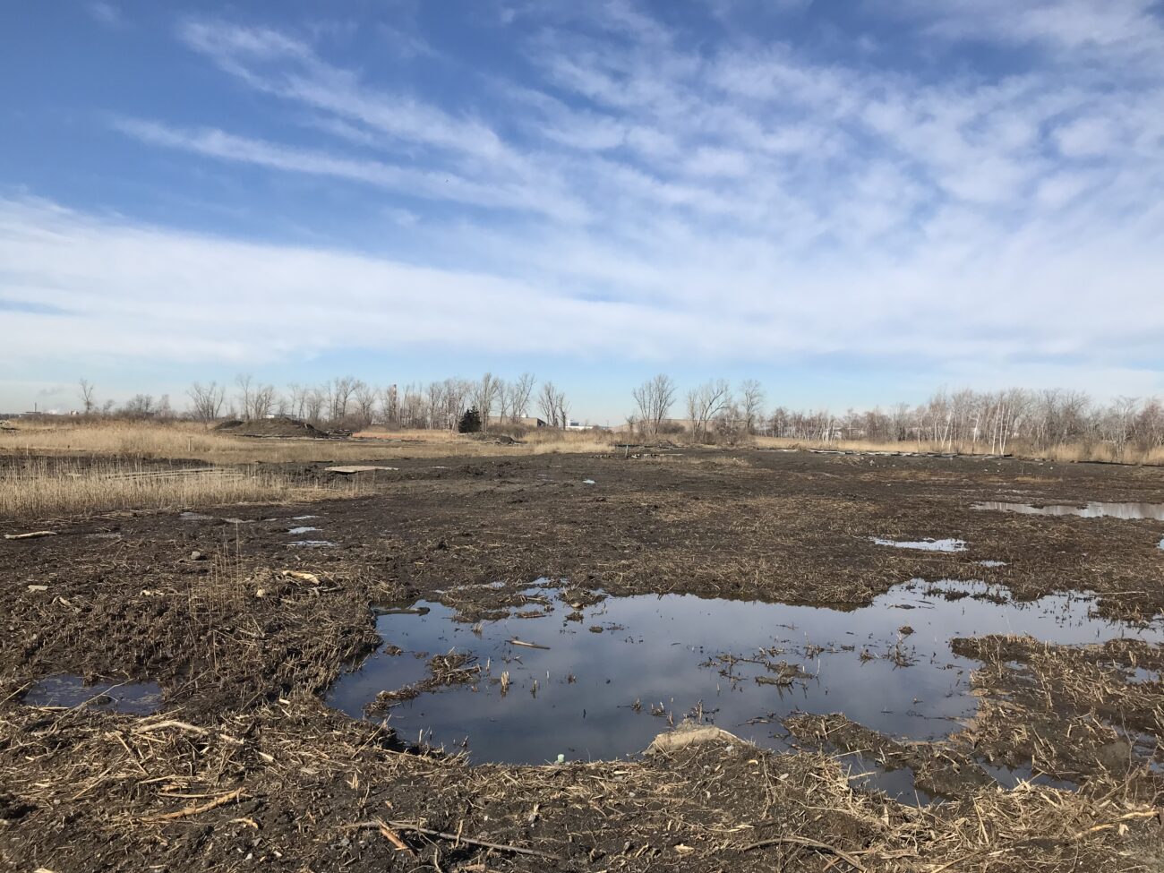
Case Study
Stratford, CT
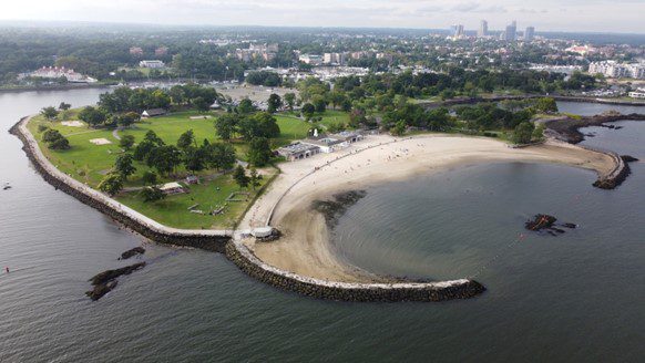
This project restored 46 acres of the Great Meadows Marsh in Connecticut that was degraded from dredge material that was dumped on site, poor drainage, and sea level rise. The marsh was also overrun with invasive plants and mosquitoes. A controlled fire was started to kill the invasive reeds growing in the marsh. Then a construction crew removed invasive plants and the dumped dredge material. Lastly, channels were carefully dug for tidal flushing which will allow the marsh to keep pace with sea level rise. Soil hummocks were constructed for Salt Marsh Sparrow habitat. Now the area continues to be monitored, assessed for resiliency, and provides a field for innovative solutions to be tested in.
Trustees: USFWS, NOAA, State of Connecticut; Project Partners: Audubon Connecticut, Town of Stratford


Molly Sperduto at molly_sperduto@fws.gov;
Corrie Folsom-O’Keefe cfolsom.okeefe@audubon.org;
Jack Matthias jack.matthias@audubon.org
Case Study
Stratford, CT
This project restored 46 acres of the Great Meadows Marsh in Connecticut that was degraded from dredge material that was dumped on site, poor drainage, and sea level rise. The marsh was also overrun with invasive plants and mosquitoes. A controlled fire was started to kill the invasive reeds growing in the marsh. Then a construction crew removed invasive plants and the dumped dredge material. Lastly, channels were carefully dug for tidal flushing which will allow the marsh to keep pace with sea level rise. Soil hummocks were constructed for Salt Marsh Sparrow habitat. Now the area continues to be monitored, assessed for resiliency, and provides a field for innovative solutions to be tested in.
Trustees: USFWS, NOAA, State of Connecticut; Project Partners: Audubon Connecticut, Town of Stratford
Case Study
Stratford, CT
This project consists of 750 feet of shoreline in Stratford, CT. The goal of the project was to protect the beach from coastal erosion and to help combat sea level rise. The steps consisted of adding a smooth cordgrass marsh, artificial shellfish reefs (reef balls), high marsh, and a coastal dune area. The site was awarded the “Best Restored Shore Area” from the American Shore and Beach Preservation Association. To adaptively manage the site, a second restoration project is being developed to extend the marsh seaward by 0.35 acres over an additional 250 feet of shore using a combination of bagged slipper shell and small, modular oyster castles near the marsh edge, along with additional cordgrass plantings in the intertidal zone.
Sacred Heart University
LaTina Steele
203-396-8485
steelel@sacredheart.edu
Case Study
Stratford, CT
This project consists of 750 feet of shoreline in Stratford, CT. The goal of the project was to protect the beach from coastal erosion and to help combat sea level rise. The steps consisted of adding a smooth cordgrass marsh, artificial shellfish reefs (reef balls), high marsh, and a coastal dune area. The site was awarded the “Best Restored Shore Area” from the American Shore and Beach Preservation Association. To adaptively manage the site, a second restoration project is being developed to extend the marsh seaward by 0.35 acres over an additional 250 feet of shore using a combination of bagged slipper shell and small, modular oyster castles near the marsh edge, along with additional cordgrass plantings in the intertidal zone.
Sacred Heart University
Case Study
Oyster Bay, NY and Cold Spring Harbor, NY
In 2023, Long Island Sound Study, New York Sea Grant and Warren Pinnacle, in partnership with committed municipalities and marsh-conservation groups/organizations, developed a Plan to understand the benefits, threats and recommended conservation actions at seven focal areas across the harbors. The goal of the Plan is to inform local municipalities and marsh-conservation groups as to where they might focus their conservation efforts to maximize the conservation of marsh ecosystem services under sea-level rise conditions. This process brought together a diversity of stakeholders to develop a cohesive strategy for seven focal areas across Oyster Bay and Cold Spring Harbor: Frost Creek, Mill Neck Creek, West Shore Road, Bayville Bridge to Centre Island, Centre Island, Shore Road, and Lower Cold Spring Harbor. The partners will now work to implement the recommendations in the plan.
St. John’s Episcopal Church (lower Cold Spring Harbor) and Village of Lattingtown (Frost Creek) were 2024 LIS Resilience Planning Support Program awardees. Their projects will build off the Oyster Bay & Cold Spring Harbor marsh conservation plan and develop specific recommendations to enhance and restore marsh habitat in lower Cold Spring Harbor and Frost Creek.

Sarah Schaefer-Brown, scs292@cornell.edu
Case Study
Oyster Bay, NY and Cold Spring Harbor, NY
In 2023, Long Island Sound Study, New York Sea Grant and Warren Pinnacle, in partnership with committed municipalities and marsh-conservation groups/organizations, developed a Plan to understand the benefits, threats and recommended conservation actions at seven focal areas across the harbors. The goal of the Plan is to inform local municipalities and marsh-conservation groups as to where they might focus their conservation efforts to maximize the conservation of marsh ecosystem services under sea-level rise conditions. This process brought together a diversity of stakeholders to develop a cohesive strategy for seven focal areas across Oyster Bay and Cold Spring Harbor: Frost Creek, Mill Neck Creek, West Shore Road, Bayville Bridge to Centre Island, Centre Island, Shore Road, and Lower Cold Spring Harbor. The partners will now work to implement the recommendations in the plan.
St. John’s Episcopal Church (lower Cold Spring Harbor) and Village of Lattingtown (Frost Creek) were 2024 LIS Resilience Planning Support Program awardees. Their projects will build off the Oyster Bay & Cold Spring Harbor marsh conservation plan and develop specific recommendations to enhance and restore marsh habitat in lower Cold Spring Harbor and Frost Creek.
Mapper
Level of Effort:
This mapper is intended to provide federal, state, and local managers with tools to estimate the vulnerability and ecosystem service potential of wetlands. It allows you to display information on the unvegetated to vegetated ratio (UVVR), marsh elevation, tidal range, and shoreline change rates for New York’s tidal wetlands.
Guidance Tool
Level of Effort:
The NYSDEC document is to provide guidance on the issuance of permits for living shorelines techniques in the Marine and Coastal District Waters of New York (the Marine District) and encourages the use of green or natural infrastructure.
Guidance Tool
Level of Effort:
The NYSDEC document is to provide guidance on the issuance of permits for living shorelines techniques in the Marine and Coastal District Waters of New York (the Marine District) and encourages the use of green or natural infrastructure.
Data
Level of Effort:
The Long Island Tidal Wetlands Trends Analysis measures wetlands loss and changes in marsh condition within the Long Island Sound, Peconic, and South Shore estuaries including all or parts of Westchester, Bronx, Queens, Nassau, and Suffolk Counties between 1974 and 2005/2008. The results of this project are intended for use by environmental managers, conservation advocates and elected officials across a variety of regulatory agencies, environmental organizations, and governments.
Guidance Tool
Level of Effort:
The New York State Department of State worked with the Department of Environmental Conservation and other partners to create model local laws to help local governments be more resilient to sea-level rise, storm surge, and flooding. Cities, towns, and villages are invited to adapt model local laws to meet the resilience needs of the community with the assistance of their municipal attorneys.
Guidance Tool
Level of Effort:
This fact sheet is intended to assist landowners in understanding the various shoreline management options and considerations for their shoreline.
Guidance Tool
Level of Effort:
This fact sheet is intended to assist landowners in understanding the various shoreline management options and considerations for their shoreline.
Mapper
Level of Effort:
Developed by The Nature Conservancy, this tool identifies priority road-stream and tidal crossings in Suffolk County for replacement or upgrades. Prioritization is based on social and ecological criteria. Additionally, it includes data on current and future projected flooding and marsh extent under various sea level rise scenarios. The tool is meant to be a screening tool for planning efforts.
Guidance Tool
Level of Effort:
The Coastal Science Navigator is intended to help users discover USGS Coastal Change Hazards information, products, and tools relevant to their scientific or decision-making needs.
Guidance Tool
Level of Effort:
The Coastal Science Navigator is intended to help users discover USGS Coastal Change Hazards information, products, and tools relevant to their scientific or decision-making needs.
Guidance Tool
Level of Effort:
Healthy ecosystems provide a wide range of benefits, from recreational opportunities to storm surge protection. These benefits are often referred to as ecosystem services. Understanding how changes to the ecosystem may affect these benefits should play a role in the community’s decision making process. This page provides a guide to learning more and key NOAA Digital Coast resources useful for this task.
Mapper
Level of Effort:
The purpose of the interactive viewer is to illustrate the fate of significant marsh systems on Long Island Sound under future Sea-Level Rise conditions. Model results are combined with tax-parcel information and integrated with information about marsh ecosystem services to assist municipalities and conservation groups in defining and assessing various land-management alternatives.
Guidance Tool
Level of Effort:
This guide gives community leaders five main strategies to carry out Nature-Based Solution projects: 1) Building Strong Partnerships, 2) Engaging the Whole Community, 3) Matching Project Size With Desired Goals and Benefits, 4) Maximizing Benefits, and 5) Designing for the Future. This is not a technical guide for planning, constructing or funding NBS. It covers the value of each strategy and suggests how to move forward with NBS projects.
Plan
Level of Effort:
An effort by Save the Sound and Earth Economics to identify opportunities for the Federal Emergency Management Agency (FEMA) and other federal agencies and funders to improve the ability of benefit-cost analysis tools to account for ecosystem-based benefits.
Plan
Level of Effort:
An effort by Save the Sound and Earth Economics to identify opportunities for the Federal Emergency Management Agency (FEMA) and other federal agencies and funders to improve the ability of benefit-cost analysis tools to account for ecosystem-based benefits.
Mapper
Level of Effort:
The Sea Level Affecting Marshes Model, or SLAMM, uses digital data and other information to simulate potential impacts of long-term sea level rise on wetlands and shorelines. Additional data related to dike locations or other protected areas, accretion rates, erosion rates, and other factors can be included within the model as optional factors. Requires ArcGIS for viewing outputs in a mapping environment and software, such as Microsoft Excel and Word, to view the text and tabular output.
Mapper
Level of Effort:
Use this web mapping tool to visualize community-level impacts from coastal flooding or sea level rise (up to 10 feet above average high tides). Photo simulations of how future flooding might impact local landmarks are also provided, as well as data related to water depth, connectivity, flood frequency, socio-economic vulnerability, wetland loss and migration, and mapping confidence.
Mapper
Level of Effort:
User-friendly access to expert-reviewed interactive maps on key topics such as marine life and habitat, marine-based industry, use and resources in the northeastern United States. The Data Explorer allows the user to define and view any combination of data hosted on the Portal on one map.
Story Map
Level of Effort:
This story map examines the coastal processes and hazards of Long Island and provides options for sustainable and resilient shoreline management. Information is useful for coastal managers, planners and coastal property owners.
Story Map
Level of Effort:
This story map examines the coastal processes and hazards of Long Island and provides options for sustainable and resilient shoreline management. Information is useful for coastal managers, planners and coastal property owners.
Guidance Tool
Level of Effort:
The New York State Department of State (NYS DOS) developed the Statewide Shoreline Monitoring Framework to provide clear and consistent information to those planning projects to improve their shoreline resiliency.
Guidance Tool
Level of Effort:
The New York State Department of State (NYS DOS) developed the Statewide Shoreline Monitoring Framework to provide clear and consistent information to those planning projects to improve their shoreline resiliency.
Mapper
Level of Effort:
This map identifies priority salt marshes within each state that are good candidates for restoration, enhancement, and/or management to provide persistent high-quality Saltmarsh Sparrow nesting habitat. A second map shows priority marsh migration space for easement and acquisition.
Training
The first annual Long Island Sound Bi-State Sustainable and Resilient Communities Workshop brought together more than 260 people virtually on Dec. 1, 2022 to learn about opportunities to increase the resilience of the Sound’s communities to climate change and other environmental threats. Interactive sessions included opportunities to learn more about the SRC Extension Professionals’ needs assessment findings and recommendations, the newly released Long Island Sound Resilience Grant Writing Assistance Program, and tips for success with Long Island Sound funding opportunities. Concurrent breakout sessions highlighted the work of partners related to shoreline planning and implementation, using green infrastructure for stormwater management, sustainable climate planning for relocation, and new sustainability/resilience tools available in both New York and Connecticut. Videos of the workshop’s six sessions are available on YouTube. They can be accessed below along with supporting documents.
Training
This online information session held Sept. 19, and repeated Sept. 21, provides an introduction to resilience planning in the Long Island Sound region. It includes discussions on local climate impacts and projections, resilience planning strategies, and climate certification programs for both New York and Connecticut municipalities. In addition to the main presentation, videos of the Connecticut and New York breakout sessions can be accessed below. The presentations and other resource materials are available here.
Training
These webinars were presented by NEIWPCC, Long Island Sound Study, and the New York State Department of Environmental Conservation. The webinars introduced the Marsh Interactive Fate Viewer, discussed the process of creating marsh conservation plans for Westchester County and Mattituck Creek (Suffolk County) in 2021, and laid the groundwork for developing additional marsh conservation plans over the course of 2023.
Resources & Tools

