Resilience Steps
Find support and resources tailored to your project needs. Select your Planning Phase, Location, and/or Topic of interest to access a filtered selection of our curated resources and tools.

Find support and resources tailored to your project needs. Select your Planning Phase, Location, and/or Topic of interest to access a filtered selection of our curated resources and tools.

Learn about the environmental threats and climate risks in your community

Identify strategies to help mitigate risks and develop ways to adapt to a changing climate

Find funding and guidance to help put your plans into action

Monitor, maintain, and adaptively-manage your project to sustain success
Select one or more of the filters below to find relevant tools and resources for your needs


Learn how to identify, prioritize, and implement high-impact projects
Resource
Level of Effort:
Check out our interactive map to learn about living shoreline projects located in the marine district of New York.
More information about living shorelines and their benefits can be found on the NYSDEC Living Shorelines webpage.
Resource
Level of Effort:
Check out our interactive map to learn about living shoreline projects located in the marine district of New York.
More information about living shorelines and their benefits can be found on the NYSDEC Living Shorelines webpage.
Report
Level of Effort:
This report provides on guidance on ways to adapt the Shoreline Greenway Trail to the increasing frequencies of heavy rain, wildfires, hurricanes, flood events, and storm surges. The report defines what we mean by resilience for a trail in coastal Connecticut, identifies climate impacts facing the trail now, and in the years to come, shares design suggestions that could build resiliency on existing and new sections, and explores how the trail itself can be essential to wider community resiliency.
Story Map
Level of Effort:
A StoryMap on Hypoxia
This StoryMap describes how the Long Island Sound (LIS) Partnership has reduced hypoxia and improved nutrient management efforts in Long Island Sound and its watershed.
It includes an explanation of hypoxia, impacts from the region’s history, how LIS Partnership is addressing hypoxia, plans for the future, and how to use this information to inform meaningful action.
Resource
Level of Effort:
This fact sheet for Conservation Commissions in Connecticut reviews the role of these commissions for enhancing the climate resilience of their communities. The resource was developed by CIRCA and covers the authority and duties of conservation commissions as well as detailing specific strategies and approaches.
Mapper
Level of Effort:
Save the Sound’s Sound Health Explorer displays information on water quality for Long Island Sound beaches, embayments, and open waters.
Mapper
Level of Effort:
Save the Sound’s Sound Health Explorer displays information on water quality for Long Island Sound beaches, embayments, and open waters.
Mapper
Level of Effort:
This NYSDEC tool provides information on shellfish closures in NY’s marine waters and can be used to help resource users understand where it is safe to harvest to shellfish.
Mapper
Level of Effort:
This NYSDEC tool provides information on shellfish closures in NY’s marine waters and can be used to help resource users understand where it is safe to harvest to shellfish.
Mapper
Level of Effort:
This interactive map provides information on boat ramps and saltwater fishing access points on Long Island in Nassau and Suffolk Counties.
Mapper
Level of Effort:
This interactive map provides information on boat ramps and saltwater fishing access points on Long Island in Nassau and Suffolk Counties.
Guidance Tool
Level of Effort:
Guide that lists various beach-related actions/activities, permitting pathways, and other considerations
Guidance Tool
Level of Effort:
Guide that lists various beach-related actions/activities, permitting pathways, and other considerations
Guidance Tool
Level of Effort:
CT DEEP recently released a new tool allowing users to search for DEEP financial assistance programs based on a variety of parameters such as eligibility requirements, grant cycle status, project types, and more. This resource and offers “one-stop shopping” for many DEEP funding opportunities.
Mapper
Level of Effort:
User-friendly access to expert-reviewed interactive maps on key topics such as marine life and habitat, marine-based industry, use and resources in the northeastern United States. The Data Explorer allows the user to define and view any combination of data hosted on the Portal on one map.
Mapper
Level of Effort:
This interactive map can help you find your way to over 350 diverse shoreline sites in Connecticut that provide a variety of opportunities for coastal enjoyment.
Mapper
Level of Effort:
This interactive map can help you find your way to over 350 diverse shoreline sites in Connecticut that provide a variety of opportunities for coastal enjoyment.
Mapper
Level of Effort:
The purpose of the Long Island Sound Blue Plan is to identify and protect places of traditional use and ecological significance, and to minimize conflicts, now and in the future. Contains data layers with policy and planning areas, ecologically significant areas, and significant human use areas.
Training
The Long Island Sound Sustainable and Resilient Communities (SRC) Team held our 2025 Annual Workshop virtually as three sessions over two days. Session topics focused on resources and tools available to help take advantage of state resilience funds, a panel discussion on why and how to incorporate nature-based solutions into resilience planning, and an overview of our available assistance programs.
Session 3 – LIS Resilience Planning Support Program: New Round Available & Showcase of Completed Projects was held on Friday, December 5, 2025. Participants learned about the newly available 3rd round of the LIS Resilience Planning Support Program and heard from three communities who received awards through the first round of the Program. Video of the session along with supporting materials is available below.


Training
The Long Island Sound Sustainable and Resilient Communities (SRC) Team held our 2025 Annual Workshop virtually as three sessions over two days. Session topics focused on resources and tools available to help take advantage of state resilience funds, a panel discussion on why and how to incorporate nature-based solutions into resilience planning, and an overview of our available assistance programs.
Session 2 – Using Nature-Based Solutions for Resilience: A Panel Discussion on Common Challenges & Strategies for Success was held on Thursday, December 4, 2025. In this interactive session, practitioners and experts discussed techniques for integrating nature-based solutions into resilience initiatives. The panel highlighted common challenges and shared successful strategies from projects in the Long Island Sound region. Video of the session along with supporting materials is available below.


Training
The Long Island Sound Sustainable and Resilient Communities (SRC) Team held our 2025 Annual Workshop virtually as three sessions over two days. Session topics focused on resources and tools available to help take advantage of state resilience funds, a panel discussion on why and how to incorporate nature-based solutions into resilience planning, and an overview of our available assistance programs.
Session 1 – Resilience 101: Helpful Tools and Strategies for Building Community Resilience was held on Thursday, December 4, 2025. Participants learned about available resilience resources and tools and then moved into breakout rooms to hear about state climate certification programs and resilience funds in both NY and CT. Videos of the main session and both breakout rooms are available below, along with supporting materials.


Training
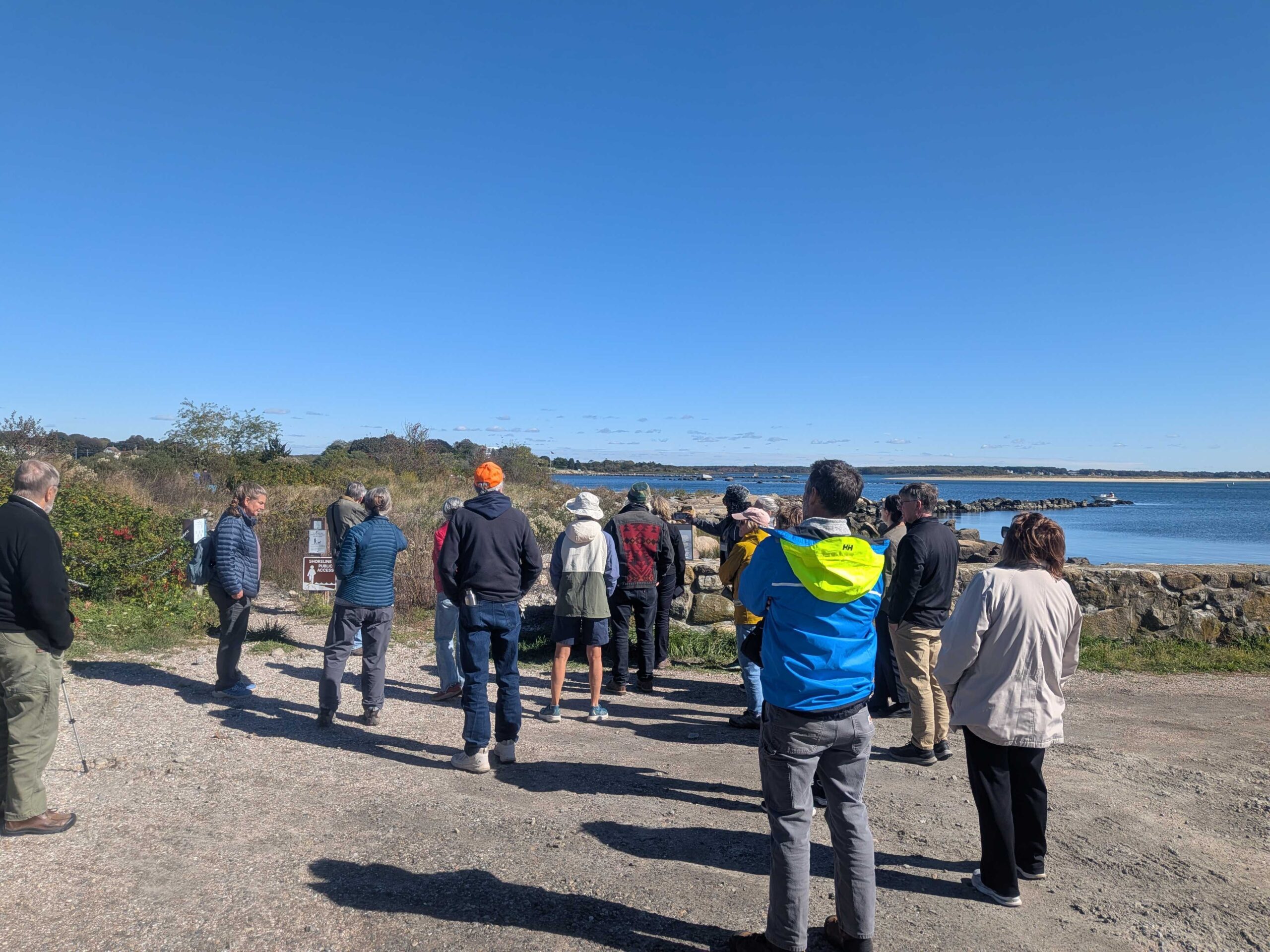
On October 16, 2025, the Sustainable and Resilient Communities (SRC) team of the Long Island Sound Partnership hosted a field trip featuring the Dodge Paddock and Beal Preserve Marsh Restoration Project in Stonington Borough. The day started with a presentation outlining the history and current state of the site, followed by a walk to Dodge Paddock and Beal Preserve where there was a guided tour led by Connecticut Sea Grant, Avalonia Land Conservancy, and local volunteers. The day included a deep dive into the invasive species removal process, plantings to accommodate marsh migration, and a close up look at what has grown since then. Special thanks to our partners with Avalonia Land Conservancy, Connecticut Sea Grant, and the Stonington Community.


Training
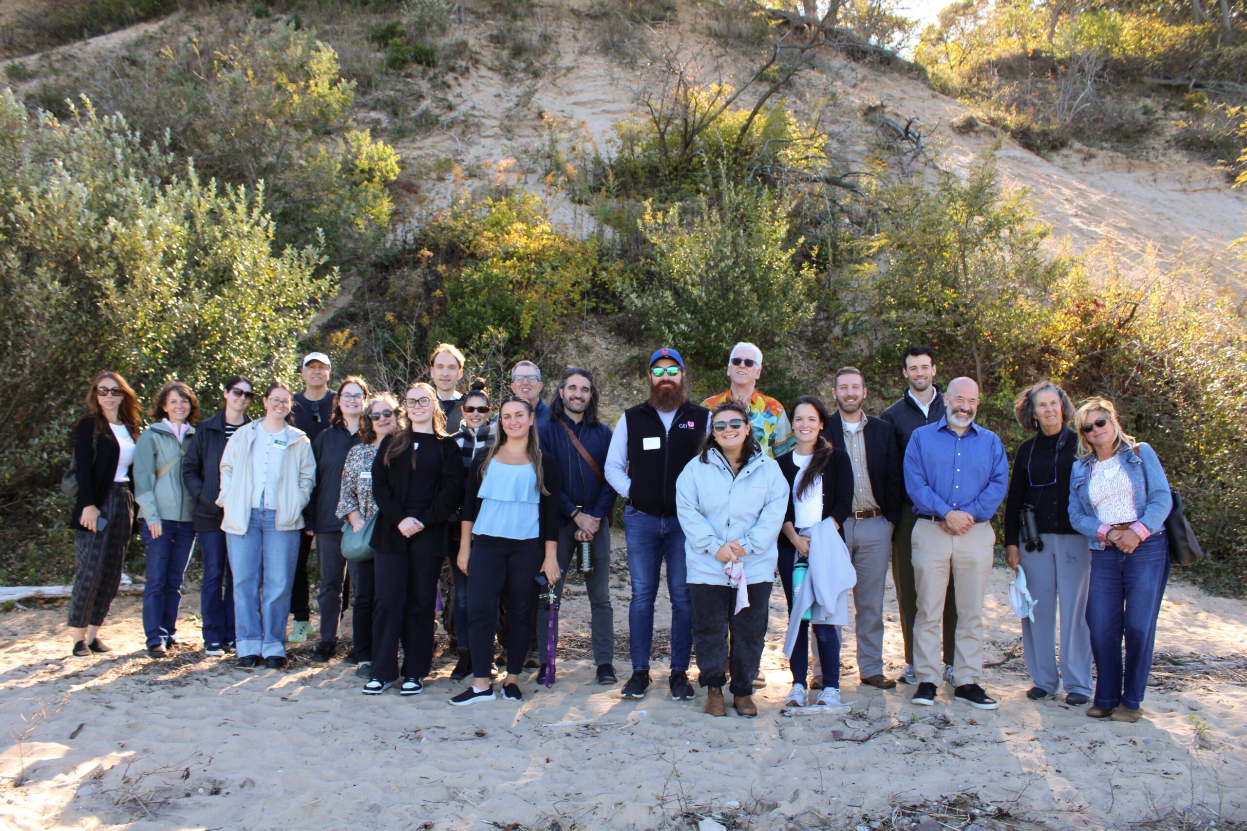
2025 Nassau Coastal Resilience Forum field trip to Sands Point Preserve. Credit: Sumayyah Uddin / NYSG
On October 9, 2025 state and local decision makers, municipal staff, and other interested parties working to address flooding, shoreline erosion and other coastal issues gathered at the Sands Point Preserve Conservancy in Sands Point, NY for the 3rd Annual Nassau County Coastal Resilience Forum. The Forum provided a chance to share information on best practices, discuss challenges, identify opportunities to increase resilience, and enhance coordination across communities. Forum attendees heard updates on State resilience initiatives from agencies like the NYS Department of Environmental Conservation and NYS Division of Homeland Security and Emergency Services, as well as presentations on new resilience tools and resources from Seatuck Environmental Association, the U.S. Geological Survey, New York Sea Grant, Cornell Cooperative Extension of Nassau County, and Nassau County Soil and Water Conservation District. In the afternoon, Forum attendees were given a guided tour of the recent expansions to the bluff stabilization project at the Preserve.
The event was hosted by Long Island Sound Partnership and New York Sea Grant, in partnership with the Sands Point Preserve Conservancy and Nassau and Suffolk County Soil and Water Conservation Districts.


Training

2025 Nassau Coastal Resilience Forum field trip to Sands Point Preserve. Credit: Sumayyah Uddin / NYSG
On October 9, 2025 state and local decision makers, municipal staff, and other interested parties working to address flooding, shoreline erosion and other coastal issues gathered at the Sands Point Preserve Conservancy in Sands Point, NY for the 3rd Annual Nassau County Coastal Resilience Forum. The Forum provided a chance to share information on best practices, discuss challenges, identify opportunities to increase resilience, and enhance coordination across communities. Forum attendees heard updates on State resilience initiatives from agencies like the NYS Department of Environmental Conservation and NYS Division of Homeland Security and Emergency Services, as well as presentations on new resilience tools and resources from Seatuck Environmental Association, the U.S. Geological Survey, New York Sea Grant, Cornell Cooperative Extension of Nassau County, and Nassau County Soil and Water Conservation District. In the afternoon, Forum attendees were given a guided tour of the recent expansions to the bluff stabilization project at the Preserve.
The event was hosted by Long Island Sound Partnership and New York Sea Grant, in partnership with the Sands Point Preserve Conservancy and Nassau and Suffolk County Soil and Water Conservation Districts.


Training
The Long Island Sound Sustainable and Resilient Communities (SRC) Team held our 2024 Annual Workshop virtually as three sessions over two days. Session topics focused on our assistance programs, new regional resilience resources and tools, and a discussion on planning for inundation and different considerations communities may face.
Session 2 – Resilience Tools was held on Tuesday, December 10th from 1:30-3:30 PM. Participants learned about new Resilience Tools being developed and used throughout coastal Long Island Sound.


Training
The Long Island Sound Sustainable and Resilient Communities (SRC) Team held our 2024 Annual Workshop virtually as three sessions over two days. Session topics focused on our assistance programs, new regional resilience resources and tools, and a discussion on planning for inundation and different considerations communities may face.
Session 1 – SRC Resilience Assistance Programs was held on Tuesday, December 10th from 10-11:30 AM. Participants learned about our Sustainable and Resilient Communities resilience assistance programs and heard from communities who have successfully utilized them to advance resilience project plans, build capacity, and secure competitive grant funding!


Training
The Long Island Sound Community Impact Fund (LISCIF) is a partnership between Restore America’s Estuaries, the U.S. Environmental Protection Agency, and the Long Island Sound Study (LISS). The purpose of LISCIF is to build capacity for organizations located in communities affected by disproportionate environmental and human health risks. The purpose of the LISCIF is to provide technical and financial assistance to communities and improve the quality and accessibility of the Long Island Sound. The Long Island Sound Community Impact Fund seeks to increase organizational capacity through training that supports day-to-day operations, project implementation, and future funding opportunities.


Training
In this Coastal Resiliency Network webinar, Barbara Kendall from the NYS Department of State provides an overview of Local Waterfront Revitalization Programs (LWRP) and then representatives from four NYS coastal communities discuss their experiences developing and implementing their LWRPs. The Coastal Resilience Network, led by the New York State Association of Conservation Commissions (NYSACC) with assistance from NY Sea Grant, is a collaborative open forum for communities in coastal Westchester, Nassau, and Suffolk Counties to discuss and learn about opportunities to increase their resilience to sea level rise, flooding, and extreme events.


Case Study
Project
Halesite, NY
With support from the Long Island Sound Resilience Grant Writing Assistance Program, in December 2024 1653 Foundation was awarded $549,955 from the NYSDEC Water Quality Improvement Project (WQIP) Program to fund the Final design and implementation of habitat improvements and green infrastructure at Halesite Park, NY.
1653 Foundation Inc. will restore degrading shoreline at Halesite Park on the eastern shore of Huntington Harbor. The project will remove a failing seawall to expand shallow water habitat, install an offshore rock sill and oyster reef, and expand salt marsh vegetation, and upland plantings.
LIS Resilience Grant Writing Assistance Program Details:
Grant Writing Consultant: DLB Planning, LLC.
Grant Writing Assistance Award: $9,900
Case Study
Project
Fairfield, CT
With support from the Long Island Sound Resilience Grant Writing Assistance (GWA) Program, in 2024 the Mill River Wetland Committee (MRWC) was awarded $26,987 from the Long Island Sound Community Impact Fund to support MRWC to lead the 5th Grade classes (2) at Barnum School in Bridgeport, CT through the Groundwater Study Trip in the fall of 2024 and Water Monitoring training in the spring of 2025.
LIS Resilience Grant Writing Assistance Program Details:
Grant Writing Consultant: CT Grant Writers
Grant Writing Assistance Award: $1,912.50
Case Study
Project
Cold Spring Harbor, NY
With support from the Long Island Sound Resilience Grant Writing Assistance (GWA) Program, in December 2023, North Shore Land Alliance was awarded $192,969 from the NYSDEC Water Quality Improvement Project (WQIP) Program to fund the implementation of green infrastructure at the North Shore Land Alliance Shore Road Sanctuary in Cold Spring Harbor, NY. The North Shore Land Alliance will install an upland infiltration system to reduce the volume and velocity of stormwater on a 40-acre parcel and replace invasive plants along the shoreline with a native plant community. The project will restore habitat and reduce the amount stormwater and pollutants entering Cold Spring Harbor and Long Island Sound.
LIS Resilience Grant Writing Assistance Program Details:
Grant Writing Consultant: Nelson Pope & Voorhis
Grant Writing Assistance Award: $9,900

Jane Jackson, Director of Stewardship, North Shore Land Alliance, jjackson@northshorelandalliance.org
Case Study
Project
Cold Spring Harbor, NY
With support from the Long Island Sound Resilience Grant Writing Assistance (GWA) Program, in December 2023, North Shore Land Alliance was awarded $192,969 from the NYSDEC Water Quality Improvement Project (WQIP) Program to fund the implementation of green infrastructure at the North Shore Land Alliance Shore Road Sanctuary in Cold Spring Harbor, NY. The North Shore Land Alliance will install an upland infiltration system to reduce the volume and velocity of stormwater on a 40-acre parcel and replace invasive plants along the shoreline with a native plant community. The project will restore habitat and reduce the amount stormwater and pollutants entering Cold Spring Harbor and Long Island Sound.
LIS Resilience Grant Writing Assistance Program Details:
Grant Writing Consultant: Nelson Pope & Voorhis
Grant Writing Assistance Award: $9,900
Case Study
Plan
East Haddam, CT
With support from the Nature Conservancy and Sustainable CT, East Haddam organized a Community Resilience Building process and workshop, the results of which were compiled into this summary. The team engaged with community members to determine the present hazards and vulnerabilities and identify resilient solutions.
Case Study
Project
Stratford, CT
This project restored 46 acres of the Great Meadows Marsh in Connecticut that was degraded from dredge material that was dumped on site, poor drainage, and sea level rise. The marsh was also overrun with invasive plants and mosquitoes. A controlled fire was started to kill the invasive reeds growing in the marsh. Then a construction crew removed invasive plants and the dumped dredge material. Lastly, channels were carefully dug for tidal flushing which will allow the marsh to keep pace with sea level rise. Soil hummocks were constructed for Salt Marsh Sparrow habitat. Now the area continues to be monitored, assessed for resiliency, and provides a field for innovative solutions to be tested in.
Trustees: USFWS, NOAA, State of Connecticut; Project Partners: Audubon Connecticut, Town of Stratford


Molly Sperduto at molly_sperduto@fws.gov;
Corrie Folsom-O’Keefe cfolsom.okeefe@audubon.org;
Jack Matthias jack.matthias@audubon.org
Case Study
Project
Stratford, CT
This project restored 46 acres of the Great Meadows Marsh in Connecticut that was degraded from dredge material that was dumped on site, poor drainage, and sea level rise. The marsh was also overrun with invasive plants and mosquitoes. A controlled fire was started to kill the invasive reeds growing in the marsh. Then a construction crew removed invasive plants and the dumped dredge material. Lastly, channels were carefully dug for tidal flushing which will allow the marsh to keep pace with sea level rise. Soil hummocks were constructed for Salt Marsh Sparrow habitat. Now the area continues to be monitored, assessed for resiliency, and provides a field for innovative solutions to be tested in.
Trustees: USFWS, NOAA, State of Connecticut; Project Partners: Audubon Connecticut, Town of Stratford
Case Study
Plan
Huntington, NY
This comprehensive study and plan, funded through the National Fish and Wildlife Foundation, Long Island Sound Futures Fund, identifies initial strategies to maintain and enhance the local watershed resources of Crab Meadow. It is meant to be a land management tool to guide the implementation of best practices. The plan was developed in consultation with many partners and stakeholders. There is now significant community buy-in to take action to protect and restore this important watershed.
Following adoption of the plan, the Town of Huntington began working with US Fish and Wildlife Service and Audubon to study and restore Crab Meadow marsh and implement recommendations from the Stewardship Plan. Audubon, in partnership with Town of Huntington and USFWS, received a 2024 Long Island Sound Futures Fund Grant ($429K) to develop design plans for marsh restoration at Crab Meadow.
Garrett Chelius gchelius@huntingtonny.gov, Victoria O’Neill victoria.oneill@audubon.org, Suzanne Paton suzanne_paton@fws.gov
 Photo by Jonah Saitz, USFWS.
Case Study
Plan
Huntington, NY
This comprehensive study and plan, funded through the National Fish and Wildlife Foundation, Long Island Sound Futures Fund, identifies initial strategies to maintain and enhance the local watershed resources of Crab Meadow. It is meant to be a land management tool to guide the implementation of best practices. The plan was developed in consultation with many partners and stakeholders. There is now significant community buy-in to take action to protect and restore this important watershed.
Following adoption of the plan, the Town of Huntington began working with US Fish and Wildlife Service and Audubon to study and restore Crab Meadow marsh and implement recommendations from the Stewardship Plan. Audubon, in partnership with Town of Huntington and USFWS, received a 2024 Long Island Sound Futures Fund Grant ($429K) to develop design plans for marsh restoration at Crab Meadow.
Case Study
Project
Increased development and the historic construction of a dam on Sunken Meadow Creek in the 1950’s led to reduced tidal exchange, increased water levels in the creek, poor water quality, and the proliferation of invasive species. In 2008 a number of partners (NYS OPRHP, NOAA, NYSDEC, LISS, TNC, Save the Sound, USFWS, LI Botanical Society) came together to work to restore the degraded marsh habitat around Sunken Meadow Creek, increase tidal flow, improve aquatic organism passage, limit invasives, and improve water quality. A restoration feasibility study was completed in 2010. In 2012 Superstorm Sandy blew out the dam on Sunken Meadow Creek, naturally kick-starting restoration. Following Superstorm Sandy, the project partners were able to quickly capitalize on available funding and grants, due to their prior planning efforts. A bridge was built across the Creek where the dam blew out, salt marsh habitat was restored at three locations, green infrastructure was installed in one of the parking areas to capture and treat stormwater runoff, fish passage feasibility on the creek was investigated, and education and outreach was conducted to thousands of people. These projects were completed in 2019. Now, with funding through Long Island Sound Futures Fund, Audubon NY is leading a large-scale marsh restoration project at Sunken Meadow Creek to restore important high-marsh habitat for at risk species, like the Saltmarsh Sparrow, and to increase the resilience of the marsh in the face of rising sea levels. Audubon will be working to finalize the designs and secure permits over the next two years, with on-the-ground restoration expected in 2026.


Sean Cruickshank Sean.Cruickshank@parks.ny.gov, Jon Vander Werff jvanderwerff@savethesound.org, Phoebe Clark phoebe.clark@audubon.org, Vicky O’Neill victoria.oneill@audubon.org
Case Study
Project
Increased development and the historic construction of a dam on Sunken Meadow Creek in the 1950’s led to reduced tidal exchange, increased water levels in the creek, poor water quality, and the proliferation of invasive species. In 2008 a number of partners (NYS OPRHP, NOAA, NYSDEC, LISS, TNC, Save the Sound, USFWS, LI Botanical Society) came together to work to restore the degraded marsh habitat around Sunken Meadow Creek, increase tidal flow, improve aquatic organism passage, limit invasives, and improve water quality. A restoration feasibility study was completed in 2010. In 2012 Superstorm Sandy blew out the dam on Sunken Meadow Creek, naturally kick-starting restoration. Following Superstorm Sandy, the project partners were able to quickly capitalize on available funding and grants, due to their prior planning efforts. A bridge was built across the Creek where the dam blew out, salt marsh habitat was restored at three locations, green infrastructure was installed in one of the parking areas to capture and treat stormwater runoff, fish passage feasibility on the creek was investigated, and education and outreach was conducted to thousands of people. These projects were completed in 2019. Now, with funding through Long Island Sound Futures Fund, Audubon NY is leading a large-scale marsh restoration project at Sunken Meadow Creek to restore important high-marsh habitat for at risk species, like the Saltmarsh Sparrow, and to increase the resilience of the marsh in the face of rising sea levels. Audubon will be working to finalize the designs and secure permits over the next two years, with on-the-ground restoration expected in 2026.
Resources & Tools