Training
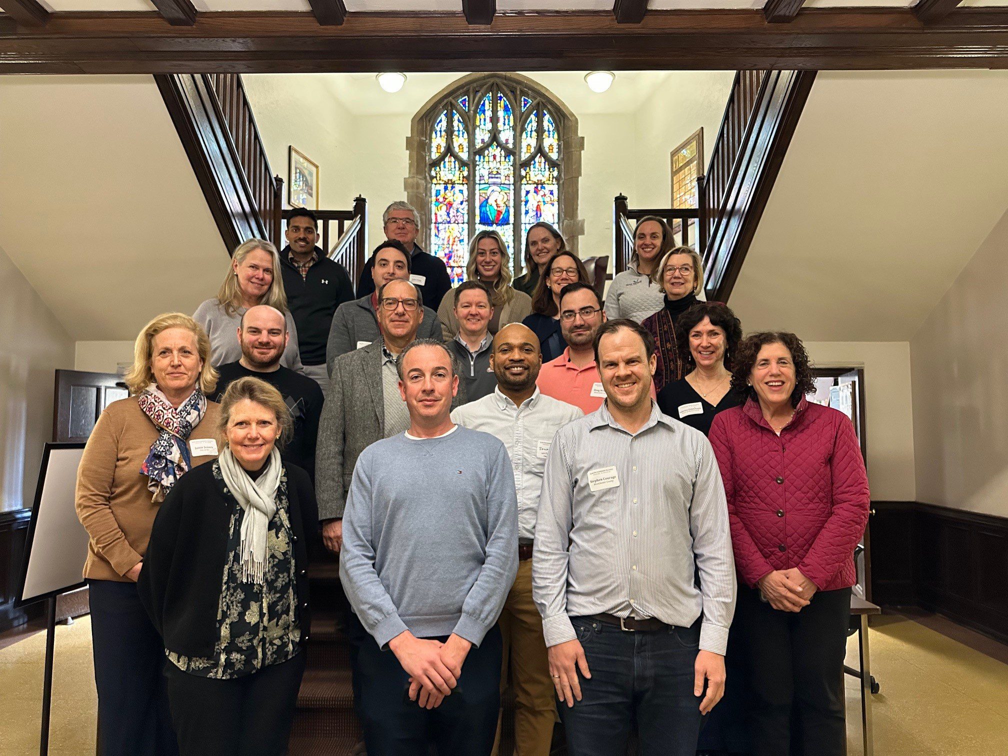
With funding from Long Island Sound Study and support from New York Sea Grant’s Sustainable and Resilient Communities Extension Professionals, Pace University’s Land Use Law Center brought its award-winning Land Use Leadership Alliance Training Program to Westchester municipalities within the Long Island Sound watershed. The training consisted of three full-day workshops held April 1, 8, and 22, 2025 in White Plains, NY to train local leaders on developing balanced strategies for effectively accomplishing policy objectives, particularly focused on land use, flood resilience, and natural resource protection to strengthen community planning and informed decision-making.
22 municipal staff and community leaders, representing 7 different Long Island Sound communities received resilience gap analyses that reviewed their municipality’s current zoning and comprehensive plan language, discussed common issues with their neighbors and built new networks of support, and graduated from the program empowered to plan for a more resilient future for their community and the Long Island Sound region.
If you are interested in learning more and participating in a future LULA training, please email lisresilience@gmail.com.
Training
With funding from Long Island Sound Study and support from New York Sea Grant’s Sustainable and Resilient Communities Extension Professionals, Pace University’s Land Use Law Center brought its award-winning Land Use Leadership Alliance Training Program to Westchester municipalities within the Long Island Sound watershed. The training consisted of three full-day workshops held April 1, 8, and 22, 2025 in White Plains, NY to train local leaders on developing balanced strategies for effectively accomplishing policy objectives, particularly focused on land use, flood resilience, and natural resource protection to strengthen community planning and informed decision-making.
22 municipal staff and community leaders, representing 7 different Long Island Sound communities received resilience gap analyses that reviewed their municipality’s current zoning and comprehensive plan language, discussed common issues with their neighbors and built new networks of support, and graduated from the program empowered to plan for a more resilient future for their community and the Long Island Sound region.
If you are interested in learning more and participating in a future LULA training, please email lisresilience@gmail.com.
Case Study
Old Saybrook, CT
With support from the Long Island Sound Resilience Grant Writing Assistance Program, in December 2024 the Town of Old Saybrook was awarded $323,400 from the Long Island Sound Futures Fund to support the project: Planning to Restore Chalker and Chapman Beach Marshes and Mitigate Marsh-Associated Flooding (CT).
The project will conduct a feasibility analysis for restoring the degraded Chalker Beach Marsh and mitigate erosion of Cold Spring Brook marsh, examine potential residential neighborhood flood mitigation strategies and evaluate alternative concepts to restore the Cold Spring Brook marsh. Project will provide Chalker Beach marsh restoration plan and design alternatives, concept-level neighborhood-scale flood mitigation strategies and a concept-level Cold Spring Brook marsh erosion control/restoration practices.
LIS Resilience Grant Writing Assistance Program Details:
Grant Writing Consultant: David Kozak
Grant Writing Assistance Award: $6,375
Christina M. Costa, CZEO, CFM, Zoning Enforcement Officer/Town Planner, Town of Old Saybrook, Chris.Costa@OldSaybrookCT.gov
Case Study
Old Saybrook, CT
With support from the Long Island Sound Resilience Grant Writing Assistance Program, in December 2024 the Town of Old Saybrook was awarded $323,400 from the Long Island Sound Futures Fund to support the project: Planning to Restore Chalker and Chapman Beach Marshes and Mitigate Marsh-Associated Flooding (CT).
The project will conduct a feasibility analysis for restoring the degraded Chalker Beach Marsh and mitigate erosion of Cold Spring Brook marsh, examine potential residential neighborhood flood mitigation strategies and evaluate alternative concepts to restore the Cold Spring Brook marsh. Project will provide Chalker Beach marsh restoration plan and design alternatives, concept-level neighborhood-scale flood mitigation strategies and a concept-level Cold Spring Brook marsh erosion control/restoration practices.
LIS Resilience Grant Writing Assistance Program Details:
Grant Writing Consultant: David Kozak
Grant Writing Assistance Award: $6,375
The NYS Department of State (NYSDOS) is soliciting applications from eligible towns, villages, cities, counties, regional planning entities and not-for-profit organizations to support the creation, or modification of comprehensive plans, area plans, or zoning codes to align with smart growth principals.
The NYS Department of State (NYSDOS) is soliciting applications from eligible towns, villages, cities, counties, regional planning entities and not-for-profit organizations to support the creation, or modification of comprehensive plans, area plans, or zoning codes to align with smart growth principals.
Events
The Long Island Sound Study will host a series of public meetings to discuss and finalize the Stewardship Strategy. The Strategy aims to provide a framework in support of the 33 Stewardship Areas of the Initiative. The draft of the Strategy will be shared for public comment March 10 – May 9. View the Draft Strategy here. Comments can be submitted to Cayla Sullivan at Sullivan.Cayla@epa.gov.
The last meeting in the series will be held on June 4th 11 am – 1 pm and will summarize the input and ideas for advancing the Stewardship Strategy!
Report
Level of Effort:
This study by the Regional Plan Association assessed how flooding will threaten housing in Long Island, NYC, and Westchester County in the coming decades. It found that by 2040 as many as 1.6 million people could live in areas exposed to flooding and as many as 82,000 housing units could be lost, exacerbating housing shortages. The report includes recommendations for an integrated approach to land use planning and policy initiatives to create resilient communities.
$1 million to $10 million per project
This competitive grant program through the NYS Environmental Facilities Cooperation is designed to support flood-prone communities in implementing transformative green infrastructure projects that combat the effects of extreme weather. Eligible projects must utilize green infrastructure (GI) stormwater management practices (SMPs) and/or nature-based solutions to manage combined and/or sanitary sewer overflows and/or mitigate risks associated with extreme weather events.
Funding
: Apr 17 – Apr 27, 2025
Congressionally Directed Spending requests, also known as Community Project Funding or Earmarks, are funding requests for high-impact, Connecticut-based projects that can be completed with assistance from the federal government. The project must meet the eligibility requirements for at least one of the accounts listed.
Events
The 2nd Annual Learning Exchange will bring together current and new grant recipients to highlight completed projects benefiting the Long Island Sound estuary. Organizations will share their work, challenges, and successes via breakout sessions. Attendees will also have opportunities to participate in workshops, network, strengthen ties, and build community. This annual event aims to be a knowledge and tech share of projects within a collaborative framework.
The Target Audience includes:
Mapper
Level of Effort:
A product of Climate Central’s Sea Level Program, Coastal Risk Finder allows users to get local flood projections, understand who and what is at risk in their communities, and learn about solutions for coastal states, counties, cities, towns, congressional districts, and state legislative districts in the contiguous U.S., with more to come. Users can download data and graphics to further their local adaptation and communication efforts related to coastal flooding. Coastal Risk Finder includes detailed briefs on adaptation efforts in coastal states and territories, providing insights into policies, projects, and key organizations working to mitigate flood risks. By highlighting actionable solutions, we aim to empower communities with the knowledge and tools needed to address coastal flooding challenges.
The accompanying User Guides highlight the most useful features and provide guidance on using the tool for specific applications. A recording of the Launch Webinar featuring expert insights is also available.
Funding
: Mar 27 – May 6, 2025
$100,000 - $10M
The National Coastal Resilience Fund (NCRF) is a national program focused on reducing risks to coastal communities. The NCRF is now soliciting pre-proposals for projects that will create and/or restore natural systems in order to increase protection for communities from coastal hazards, such as storms, sea- and lake-level changes, inundation, and coastal erosion, while improving habitats for fish and wildlife species.
Funding
: Oct 1, 2025
The Safeguarding Tomorrow Revolving Loan Fund (RLF) program is authorized under Section 205 of the Robert T. Stafford Disaster Relief and Emergency Assistance Act to provide capitalization grants to states, eligible federally recognized tribes, territories and the District of Columbia to establish revolving loan funds that provide hazard mitigation assistance for local governments to reduce risks from natural hazards and disasters.
These low interest loans will allow jurisdictions to reduce vulnerability to natural disasters, foster greater community resilience and reduce disaster suffering.
Funding
: Dec 13 – May 12, 2025
$75,000-$2M
$20 million in funding is available under the Bipartisan Infrastructure Law for projects that will advance the coastal habitat restoration and climate resilience priorities of tribes and underserved communities. Through this funding, NOAA will help support community-driven habitat restoration and build the capacity of tribes and underserved communities to more fully participate in restoration activities.
Funding
: Jul 3 – Mar 31, 2025
$10,000-$50,000
This grant opportunity is open to municipalities and non-governmental organizations interested in partnering with SCSWCD to implement a variety of projects focused on improving Suffolk County and its environment. These projects focus on revitalizing and protecting Long Islands ecosystems, waterbodies, ground water and habitats. The goal of this grant is to attract new partners to develop and implement innovative and sustainable solutions for environmental issues.
Funding
: Feb 26 – Jun 6, 2025
Minimum grant amount $150,000
Through New York State’s Clean Energy, Clean Water & Green Jobs Bond Act, the Department of State (DOS) is making $15 million available for implementation projects that improve waterfront and watershed resiliency and reduce climate impacts, particularly flooding. Projects should implement a complete or substantially complete LWRP or a complete or substantially complete relevant LWRP Component (including a watershed management plan funded by Department of State). The program prioritizes projects using natural solutions to enhance community resilience while also delivering environmental, economic and social benefits. Eligible applicants are: 1) A village, town, or city located along New York’s coasts or inland waterways 2) A county with the consent and acting on behalf of one or more eligible villages, towns or cities.
Funding
: Feb 26 – Jun 6, 2025
Minimum grant amount $300,000
Through New York State’s Clean Energy, Clean Water & Green Jobs Bond Act, the Department of State (DOS) is making $20 million available for habitat restoration, climate resiliency and risk reduction, and stormwater management projects located within the New York State Coastal areas, areas draining into the New York State Coastal area, and/or areas within the Coastal Nonpoint Source boundary (see map). Projects must be identified or implement goals outlined in state, regional, or local management plans/programs/studies. The program prioritizes projects using natural solutions to enhance community resilience while also delivering environmental, economic and social benefits. Eligible applicants include Municipalities (counties, cities, towns, villages, Indian Nations or Tribes recognized by the state or United States), Not-for-Profits, Soil and Water Conservation Districts, and New York State Agencies and Authorities. Projects may include design and construction, or construction.
Report
This factsheet summarizes the findings of a 2022 informal needs assessment of coastal Long Island Sound communities conducted by the Long Island Sound Study’s Sustainable & Resilient Communities (SRC) Working Group Extension Professionals Team. The goal of the needs assessment was to guide future SRC work and to understand: 1) which environmental threats communities are most concerned about, 2) what communities are already doing to address these threats (including their goals and priority projects), 3) what barriers are preventing actions, and 4) what support is needed to overcome those barriers.
Training
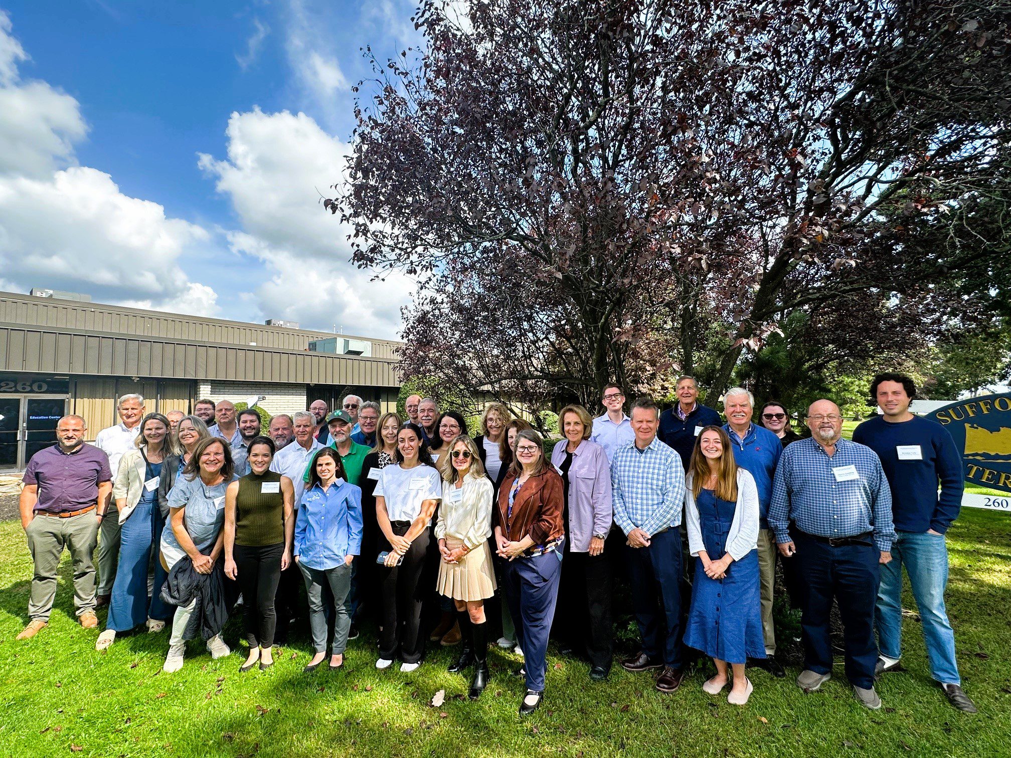
With funding from Long Island Sound Study and support from New York Sea Grant’s Sustainable and Resilient Communities Extension Professionals, Pace University’s Land Use Law Center brought its award-winning Land Use Leadership Alliance Training Program to Suffolk and Nassau municipalities within the Long Island Sound watershed. The training program consisted of three full-day workshops held in Hauppauge, NY that focused on the land use system, innovative approaches to sea level rise adaptation, hazard mitigation, and natural resource protection to strengthen community planning, regulation, and informed decision-making. 28 municipal staff and community leaders, representing 18 different Long Island Sound communities, completed the Program. Program graduates gained new networks of support, identified successful land use techniques, and developed implementation plans that will enable a more resilient future for their community and the Long Island Sound region.
The program comprised three full-day sessions on September 27, October 4, and October 18, 2024 at the Suffolk County Water Authority Education Center, 260 Motor Parkway in Hauppauge, NY.
If you are interested in learning more and participating in a future LULA training, please email lisresilience@gmail.com.
Training
The Long Island Sound Sustainable and Resilient Communities (SRC) Team held our 2024 Annual Workshop virtually as three sessions over two days. Session topics focused on our assistance programs, new regional resilience resources and tools, and a discussion on planning for inundation and different considerations communities may face.
Session 3 – Planning for Inundation was held on Wednesday, December 11th from 10 AM-12 PM. Participants heard from communities and regional entities that are using or considering different aspects of planning for inundation, including buyout programs, land use policies, and community perspectives on retreat/relocation.
Training
The Long Island Sound Sustainable and Resilient Communities (SRC) Team held our 2024 Annual Workshop virtually as three sessions over two days. Session topics focused on our assistance programs, new regional resilience resources and tools, and a discussion on planning for inundation and different considerations communities may face.
Session 2 – Resilience Tools was held on Tuesday, December 10th from 1:30-3:30 PM. Participants learned about new Resilience Tools being developed and used throughout coastal Long Island Sound.
Training
The Long Island Sound Sustainable and Resilient Communities (SRC) Team held our 2024 Annual Workshop virtually as three sessions over two days. Session topics focused on our assistance programs, new regional resilience resources and tools, and a discussion on planning for inundation and different considerations communities may face.
Session 1 – SRC Resilience Assistance Programs was held on Tuesday, December 10th from 10-11:30 AM. Participants learned about our Sustainable and Resilient Communities resilience assistance programs and heard from communities who have successfully utilized them to advance resilience project plans, build capacity, and secure competitive grant funding!
$200,000-500,000
The NEP Coastal Watersheds Grant Program is a nationally competitive grants program designed to support projects that address urgent and challenging issues threatening the well-being of estuaries within the 28 NEP boundary areas.
$200,000-500,000
The NEP Coastal Watersheds Grant Program is a nationally competitive grants program designed to support projects that address urgent and challenging issues threatening the well-being of estuaries within the 28 NEP boundary areas.
Funding
: Nov 19 – Mar 21, 2025
The Climate Smart Communities Initiative (CSCI) provides funding, expertise, training, and other resources to help communities advance their climate resilience plans and projects while also developing the strategies and capacities that communities nationwide will need as climate impacts intensify.
Training
On October 28, 2024, state and local decision makers, municipal staff, and other interested parties working to address coastal issues gathered at the Sands Point Preserve Conservancy in Sands Point, NY to identify opportunities to increase resilience, learn about best practices, and enhance coordination across communities. There were presentations on the Long Island Sound Resilience Resource Hub & Assistance Programs, NYSDEC Office of Climate Change updates, marsh conservation planning, bluff management and restoration, and nature-based solutions to increase shoreline resilience. There was also a guided walking tour of the resilience projects at Sands Point Preserve.
The event is hosted by Long Island Sound Study and New York Sea Grant, in partnership with the Sands Point Preserve Conservancy and Nassau and Suffolk Soil and Water Conservation Districts.
Min $100K for Planning Grants, $500K for Implementation
Established through the Bipartisan Infrastructure Law, the Promoting Resilient Operations for Transformative, Efficient, and Cost-Saving Transportation (PROTECT) Discretionary Grant Program aims to help make surface transportation more resilient to natural hazards, including climate change, sea level rise, flooding, extreme weather events, and other natural disasters. Funding is available for planning activities, resilience improvements, community resilience and evacuation routes, and at-risk costal infrastructure. Projects selected under this program should be grounded in the best available scientific understanding of climate change risks, impacts, and vulnerabilities, and should utilize innovative and collaborative approaches to risk reduction, including the use of nature-based solutions.
Events
The Long Island Sound Sustainable and Resilient Communities (SRC) Team is excited to announce that for our 2024 Annual Workshop we are holding a series of virtual sessions over two days focused on our assistance programs, new regional resilience resources and tools, and a discussion on planning for inundation and different considerations communities may face.
Session 3 – Planning for Inundation
Join us on Wednesday, December 11th from 10 AM-12 PM to hear from communities and regional entities that are considering different aspects of planning for inundation, including buyout programs, land use policies, and community perspectives on retreat/relocation.
Events
The Long Island Sound Sustainable and Resilient Communities (SRC) Team is excited to announce that for our 2024 Annual Workshop we are holding a series of virtual sessions over two days focused on our assistance programs, new regional resilience resources and tools, and a discussion on planning for inundation and different considerations communities may face.
Session 2 – Resilience Tools
Join us on Tuesday, December 10th from 1:30-3:30 PM to learn about new Resilience Tools being developed and used throughout coastal Long Island Sound!
Mapper
Level of Effort:
This site provides federally supported data visualizations coupled with explanations and science education to help communities prepare for challenges that will affect our coastal environments. By showing how sea levels are changing regionally, the site provides a foundation to inform decision-making related to coastal planning, resource management, and emergency operations.
This website is a collaborative effort from The Interagency Task Force on Sea Level Change (DOD, EPA, FEMA, NASA, NOAA, USACE, USAID, and USGS).
Events
The Long Island Sound Sustainable and Resilient Communities (SRC) Team is excited to announce that for our 2024 Annual Workshop we are holding a series of virtual sessions over two days focused on our assistance programs, new regional resilience resources and tools, and a discussion on planning for inundation and different considerations communities may face.
Session 1 – SRC Resilience Assistance Programs
Join us on Tuesday, December 10th from 10-11:30 AM to learn about our Sustainable and Resilient Communities resilience assistance programs and hear from communities who have successfully utilized them to advance resilience project plans, build capacity, and/or secure competitive grant funding!
Training
On October 29, 2024, state and local decision makers, municipal staff, and other interested parties working to address coastal issues gathered at the Dorothy P. Flint 4-H Camp in Riverhead, NY to identify opportunities to increase resilience, learn about best practices, and enhance coordination across communities. There were presentations on the Long Island Sound Resilience Resource Hub, NYSDEC Climate Office updates, marsh conservation planning, bluff management and restoration, and nature-based solutions to increase shoreline resilience. There was also a field trip to Iron Pier Beach/Maidstone Landing to view and learn about a community bluff restoration project.
This event was hosted by Long Island Sound Study and New York Sea Grant, in partnership with Nassau and Suffolk Soil and Water Conservation Districts, Nassau CCE, and Maidstone Landing.
Report
Level of Effort:
The Fifth National Climate Assessment is the US Government’s preeminent report on climate change impacts, risks, and responses. It is a congressionally mandated interagency effort that provides the scientific foundation to support informed decision-making across the United States.
Website
Level of Effort:
The New York State Climate Impacts Assessment explores current and future climate change impacts to New York State communities, ecosystems, and economy. The New York State Energy Research and Development Authority (NYSERDA) assembled more than 250 New York–based, national, and Indigenous climate science experts and representatives from diverse communities and industries across the state to contribute to this assessment. The findings are intended to help residents, businesses, and decision-makers across the state plan and prepare for climate change impacts.
Funding
: Jul 3, 2025
$500 - $1,000
Awards small grants in support of grassroots efforts and community-based environmental work in New England. The Grassroots Fund utilizes participatory grantmaking to move resources to New England grassroots groups working at the intersections of Environmental Justice. The program is geared toward groups who have some experience implementing a project in their community. Grants support groups to deepen their work by further developing a community vision, lowering barriers to participation, identifying new stakeholders, and working to bring more voices and lived experiences into core decision-making processes.
Funding
: Mar 11 – Apr 14, 2024
Congressionally Directed Spending requests, also known as Community Project Funding or Earmarks, are funding requests for high-impact, Connecticut-based projects that can be completed with assistance from the federal government. The project must meet the eligibility requirements for at least one of the accounts listed.
Funding
: Feb 22 – Apr 10, 2024
$100,000 - $10M
The NCRF is a national program with the goal of enhancing protection for coastal communities from the impacts of storms, floods, and other natural coastal hazards and to improve habitats for fish and wildlife. This year, NFWF will award approximately $140 million in grants for the planning, design, and implementation of natural and nature-based solutions.
Guidance Tool
The CTDEEP document provides information about the many ways individuals, property owners, and communities can help protect Connecticut’s tidal wetlands.
Guidance Tool
The CTDEEP document provides information about the many ways individuals, property owners, and communities can help protect Connecticut’s tidal wetlands.
Funding
: Oct 12 – Dec 15, 2023
$800M total available
The Flood Mitigation Assistance grant program is a competitive program that provides funding to states, federally recognized Tribal governments, U.S. territories, and local governments. Since the National Flood Insurance Reform Act of 1994 was signed into law, funds are used for projects that reduce or eliminate the risk of repetitive flood damage to buildings insured by the National Flood Insurance Program.
Funding
: Oct 12 – Dec 15, 2023
$1B total available
The Federal Emergency Management Agency (FEMA) Building Resilient Infrastructure and Communities (BRIC) grant program will support states, local communities, tribes and territories as they undertake hazard mitigation projects, reducing the risks they face from disasters and natural hazards. The BRIC program’s guiding principles are to support communities through capability and capacity building, encourage and enable innovation; promote partnerships, enable large projects, maintain flexibility, and provide consistency.
Funding
: Jul 3, 2025
up to $9,950
New York Sea Grant and Connecticut Sea Grant are providing grant preparation and writing capacity to New York and Connecticut communities that are pursuing funding for sustainability and resilience-focused projects. This technical assistance program helps municipalities and community organizations develop successful grant proposals and develop capacity for navigating the funding landscape.
up to $50,000
The Nature Conservancy is pleased to announce a fifth round of funding available in New York through our Climate Resilience Grant Program. The program supports conservation and climate adaptation projects, including land protection, led by local organizations, with the goal of increasing resilience to climate change for people and nature. Program grants will help local organizations with fee and easement acquisitions of lands that connect with important floodplains and shorelines that mitigate flooding and erosion. The grants will also provide funding for organizational capacity-building, planning and strategy development. We will prioritize projects that include engagement with and benefits to local communities, particularly in underserved and frontline communities.
Guidance Tool
Level of Effort:
Guidance and training modules for Connecticut Zoning changes to address climate vulnerabilities. On the website there are examples of zoning policies municipalities could modify and/or adopt to enhance local climate resilience. Where applicable, model ordinances and examples of where the policies have been adopted are included.
Guidance Tool
Level of Effort:
The Federal Highway Administration (FHWA’s) Vulnerability Assessment and Adaptation Framework, 3rd Edition, is a guide and collection of resources for use in analyzing the impacts of climate change and extreme weather on transportation infrastructure. Its purpose is to identify key considerations, questions, and resources that can be used to design and implement a climate change vulnerability assessment. The processes, lessons learned, and resources outlined in the framework are geared toward state departments of transportation (DOTs), metropolitan planning organizations (MPOs), and other agencies involved in planning, building, or maintaining the transportation system. It includes suggestions and examples applicable to a wide range of applications, from small qualitative studies to large, detailed, data-intensive analyses. The resources included in the framework will be added to and updated over time.
Mapper
Level of Effort:
To better understand how Connecticut’s coastal area marshes and roads may respond to sea level rise (SLR), Sea Level Affecting Marshes Model (SLAMM) was applied to Connecticut’s shoreline by Warren Pinnacle Consulting, Inc. This viewer displays the model’s results for Connecticut’s 21 largest marshes and all coastal area roads. For marshes, SLAMM was run two hundred times using alternative model inputs for key model parameters, including various SLR scenarios, to produce probability based results of likely future marsh conditions. For roads, the model uses a single SLR scenario of about 4.2 feet by 2100 from the base year of 2002. The Sea Level Rise Effects on Roads and Marshes projects is a project between CT DEEP and UConn CLEAR.
$50K-$2M for implementation grants, $10K-200K for certification grants
The Climate Smart Communities (CSC) Grant program was established in 2016 to provide grants to cities, towns, villages, and counties of the State of New York for eligible climate change mitigation, adaptation, and planning and assessment projects. Funds are available for two broad project categories – implementation and certification. The first project category supports implementation projects related to the reduction of greenhouse gas emissions (mainly outside the power sector), climate change adaptation, and engineering feasibility studies for flood mitigation and Hydrofluorocarbons. The second supports planning and assessment projects aligned with Climate Smart Communities certification actions.
$50K-$2M
The NYS Department of State (NYSDOS) is soliciting applications from eligible villages, towns, cities located along New York’s coasts or designated inland waterways, counties, or regional planning councils to advance the preparation or implementation of strategies for community and waterfront revitalization through the following grant categories: Preparing or Updating a Local Waterfront Revitalization Program (LWRP), including Updating an LWRP to be More Resilient to Climate Risks; Preparing an LWRP Component, including a Watershed Management Plan; Implementing an LWRP or a completed LWRP Component.
Funding
: Jul 3, 2025
Up to $5000
Sustainable CT’s Community Match Fund is an innovative program that provides fast, flexible funding and support for engaging your community on wide-ranging sustainability projects. Eligible projects receive dollar-for-dollar matching funds from Sustainable CT.
Funding
: Jul 3, 2025
Up to $5000
Sustainable CT’s Community Match Fund is an innovative program that provides fast, flexible funding and support for engaging your community on wide-ranging sustainability projects. Eligible projects receive dollar-for-dollar matching funds from Sustainable CT.
typically $150,000-350,000
Grants are awarded for projects that address Nonpoint Source impacts in surface waters including creation and implementation of approved Watershed Based Plans.
typically $150,000-350,000
Grants are awarded for projects that address Nonpoint Source impacts in surface waters including creation and implementation of approved Watershed Based Plans.
Funding
: Mar 20 – Sep 17, 2024
$1,000 - $4,000
Awards small grants in support of grassroots efforts and community-based environmental work in New England. The Grassroots Fund utilizes participatory grantmaking to move resources to New England grassroots groups working at the intersections of Environmental Justice. The program is geared toward groups who have some experience implementing a project in their community. Grants support groups to deepen their work by further developing a community vision, lowering barriers to participation, identifying new stakeholders, and working to bring more voices and lived experiences into core decision-making processes.
Funding
: Jul 3 – Feb 27, 2024
up to $2,000
The Connecticut Society for Women Environmental Professionals Grant Program provides funding for local projects in Connecticut that benefit the environment. Grants of up to $2,000 will be awarded. Any application meeting the grant guidelines that is not successful in one cycle may reapply during any following cycle. The applications will be judged based on the environmental benefits of each project, in comparison to others. “Environmental benefits” can vary widely and successful applications have ranged from property clean-ups to environmental education.
Funding
: Nov 14 – Feb 2, 2024
up to $10,000
The Green Fund seeks innovative proposals from committed organizations and individuals for activities that advance our mission which is to promote environmental quality, public health and equity in our community by providing grants and other incentives that contribute to a more environmentally sustainable future and reduce air, water and land pollution.
Min $100K for Planning Grants, $500K for Implementation
Established through the Bipartisan Infrastructure Law, the Promoting Resilient Operations for Transformative, Efficient, and Cost-Saving Transportation (PROTECT) Discretionary Grant Program aims to help make surface transportation more resilient to natural hazards, including climate change, sea level rise, flooding, extreme weather events, and other natural disasters. Funding is available for planning activities, resilience improvements, community resilience and evacuation routes, and at-risk costal infrastructure. Projects selected under this program should be grounded in the best available scientific understanding of climate change risks, impacts, and vulnerabilities, and should utilize innovative and collaborative approaches to risk reduction, including the use of nature-based solutions.
Funding
: Feb 23 – Jun 30, 2023
Up to $1M
The National Coastal Wetlands Conservation Grant Program annually provides grants of up to $1 million to coastal and Great Lakes states, as well as U.S. territories to protect, restore and enhance coastal wetland ecosystems and associated uplands. Eligible projects include the acquisition of real property interest in coastal lands or waters and the restoration, enhancement, or management of coastal wetlands ecosystems.
Funding
: Mar 10 – May 5, 2023
$75,000 - $250,000 (~$800,000 total available- projected around 4-10 projects total)
The NEP Coastal Watersheds Grant Program is a nationally competitive grants program designed to support projects that address urgent and challenging issues threatening the well-being of coastal and estuarine areas within determined estuaries of national significance.
Funding
: Jul 3 – Apr 20, 2023
$200,000 - $5M depending on category
Intended to streamline grant funding opportunities for new conservation and restoration projects around the U.S., the America the Beautiful Challenge consolidates funding from multiple federal agencies and the private sector to enable applicants to conceive and develop large-scale projects that address shared funder priorities and span public and private lands.
Funding
: Jul 3 – Apr 12, 2023
$100,000 - $1,000,000
NFWF will award up to $140 million in grants to create and restore natural systems in order to increase protection for communities from coastal hazards, such as storms, sea- and lake-level changes, inundation, and coastal erosion, while improving habitats for fish and wildlife species. NFWF prioritizes projects that are community led or incorporate direct community engagement and benefit underserved communities facing disproportionate harm from climate impacts.
Funding
: Mar 27 – May 29, 2025
$50K - $1.5M
The Long Island Sound Futures Fund (LISFF) is seeking proposals to restore the health and living resources of Long Island Sound (Sound). The program is managed by National Fish and Wildlife Foundation (NFWF) in collaboration with the U.S. Environmental Protection Agency (EPA) and the Long Island Sound Study (LISS). Major funding is from EPA through the LISS with additional funding from the U.S. Fish and Wildlife Service, Natural Resources Conservation Service, and Zoetis Foundation.
This grant program supports efforts to test innovative approaches to conservation, deliver transformative projects, and support people and communities who value the sound and take a direct role in its future. Projects should advance implementation of the Long Island Sound Comprehensive Conservation and Management Plan 2020-2024 Update (CCMP). The Futures Fund invests in projects under three CCMP themes: 1) Clean Waters and Healthy Watersheds; 2) Thriving Habitats and Abundant Wildlife; 3) Sustainable and Resilient Communities.
Funding
: Jan 1 – Mar 31, 2024
Typically $40,000 - $150,000 (avg $75,000)
11th Hour Racing fosters systemic change to restore ocean health — our vision for the future includes cleaner, healthier waterways through strong local stewardship and collective action around the world. By supporting local pilot programs that model best practices of sustainability, restore coastal ecosystems, and advance ocean stewardship, our grantees are creating systemic change to restore ocean health. We are working toward a future of cleaner, healthier waterways through strong local stewardship and collective action around the world. 11th Hour Racing works to facilitate this transition by supporting local solutions to global problems, led by community organizations and industry leaders.
Funding
: Oct 12 – Jan 23, 2024
$1B total available
The Federal Emergency Management Agency (FEMA) Building Resilient Infrastructure and Communities (BRIC) grant program will support states, local communities, tribes and territories as they undertake hazard mitigation projects, reducing the risks they face from disasters and natural hazards. The BRIC program’s guiding principles are to support communities through capability and capacity building, encourage and enable innovation; promote partnerships, enable large projects, maintain flexibility, and provide consistency.
Funding
: Oct 12 – Jan 23, 2024
$800M total available
The Flood Mitigation Assistance grant program is a competitive program that provides funding to states, federally recognized Tribal governments, U.S. territories, and local governments. Since the National Flood Insurance Reform Act of 1994 was signed into law, funds are used for projects that reduce or eliminate the risk of repetitive flood damage to buildings insured by the National Flood Insurance Program.
Funding
: Dec 6 – Apr 16, 2025
typically $4M-6M
NOAA is seeking proposals for transformational projects that will restore coastal habitat and strengthen community resilience under the Bipartisan Infrastructure Law.
This funding will prioritize habitat restoration actions that rebuild productive and sustainable fisheries, contribute to the recovery and conservation of threatened and endangered species, use natural infrastructure to reduce damage from flooding and storms, promote resilient ecosystems and communities, and yield socioeconomic benefits. This funding opportunity will invest in projects that have the greatest potential to provide holistic benefits, through habitat-based approaches that strengthen both ecosystem and community resilience.
Case Study
East Haddam, CT
With support from the Nature Conservancy and Sustainable CT, East Haddam organized a Community Resilience Building process and workshop, the results of which were compiled into this summary. The team engaged with community members to determine the present hazards and vulnerabilities and identify resilient solutions.
Case Study
In 2023, Long Island Sound Study and Warren Pinnacle, in partnership with Westchester County and conservation groups/organizations, have developed a Plan to understand the benefits of, threats to, and recommended conservation actions for marsh ecosystems on Glen Island Park in New Rochelle, NY. The goal of the Plan is to help inform conservation and restoration efforts to maximize marsh ecosystem services under rising sea levels.
Sara Powell, slp285@cornell.edu
Case Study
In 2023, Long Island Sound Study and Warren Pinnacle, in partnership with Westchester County and conservation groups/organizations, have developed a Plan to understand the benefits of, threats to, and recommended conservation actions for marsh ecosystems on Glen Island Park in New Rochelle, NY. The goal of the Plan is to help inform conservation and restoration efforts to maximize marsh ecosystem services under rising sea levels.
Case Study
Stony Brook, Head of Harbor and Nissequogue, NY
In 2023, Long Island Sound Study and Warren Pinnacle, in partnership with committed municipalities and conservation groups/organizations, developed a Plan to understand the benefits, threats, and recommended conservation actions for the Stony Brook Harbor and West Meadow Creek marsh ecosystem. The goal of the Plan is to help inform conservation and restoration efforts to maximize marsh ecosystem services under rising sea levels.

Elizabeth Hornstein, eeh78@cornell.edu
Case Study
Stony Brook, Head of Harbor and Nissequogue, NY
In 2023, Long Island Sound Study and Warren Pinnacle, in partnership with committed municipalities and conservation groups/organizations, developed a Plan to understand the benefits, threats, and recommended conservation actions for the Stony Brook Harbor and West Meadow Creek marsh ecosystem. The goal of the Plan is to help inform conservation and restoration efforts to maximize marsh ecosystem services under rising sea levels.
Case Study
Oyster Bay, NY and Cold Spring Harbor, NY
In 2023, Long Island Sound Study, New York Sea Grant and Warren Pinnacle, in partnership with committed municipalities and marsh-conservation groups/organizations, developed a Plan to understand the benefits, threats and recommended conservation actions at seven focal areas across the harbors. The goal of the Plan is to inform local municipalities and marsh-conservation groups as to where they might focus their conservation efforts to maximize the conservation of marsh ecosystem services under sea-level rise conditions. This process brought together a diversity of stakeholders to develop a cohesive strategy for seven focal areas across Oyster Bay and Cold Spring Harbor: Frost Creek, Mill Neck Creek, West Shore Road, Bayville Bridge to Centre Island, Centre Island, Shore Road, and Lower Cold Spring Harbor. The partners will now work to implement the recommendations in the plan.
St. John’s Episcopal Church (lower Cold Spring Harbor) and Village of Lattingtown (Frost Creek) were 2024 LIS Resilience Planning Support Program awardees. Their projects will build off the Oyster Bay & Cold Spring Harbor marsh conservation plan and develop specific recommendations to enhance and restore marsh habitat in lower Cold Spring Harbor and Frost Creek.

Sarah Schaefer-Brown, scs292@cornell.edu
Case Study
Oyster Bay, NY and Cold Spring Harbor, NY
In 2023, Long Island Sound Study, New York Sea Grant and Warren Pinnacle, in partnership with committed municipalities and marsh-conservation groups/organizations, developed a Plan to understand the benefits, threats and recommended conservation actions at seven focal areas across the harbors. The goal of the Plan is to inform local municipalities and marsh-conservation groups as to where they might focus their conservation efforts to maximize the conservation of marsh ecosystem services under sea-level rise conditions. This process brought together a diversity of stakeholders to develop a cohesive strategy for seven focal areas across Oyster Bay and Cold Spring Harbor: Frost Creek, Mill Neck Creek, West Shore Road, Bayville Bridge to Centre Island, Centre Island, Shore Road, and Lower Cold Spring Harbor. The partners will now work to implement the recommendations in the plan.
St. John’s Episcopal Church (lower Cold Spring Harbor) and Village of Lattingtown (Frost Creek) were 2024 LIS Resilience Planning Support Program awardees. Their projects will build off the Oyster Bay & Cold Spring Harbor marsh conservation plan and develop specific recommendations to enhance and restore marsh habitat in lower Cold Spring Harbor and Frost Creek.
Case Study
Stratford, CT
This project restored 46 acres of the Great Meadows Marsh in Connecticut that was degraded from dredge material that was dumped on site, poor drainage, and sea level rise. The marsh was also overrun with invasive plants and mosquitoes. A controlled fire was started to kill the invasive reeds growing in the marsh. Then a construction crew removed invasive plants and the dumped dredge material. Lastly, channels were carefully dug for tidal flushing which will allow the marsh to keep pace with sea level rise. Soil hummocks were constructed for Salt Marsh Sparrow habitat. Now the area continues to be monitored, assessed for resiliency, and provides a field for innovative solutions to be tested in.
Trustees: USFWS, NOAA, State of Connecticut; Project Partners: Audubon Connecticut, Town of Stratford


Molly Sperduto at molly_sperduto@fws.gov;
Corrie Folsom-O’Keefe cfolsom.okeefe@audubon.org;
Jack Matthias jack.matthias@audubon.org
Case Study
Stratford, CT
This project restored 46 acres of the Great Meadows Marsh in Connecticut that was degraded from dredge material that was dumped on site, poor drainage, and sea level rise. The marsh was also overrun with invasive plants and mosquitoes. A controlled fire was started to kill the invasive reeds growing in the marsh. Then a construction crew removed invasive plants and the dumped dredge material. Lastly, channels were carefully dug for tidal flushing which will allow the marsh to keep pace with sea level rise. Soil hummocks were constructed for Salt Marsh Sparrow habitat. Now the area continues to be monitored, assessed for resiliency, and provides a field for innovative solutions to be tested in.
Trustees: USFWS, NOAA, State of Connecticut; Project Partners: Audubon Connecticut, Town of Stratford
Case Study
This public greenspace was suffering from mosquito overpopulation, invasion from Phragmites, and poor tidal/stormwater drainage. The Wetland’s Habitat and Mosquito Management Program (WHAMM) created a new drainage area and tunnels, while also eliminating invasive plants. Then organizations and volunteers banded together to remove and replace invasive plant species with native plants.
Juliana Barrett, CT Sea Grant Extension, 860-405-9106 & juliana.barrett@uconn.edu.
Case Study
This public greenspace was suffering from mosquito overpopulation, invasion from Phragmites, and poor tidal/stormwater drainage. The Wetland’s Habitat and Mosquito Management Program (WHAMM) created a new drainage area and tunnels, while also eliminating invasive plants. Then organizations and volunteers banded together to remove and replace invasive plant species with native plants.
Case Study
Old Saybrook, CT
The purpose of this project was to mitigate 450 ft of coastal erosion on the Long Island Sound. A part of Crab Creek was moved further inland, thus allowing for beach and dune migration over time. New rock sills, plants, and sand sills were also positioned along the shore.
Guidance Tool
Level of Effort:
The NYSDEC document is to provide guidance on the issuance of permits for living shorelines techniques in the Marine and Coastal District Waters of New York (the Marine District) and encourages the use of green or natural infrastructure.
Guidance Tool
Level of Effort:
The NYSDEC document is to provide guidance on the issuance of permits for living shorelines techniques in the Marine and Coastal District Waters of New York (the Marine District) and encourages the use of green or natural infrastructure.
Guidance Tool
Level of Effort:
The New York State Department of State worked with the Department of Environmental Conservation and other partners to create model local laws to help local governments be more resilient to sea-level rise, storm surge, and flooding. Cities, towns, and villages are invited to adapt model local laws to meet the resilience needs of the community with the assistance of their municipal attorneys.
Guidance Tool
Level of Effort:
This document developed in support of the NYS Community Risk and Resiliency Act 1) Describes natural resilience measures and how they can be used to mitigate the risks of flooding and erosion, 2) Provides definitions for different types of natural resilience measures and distinguishes among conserved, restored, nature-based and hard structural approaches, 3) Provides information on the value and benefits of using natural resilience measures, along with information on the co-benefits they provide, 4) Lists key factors to consider in the restoration, design and construction of natural resilience measures, and 5) Provides background to support the development of NYS agency guidance on natural resilience measures in the future
Mapper
Level of Effort:
Developed by The Nature Conservancy, this tool identifies priority road-stream and tidal crossings in Suffolk County for replacement or upgrades. Prioritization is based on social and ecological criteria. Additionally, it includes data on current and future projected flooding and marsh extent under various sea level rise scenarios. The tool is meant to be a screening tool for planning efforts.
Plan
Level of Effort:
Suffolk County and the local governments within Suffolk County developed a FEMA approved Hazard Mitigation Plan, which documents risks from natural hazards and strategies to mitigate hazards.
Plan
Level of Effort:
Suffolk County and the local governments within Suffolk County developed a FEMA approved Hazard Mitigation Plan, which documents risks from natural hazards and strategies to mitigate hazards.
Mapper
Level of Effort:
Coastal Resilience is a Connecticut-based decision support tool that provides local, regional, state and national stakeholders a step-wise process to guide decisions to reduce the ecological and socio-economic risks of coastal and inland hazards.
Mapper
Level of Effort:
Coastal Resilience is a Connecticut-based decision support tool that provides local, regional, state and national stakeholders a step-wise process to guide decisions to reduce the ecological and socio-economic risks of coastal and inland hazards.
Mapper
Level of Effort:
This mapper is intended to provide federal, state, and local managers with tools to estimate the vulnerability and ecosystem service potential of wetlands. It allows you to display information on the unvegetated to vegetated ratio (UVVR), marsh elevation, tidal range, and shoreline change rates for New York’s tidal wetlands.
Story Map
Level of Effort:
This Story Map was developed to provide an overview of the Westchester County Multi-Jurisdictional Hazard Mitigation Plan (HMP) to facilitate county-wide access to the plan. The Westchester County HMP was developed to provide a roadmap to resilience by identifying hazards affecting the county and its communities.
Plan
The Superstorm Sandy Review Task Force conducted an in-depth review of the preparation for and response to Superstorm Sandy in Suffolk County by government agencies, first responders, nonprofits and private sector entities to determine which measures were effective and what actions must be taken in the future to increase resiliency and improve response to extreme weather events.
Guidance Tool
Level of Effort:
Provides information about coastal hazard management in Connecticut including steps for developing plans and responses.
Guidance Tool
Level of Effort:
Provides information about coastal hazard management in Connecticut including steps for developing plans and responses.
Mapper
Level of Effort:
Connecticut-specific site with maps, data, and visualization tools. Contains: Blue Plan, MS4 Viewer, CT Parcel Viewer, Sea Level Rise Effects on Roads & Marshes, CT DEEP Fish Community Data – Inland Waters, CT Aquaculture Mapping Atlas, CT Coastal Hazards Viewer, Carbon Stock & Land Cover Viewer
Story Map
Level of Effort:
This Story map illustrates climate change projections, considering scenarios that factor in temperature, precipitation, extreme heat, storms, and sea level.
Story Map
Level of Effort:
This Story map illustrates climate change projections, considering scenarios that factor in temperature, precipitation, extreme heat, storms, and sea level.
Mapper
Level of Effort:
RAPT provides access to important data and analysis tools to support your community before, during and after a disaster.
Mapper
Level of Effort:
RAPT provides access to important data and analysis tools to support your community before, during and after a disaster.
Data
Level of Effort:
Provides the most up-to-date sea level rise projections for all U.S. states and territories, out to the year 2150. Extrapolations of available tide gauge observations are also provided. The sea level scenarios and information contained in this tool originate from 2022 technical report produced by the Sea Level Rise and Coastal Flood Hazard Scenarios and Tools Interagency Task Force.
Mapper
Level of Effort:
The purpose of the interactive viewer is to illustrate the fate of significant marsh systems on Long Island Sound under future Sea-Level Rise conditions. Model results are combined with tax-parcel information and integrated with information about marsh ecosystem services to assist municipalities and conservation groups in defining and assessing various land-management alternatives.
Website
Level of Effort:
Submit your coastal flooding photos through this website/app. Photos are linked to real-time environmental conditions to create flooding reports that help stakeholders understand our changing environment and make informed decisions.
Website
Level of Effort:
Submit your coastal flooding photos through this website/app. Photos are linked to real-time environmental conditions to create flooding reports that help stakeholders understand our changing environment and make informed decisions.
Website
Level of Effort:
MyCoast NY collects and catalogs photos provided by volunteers that document changing water levels, shorelines, and hazardous weather impacts across New York’s varied coasts and water bodies. Photos are linked to real-time environmental conditions to create flooding and storm impact reports that help stakeholders like government agencies, business owners, and residents understand our changing environment and make informed decisions.
Guidance Tool
Level of Effort:
This website and the associated tools can be used by planners and engineers to help understand how rising sea levels, more intense storms, and heavy rainfalls affect stormwater systems, and to generate reports that can be used to inform planning.
Guidance Tool
Level of Effort:
This website and the associated tools can be used by planners and engineers to help understand how rising sea levels, more intense storms, and heavy rainfalls affect stormwater systems, and to generate reports that can be used to inform planning.
Data
Level of Effort:
Assess your county’s exposure and resilience to flooding and the potential economic impacts.
Data
Level of Effort:
Assess your county’s exposure and resilience to flooding and the potential economic impacts.
Mapper
Level of Effort:
Use this mapper to visualize people, infrastructure, and natural resources exposed to coastal flood hazards. You can save and share the online maps to communicate with stakeholders. Tip: watch the short video about the tool before getting started!
Mapper
Level of Effort:
Use this mapper to visualize people, infrastructure, and natural resources exposed to coastal flood hazards. You can save and share the online maps to communicate with stakeholders. Tip: watch the short video about the tool before getting started!
Mapper
Level of Effort:
This tool produces location-specific scenarios for sea level and flooding, as well as information about present-day and past conditions. Local governments and other practitioners can use the information to make informed decisions about strategic adaptation investments. The site incorporates data, maps, and visualizations and produces automated, location-specific reports.
Mapper
Level of Effort:
The Sea Level Affecting Marshes Model, or SLAMM, uses digital data and other information to simulate potential impacts of long-term sea level rise on wetlands and shorelines. Additional data related to dike locations or other protected areas, accretion rates, erosion rates, and other factors can be included within the model as optional factors. Requires ArcGIS for viewing outputs in a mapping environment and software, such as Microsoft Excel and Word, to view the text and tabular output.
Mapper
Level of Effort:
Use this web mapping tool to visualize community-level impacts from coastal flooding or sea level rise (up to 10 feet above average high tides). Photo simulations of how future flooding might impact local landmarks are also provided, as well as data related to water depth, connectivity, flood frequency, socio-economic vulnerability, wetland loss and migration, and mapping confidence.
Website
Level of Effort:
The 2022 State Climate Summaries provide new information on assessment topics directly related to NOAA’s mission, specifically historical climate variations and trends, future climate model projections of climate conditions during the 21st century, and past and future conditions of sea level and coastal flooding. Select your state to find state-level information for observed changes in climate, including both long-term trends and extreme weather events.
Story Map
Level of Effort:
This story map examines the coastal processes and hazards of Long Island and provides options for sustainable and resilient shoreline management. Information is useful for coastal managers, planners and coastal property owners.
Story Map
Level of Effort:
This story map examines the coastal processes and hazards of Long Island and provides options for sustainable and resilient shoreline management. Information is useful for coastal managers, planners and coastal property owners.
Data
Level of Effort:
New York State sea level rise projections. The New York State Department of Environmental Conservation is currently updating these projections.
Data
Level of Effort:
New York State sea level rise projections. The New York State Department of Environmental Conservation is currently updating these projections.
Mapper
Level of Effort:
This floodplain mapper shows the estimated boundary of future coastal floodplains for different sea level rise scenarios for New York State. Customize a scenario by choosing the amount of sea level rise in inches and a coastal flood recurrence interval.
Mapper
Level of Effort:
This floodplain mapper shows the estimated boundary of future coastal floodplains for different sea level rise scenarios for New York State. Customize a scenario by choosing the amount of sea level rise in inches and a coastal flood recurrence interval.
Guidance Tool
Level of Effort:
This guide is designed to assist decision makers and coastal professionals with applying and integrating the information in the 2022 Sea Level Rise Technical Report, produced by the Sea Level Rise and Coastal Flood Hazard Scenarios and Tools Interagency Task Force, into local sea level rise planning and adaptation decisions.
Mapper
Level of Effort:
Shows various SLR scenarios and flood event scenarios calibrated for the Long Island Sound CT coast. Also includes FEMA Limit of Moderate Wave Action boundary for referencing building codes.
Mapper
Level of Effort:
Shows various SLR scenarios and flood event scenarios calibrated for the Long Island Sound CT coast. Also includes FEMA Limit of Moderate Wave Action boundary for referencing building codes.
Plan
Level of Effort:
Sea level preparation guidance for CT. Recommends planning for 20″ by 2050.
Plan
Level of Effort:
Sea level preparation guidance for CT. Recommends planning for 20″ by 2050.
Mapper
Level of Effort:
Shows areas vulnerable to near-term flooding from different combinations of sea level rise, storm surge, tides, and tsunamis, or to permanent submersion by long-term sea level rise. Within the U.S., it incorporates the latest, high-resolution, high-accuracy lidar elevation data supplied by NOAA (exceptions: see Sources), displays points of interest, and contains layers displaying social vulnerability, population density, and property value.
Training
The second annual Long Island Sound Bi-State Sustainable and Resilient Communities Workshop brought together nearly 200 people virtually on Dec. 7, 2023 to learn about a new Long Island Sound Resilience Resource Hub (launching in early 2024), hear from communities and groups around the Sound working on resilience planning, and consider pathways for updating codes and ordinances. Videos of the workshop’s six sessions are available on YouTube. They can be accessed below along with supporting documents.
Training
In this Coastal Resiliency Network webinar, Samantha Klein, Environmental Analyst for the Town of East Hampton, discusses her experience in paving the way to a more resilient East Hampton with the development of their CARP (Coastal Assessment Resiliency Plan). She focuses on lessons learned, funding, and providing guidance on how to get started creating your own CARP. The Coastal Resilience Network, led by the New York State Association of Conservation Commissions (NYSACC) with assistance from NY Sea Grant, is a collaborative open forum for communities in coastal Westchester, Nassau, and Suffolk Counties to discuss and learn about opportunities to increase their resilience to sea level rise, flooding, and extreme events.
Training
In this Coastal Resiliency Network webinar, Barbara Kendall from the NYS Department of State provides an overview of Local Waterfront Revitalization Programs (LWRP) and then representatives from four NYS coastal communities discuss their experiences developing and implementing their LWRPs. The Coastal Resilience Network, led by the New York State Association of Conservation Commissions (NYSACC) with assistance from NY Sea Grant, is a collaborative open forum for communities in coastal Westchester, Nassau, and Suffolk Counties to discuss and learn about opportunities to increase their resilience to sea level rise, flooding, and extreme events.
Resources & Tools

