
Resilience Steps
Find support and resources tailored to your project needs. Select your Planning Phase, Location, and/or Topic of interest to access a filtered selection of our curated resources and tools.

Learn
Learn about the environmental threats and climate risks in your community

Plan
Identify strategies to help mitigate risks and develop ways to adapt to a changing climate

Implement
Find funding and guidance to help put your plans into action

Sustain
Monitor, maintain, and adaptively-manage your project to sustain success
Filters
Select one or more of the filters below to find relevant tools and resources for your needs
Need help deciding where to start?
Learn how to identify, prioritize, and implement high-impact projects

Resource
Long Island Watershed Action Agenda
The Long Island Watershed Action Agenda is a clear-cut blueprint for water quality improvements, aquatic habitat conservation, groundwater protection, and the public engagement necessary to ensure success for the surface, coastal, and ground waters of Nassau and Suffolk counties. The Long Island Watershed Action Agenda is an evolution of the success of the Long Island Nitrogen Action Plan (LINAP) and will expand the scope of its work beyond nitrogen reduction.
Guidance Tool
CTDEEP Tidal Wetlands Guidance Document
The CTDEEP document provides information about the many ways individuals, property owners, and communities can help protect Connecticut’s tidal wetlands.
Guidance Tool
CTDEEP Tidal Wetlands Guidance Document
The CTDEEP document provides information about the many ways individuals, property owners, and communities can help protect Connecticut’s tidal wetlands.
Incentive Program
Long Island Garden Rewards Program
The Long Island Garden Rewards Program offers reimbursement of up to $500 total for making your yard more water friendly. Homeowners can be reimbursed for installing rain barrels, rain gardens, or native plantings on their properties. These actions reduce the amount of nitrogen pollution entering local waterways and helps conserve water. Funds are limited and available on a first come, first serve basis.
Due to the high participation in the program, as of May 20, 2025 the Long Island Garden Rewards Program is closed. Thank you to all who participated. Check back for when applications open again!
Report
Level of Effort:
Building Urban Flood Resilience with Ecosystem Services
This report from the Liberty Mutual Climate Transition Center and the Boston College Center for Corporate Citizenship examines how nature-based solutions can help communities reduce urban flood risk while improving long-term resilience. It offers recommendations for businesses, policymakers, and communities seeking to better manage flood risk. The report makes a case for corporate participation and emphasizes innovative strategies from nature-based solutions to financial investment mechanisms.
Resource
Level of Effort:
UConn Extension Fact Sheet
Reducing Flood Risk in our Communities Fact Sheet
Severe rain events and flooding in our municipalities and communities is becoming more common. Flood risk reduction involves adapting infrastructure and land use to increasing flood frequency and intensity along with mitigating human impacts. While strategies must be place specific, this fact sheet provides starting point guidance on how different stakeholders in Connecticut’s land and infrastructure can contribute to reducing floods.
Guidance Tool
Level of Effort:
Climate Action Tool
The 2025 expansion of the Climate Action Tool (CAT) allows you to:
1) Access information on climate impacts and vulnerability of species and habitats; and
2) Explore adaptation strategies and actions, related to connectivity, conservation planning, and forestry, among other relevant areas.
This tool was developed by the Northeast Climate Adaptation Science Center and the University of Massachusetts Amherst (UMass) Center for Agriculture, Food, and the Environment.
Resource
Level of Effort:
NYSDEC Living Shoreline Map
Check out our interactive map to learn about living shoreline projects located in the marine district of New York.
More information about living shorelines and their benefits can be found on the NYSDEC Living Shorelines webpage.
Resource
Level of Effort:
NYSDEC Living Shoreline Map
Check out our interactive map to learn about living shoreline projects located in the marine district of New York.
More information about living shorelines and their benefits can be found on the NYSDEC Living Shorelines webpage.
Resource
Level of Effort:
Adapting to Flood and Erosion Risk
A start guide for addressing flooding and erosion in coastal communities. Learn about the steps communities can take to adapt along with different adaptation strategies.
Resource
Level of Effort:
Adapting to Flood and Erosion Risk
A start guide for addressing flooding and erosion in coastal communities. Learn about the steps communities can take to adapt along with different adaptation strategies.
Website
Level of Effort:
The Atlas of Inspiration
The Atlas of Inspiration is a national database that highlights real projects helping communities adapt to extreme weather, flooding, heat, and sea-level rise. It showcases innovative infrastructure, planning strategies, and funding approaches that can be adapted or scaled by other communities. The Atlas is designed to celebrate successful ideas and give decision-makers examples they can use when seeking state or federal funding.
The Atlas is fully searchable, allowing users to browse projects by type, climate hazard, or location. It builds on Rebuild by Design’s earlier work including the Atlas of Disaster and the Atlas of Accountability by showing not only the risks communities face, but the solutions that are already making a difference.
Rebuild by Design also invites communities to share their own climate resilience projects for inclusion in the Atlas. Submissions help expand the collection and highlight new approaches being used across the country.
Guidance Tool
Level of Effort:
Funding and Financing Coastal Resilience (Recorded Webinars)
The “Funding and Financing Coastal Resilience” webinar series from the NOAA Office for Coastal Management offers a comprehensive foundation for understanding how coastal resilience projects are funded and financed. These 30- to 45-minute recorded sessions break down complex approaches into accessible lessons, featuring experts who share real world examples, emerging strategies like environmental impact bonds and tax-increment financing, and ways to overcome common obstacles to funding such work. As a resource, the series is ideal if you’re looking to generate ideas, explore different financing pathways, and build your capacity to access and manage funding for nature-based or infrastructure-driven resilience efforts.
Report
Level of Effort:
Building a Resilient Trail
This report provides on guidance on ways to adapt the Shoreline Greenway Trail to the increasing frequencies of heavy rain, wildfires, hurricanes, flood events, and storm surges. The report defines what we mean by resilience for a trail in coastal Connecticut, identifies climate impacts facing the trail now, and in the years to come, shares design suggestions that could build resiliency on existing and new sections, and explores how the trail itself can be essential to wider community resiliency.
Website
Level of Effort:
GSI Impact Hub
The GSI Impact Hub is an interactive platform that provides tools, research, and data to help communities plan and evaluate green stormwater infrastructure (GSI) projects. GSI uses natural systems like plants, soil, and stone to manage stormwater on-site reducing flooding, improving water quality, and creating healthier, more resilient neighborhoods. The Hub includes a benefits calculator, educational resources, and guidance to support city planners, advocates, and policymakers in designing projects that maximize environmental, social, and economic benefits.
Explore the GSI Impact Calculator, Detailed Resource Library, and Project Background to better understand how GSI can reduce flooding, improve water quality, and build climate-resilient neighborhoods.
Resource
Level of Effort:
Culverts and Climate Resilience Fact Sheet
This fact sheet produced by the Connecticut Institute for Resilience and Climate Adaptation (CIRCA) reviews how culverts are defined in Connecticut, explains their connection to climate resilience, provides examples of how Connecticut towns are addressing needs for upgraded culverts, and highlights related resources.
Resource
Level of Effort:
How vegetated buffers protect water quality, and a whole lot more
Use this fact sheet to learn about riparian buffers and how they can be a tool for filtering excess nutrients and sediment from runoff, reducing flood impacts, and providing habitat. Learn more about buffers using this fact sheet. Details include what buffers are, why they are important, best practice recommendations, and design considerations.
Resource
Level of Effort:
Green Stormwater Infrastructure Workbook
This workbook made by Groundwork Bridgeport provides a thorough but accessible introduction to green stormwater infrastructure. The workbook explains the issues that green infrastructure can help solve, introduces several green infrastructure methods, and then provides definitions, explains why each is uses, and details how to build them.
Resource
Level of Effort:
Conservation Commissions and Natural Resource Resilience
This fact sheet for Conservation Commissions in Connecticut reviews the role of these commissions for enhancing the climate resilience of their communities. The resource was developed by CIRCA and covers the authority and duties of conservation commissions as well as detailing specific strategies and approaches.
Guidance Tool
Level of Effort:
NYSG Shoreline Management on Long Island
This fact sheet is intended to assist landowners in understanding the various shoreline management options and considerations for their shoreline.
Guidance Tool
Level of Effort:
NYSG Shoreline Management on Long Island
This fact sheet is intended to assist landowners in understanding the various shoreline management options and considerations for their shoreline.
Guidance Tool
Level of Effort:
NYSG Coastal Processes on Long Island
The purpose of this fact sheet is to assist landowners in identifying and understanding the primary causes and processes responsible for erosion.
Guidance Tool
Level of Effort:
NYSG Coastal Processes on Long Island
The purpose of this fact sheet is to assist landowners in identifying and understanding the primary causes and processes responsible for erosion.
Website
Level of Effort:
Understanding Living Shorelines
NOAA overview of living shorelines and their benefits, steps to construction. There is a good map of places where they have been constructed around the US. It is a good place to get basic info about living shorelines, with appropriate links to more specific information like how to get a permit
Guidance Tool
Level of Effort:
CT DEEP Living Shorelines
CT state resource on living shorelines, with a few good fact sheets and pages about types of living shoreline techniques and permitting for our state. There is also a list of pilot projects in CT.
Guidance Tool
Level of Effort:
CT DEEP Living Shorelines
CT state resource on living shorelines, with a few good fact sheets and pages about types of living shoreline techniques and permitting for our state. There is also a list of pilot projects in CT.
Website
Level of Effort:
CLEAR: Rain Garden App
A website and a downloadable app for your mobile device. The resource has information about rain gardens, designing, selecting plants, and installing a garden on your property.
Website
Level of Effort:
CLEAR: Rain Garden App
A website and a downloadable app for your mobile device. The resource has information about rain gardens, designing, selecting plants, and installing a garden on your property.
Story Map
Level of Effort:
NY Sea Grant Long Island Dynamic Shorelines
This story map examines the coastal processes and hazards of Long Island and provides options for sustainable and resilient shoreline management. Information is useful for coastal managers, planners and coastal property owners.
Story Map
Level of Effort:
NY Sea Grant Long Island Dynamic Shorelines
This story map examines the coastal processes and hazards of Long Island and provides options for sustainable and resilient shoreline management. Information is useful for coastal managers, planners and coastal property owners.
Guidance Tool
Level of Effort:
Adapt CT (CTSG & CLEAR) – A Planting Guide for Riparian Sites Along the Connecticut Coast
lists native trees, shrubs, ferns, grasses, sedges, reeds and herbaceous plants suitable for planting along the banks of a river, stream or other body of water.
Guidance Tool
Level of Effort:
Adapt CT (CTSG & CLEAR) – A Planting Guide for Riparian Sites Along the Connecticut Coast
lists native trees, shrubs, ferns, grasses, sedges, reeds and herbaceous plants suitable for planting along the banks of a river, stream or other body of water.
Guidance Tool
Level of Effort:
Adapt CT (CTSG & CLEAR) – Coastal Landscaping Guide for Long Island Sound
Helps shoreline homeowners choose appropriate landscaping options including plant species.
Guidance Tool
Level of Effort:
Adapt CT (CTSG & CLEAR) – Coastal Landscaping Guide for Long Island Sound
Helps shoreline homeowners choose appropriate landscaping options including plant species.
Guidance Tool
Level of Effort:
Adapt CT (CTSG & CLEAR) – Connecticut Beaches and Dunes: A Hazard Guide for Coastal Property Owners
Website (also available as a PDF) to help coastal property owners evaluate threats to beaches and dunes and consider potential solutions. It includes background information on dune systems, and how to identify shoreline erosion.
Guidance Tool
Level of Effort:
Adapt CT (CTSG & CLEAR) – Connecticut Coastal Planting Guide
List of native plants that will grow well in Connecticut’s coastal zone. Includes wildlife and pollinator benefits.
Guidance Tool
Level of Effort:
Adapt CT (CTSG & CLEAR) – Connecticut Coastal Planting Guide
List of native plants that will grow well in Connecticut’s coastal zone. Includes wildlife and pollinator benefits.
Guidance Tool
Level of Effort:
Adapt CT (CTSG & CLEAR) – Native Plants for Riparian Corridors in Connecticut
A guide listing the trees, shrubs, grasses, sedges, reeds and herbaceous plants best for the banks of rivers, streams or other bodies of water (a companion to: A Planting Guide for Riparian Sites Along the Connecticut Coast)
Mapper
Level of Effort:
Resilient Land Mapping Tool
The Resilient Land Mapping Tool, developed by The Nature Conservancy’s Center for Resilient Conservation Science, is an interactive mapping tool that helps users explore climate resilient landscapes across the United States. The tool allows users to view and analyze data on terrestrial resilience, biodiversity, connectivity, and other conservation indicators to support land protection and planning decisions. Users can explore different map layers, analyze specific areas, and download datasets for conservation research and planning. This tool is designed to support conservation efforts that protect biodiversity and maintain ecological functions in a changing climate.
Mapper
Level of Effort:
Long Island Sound Crossing Prioritization Tool
The Long Island Sound Crossing Prioritization Tool can be used to prioritize road-stream crossings (culverts and bridges) for ecological, infrastructure, and community resilience benefits in Westchester, Nassau and Suffolk County, NY. The tool helps communities plan improvements that restore habitat for diadromous fishes, strengthen infrastructure, and keep communities connected.
Developed by Save the Sound in partnership with Seatuck Environmental Association and The Nature Conservancy, the Long Island Sound Crossing Prioritization Tool was built by CivicMapper and is hosted on ArcGIS Online. It is intended to be a resource for municipalities, especially parts of municipal government that make infrastructure or environmental decisions for their communities, by making it easier to apply for grant funding. The tool is a useful resource for agency partners and fellow environmental organizations working to accelerate river restoration and protect communities from a changing climate.
Mapper
Level of Effort:
Resilience and Adaptation in New England (RAINE) Database
Explore a range of tools and guidance to support climate adaptation planning through EPA New England’s Resilience and Adaptation in New England (RAINE) initiative, which supports users in exploring climate resilience planning across the New England. These resources include more than 1,200 climate adaptation plans. Practitioners can use the Featured Locations Interactive Map to view climate action examples or explore additional climate visualization platforms through the Mapping Climate Change Impacts Tools page. The database also highlights Tribal Climate Adaptation Resources, featuring plans from federally recognized tribes in New England. Users can view recorded webinars and trainings for technical guidance.
Guidance Tool
Level of Effort:
CT DEEP Grants Database
CT DEEP recently released a new tool allowing users to search for DEEP financial assistance programs based on a variety of parameters such as eligibility requirements, grant cycle status, project types, and more. This resource and offers “one-stop shopping” for many DEEP funding opportunities.
Data
Level of Effort:
NYC Hazard Mitigation Plan
This website contains New York City’s Federal Emergency Management Agency–mandated Hazard Mitigation Plan, which identifies natural hazard risks and vulnerabilities that are common to New York City (NYC) and long-term strategies for reducing them. It also features a Mitigation Actions Database and Map that tracks and records actions that are taken to mitigate risk from the hazards profiled in the Hazard Mitigation Plan.
Mapper
Level of Effort:
New England District Beneficial Use Planning Tool
The US Army Corps of Engineers New England District Disposal Area Monitoring System (DAMOS) Program developed an online mapping tool to facilitate the identification of beneficial use opportunities for dredged material in New England. The tool includes all Federal Navigation Projects that the District anticipates dredging in the next five years as well as beneficial use sites that were catalogued from federal, state, and non-government sources. The tool is an interactive map to allow project proponents and stakeholders to match projects in need of sediment with a local source of available dredged material.
Guidance Tool
Level of Effort:
FEMA National Resilience Guidance: A Collaborative Approach to Building Resilience
FEMA’s National Resilience Guidance document is intended to help all individuals, communities, and organizations understand our nation’s vision for resilience, the key principles that must be applied to strengthen resilience, and the players and systems that contribute to resilience. It also outlines how to strengthen resilience by organizing and engaging people, incorporating resilience concepts into planning efforts, creating change through policies, prioritizing projects and programs, financing resilience efforts, and measuring and evaluating resilience. Finally, the NRG includes a Resilience Maturity Model that illustrates stages in the evolution of a community’s approach to resilience.
Report
Level of Effort:
The Fifth National Climate Assessment
The Fifth National Climate Assessment is the US Government’s preeminent report on climate change impacts, risks, and responses. It is a congressionally mandated interagency effort that provides the scientific foundation to support informed decision-making across the United States.
Guidance Tool
Level of Effort:
A Guide to Permitting Shoreline Modification Projects in New York’s Tidal Waters
The permitting process for shoreline modification projects is complex and it can be daunting to know where to begin. Check out New York Sea Grant’s NEW Guide to Permitting Shoreline Modification Projects in New York’s Tidal Waters for an overview of the process informed by federal, state, and local perspectives. It is intended for permit applicants using the New York State Joint Application for shoreline construction or modification, ranging from major to minor projects such as construction of floating docks, installing natural and nature-based features, bulkhead repair, development near a wetland, dredging, and invasive species removal.
Guidance Tool
Level of Effort:
LINAP Embayment Water Exchange Study
The LINAP Embayment Water Exchange Study looked at how water exchange practices could affect the nitrogen impairments in embayments. A water exchange practice changes the amount, speed, or direction of water moving through an area. The results of the study show that water exchange techniques are not effective in large waterbodies like most of Long Island’s embayments. Often, the physical size of the water exchange practice is small compared to the large waterbodies to which they are applied, which means their impact is limited. Water exchange projects may be useful, however, for smaller Long Island waterbodies, where the volume of increased water exchange approaches the volume of the overall waterbody. The goal of the study was to provide communities with basic information on water exchange practices suitable for Long Island.
Mapper
Level of Effort:
Road-Stream and Tidal Crossing Prioritization Tool – Suffolk County, Long Island
Developed by The Nature Conservancy, this tool identifies priority road-stream and tidal crossings in Suffolk County for replacement or upgrades. Prioritization is based on social and ecological criteria. Additionally, it includes data on current and future projected flooding and marsh extent under various sea level rise scenarios. The tool is meant to be a screening tool for planning efforts.
Mapper
Level of Effort:
TNC Coastal Resilience Tool
Coastal Resilience is a Connecticut-based decision support tool that provides local, regional, state and national stakeholders a step-wise process to guide decisions to reduce the ecological and socio-economic risks of coastal and inland hazards.
Mapper
Level of Effort:
TNC Coastal Resilience Tool
Coastal Resilience is a Connecticut-based decision support tool that provides local, regional, state and national stakeholders a step-wise process to guide decisions to reduce the ecological and socio-economic risks of coastal and inland hazards.
Guidance Tool
Level of Effort:
USGS Coastal Science Navigator
The Coastal Science Navigator is intended to help users discover USGS Coastal Change Hazards information, products, and tools relevant to their scientific or decision-making needs.
Guidance Tool
Level of Effort:
USGS Coastal Science Navigator
The Coastal Science Navigator is intended to help users discover USGS Coastal Change Hazards information, products, and tools relevant to their scientific or decision-making needs.
Guidance Tool
Level of Effort:
EPA Green Infrastructure
Includes information about preparing for, and implementing green infrastructure with helpful links to other fact sheets and resources.
Guidance Tool
Level of Effort:
EPA Green Infrastructure
Includes information about preparing for, and implementing green infrastructure with helpful links to other fact sheets and resources.
Plan
Level of Effort:
Expanding FEMA’s Benefit Cost Analysis: Chittenden Living Shoreline Case Study
An effort by Save the Sound and Earth Economics to identify opportunities for the Federal Emergency Management Agency (FEMA) and other federal agencies and funders to improve the ability of benefit-cost analysis tools to account for ecosystem-based benefits.
Guidance Tool
Level of Effort:
Building Community Resilience with Nature-Based Solutions: A Guide for Local Communities (FEMA)
The primary goal of this guide is to help communities identify and engage the staff and resources that can be used to implement nature-based solutions to build resilience to natural hazards, which may be exacerbated by climate change.
Guidance Tool
Level of Effort:
Building Community Resilience with Nature-Based Solutions: Strategies for Success (FEMA)
This guide gives community leaders five main strategies to carry out Nature-Based Solution projects: 1) Building Strong Partnerships, 2) Engaging the Whole Community, 3) Matching Project Size with Desired Goals and Benefits, 4) Maximizing Benefits, and 5) Designing for the Future. This is not a technical guide for planning, constructing, or funding NBS. It covers the value of each strategy and suggests how to move forward with NBS projects.
Guidance Tool
Level of Effort:
Georgetown Climate Center Managed Retreat Toolkit
This toolkit features legal and policy tools, best and emerging practices, and case studies to support learning and decision making around managed retreat and climate adaptation. It is meant to be used by state, territorial, and local policymakers in U.S. coastal jurisdictions
Mapper
Level of Effort:
LIS Marsh Viewer
The purpose of the interactive viewer is to illustrate the fate of significant marsh systems on Long Island Sound under future Sea-Level Rise conditions. Model results are combined with tax-parcel information and integrated with information about marsh ecosystem services to assist municipalities and conservation groups in defining and assessing various land-management alternatives.
Website
Level of Effort:
Living Shorelines Academy
Learn about living shorelines and their benefits to communities. This website contains training modules, a white papers database, a database of living shoreline projects, professionals directory, and online forum.
Website
Level of Effort:
Living Shorelines Academy
Learn about living shorelines and their benefits to communities. This website contains training modules, a white papers database, a database of living shoreline projects, professionals directory, and online forum.
Mapper
Level of Effort:
NOAA Sea Level Rise Viewer
Use this web mapping tool to visualize community-level impacts from coastal flooding or sea level rise (up to 10 feet above average high tides). Photo simulations of how future flooding might impact local landmarks are also provided, as well as data related to water depth, connectivity, flood frequency, socio-economic vulnerability, wetland loss and migration, and mapping confidence.
Guidance Tool
Level of Effort:
NYS Shoreline Monitoring Framework
The New York State Department of State (NYS DOS) developed the Statewide Shoreline Monitoring Framework to provide clear and consistent information to those planning projects to improve their shoreline resiliency.
Guidance Tool
Level of Effort:
NYS Shoreline Monitoring Framework
The New York State Department of State (NYS DOS) developed the Statewide Shoreline Monitoring Framework to provide clear and consistent information to those planning projects to improve their shoreline resiliency.
Mapper
Level of Effort:
USFWS Atlantic Coast Joint Venture (ACJV) Saltmarsh Priorities for Saltmarsh Sparrow
This map identifies priority salt marshes within each state that are good candidates for restoration, enhancement, and/or management to provide persistent high-quality Saltmarsh Sparrow nesting habitat. A second map shows priority marsh migration space for easement and acquisition.
Guidance Tool
Level of Effort:
Adapt CT (CTSG & CLEAR) – Climate Adaptation Academy
Aimed at municipalities, this website provides workshop materials and legal issue fact sheets on topics relating to climate adaptation, including living shorelines, flooding, liability, shoreline boundaries, and more.
Website
Level of Effort:
CLEAR: Center for Land Use Education and Research
CLEAR, a program of UConn’s College of Agriculture, Health, and Natural Resources, provides information, education, and assistance to land use decision makers, in support of balancing growth and natural resource protection.
Website
Level of Effort:
CLEAR: Center for Land Use Education and Research
CLEAR, a program of UConn’s College of Agriculture, Health, and Natural Resources, provides information, education, and assistance to land use decision makers, in support of balancing growth and natural resource protection.
Guidance Tool
Level of Effort:
Forest Adaptation Workbook
Created by the Northern Institute of Applied Climate Science, the Adaptation Workbook provides a structured, five step process designed to help natural resource professionals and landowners translate broad climate trends into specific, actionable management plans. By moving from defining project goals to monitoring long term results, the workbook helps users assess local vulnerabilities and identify custom adaptation tactics. This flexible framework is applicable across diverse landscapes including forests, urban areas, and agricultural lands ensuring that climate data becomes a practical tool for protecting ecosystems rather than just a collection of abstract projections.
This resource page also offers a variety of supporting materials including: the full Forest Adaptation Resources guide, “Quick Guide” versions for rapid assessment, and a library of real-world demonstration projects that showcase successful adaptation in practice.
Mapper
Level of Effort:
Connecticut Sea Level Rise Effects on Roads & Marshes
To better understand how Connecticut’s coastal area marshes and roads may respond to sea level rise (SLR), Sea Level Affecting Marshes Model (SLAMM) was applied to Connecticut’s shoreline by Warren Pinnacle Consulting, Inc. This viewer displays the model’s results for Connecticut’s 21 largest marshes and all coastal area roads. For marshes, SLAMM was run two hundred times using alternative model inputs for key model parameters, including various SLR scenarios, to produce probability based results of likely future marsh conditions. For roads, the model uses a single SLR scenario of about 4.2 feet by 2100 from the base year of 2002. The Sea Level Rise Effects on Roads and Marshes projects is a project between CT DEEP and UConn CLEAR.
Guidance Tool
Level of Effort:
NYSDEC Tidal Wetlands Guidance Document
The NYSDEC document is to provide guidance on the issuance of permits for living shorelines techniques in the Marine and Coastal District Waters of New York (the Marine District) and encourages the use of green or natural infrastructure.
Data
Level of Effort:
NYSDEC Tidal Wetlands Trends Analysis
The Long Island Tidal Wetlands Trends Analysis measures wetlands loss and changes in marsh condition within the Long Island Sound, Peconic, and South Shore estuaries including all or parts of Westchester, Bronx, Queens, Nassau, and Suffolk Counties between 1974 and 2005/2008. The results of this project are intended for use by environmental managers, conservation advocates and elected officials across a variety of regulatory agencies, environmental organizations, and governments.
Guidance Tool
Level of Effort:
NYSDEC/NYSDOS Model Local Laws to Increase Resilience
The New York State Department of State worked with the Department of Environmental Conservation and other partners to create model local laws to help local governments be more resilient to sea-level rise, storm surge, and flooding. Cities, towns, and villages are invited to adapt model local laws to meet the resilience needs of the community with the assistance of their municipal attorneys.
Guidance Tool
Level of Effort:
NYSDEC/NYSDOS Using Natural Measures to Reduce the Risk of Flooding and Erosion
This document developed in support of the NYS Community Risk and Resiliency Act 1) Describes natural resilience measures and how they can be used to mitigate the risks of flooding and erosion, 2) Provides definitions for different types of natural resilience measures and distinguishes among conserved, restored, nature-based and hard structural approaches, 3) Provides information on the value and benefits of using natural resilience measures, along with information on the co-benefits they provide, 4) Lists key factors to consider in the restoration, design and construction of natural resilience measures, and 5) Provides background to support the development of NYS agency guidance on natural resilience measures in the future
Guidance Tool
Level of Effort:
Promoting Nature-Based Hazard Mitigation Through FEMA Mitigation Grants
This guidance document is intended for stakeholders pursuing FEMA HMA grants for nature-based solutions to mitigate risks associated with flooding (riverine and coastal) and wildfire.
Guidance Tool
Level of Effort:
Promoting Nature-Based Hazard Mitigation Through FEMA Mitigation Grants
This guidance document is intended for stakeholders pursuing FEMA HMA grants for nature-based solutions to mitigate risks associated with flooding (riverine and coastal) and wildfire.
Mapper
Level of Effort:
USGS Coastal Wetland Synthesis Mapper
This mapper is intended to provide federal, state, and local managers with tools to estimate the vulnerability and ecosystem service potential of wetlands. It allows you to display information on the unvegetated to vegetated ratio (UVVR), marsh elevation, tidal range, and shoreline change rates for New York’s tidal wetlands.
Guidance Tool
Level of Effort:
NOAA Digital Coast – Ecosystem Services
Healthy ecosystems provide a wide range of benefits, from recreational opportunities to storm surge protection. These benefits are often referred to as ecosystem services. Understanding how changes to the ecosystem may affect these benefits should play a role in the community’s decision making process. This page provides a guide to learning more and key NOAA Digital Coast resources useful for this task.
Mapper
Level of Effort:
NOAA Digital Coast – Sea Level Affecting Marshes Model (SLAMM)
The Sea Level Affecting Marshes Model, or SLAMM, uses digital data and other information to simulate potential impacts of long-term sea level rise on wetlands and shorelines. Additional data related to dike locations or other protected areas, accretion rates, erosion rates, and other factors can be included within the model as optional factors. Requires ArcGIS for viewing outputs in a mapping environment and software, such as Microsoft Excel and Word, to view the text and tabular output.
SRC Training
This field trip was part of a Community Resilience Project Showcase leading up to the 2024 Annual SRC Workshop.
Edith Read Sanctuary Living Shoreline Field Trip
On December, 6, 2024, the Sustainable and Resilient Communities (SRC) Team hosted a field trip featuring Westchester County’s Edith Read Sanctuary living shoreline in Rye, NY. Participants got a guided tour of the recently completed living shoreline project and heard from Suzette Lopane with the Westchester County Department of Planning and Scott Williamson with the Edith Read Wildlife Sanctuary about the history of the site and how the living shoreline project came to be. Jake Dittes from Save the Sound also shared information on other living shoreline opportunities and projects in the region with the group. The tour was followed by a networking lunch and an opportunity to further explore the Sanctuary.
Special thanks to our partners: the Westchester County Department of Planning, Westchester County Department of Parks, Recreation, & Conservation/Edith G. Read Wildlife Sanctuary, Save the Sound, and Cornell Cooperative Extension of Westchester County.
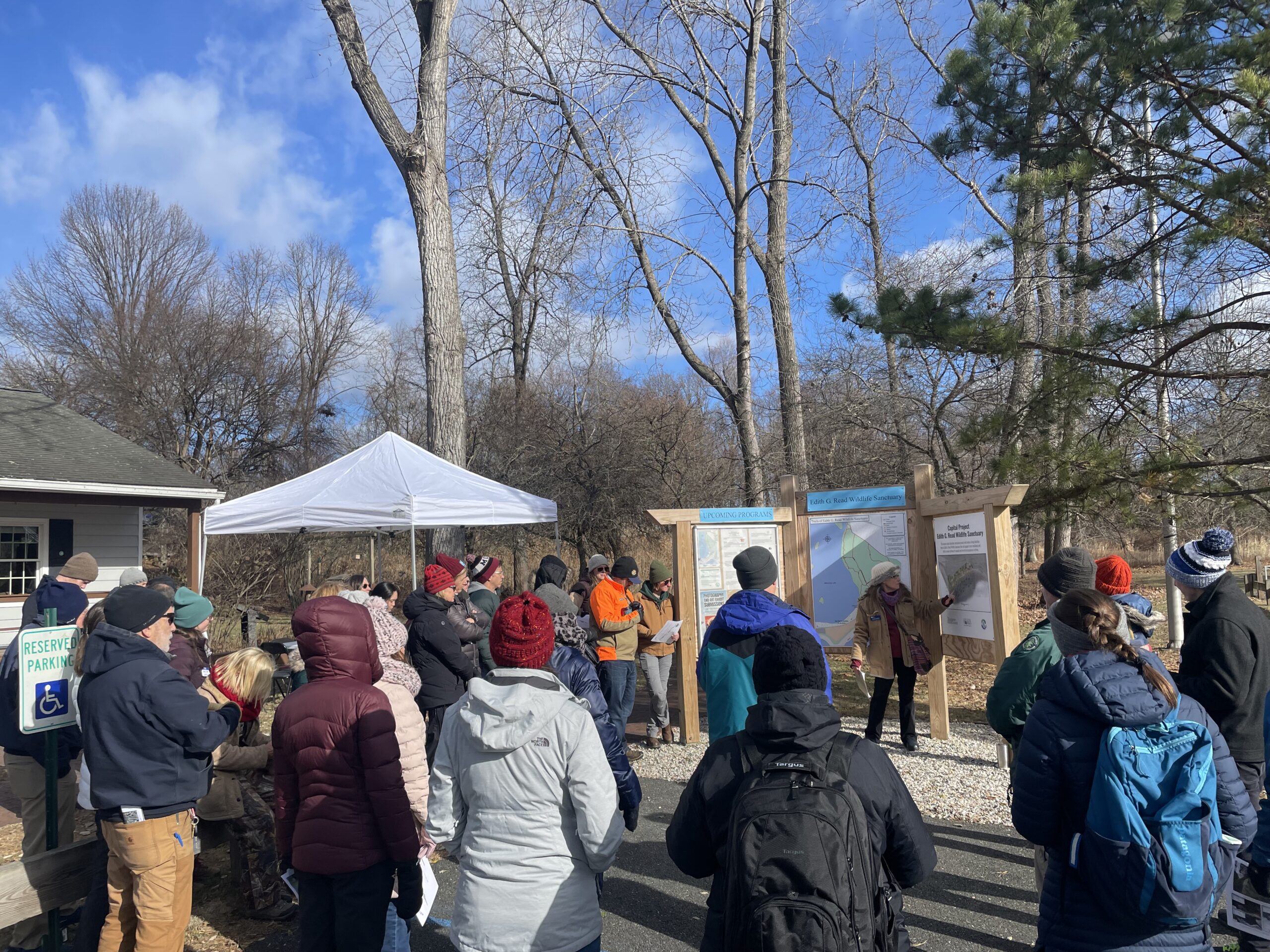
Photo credits: Sara Powell
SRC Training
This field trip was part of a Community Resilience Project Showcase leading up to the 2024 Annual SRC Workshop.
Edith Read Sanctuary Living Shoreline Field Trip
On December, 6, 2024, the Sustainable and Resilient Communities (SRC) Team hosted a field trip featuring Westchester County’s Edith Read Sanctuary living shoreline in Rye, NY. Participants got a guided tour of the recently completed living shoreline project and heard from Suzette Lopane with the Westchester County Department of Planning and Scott Williamson with the Edith Read Wildlife Sanctuary about the history of the site and how the living shoreline project came to be. Jake Dittes from Save the Sound also shared information on other living shoreline opportunities and projects in the region with the group. The tour was followed by a networking lunch and an opportunity to further explore the Sanctuary.
Special thanks to our partners: the Westchester County Department of Planning, Westchester County Department of Parks, Recreation, & Conservation/Edith G. Read Wildlife Sanctuary, Save the Sound, and Cornell Cooperative Extension of Westchester County.
Photo credits: Sara Powell
SRC Training
4th Annual SRC Workshop: Session 3 – LIS Resilience Planning Support Program
The Long Island Sound Sustainable and Resilient Communities (SRC) Team held our 2025 Annual Workshop virtually as three sessions over two days. Session topics focused on resources and tools available to help take advantage of state resilience funds, a panel discussion on why and how to incorporate nature-based solutions into resilience planning, and an overview of our available assistance programs.
Session 3 – LIS Resilience Planning Support Program: New Round Available & Showcase of Completed Projects was held on Friday, December 5, 2025. Participants learned about the newly available 3rd round of the LIS Resilience Planning Support Program and heard from three communities who received awards through the first round of the Program. Video of the session along with supporting materials is available below.
SRC Training
4th Annual SRC Workshop: Session 2 – Using Nature-Based Solutions for Resilience
The Long Island Sound Sustainable and Resilient Communities (SRC) Team held our 2025 Annual Workshop virtually as three sessions over two days. Session topics focused on resources and tools available to help take advantage of state resilience funds, a panel discussion on why and how to incorporate nature-based solutions into resilience planning, and an overview of our available assistance programs.
Session 2 – Using Nature-Based Solutions for Resilience: A Panel Discussion on Common Challenges & Strategies for Success was held on Thursday, December 4, 2025. In this interactive session, practitioners and experts discussed techniques for integrating nature-based solutions into resilience initiatives. The panel highlighted common challenges and shared successful strategies from projects in the Long Island Sound region. Video of the session along with supporting materials is available below.
SRC Training
4th Annual SRC Workshop: Session 1 – Resilience 101
The Long Island Sound Sustainable and Resilient Communities (SRC) Team held our 2025 Annual Workshop virtually as three sessions over two days. Session topics focused on resources and tools available to help take advantage of state resilience funds, a panel discussion on why and how to incorporate nature-based solutions into resilience planning, and an overview of our available assistance programs.
Session 1 – Resilience 101: Helpful Tools and Strategies for Building Community Resilience was held on Thursday, December 4, 2025. Participants learned about available resilience resources and tools and then moved into breakout rooms to hear about state climate certification programs and resilience funds in both NY and CT. Videos of the main session and both breakout rooms are available below, along with supporting materials.
SRC Training
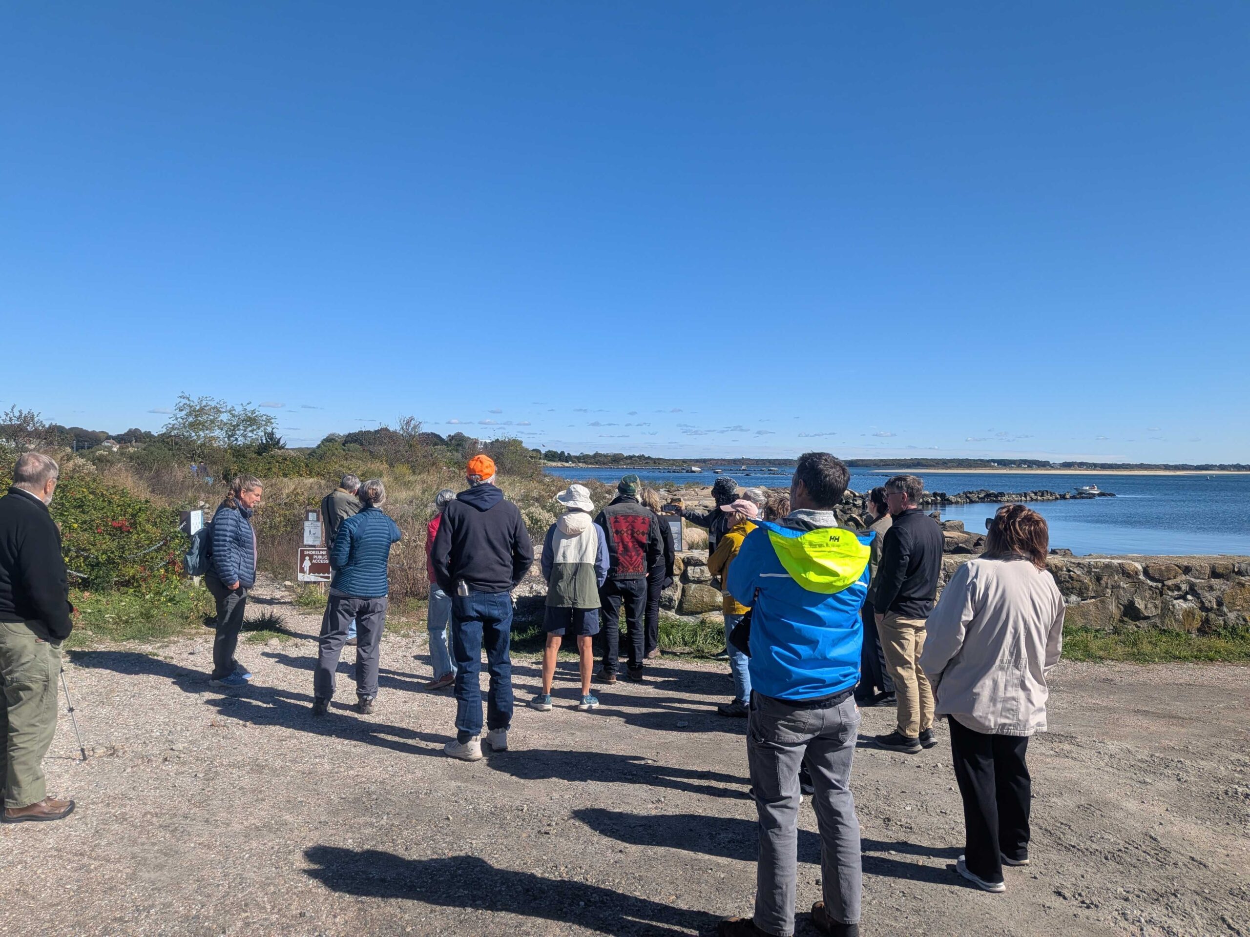
Dodge Paddock & Beal Preserve Marsh Restoration Field Trip and Workshop
On October 16, 2025, the Sustainable and Resilient Communities (SRC) team of the Long Island Sound Partnership hosted a field trip featuring the Dodge Paddock and Beal Preserve Marsh Restoration Project in Stonington Borough. The day started with a presentation outlining the history and current state of the site, followed by a walk to Dodge Paddock and Beal Preserve where there was a guided tour led by Connecticut Sea Grant, Avalonia Land Conservancy, and local volunteers. The day included a deep dive into the invasive species removal process, plantings to accommodate marsh migration, and a close up look at what has grown since then. Special thanks to our partners with Avalonia Land Conservancy, Connecticut Sea Grant, and the Stonington Community.
SRC Training
Suffolk County Coastal Resilience Forum & Field Trip – 2025
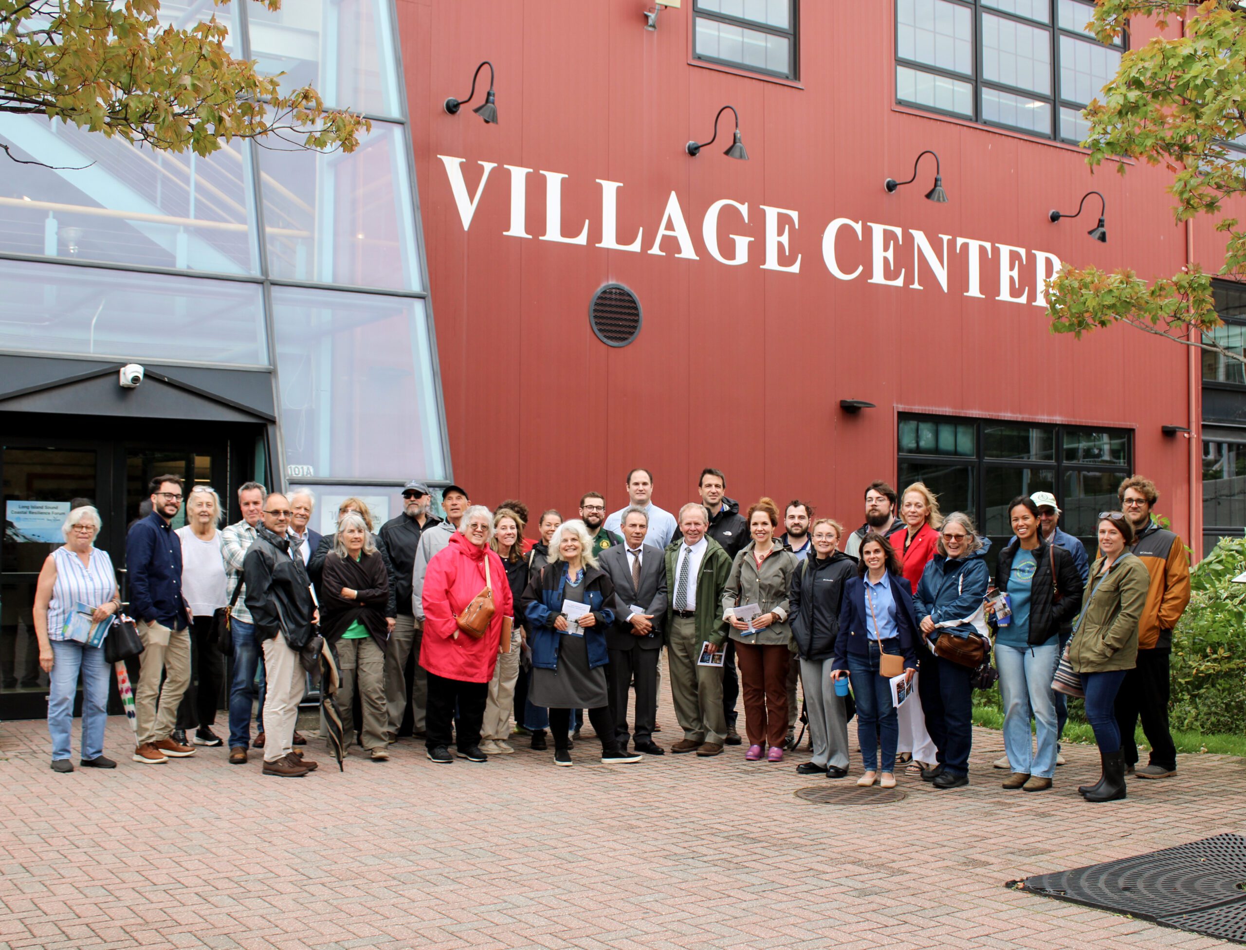
On October 8, 2025 state and local decision makers, municipal staff, and other interested parties working to address flooding, shoreline erosion and other coastal issues gathered at the Port Jefferson Village Center in Port Jefferson, NY for the 3rd Annual Suffolk County Coastal Resilience Forum. The Forum provided a chance to share information on best practices, discuss challenges, identify opportunities to increase resilience, and enhance coordination across communities. Forum attendees heard updates on State resilience initiatives from the NYS Department of Environmental Conservation and NYS Division of Homeland Security and Emergency Services, as well as presentations on new resilience tools and resources from Seatuck Environmental Association, the U.S. Geological Survey, New York Sea Grant, and Suffolk County Soil and Water Conservation District. In the afternoon, Village of Port Jefferson Mayor, Lauren Sheprow, presented on the Village’s resilience issues and initiatives and then led attendees on a walking tour of the Village highlighting flooding hotspots, challenges faced by local businesses and residents, and efforts to help mitigate flooding and increase community resilience.
The event was hosted by Long Island Sound Partnership and New York Sea Grant, in partnership with the Village of Port Jefferson and Suffolk County Soil and Water Conservation District.
SRC Training
Suffolk County Coastal Resilience Forum & Field Trip – 2025
On October 8, 2025 state and local decision makers, municipal staff, and other interested parties working to address flooding, shoreline erosion and other coastal issues gathered at the Port Jefferson Village Center in Port Jefferson, NY for the 3rd Annual Suffolk County Coastal Resilience Forum. The Forum provided a chance to share information on best practices, discuss challenges, identify opportunities to increase resilience, and enhance coordination across communities. Forum attendees heard updates on State resilience initiatives from the NYS Department of Environmental Conservation and NYS Division of Homeland Security and Emergency Services, as well as presentations on new resilience tools and resources from Seatuck Environmental Association, the U.S. Geological Survey, New York Sea Grant, and Suffolk County Soil and Water Conservation District. In the afternoon, Village of Port Jefferson Mayor, Lauren Sheprow, presented on the Village’s resilience issues and initiatives and then led attendees on a walking tour of the Village highlighting flooding hotspots, challenges faced by local businesses and residents, and efforts to help mitigate flooding and increase community resilience.
The event was hosted by Long Island Sound Partnership and New York Sea Grant, in partnership with the Village of Port Jefferson and Suffolk County Soil and Water Conservation District.
SRC Training
Nassau County Coastal Resilience Forum & Field Trip – 2025
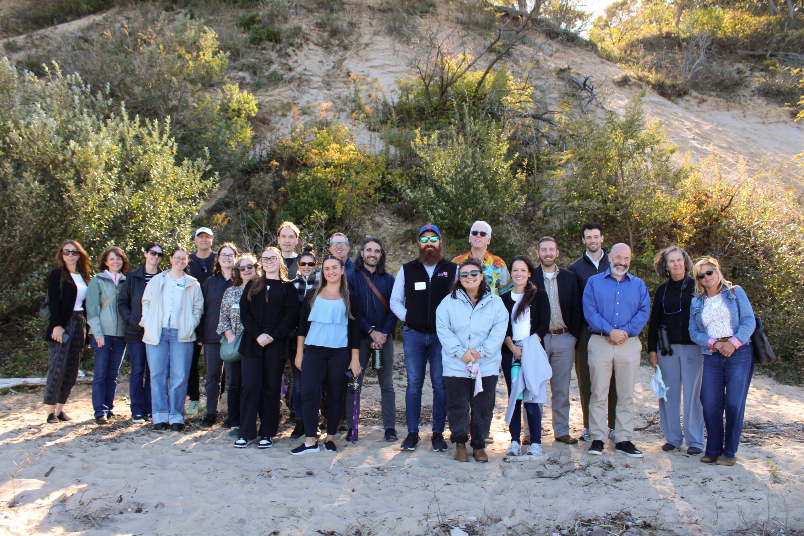
2025 Nassau Coastal Resilience Forum field trip to Sands Point Preserve. Credit: Sumayyah Uddin / NYSG
On October 9, 2025 state and local decision makers, municipal staff, and other interested parties working to address flooding, shoreline erosion and other coastal issues gathered at the Sands Point Preserve Conservancy in Sands Point, NY for the 3rd Annual Nassau County Coastal Resilience Forum. The Forum provided a chance to share information on best practices, discuss challenges, identify opportunities to increase resilience, and enhance coordination across communities. Forum attendees heard updates on State resilience initiatives from agencies like the NYS Department of Environmental Conservation and NYS Division of Homeland Security and Emergency Services, as well as presentations on new resilience tools and resources from Seatuck Environmental Association, the U.S. Geological Survey, New York Sea Grant, Cornell Cooperative Extension of Nassau County, and Nassau County Soil and Water Conservation District. In the afternoon, Forum attendees were given a guided tour of the recent expansions to the bluff stabilization project at the Preserve.
The event was hosted by Long Island Sound Partnership and New York Sea Grant, in partnership with the Sands Point Preserve Conservancy and Nassau and Suffolk County Soil and Water Conservation Districts.
SRC Training
Nassau County Coastal Resilience Forum & Field Trip – 2025
2025 Nassau Coastal Resilience Forum field trip to Sands Point Preserve. Credit: Sumayyah Uddin / NYSG
On October 9, 2025 state and local decision makers, municipal staff, and other interested parties working to address flooding, shoreline erosion and other coastal issues gathered at the Sands Point Preserve Conservancy in Sands Point, NY for the 3rd Annual Nassau County Coastal Resilience Forum. The Forum provided a chance to share information on best practices, discuss challenges, identify opportunities to increase resilience, and enhance coordination across communities. Forum attendees heard updates on State resilience initiatives from agencies like the NYS Department of Environmental Conservation and NYS Division of Homeland Security and Emergency Services, as well as presentations on new resilience tools and resources from Seatuck Environmental Association, the U.S. Geological Survey, New York Sea Grant, Cornell Cooperative Extension of Nassau County, and Nassau County Soil and Water Conservation District. In the afternoon, Forum attendees were given a guided tour of the recent expansions to the bluff stabilization project at the Preserve.
The event was hosted by Long Island Sound Partnership and New York Sea Grant, in partnership with the Sands Point Preserve Conservancy and Nassau and Suffolk County Soil and Water Conservation Districts.
SRC Training
Land Use Leadership Alliance (LULA) Training Program – Spring 2025
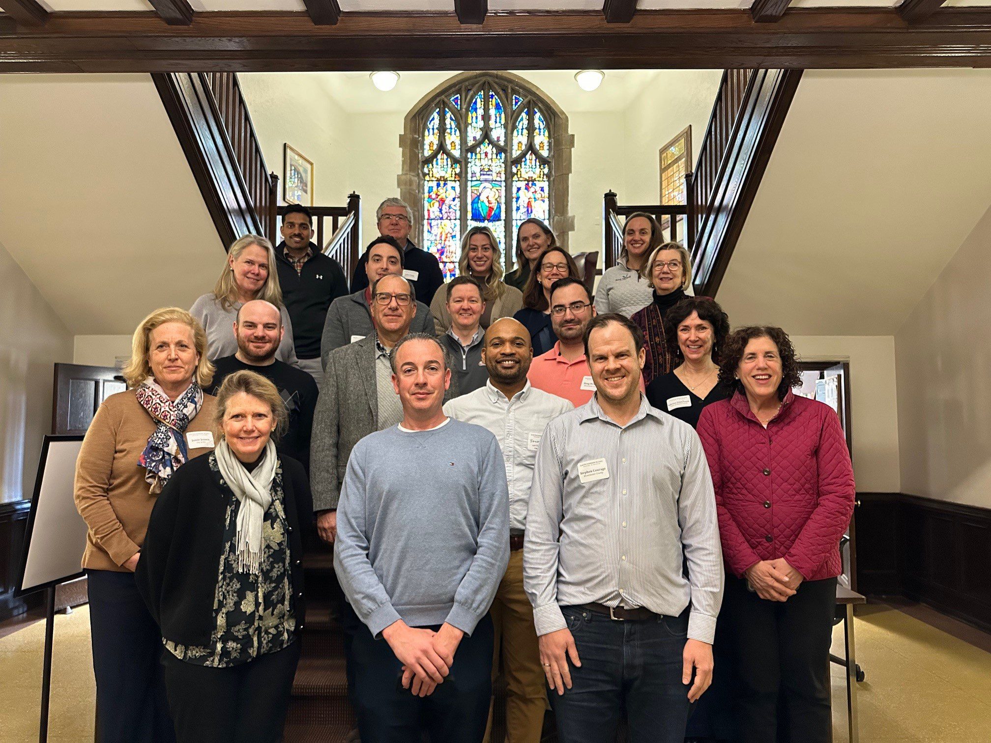
With funding from Long Island Sound Study and support from New York Sea Grant’s Sustainable and Resilient Communities Extension Professionals, Pace University’s Land Use Law Center brought its award-winning Land Use Leadership Alliance Training Program to Westchester municipalities within the Long Island Sound watershed. The training consisted of three full-day workshops held April 1, 8, and 22, 2025 in White Plains, NY to train local leaders on developing balanced strategies for effectively accomplishing policy objectives, particularly focused on land use, flood resilience, and natural resource protection to strengthen community planning and informed decision-making.
22 municipal staff and community leaders, representing 7 different Long Island Sound communities received resilience gap analyses that reviewed their municipality’s current zoning and comprehensive plan language, discussed common issues with their neighbors and built new networks of support, and graduated from the program empowered to plan for a more resilient future for their community and the Long Island Sound region.
If you are interested in learning more and participating in a future LULA training, please email lisresilience@gmail.com.
SRC Training
Land Use Leadership Alliance (LULA) Training Program – Spring 2025
With funding from Long Island Sound Study and support from New York Sea Grant’s Sustainable and Resilient Communities Extension Professionals, Pace University’s Land Use Law Center brought its award-winning Land Use Leadership Alliance Training Program to Westchester municipalities within the Long Island Sound watershed. The training consisted of three full-day workshops held April 1, 8, and 22, 2025 in White Plains, NY to train local leaders on developing balanced strategies for effectively accomplishing policy objectives, particularly focused on land use, flood resilience, and natural resource protection to strengthen community planning and informed decision-making.
22 municipal staff and community leaders, representing 7 different Long Island Sound communities received resilience gap analyses that reviewed their municipality’s current zoning and comprehensive plan language, discussed common issues with their neighbors and built new networks of support, and graduated from the program empowered to plan for a more resilient future for their community and the Long Island Sound region.
If you are interested in learning more and participating in a future LULA training, please email lisresilience@gmail.com.
SRC Training
This field trip was part of a Community Resilience Project Showcase leading up to the 2024 Annual SRC Workshop.
Hamden Bioretention Project Tour & Workshop
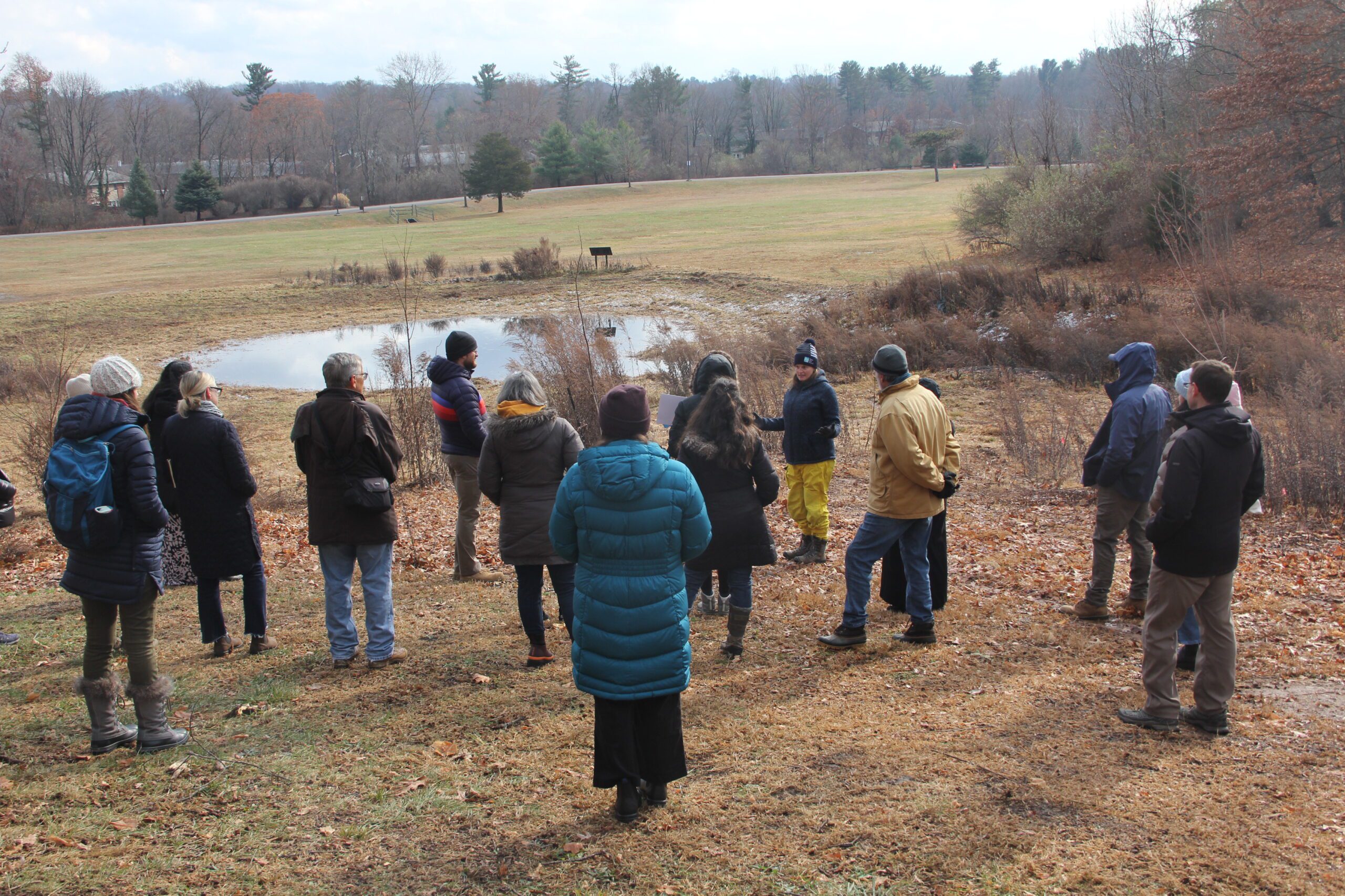 On December 5, 2024, the Sustainable and Resilient Communities (SRC) team of the Long Island Sound Study hosted a field trip featuring the Town of Hamden’s Bioretention Project – the largest municipally owned rain garden in the state! Participants began with a guided tour of the rain garden and bioretention areas at Town Center Park, where they heard from project planners and managers about its history, partnerships, challenges, and maintenance. Following this, participants gathered at the Hamden Government Center for a working lunch and presentations on topics including UConn’s Stormwater Corps, native plants, project engineering, and using nature-based solutions to advance climate resilience goals. The day concluded with a lively group discussion. Special thanks to our partners with the Town of Hamden, Save the Sound, the Hamden Land Trust, and UConn Extension.
Photo credit: Judy Benson
SRC Training
This field trip was part of a Community Resilience Project Showcase leading up to the 2024 Annual SRC Workshop.
Hamden Bioretention Project Tour & Workshop
On December 5, 2024, the Sustainable and Resilient Communities (SRC) team of the Long Island Sound Study hosted a field trip featuring the Town of Hamden’s Bioretention Project – the largest municipally owned rain garden in the state! Participants began with a guided tour of the rain garden and bioretention areas at Town Center Park, where they heard from project planners and managers about its history, partnerships, challenges, and maintenance. Following this, participants gathered at the Hamden Government Center for a working lunch and presentations on topics including UConn’s Stormwater Corps, native plants, project engineering, and using nature-based solutions to advance climate resilience goals. The day concluded with a lively group discussion. Special thanks to our partners with the Town of Hamden, Save the Sound, the Hamden Land Trust, and UConn Extension.
Photo credit: Judy Benson
SRC Training
3rd Annual SRC Workshop: Session 3 – Planning for Inundation
The Long Island Sound Sustainable and Resilient Communities (SRC) Team held our 2024 Annual Workshop virtually as three sessions over two days. Session topics focused on our assistance programs, new regional resilience resources and tools, and a discussion on planning for inundation and different considerations communities may face.
Session 3 – Planning for Inundation was held on Wednesday, December 11th from 10 AM-12 PM. Participants heard from communities and regional entities that are using or considering different aspects of planning for inundation, including buyout programs, land use policies, and community perspectives on retreat/relocation.
SRC Training
3rd Annual SRC Workshop: Session 2 – Resilience Tools
The Long Island Sound Sustainable and Resilient Communities (SRC) Team held our 2024 Annual Workshop virtually as three sessions over two days. Session topics focused on our assistance programs, new regional resilience resources and tools, and a discussion on planning for inundation and different considerations communities may face.
Session 2 – Resilience Tools was held on Tuesday, December 10th from 1:30-3:30 PM. Participants learned about new Resilience Tools being developed and used throughout coastal Long Island Sound.
SRC Training
3rd Annual SRC Workshop: Session 1 – SRC Resilience Assistance Programs
The Long Island Sound Sustainable and Resilient Communities (SRC) Team held our 2024 Annual Workshop virtually as three sessions over two days. Session topics focused on our assistance programs, new regional resilience resources and tools, and a discussion on planning for inundation and different considerations communities may face.
Session 1 – SRC Resilience Assistance Programs was held on Tuesday, December 10th from 10-11:30 AM. Participants learned about our Sustainable and Resilient Communities resilience assistance programs and heard from communities who have successfully utilized them to advance resilience project plans, build capacity, and secure competitive grant funding!
SRC Training
Nassau County Coastal Resilience Forum & Field Trip – 2024
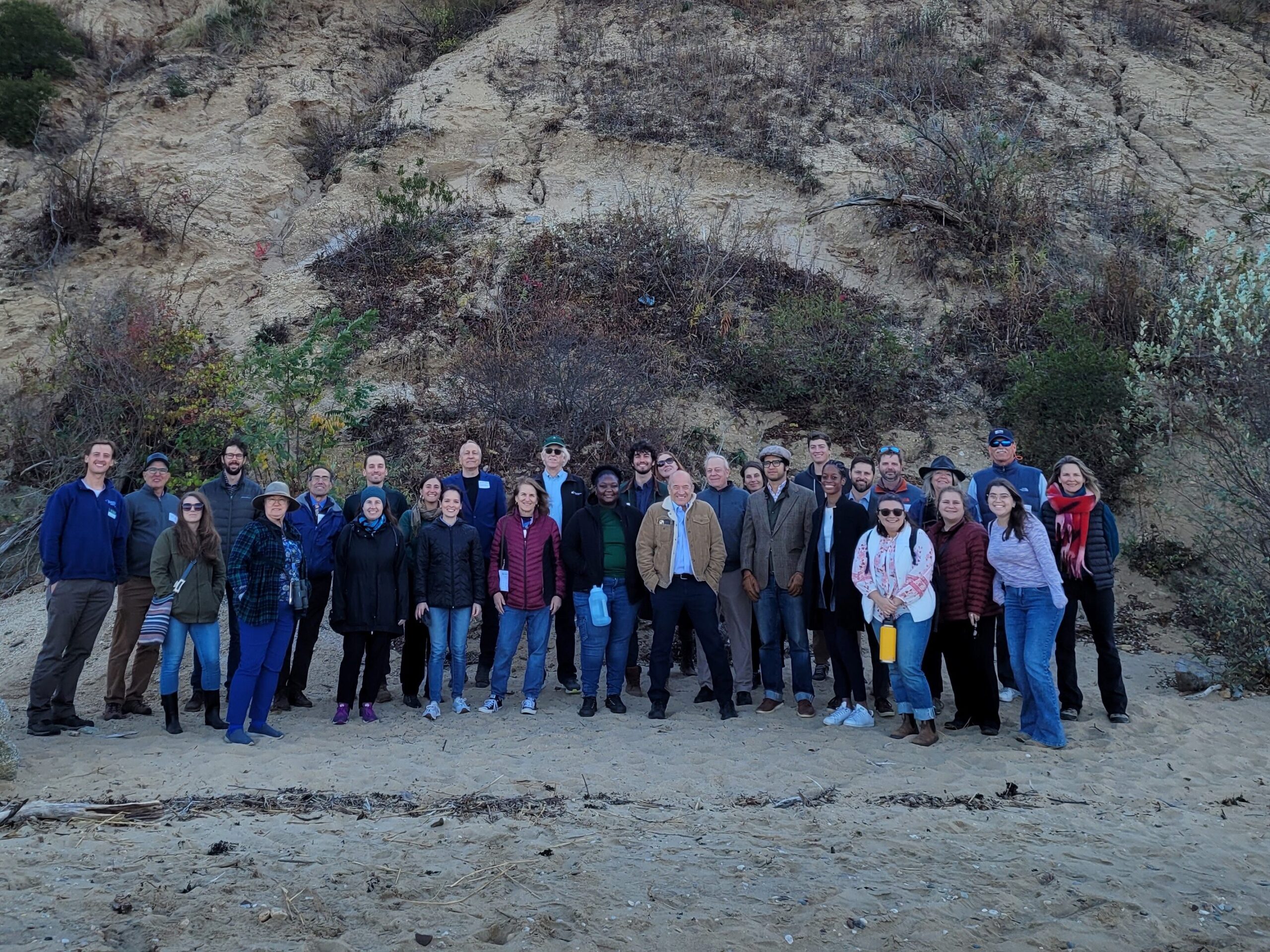
2024 Nassau Coastal Resilience Forum field trip to Sands Point Preserve. Credit: NYSG
On October 28, 2024, state and local decision makers, municipal staff, and other interested parties working to address coastal issues gathered at the Sands Point Preserve Conservancy in Sands Point, NY for the 2nd Annual Nassau County Coastal Resilience Forum to identify opportunities to increase resilience, learn about best practices, and enhance coordination across communities. There were presentations on the Long Island Sound Resilience Resource Hub & Assistance Programs, NYSDEC Office of Climate Change updates, marsh conservation planning, bluff management and restoration, and nature-based solutions to increase shoreline resilience. There was also a guided walking tour of the resilience projects at Sands Point Preserve.
The event is hosted by Long Island Sound Study and New York Sea Grant, in partnership with the Sands Point Preserve Conservancy and Nassau and Suffolk Soil and Water Conservation Districts.
SRC Training
Nassau County Coastal Resilience Forum & Field Trip – 2024
2024 Nassau Coastal Resilience Forum field trip to Sands Point Preserve. Credit: NYSG
On October 28, 2024, state and local decision makers, municipal staff, and other interested parties working to address coastal issues gathered at the Sands Point Preserve Conservancy in Sands Point, NY for the 2nd Annual Nassau County Coastal Resilience Forum to identify opportunities to increase resilience, learn about best practices, and enhance coordination across communities. There were presentations on the Long Island Sound Resilience Resource Hub & Assistance Programs, NYSDEC Office of Climate Change updates, marsh conservation planning, bluff management and restoration, and nature-based solutions to increase shoreline resilience. There was also a guided walking tour of the resilience projects at Sands Point Preserve.
The event is hosted by Long Island Sound Study and New York Sea Grant, in partnership with the Sands Point Preserve Conservancy and Nassau and Suffolk Soil and Water Conservation Districts.
SRC Training
Suffolk County Coastal Resilience Forum & Field Trip
On October 29, 2024, state and local decision makers, municipal staff, and other interested parties working to address coastal issues gathered at the Dorothy P. Flint 4-H Camp in Riverhead, NY to identify opportunities to increase resilience, learn about best practices, and enhance coordination across communities. There were presentations on the Long Island Sound Resilience Resource Hub, NYSDEC Climate Office updates, marsh conservation planning, bluff management and restoration, and nature-based solutions to increase shoreline resilience. There was also a field trip to Iron Pier Beach/Maidstone Landing to view and learn about a community bluff restoration project.
This event was hosted by Long Island Sound Study and New York Sea Grant, in partnership with Nassau and Suffolk Soil and Water Conservation Districts, Nassau CCE, and Maidstone Landing.
Training
Living Shorelines
In this Coastal Resiliency Network webinar Suzette Lopane with Westchester County and Marian Russo with the Village of Patchogue spoke about two exciting living shoreline projects. The Coastal Resilience Network, led by the New York State Association of Conservation Commissions (NYSACC) with assistance from NY Sea Grant, is a collaborative open forum for communities in coastal Westchester, Nassau, and Suffolk Counties to discuss and learn about opportunities to increase their resilience to sea level rise, flooding, and extreme events.
SRC Training
SRC Annual Bi-State Workshop 2022
The first annual Long Island Sound Bi-State Sustainable and Resilient Communities Workshop brought together more than 260 people virtually on Dec. 1, 2022 to learn about opportunities to increase the resilience of the Sound’s communities to climate change and other environmental threats. Interactive sessions included opportunities to learn more about the SRC Extension Professionals’ needs assessment findings and recommendations, the newly released Long Island Sound Resilience Grant Writing Assistance Program, and tips for success with Long Island Sound funding opportunities. Concurrent breakout sessions highlighted the work of partners related to shoreline planning and implementation, using green infrastructure for stormwater management, sustainable climate planning for relocation, and new sustainability/resilience tools available in both New York and Connecticut. Videos of the workshop’s six sessions are available on YouTube. They can be accessed below along with supporting documents.
Training
Expanding the Benefit-Cost Analysis for Nature-Based Solutions
On Thursday, June 15, Save the Sound, Connecticut Sea Grant, New York Sea Grant, The Pew Charitable Trusts, and Earth Economics hosted an invite-only workshop, “Expanding the Benefit-Cost Analysis for Nature-Based Solutions,” which was attended by more than 50 professionals from federal and state agencies, municipalities, environmental NGOs, and engineering firms.
The workshop reviewed the results of an effort by Save the Sound and Earth Economics to identify opportunities for the Federal Emergency Management Agency (FEMA) and other federal agencies and funders to improve the ability of benefit-cost analysis tools to account for ecosystem-based benefits. See here for the associated report, Expanding FEMA’s Benefit Cost Analysis: Chittenden Living Shoreline Case Study (published June 2023).
SRC Training
Steps to Resilience
This online information session held Sept. 19, and repeated Sept. 21, provides an introduction to resilience planning in the Long Island Sound region. It includes discussions on local climate impacts and projections, resilience planning strategies, and climate certification programs for both New York and Connecticut municipalities. In addition to the main presentation, videos of the Connecticut and New York breakout sessions can be accessed below. The presentations and other resource materials are available here.
SRC Training
Long Island Sound Coastal Erosion Forum- Suffolk County
Held at Port Jefferson Village Center in Suffolk County on May 10, 2023, this forum brought together state and local decision makers and other stakeholders, working to address coastal erosion along the Long Island Sound shoreline. Panelists highlighted strategies and options to address coastal erosion, discussed the Coastal Erosion Hazard Areas Program, local codes, updated New York State sea level rise projections and more. During small group discussions, attendees discussed challenges and identified opportunities to increase resilience, all in an effort to enhance coordination across communities. This forum was hosted by New York Sea Grant and Long Island Sound Study, in partnership with Suffolk County Soil and Water Conservation District and Suffolk County Legislators Sarah Anker, Stephanie Bontempi, Kara Hahn, and Al Krupski.
SRC Training
2023 Long Island Sound Coastal Erosion Forum – Nassau County
Held at Locust Valley Library in Nassau County on May 4, 2023, this forum brought together state and local decision makers and other stakeholders, working to address coastal erosion along the Long Island Sound shoreline. Panelists highlighted strategies and options to address coastal erosion, discussed the Coastal Erosion Hazard Areas Program, local codes, updated New York State sea level rise projections and more. During small group discussions, attendees discussed challenges and identified opportunities to increase resilience, all in an effort to enhance coordination across communities. This forum was hosted by New York Sea Grant and Long Island Sound Study, in partnership with Nassau County Soil and Water Conservation District.
Case Study
Project
Hamden, CT
Town of Hamden’s Bioretention Project
The Town of Hamden’s Bioretention Project is the largest municipally owned rain garden in the state! Save the Sound, in partnership with the Town of Hamden, completed this large-scale rain garden project at Hamden Town Center Park to improve local water quality, restore habitat, and enhance community resilience. The project transformed approximately 2.5 acres of lawn into a functioning green infrastructure system that now manages runoff from an 88-acre urban watershed draining Dixwell Avenue and surrounding neighborhoods. Prior to the project, stormwater often overflowed directly into Pardee Brook and the Mill River, carrying pollutants and inundating the park.
The newly constructed rain garden was engineered with layers of soil, sand, and rock, and planted with more than 7,000 native grasses, flowers, and shrubs thanks to additional support from the Land Trust of Hamden. These plantings naturally filter pollutants such as fertilizers, road salt, and chemicals. Community volunteers helped complete the planting, strengthening local stewardship in the Town of Hamden.


A 40,000 sq ft rain garden was installed and included restoration of an acre of park land. The system now treats over 20 million gallons of stormwater annually, reducing flooding and restoring more natural hydrology to Shepard Brook and the Mill River. Beyond its environmental benefits, the project created valuable wildlife habitat and a welcoming green space for residents to enjoy. Adaptive management, more planting, and stewardship is planned for 2025 and 2026.
Nicole Davis, Save the Sound
Jim Sirch, Hamden Land Conservation Trust
Stephen White, PE, Town of Hamden Engineer/LTA
Case Study
Project
Hamden, CT
Town of Hamden’s Bioretention Project
The Town of Hamden’s Bioretention Project is the largest municipally owned rain garden in the state! Save the Sound, in partnership with the Town of Hamden, completed this large-scale rain garden project at Hamden Town Center Park to improve local water quality, restore habitat, and enhance community resilience. The project transformed approximately 2.5 acres of lawn into a functioning green infrastructure system that now manages runoff from an 88-acre urban watershed draining Dixwell Avenue and surrounding neighborhoods. Prior to the project, stormwater often overflowed directly into Pardee Brook and the Mill River, carrying pollutants and inundating the park.
The newly constructed rain garden was engineered with layers of soil, sand, and rock, and planted with more than 7,000 native grasses, flowers, and shrubs thanks to additional support from the Land Trust of Hamden. These plantings naturally filter pollutants such as fertilizers, road salt, and chemicals. Community volunteers helped complete the planting, strengthening local stewardship in the Town of Hamden.
Case Study
Project
Halesite, NY
Halesite Park Shoreline Restoration
With support from the Long Island Sound Resilience Grant Writing Assistance Program, in December 2024 1653 Foundation was awarded $549,955 from the NYSDEC Water Quality Improvement Project (WQIP) Program to fund the Final design and implementation of habitat improvements and green infrastructure at Halesite Park, NY.
1653 Foundation Inc. will restore degrading shoreline at Halesite Park on the eastern shore of Huntington Harbor. The project will remove a failing seawall to expand shallow water habitat, install an offshore rock sill and oyster reef, and expand salt marsh vegetation, and upland plantings.
LIS Resilience Grant Writing Assistance Program Details:
Grant Writing Consultant: DLB Planning, LLC.
Grant Writing Assistance Award: $9,900
Case Study
Project
Old Saybrook, CT
Planning to Restore Chalker and Chapman Beach Marshes and Mitigate Marsh-Associated Flooding
With support from the Long Island Sound Resilience Grant Writing Assistance (GWA) Program, in December 2024 the Town of Old Saybrook was awarded $323,400 from the Long Island Sound Futures Fund to support the project: Planning to Restore Chalker and Chapman Beach Marshes and Mitigate Marsh-Associated Flooding (CT).
The project will conduct a feasibility analysis for restoring the degraded Chalker Beach Marsh and mitigate erosion of Cold Spring Brook marsh, examine potential residential neighborhood flood mitigation strategies and evaluate alternative concepts to restore the Cold Spring Brook marsh. Project will provide Chalker Beach marsh restoration plan and design alternatives, concept-level neighborhood-scale flood mitigation strategies and a concept-level Cold Spring Brook marsh erosion control/restoration practices.
LIS Resilience Grant Writing Assistance Program Details:
Grant Writing Consultant: David Kozak
Grant Writing Assistance Award: $6,375
Christina M. Costa, CZEO, CFM, Zoning Enforcement Officer/Town Planner, Town of Old Saybrook, Chris.Costa@OldSaybrookCT.gov
Case Study
Project
Old Saybrook, CT
Planning to Restore Chalker and Chapman Beach Marshes and Mitigate Marsh-Associated Flooding
With support from the Long Island Sound Resilience Grant Writing Assistance (GWA) Program, in December 2024 the Town of Old Saybrook was awarded $323,400 from the Long Island Sound Futures Fund to support the project: Planning to Restore Chalker and Chapman Beach Marshes and Mitigate Marsh-Associated Flooding (CT).
The project will conduct a feasibility analysis for restoring the degraded Chalker Beach Marsh and mitigate erosion of Cold Spring Brook marsh, examine potential residential neighborhood flood mitigation strategies and evaluate alternative concepts to restore the Cold Spring Brook marsh. Project will provide Chalker Beach marsh restoration plan and design alternatives, concept-level neighborhood-scale flood mitigation strategies and a concept-level Cold Spring Brook marsh erosion control/restoration practices.
LIS Resilience Grant Writing Assistance Program Details:
Grant Writing Consultant: David Kozak
Grant Writing Assistance Award: $6,375
GWA Case Study
Project
Mystic, CT
Mystic River Watershed Resilience Action Plan
With support from the Long Island Sound Resilience Grant Writing Assistance (GWA) Program, in December 2024 the Alliance for the Mystic River Watershed was awarded $419,900 from the Long Island Sound Futures Fund to support the project: Developing a Mystic River Watershed Resilience Action Plan Using Equitable Community Engagement, CT.
The project will launch a robust engagement effort and planning process throughout four municipalities and two Tribal Nations within Mystic, Connecticut, in order to initiate efforts to improve the watershed health along the 30.6-square-mile Mystic River Watershed. The project will develop a community- and stakeholder-supported EPA Nine Element watershed-based plan, which will strive to address water quality impairments, community inequities and resilience challenges in the watershed.
LIS Resilience Grant Writing Assistance Program Details:
Grant Writing Consultant: Resilient Land and Water, LLC.
Grant Writing Assistance Award: $9,950

Maggie Favretti, President & Chair Board of Directors, Alliance for the Mystic River Watershed, info@alliancemrw.org
GWA Case Study
Project
Mystic, CT
Mystic River Watershed Resilience Action Plan
With support from the Long Island Sound Resilience Grant Writing Assistance (GWA) Program, in December 2024 the Alliance for the Mystic River Watershed was awarded $419,900 from the Long Island Sound Futures Fund to support the project: Developing a Mystic River Watershed Resilience Action Plan Using Equitable Community Engagement, CT.
The project will launch a robust engagement effort and planning process throughout four municipalities and two Tribal Nations within Mystic, Connecticut, in order to initiate efforts to improve the watershed health along the 30.6-square-mile Mystic River Watershed. The project will develop a community- and stakeholder-supported EPA Nine Element watershed-based plan, which will strive to address water quality impairments, community inequities and resilience challenges in the watershed.
LIS Resilience Grant Writing Assistance Program Details:
Grant Writing Consultant: Resilient Land and Water, LLC.
Grant Writing Assistance Award: $9,950
Case Study
Project
Fairfield, CT
Mill River Wetland Committee’s River-Lab programs in Bridgeport, CT
With support from the Long Island Sound Resilience Grant Writing Assistance (GWA) Program, in 2024 the Mill River Wetland Committee (MRWC) was awarded $26,987 from the Long Island Sound Community Impact Fund to support MRWC to lead the 5th Grade classes (2) at Barnum School in Bridgeport, CT through the Groundwater Study Trip in the fall of 2024 and Water Monitoring training in the spring of 2025.
LIS Resilience Grant Writing Assistance Program Details:
Grant Writing Consultant: CT Grant Writers
Grant Writing Assistance Award: $1,912.50
GWA Case Study
Project
Nassau & Suffolk County, NY
ReWild Long Island Community Gardens Program
With support from the Long Island Sound Resilience Grant Writing Assistance (GWA) Program, in December 2023 ReWild Long Island was awarded $230,300 from the Long Island Sound Futures Fund to fund the project – ReWild Gardens for Long Island Sound: Implementation of an expanded community garden program Long Island within the LISS watershed.
The Community Gardens Program installs native plant gardens with community partners who plant & maintain them. The Summer Program to Fight Hunger and Climate Change supports high school students to plant & tend gardens with local nonprofit partners.
LIS Resilience Grant Writing Assistance Program Details:
Grant Writing Consultant: Elizabeth Skolnick
Grant Writing Assistance Award: $7,500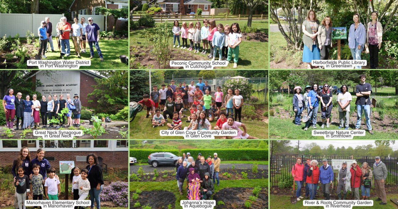
Case Study
Project
Cold Spring Harbor, NY
North Shore Land Alliance Shore Road Sanctuary Habitat Restoration Project
With support from the Long Island Sound Resilience Grant Writing Assistance (GWA) Program, in December 2023, North Shore Land Alliance was awarded $192,969 from the NYSDEC Water Quality Improvement Project (WQIP) Program to fund the implementation of green infrastructure at the North Shore Land Alliance Shore Road Sanctuary in Cold Spring Harbor, NY. The North Shore Land Alliance will install an upland infiltration system to reduce the volume and velocity of stormwater on a 40-acre parcel and replace invasive plants along the shoreline with a native plant community. The project will restore habitat and reduce the amount stormwater and pollutants entering Cold Spring Harbor and Long Island Sound.
LIS Resilience Grant Writing Assistance Program Details:
Grant Writing Consultant: Nelson Pope & Voorhis
Grant Writing Assistance Award: $9,900

Jane Jackson, Director of Stewardship, North Shore Land Alliance, jjackson@northshorelandalliance.org
Case Study
Project
Cold Spring Harbor, NY
North Shore Land Alliance Shore Road Sanctuary Habitat Restoration Project
With support from the Long Island Sound Resilience Grant Writing Assistance (GWA) Program, in December 2023, North Shore Land Alliance was awarded $192,969 from the NYSDEC Water Quality Improvement Project (WQIP) Program to fund the implementation of green infrastructure at the North Shore Land Alliance Shore Road Sanctuary in Cold Spring Harbor, NY. The North Shore Land Alliance will install an upland infiltration system to reduce the volume and velocity of stormwater on a 40-acre parcel and replace invasive plants along the shoreline with a native plant community. The project will restore habitat and reduce the amount stormwater and pollutants entering Cold Spring Harbor and Long Island Sound.
LIS Resilience Grant Writing Assistance Program Details:
Grant Writing Consultant: Nelson Pope & Voorhis
Grant Writing Assistance Award: $9,900
Case Study
Plan
East Haddam, CT
East Haddam Community Resilience Building Summary of Findings
With support from the Nature Conservancy and Sustainable CT, East Haddam organized a Community Resilience Building process and workshop, the results of which were compiled into this summary. The team engaged with community members to determine the present hazards and vulnerabilities and identify resilient solutions.
Case Study
Plan
Marsh Conservation Planning for Glen Island Park
In 2023, Long Island Sound Study and Warren Pinnacle, in partnership with Westchester County and conservation groups/organizations, have developed a Plan to understand the benefits of, threats to, and recommended conservation actions for marsh ecosystems on Glen Island Park in New Rochelle, NY. The goal of the Plan is to help inform conservation and restoration efforts to maximize marsh ecosystem services under rising sea levels.
This process brought together a diversity of stakeholders to consider management strategies for Glen Island Park.
Sara Powell, slp285@cornell.edu
Case Study
Plan
Marsh Conservation Planning for Glen Island Park
In 2023, Long Island Sound Study and Warren Pinnacle, in partnership with Westchester County and conservation groups/organizations, have developed a Plan to understand the benefits of, threats to, and recommended conservation actions for marsh ecosystems on Glen Island Park in New Rochelle, NY. The goal of the Plan is to help inform conservation and restoration efforts to maximize marsh ecosystem services under rising sea levels.
Case Study
Project
Sunken Meadow State Park Restoration
Increased development and the historic construction of a dam on Sunken Meadow Creek in the 1950’s led to reduced tidal exchange, increased water levels in the creek, poor water quality, and the proliferation of invasive species. In 2008 a number of partners (NYS OPRHP, NOAA, NYSDEC, LISS, TNC, Save the Sound, USFWS, LI Botanical Society) came together to work to restore the degraded marsh habitat around Sunken Meadow Creek, increase tidal flow, improve aquatic organism passage, limit invasives, and improve water quality. A restoration feasibility study was completed in 2010. In 2012 Superstorm Sandy blew out the dam on Sunken Meadow Creek, naturally kick-starting restoration. Following Superstorm Sandy, the project partners were able to quickly capitalize on available funding and grants, due to their prior planning efforts. A bridge was built across the Creek where the dam blew out, salt marsh habitat was restored at three locations, green infrastructure was installed in one of the parking areas to capture and treat stormwater runoff, fish passage feasibility on the creek was investigated, and education and outreach was conducted to thousands of people. These projects were completed in 2019. Now, with funding through Long Island Sound Futures Fund, Audubon NY is leading a large-scale marsh restoration project at Sunken Meadow Creek to restore important high-marsh habitat for at risk species, like the Saltmarsh Sparrow, and to increase the resilience of the marsh in the face of rising sea levels. Audubon will be working to finalize the designs and secure permits over the next two years, with on-the-ground restoration expected in 2026.


Overall the project has been highly successful, reducing flooding, polluted runoff, and invasives, as well as increasing the recreational value and beauty of the Park. There has been positive feedback from the public following the restoration projects. Some challenges remain with dealing with invasive species. It was determined that proceeding with the fish passage plans was not worthwhile, following the feasibility assessment.
Sean Cruickshank Sean.Cruickshank@parks.ny.gov, Jon Vander Werff jvanderwerff@savethesound.org, Phoebe Clark phoebe.clark@audubon.org, Vicky O’Neill victoria.oneill@audubon.org
Case Study
Project
Sunken Meadow State Park Restoration
Increased development and the historic construction of a dam on Sunken Meadow Creek in the 1950’s led to reduced tidal exchange, increased water levels in the creek, poor water quality, and the proliferation of invasive species. In 2008 a number of partners (NYS OPRHP, NOAA, NYSDEC, LISS, TNC, Save the Sound, USFWS, LI Botanical Society) came together to work to restore the degraded marsh habitat around Sunken Meadow Creek, increase tidal flow, improve aquatic organism passage, limit invasives, and improve water quality. A restoration feasibility study was completed in 2010. In 2012 Superstorm Sandy blew out the dam on Sunken Meadow Creek, naturally kick-starting restoration. Following Superstorm Sandy, the project partners were able to quickly capitalize on available funding and grants, due to their prior planning efforts. A bridge was built across the Creek where the dam blew out, salt marsh habitat was restored at three locations, green infrastructure was installed in one of the parking areas to capture and treat stormwater runoff, fish passage feasibility on the creek was investigated, and education and outreach was conducted to thousands of people. These projects were completed in 2019. Now, with funding through Long Island Sound Futures Fund, Audubon NY is leading a large-scale marsh restoration project at Sunken Meadow Creek to restore important high-marsh habitat for at risk species, like the Saltmarsh Sparrow, and to increase the resilience of the marsh in the face of rising sea levels. Audubon will be working to finalize the designs and secure permits over the next two years, with on-the-ground restoration expected in 2026.
Case Study
Project
Maidstone Landing Bluff Restoration
The Maidstone Landing Association, situated between Town of Riverhead Iron Pier Beach and Hallock State Park, wanted to take action to mitigate erosion of their bluff. First they worked with Town of Riverhead to put up signage and fencing to stop beachgoers from climbing and driving on or near the bluff, which was causing significant destruction. Next they opted for a small-scale, nature-based approach to help stabilize the bluff. They purchased snow fencing from Home Depot and native beachgrass from Long Island Natives. They engaged Riverhead Charter High School to help with putting up the snow fencing and the plantings. The Maidstone Landing Association is using their bluff as an “outdoor classroom” to teach students and the public about the importance of conserving our coastal habitats and best practices.


The beachgrass is now thriving, and the both the fencing and plants have held up during recent storms. Maidstone Landing Association recently received approval to expand the project across their entire bluff. The Association plans to continue to collaborate with New York Sea Grant, Long Island Sound Study, and Suffolk Soil & Water Conservation District, to use this project to educate students and the public on best practices and the importance of protecting our coastal bluffs.
Tom Mohrman mustangtpm@gmail.com; Corey Humphrey corey.humphrey@suffolkcountyny.gov
Case Study
Project
Maidstone Landing Bluff Restoration
The Maidstone Landing Association, situated between Town of Riverhead Iron Pier Beach and Hallock State Park, wanted to take action to mitigate erosion of their bluff. First they worked with Town of Riverhead to put up signage and fencing to stop beachgoers from climbing and driving on or near the bluff, which was causing significant destruction. Next they opted for a small-scale, nature-based approach to help stabilize the bluff. They purchased snow fencing from Home Depot and native beachgrass from Long Island Natives. They engaged Riverhead Charter High School to help with putting up the snow fencing and the plantings. The Maidstone Landing Association is using their bluff as an “outdoor classroom” to teach students and the public about the importance of conserving our coastal habitats and best practices.
Case Study
Plan
Huntington, NY
Crab Meadow Watershed Hydrology Study and Stewardship Plan
This comprehensive study and plan, funded through the National Fish and Wildlife Foundation, Long Island Sound Futures Fund, identifies initial strategies to maintain and enhance the local watershed resources of Crab Meadow. It is meant to be a land management tool to guide the implementation of best practices. The plan was developed in consultation with many partners and stakeholders. There is now significant community buy-in to take action to protect and restore this important watershed.
Following adoption of the plan, the Town of Huntington began working with US Fish and Wildlife Service and Audubon to study and restore Crab Meadow marsh and implement recommendations from the Stewardship Plan. Audubon, in partnership with Town of Huntington and USFWS, received a 2024 Long Island Sound Futures Fund Grant ($429K) to develop design plans for marsh restoration at Crab Meadow.
Garrett Chelius gchelius@huntingtonny.gov, Victoria O’Neill victoria.oneill@audubon.org, Suzanne Paton suzanne_paton@fws.gov
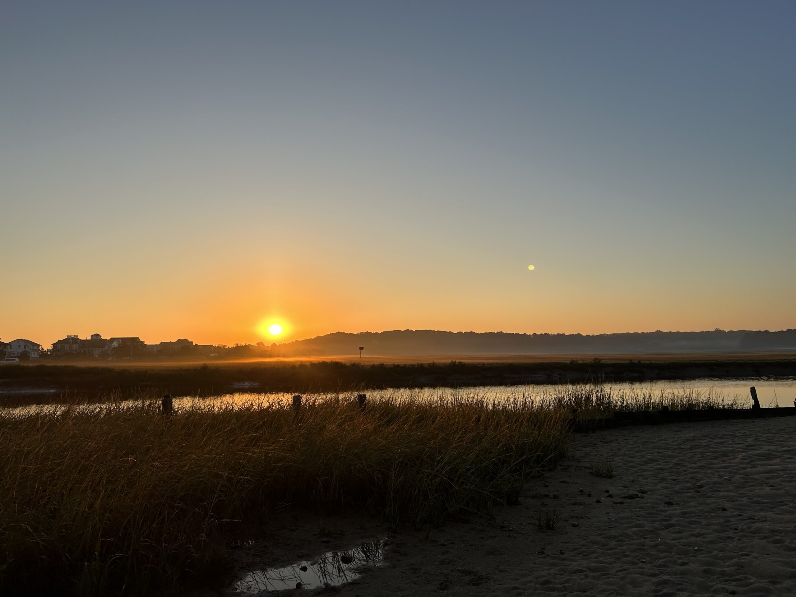 Photo by Jonah Saitz, USFWS.
Case Study
Plan
Huntington, NY
Crab Meadow Watershed Hydrology Study and Stewardship Plan
This comprehensive study and plan, funded through the National Fish and Wildlife Foundation, Long Island Sound Futures Fund, identifies initial strategies to maintain and enhance the local watershed resources of Crab Meadow. It is meant to be a land management tool to guide the implementation of best practices. The plan was developed in consultation with many partners and stakeholders. There is now significant community buy-in to take action to protect and restore this important watershed.
Following adoption of the plan, the Town of Huntington began working with US Fish and Wildlife Service and Audubon to study and restore Crab Meadow marsh and implement recommendations from the Stewardship Plan. Audubon, in partnership with Town of Huntington and USFWS, received a 2024 Long Island Sound Futures Fund Grant ($429K) to develop design plans for marsh restoration at Crab Meadow.
Case Study
Plan
Stony Brook, Head of Harbor and Nissequogue, NY
Marsh Conservation Planning for Stony Brook Harbor
In 2023, Long Island Sound Partnership and Warren Pinnacle, in partnership with committed municipalities and conservation groups/organizations, developed a Plan to understand the benefits, threats, and recommended conservation actions for the Stony Brook Harbor and West Meadow Creek marsh ecosystem. The goal of the Plan is to help inform conservation and restoration efforts to maximize marsh ecosystem services under rising sea levels.

This process brought together a diversity of stakeholders to develop a cohesive strategy for Stony Brook Harbor. The partners will now work to implement the recommendations in the plan.
Elizabeth Hornstein, eeh78@cornell.edu
Case Study
Plan
Stony Brook, Head of Harbor and Nissequogue, NY
Marsh Conservation Planning for Stony Brook Harbor
In 2023, Long Island Sound Partnership and Warren Pinnacle, in partnership with committed municipalities and conservation groups/organizations, developed a Plan to understand the benefits, threats, and recommended conservation actions for the Stony Brook Harbor and West Meadow Creek marsh ecosystem. The goal of the Plan is to help inform conservation and restoration efforts to maximize marsh ecosystem services under rising sea levels.
Case Study
Plan
Oyster Bay, NY and Cold Spring Harbor, NY
Marsh Conservation Planning for Oyster Bay & Cold Spring Harbor
In 2023, Long Island Sound Study, New York Sea Grant and Warren Pinnacle, in partnership with committed municipalities and marsh-conservation groups/organizations, developed a Plan to understand the benefits, threats and recommended conservation actions at seven focal areas across the harbors. The goal of the Plan is to inform local municipalities and marsh-conservation groups as to where they might focus their conservation efforts to maximize the conservation of marsh ecosystem services under sea-level rise conditions. This process brought together a diversity of stakeholders to develop a cohesive strategy for seven focal areas across Oyster Bay and Cold Spring Harbor: Frost Creek, Mill Neck Creek, West Shore Road, Bayville Bridge to Centre Island, Centre Island, Shore Road, and Lower Cold Spring Harbor. The partners will now work to implement the recommendations in the plan.
St. John’s Episcopal Church (lower Cold Spring Harbor) and Village of Lattingtown (Frost Creek) were 2024 LIS Resilience Planning Support Program awardees. Their projects will build off the Oyster Bay & Cold Spring Harbor marsh conservation plan and develop specific recommendations to enhance and restore marsh habitat in lower Cold Spring Harbor and Frost Creek.

Sarah Schaefer-Brown, scs292@cornell.edu
Case Study
Plan
Oyster Bay, NY and Cold Spring Harbor, NY
Marsh Conservation Planning for Oyster Bay & Cold Spring Harbor
In 2023, Long Island Sound Study, New York Sea Grant and Warren Pinnacle, in partnership with committed municipalities and marsh-conservation groups/organizations, developed a Plan to understand the benefits, threats and recommended conservation actions at seven focal areas across the harbors. The goal of the Plan is to inform local municipalities and marsh-conservation groups as to where they might focus their conservation efforts to maximize the conservation of marsh ecosystem services under sea-level rise conditions. This process brought together a diversity of stakeholders to develop a cohesive strategy for seven focal areas across Oyster Bay and Cold Spring Harbor: Frost Creek, Mill Neck Creek, West Shore Road, Bayville Bridge to Centre Island, Centre Island, Shore Road, and Lower Cold Spring Harbor. The partners will now work to implement the recommendations in the plan.
St. John’s Episcopal Church (lower Cold Spring Harbor) and Village of Lattingtown (Frost Creek) were 2024 LIS Resilience Planning Support Program awardees. Their projects will build off the Oyster Bay & Cold Spring Harbor marsh conservation plan and develop specific recommendations to enhance and restore marsh habitat in lower Cold Spring Harbor and Frost Creek.
Case Study
Project
Sea Cliff, NY
Scudders Pond Subwatershed Improvements
The Hempstead Harbor Protection Committee and Village of Sea Cliff completed subwatershed improvements at Scudders Pond to address stormwater drainage problems impacting the water quality of the pond and Hempstead Harbor, highlighted as a priority in the 1998 Hempstead Harbor Water Quality Improvement Plan. The improvements included dredging the pond, installing a hydrodynamic separator to intercept sediment, removing invasive Phragmites australis and replacing with native plants, realigning the stream to reduce erosion, redirecting the stormwater from residences to the bioswale, creation of a biofilter wetland area, replacement of the weir between the upper and lower ponds and weir at Shore Road.

Water quality improvements in Scudders Pond and Hempstead Harbor, views of the Pond have been restored.
Eric Swenson, Hempstead Harbor Protection Committee, hempsteadharbor@gmail.com
Case Study
Project
Sea Cliff, NY
Scudders Pond Subwatershed Improvements
The Hempstead Harbor Protection Committee and Village of Sea Cliff completed subwatershed improvements at Scudders Pond to address stormwater drainage problems impacting the water quality of the pond and Hempstead Harbor, highlighted as a priority in the 1998 Hempstead Harbor Water Quality Improvement Plan. The improvements included dredging the pond, installing a hydrodynamic separator to intercept sediment, removing invasive Phragmites australis and replacing with native plants, realigning the stream to reduce erosion, redirecting the stormwater from residences to the bioswale, creation of a biofilter wetland area, replacement of the weir between the upper and lower ponds and weir at Shore Road.
Case Study
Project
Stabilization of Bluff at Sands Point Preserve
In partnership with Sands Point Preserve Conservancy, an innovative cliff face stabilization system, engineered by Long Island based company Coastal Technologies Corp (CTC), was deployed as a pilot on Oct. 30th, 2022 at a steep & loose coastal moraine bluff located at The Sands Point Preserve, NY. The pilot project was designed to test the efficacy of this system to secure and stabilize sediment under constant erosive pressure preventing vegetation from taking hold. This bluff was selected due to its very high rate of stormwater & aeolian erosion. American beach grass, bayberry, beach plum & rose plugs, all protected from erosive forces, have thrived. Slope erosion was prevented by the devices, and all plants were successfully held against the slope, exactly as designed.
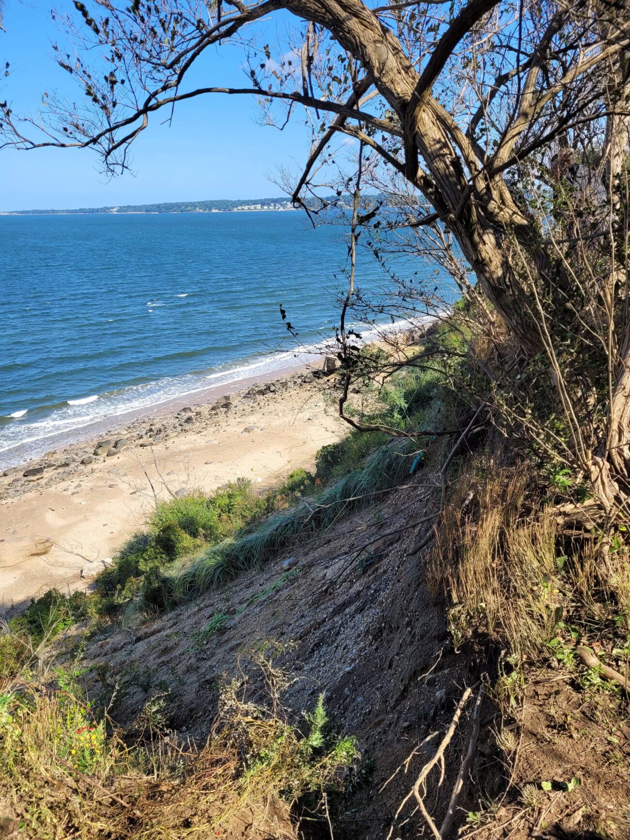
Eighteen (18) Cliff Stabilizer devices were driven into the escarpment using a battery-powered tool and plant plugs were planted into the cubbies. The test field was then coincidentally subjected to three days of storms caused by Hurricane Ian. All Cliff Stabilizer devices remained firmly in place, as did all the planted vegetation. No erosion occurred in the device footprint. Stormwater erosion was evident at control areas, with all control test plugs planted outside the cubby devices being washed away. The site was left unattended, with zero maintenance. The site was accessed on May 30, 2023, six months after initial deployment for preliminary readout – Slope erosion was prevented by the devices, and all plants were successfully held against the slope, exactly as designed. On September 27th, 2023 the site was assessed and the established vegetation was assessed after some of the devices were removed, stable vegetation was left behind. The pilot project seems to be a success and Sands Point Preserve Conservancy is looking for additional funding to expand the project at the site.
Case Study
Project
Stabilization of Bluff at Sands Point Preserve
In partnership with Sands Point Preserve Conservancy, an innovative cliff face stabilization system, engineered by Long Island based company Coastal Technologies Corp (CTC), was deployed as a pilot on Oct. 30th, 2022 at a steep & loose coastal moraine bluff located at The Sands Point Preserve, NY. The pilot project was designed to test the efficacy of this system to secure and stabilize sediment under constant erosive pressure preventing vegetation from taking hold. This bluff was selected due to its very high rate of stormwater & aeolian erosion. American beach grass, bayberry, beach plum & rose plugs, all protected from erosive forces, have thrived. Slope erosion was prevented by the devices, and all plants were successfully held against the slope, exactly as designed.
Case Study
Project
Rain Gardens on Western Waterfront
Friends of the Bay installed two raingardens at the Western Waterfront, which was done in October 2021 with the help of volunteers.


The main ways Friends of the Bay measured outcomes was by observing the absorption of water into the gardens after rain storms and seeing pollinators just a day or two after planting. The biggest benefit though was the engagement by the Town of Oyster Bay in fixing another rain garden at the Western Waterfront with help from a grant they received as well as plans to install more rain gardens in the area. Friends of the Bay was also able to engage a corps. of dedicated volunteers from the community. The long-term impact of the work is the continuation of stormwater runoff mitigation to the bay.
Friends of the Bay, info@friendsofthebay.org
Case Study
Project
Rain Gardens on Western Waterfront
Friends of the Bay installed two raingardens at the Western Waterfront, which was done in October 2021 with the help of volunteers.
Case Study
Project
Stratford, CT
Restoration of the Great Meadows Marsh
This project restored 46 acres of the Great Meadows Marsh in Connecticut that was degraded from dredge material that was dumped on site, poor drainage, and sea level rise. The marsh was also overrun with invasive plants and mosquitoes. A controlled fire was started to kill the invasive reeds growing in the marsh. Then a construction crew removed invasive plants and the dumped dredge material. Lastly, channels were carefully dug for tidal flushing which will allow the marsh to keep pace with sea level rise. Soil hummocks were constructed for Salt Marsh Sparrow habitat. Now the area continues to be monitored, assessed for resiliency, and provides a field for innovative solutions to be tested in.
Partners
Trustees: USFWS, NOAA, State of Connecticut; Project Partners: Audubon Connecticut, Town of Stratford
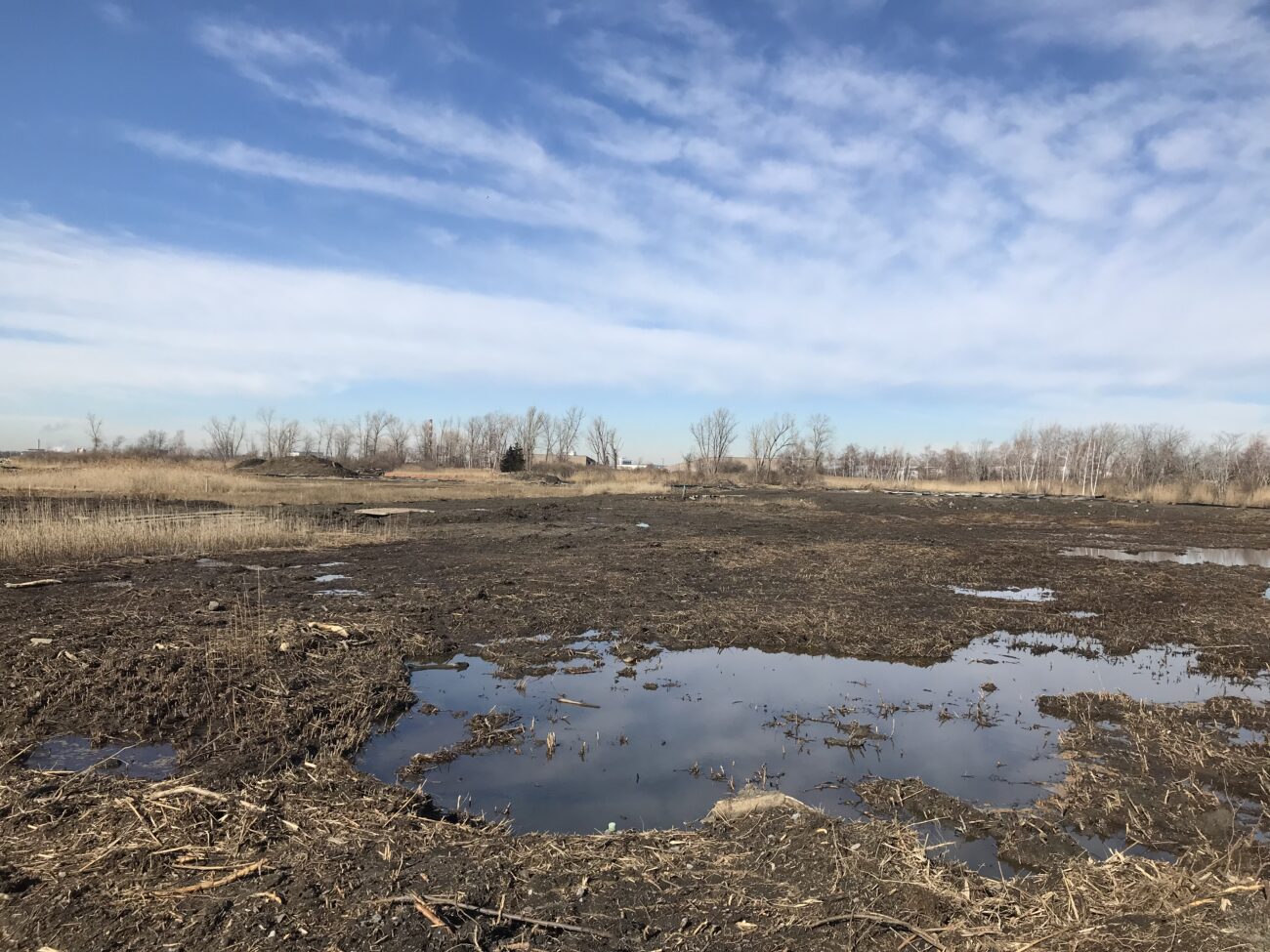


Monitoring immediately following the restoration revealed at least 12 saltmarsh sparrows returned to their annual nesting areas near the experimental hummocks, despite the disruptive activities taking place earlier in the year. University students will survey vegetation on the hummocks and throughout the restoration area, measuring and counting individual plants to see how different species grow at different elevations and in different types of soil, and to determine if additional plantings are needed. Audubon Connecticut will manage and control invasive plant species across the restoration area for three years, periodically removing and chemically treating the ever-persistent common reed. The project team will also monitor saltwater flooding of the marsh and carve runnels (short channels), if needed, to connect more areas to saltwater.
Molly Sperduto at molly_sperduto@fws.gov;
Corrie Folsom-O’Keefe cfolsom.okeefe@audubon.org;
Jack Matthias jack.matthias@audubon.org
Case Study
Project
Stratford, CT
Restoration of the Great Meadows Marsh
This project restored 46 acres of the Great Meadows Marsh in Connecticut that was degraded from dredge material that was dumped on site, poor drainage, and sea level rise. The marsh was also overrun with invasive plants and mosquitoes. A controlled fire was started to kill the invasive reeds growing in the marsh. Then a construction crew removed invasive plants and the dumped dredge material. Lastly, channels were carefully dug for tidal flushing which will allow the marsh to keep pace with sea level rise. Soil hummocks were constructed for Salt Marsh Sparrow habitat. Now the area continues to be monitored, assessed for resiliency, and provides a field for innovative solutions to be tested in.
Partners
Trustees: USFWS, NOAA, State of Connecticut; Project Partners: Audubon Connecticut, Town of Stratford
Case Study
Project
Stratford, CT
Stratford Point Living Shoreline & Tidal Wetland Restoration
This project consists of 750 feet of shoreline in Stratford, CT. The goal of the project was to protect the beach from coastal erosion and to help combat sea level rise. The steps consisted of adding a smooth cordgrass marsh, artificial shellfish reefs (reef balls), high marsh, and a coastal dune area. The site was awarded the “Best Restored Shore Area” from the American Shore and Beach Preservation Association. To adaptively manage the site, a second restoration project is being developed to extend the marsh seaward by 0.35 acres over an additional 250 feet of shore using a combination of bagged slipper shell and small, modular oyster castles near the marsh edge, along with additional cordgrass plantings in the intertidal zone.
Project Lead:
Sacred Heart University
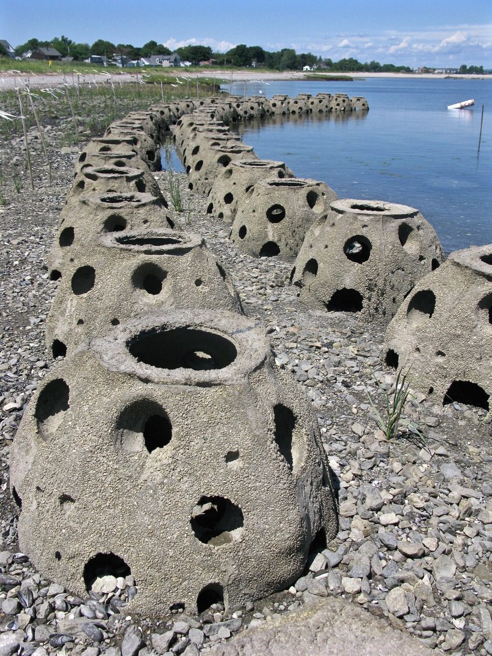
Thus far, the project has provided 750 feet of coastal erosion control, 4.5 acres of intertidal habitat, 1.5 acres of coastal dune habitat, and 25 acres of woodland/meadow mix. Monitoring has demonstrated that this living shoreline project has successfully prevented erosion, allowing sediment deposition, and salt marsh restoration. Increased horseshoe crab spawning and nursery habitat have also been observed.
LaTina Steele
203-396-8485
steelel@sacredheart.edu
Case Study
Project
Stratford, CT
Stratford Point Living Shoreline & Tidal Wetland Restoration
This project consists of 750 feet of shoreline in Stratford, CT. The goal of the project was to protect the beach from coastal erosion and to help combat sea level rise. The steps consisted of adding a smooth cordgrass marsh, artificial shellfish reefs (reef balls), high marsh, and a coastal dune area. The site was awarded the “Best Restored Shore Area” from the American Shore and Beach Preservation Association. To adaptively manage the site, a second restoration project is being developed to extend the marsh seaward by 0.35 acres over an additional 250 feet of shore using a combination of bagged slipper shell and small, modular oyster castles near the marsh edge, along with additional cordgrass plantings in the intertidal zone.
Project Lead:
Sacred Heart University
Case Study
Project
New Haven, CT
New Haven Bioswales
The City of New Haven has installed 286 right-of-way bioswales throughout the city as part of a multifaceted approach to reducing flooding in the downtown area. Right-of-way bioswales are engineered planted areas that are located on sidewalks. They are designed to capture and infiltrate stormwater into the ground that would otherwise directly enter a storm drain. These bioswales were installed as the result of various partnerships and funding opportunities related to flood prevention, localized drainage solutions, combined sewer overflow mitigation, research, and traffic calming projects.
Project Lead
City of New Haven, Dept of Engineering
Project Partners
Urban Resources Initiative, EMERGE Inc., Save the Sound, Yale School of the Environment, and Quinnipiac University, among others.

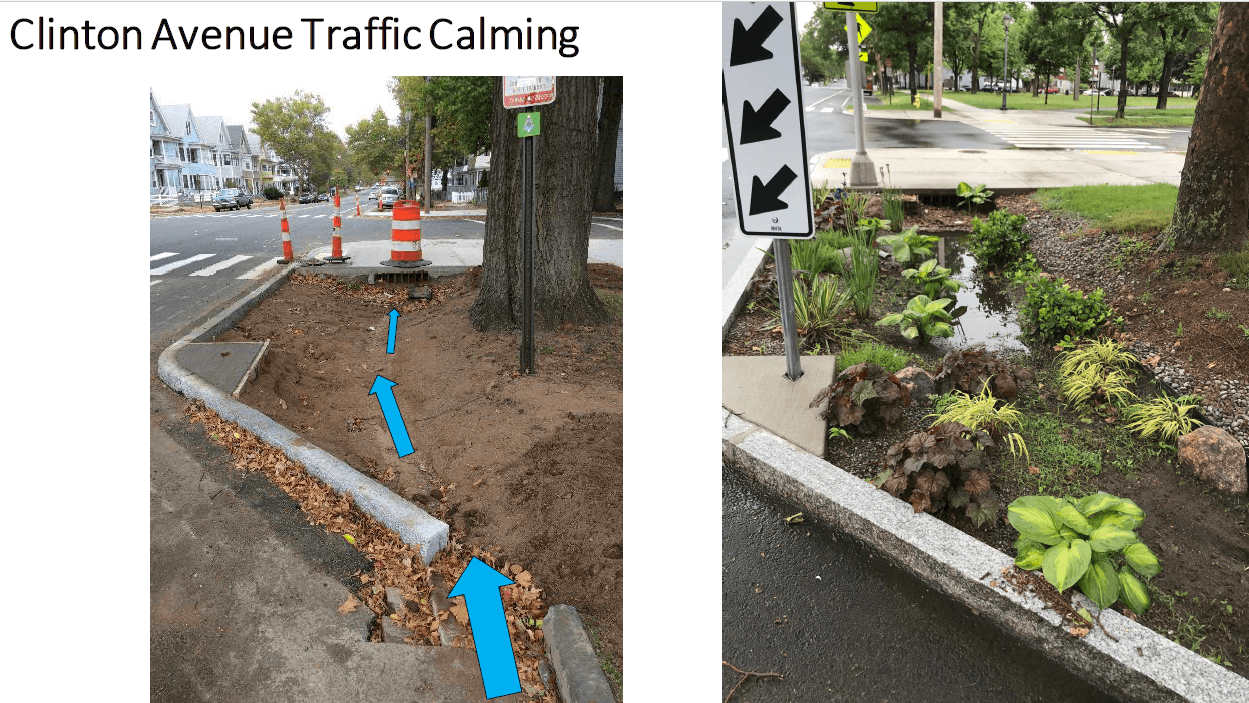

Monitoring performed by Yale School of the Environment researchers (led by Prof. Gaboury Benoit) have demonstrated that the bioswales have captured 70-75% of stormwater runoff in two locations. These results indicate that the bioswales are highly effective in diverting stormwater and thus, preventing pollution.
Dawn Henning
dhenning@newhavenct.gov
475-434-1643
Case Study
Project
New Haven, CT
New Haven Bioswales
The City of New Haven has installed 286 right-of-way bioswales throughout the city as part of a multifaceted approach to reducing flooding in the downtown area. Right-of-way bioswales are engineered planted areas that are located on sidewalks. They are designed to capture and infiltrate stormwater into the ground that would otherwise directly enter a storm drain. These bioswales were installed as the result of various partnerships and funding opportunities related to flood prevention, localized drainage solutions, combined sewer overflow mitigation, research, and traffic calming projects.
Project Lead
City of New Haven, Dept of Engineering
Project Partners
Urban Resources Initiative, EMERGE Inc., Save the Sound, Yale School of the Environment, and Quinnipiac University, among others.
Case Study
Project
Stonington, CT
Dodge Paddock/Beal Preserve
This public greenspace was suffering from mosquito overpopulation, invasion from Phragmites, and poor tidal/stormwater drainage. The Wetland’s Habitat and Mosquito Management Program (WHAMM) created a new drainage area and tunnels, while also eliminating invasive plants. Then organizations and volunteers banded together to remove and replace invasive plant species with native plants.


Juliana Barrett, CT Sea Grant Extension, 860-405-9106, juliana.barrett@uconn.edu
Journal of Extension Article: Moving With the Marsh: Encouraging Property Owner Adaptation to Marsh Migration
Case Study
Project
Stonington, CT
Dodge Paddock/Beal Preserve
This public greenspace was suffering from mosquito overpopulation, invasion from Phragmites, and poor tidal/stormwater drainage. The Wetland’s Habitat and Mosquito Management Program (WHAMM) created a new drainage area and tunnels, while also eliminating invasive plants. Then organizations and volunteers banded together to remove and replace invasive plant species with native plants.
Case Study
Project
Hoffman Evergreen Preserve
This Avalonia and Sea Grant effort in Stonington, CT restored the preserve using native, well-researched plant species that would thrive in the forest and offer biodiversity. First, the area was cut down precisely to allow for new, ground-level growth. Then the preserve was seeded with plants chosen by the field team.
Juliana Barrett, CT Sea Grant Extension, 860-405-9106 & juliana.barrett@uconn.edu. Beth Sullivan, Avalonia
Case Study
Project
Hoffman Evergreen Preserve
This Avalonia and Sea Grant effort in Stonington, CT restored the preserve using native, well-researched plant species that would thrive in the forest and offer biodiversity. First, the area was cut down precisely to allow for new, ground-level growth. Then the preserve was seeded with plants chosen by the field team.
Case Study
Project
Old Saybrook, CT
Fenwick Living Shoreline
The purpose of this project was to mitigate 450 ft of coastal erosion on the Long Island Sound. A part of Crab Creek was moved further inland, thus allowing for beach and dune migration over time. New rock sills, plants, and sand sills were also positioned along the shore.